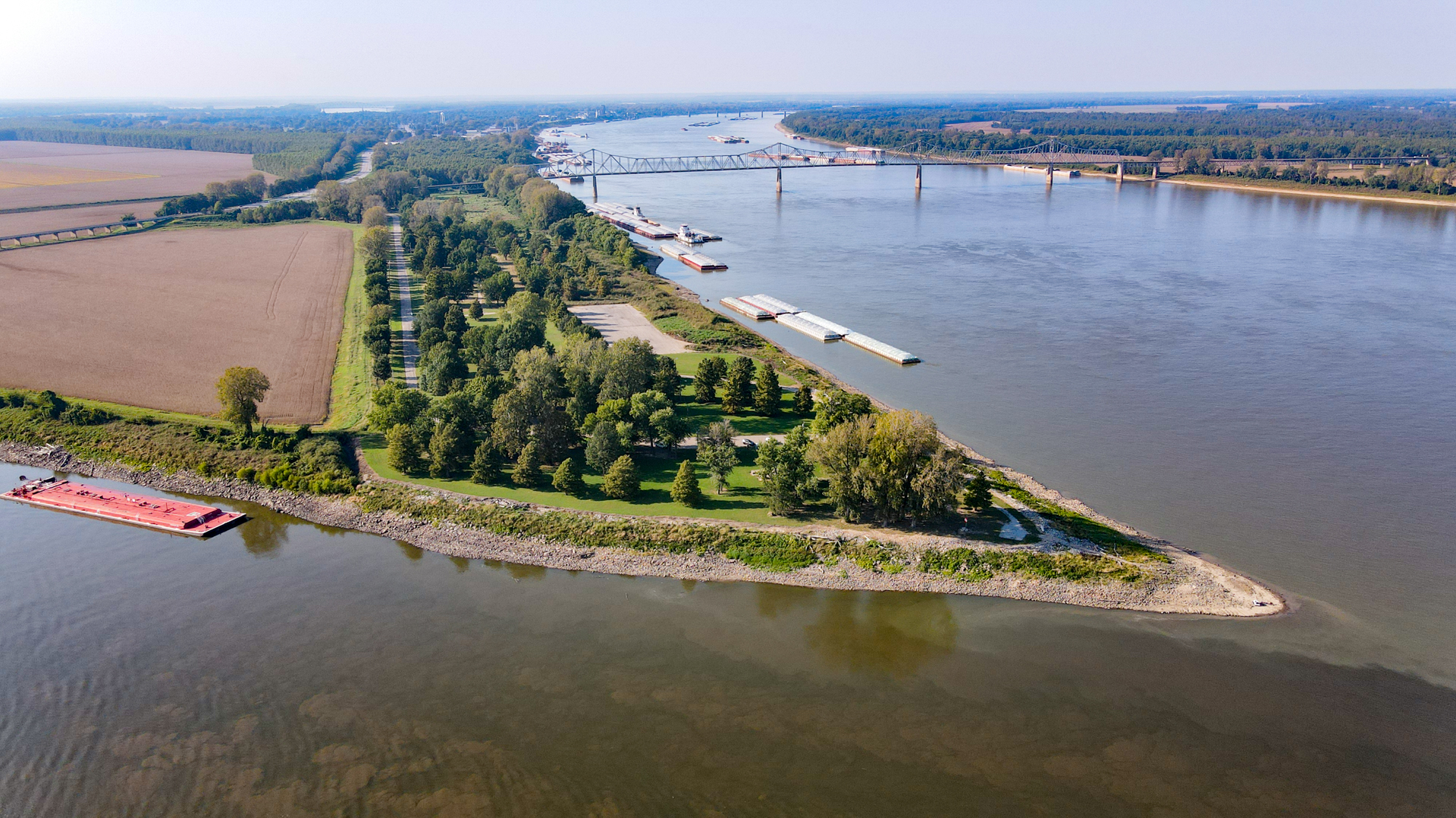
Fort Defiance Park in Cairo, Illinois, marks one of the world’s most important river confluences – the Ohio and Mississippi. On a typical day, 4.4 million gallons of water merge at Fort Defiance every second. That’s equivalent of every person on earth receiving 49 gallons of water each day. So yes – watching these two mighty rivers come together is quite impressive.
Before modern times, these two rivers were the most important trade routes in the United States. Ships would move cargo up and down these rivers and their tributaries as critical supply lines for the fledging nation.
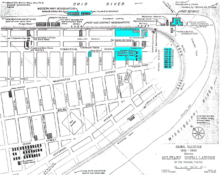
During the Civil War, Cairo was the southernmost stronghold and border of the Union. Cairo was booming with a population of 2,188 in 1860. Defending Cairo and these two rivers were of the utmost importance.
Camp Defiance was commissioned in 1861 to provide defense against a potential attack from the Confederacy. A line of sentries was posted along the Mississippi River levee upstream 20 miles from Cairo. Boats were stopped and searched for goods being shipped south to the rebels.
Forty pieces of artillery were in position and 5,000 men were being trained at the site. The Illinois Central Railroad stopped in Cairo and reportedly could provide 50,000 men in 24 hours’ notice if provoked by the South.
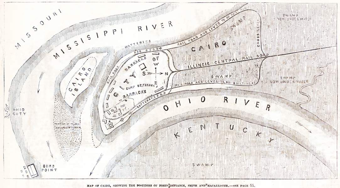
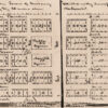
Civil War Map
General B. M. Pentriss was in command and was well-respected. The Chicago Tribune reported:
An officer of much experience, and well qualified for the position he fills. He is a cool, prudent, unostentatious gentleman: not likely to undertake any thing rash, nor to fail in anything that he does undertake. He commands the full confidence of the troops, and we doubt very much if a better choice could have been made.
Cairo was occupied by General Ulysses S. Grant in January 1862, where he used the fortified city as a Union supply base and continued training throughout the rest of the Civil War.
A Civil War Map
The Changing Confluence
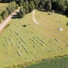
The location of Fort Defiance Park today is not the actual location of the fort. Maps from the Civil War era show the batteries, barracks, and regimental headquarters located in the southern part of Cairo. Today, this would be at or just south of the city sewage treatment plant or where US 51 crosses the levee.
Lewis & Clark camped near this site for six days in November 1803 and surveyed the mouth of the Ohio River. They marked the “Third Principal Meridian” at the confluence, then located approximately 4,500 feet northwest of where it is today. Over the last 200 years, river sediment has piled up along the point, extending it further southeast.
"An Ugly Park"
Adequately commemorating the confluence and its historical significance has been a struggle over the years. Fort Defiance once was a state park but became dilapidated and neglected. In 1987, a story appeared in the Chicago Tribune with the headline “Ugliness of State Park at Ft. Defiance Almost Defies Belief.” The author of the article goes on to recount his experience of finding the place trashed, full of river debris, and no historical interpretative signage.
With the City of Cairo not interested in maintaining the park, the Illinois Department of Natural Resources took control in 2014 and is now maintained by staff from Horseshoe Lake – Alexander State Fish and Wildlife Area.
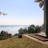
Today the park features a large parking area and an observation deck overlooking the confluence. When we visited in October, we noticed the park was kept in good shape, although driftwood seemed to be a common problem throughout the grounds. Some interpretive signage is located there, even though some of it is quite weathered.
But it’s certainly not like the newspaper article from the 80s. While not a destination per se, it is a great place to visit when passing through the area. Afterall, it’s not every day you get to see two enormous rivers come together.
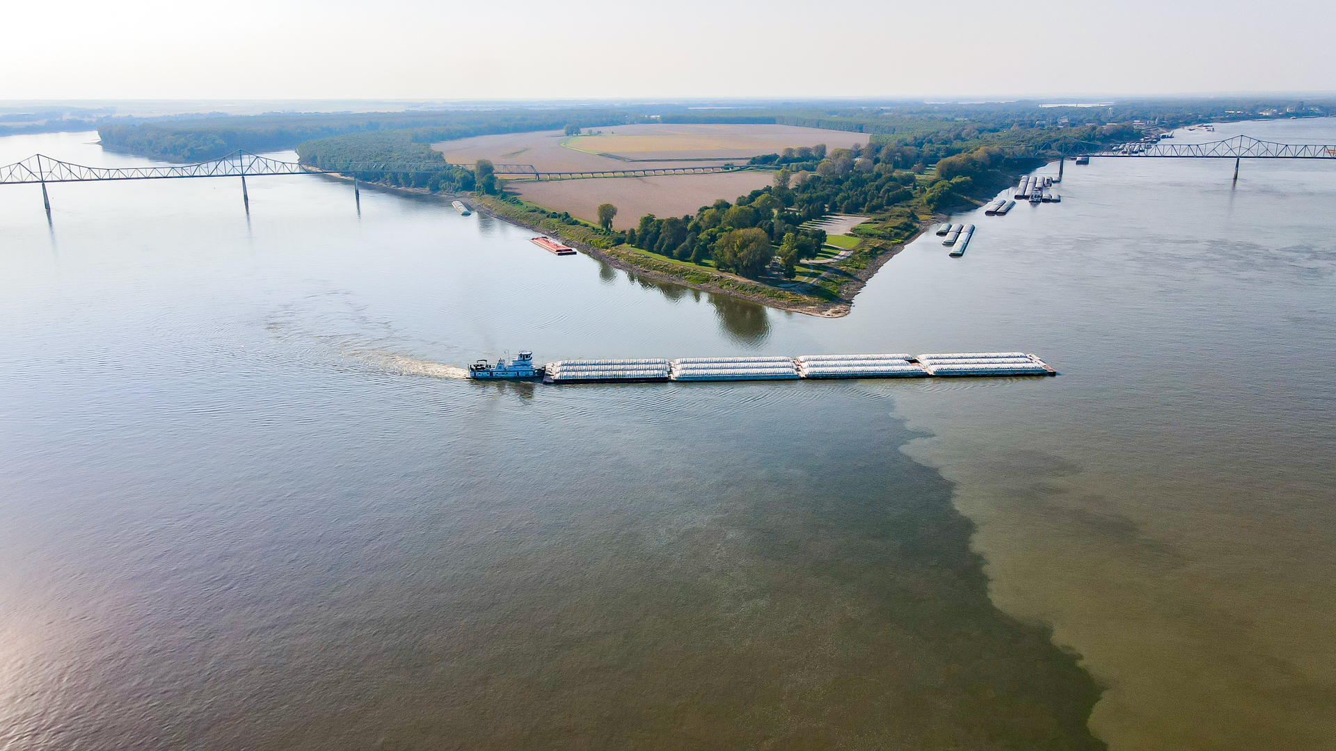
A barge navigates from the Mississippi River to the Ohio River at Fort Defiance in October 2021.