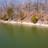
When the waters of Kentucky Lake reach their scheduled low point each fall, mysterious objects begin to appear. One of those is Cemetery Island, which is a lone tombstone in the middle of Kentucky Lake, explored by my crew a couple years back.
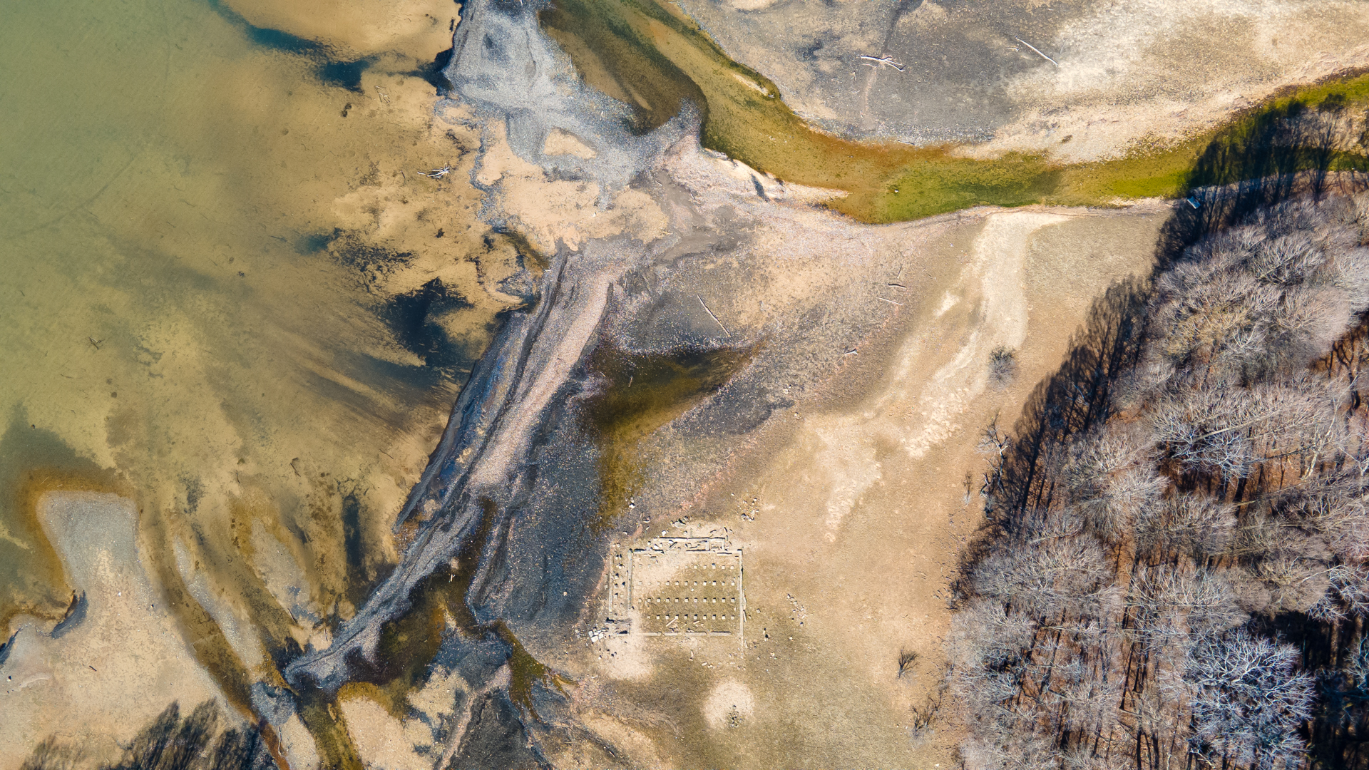
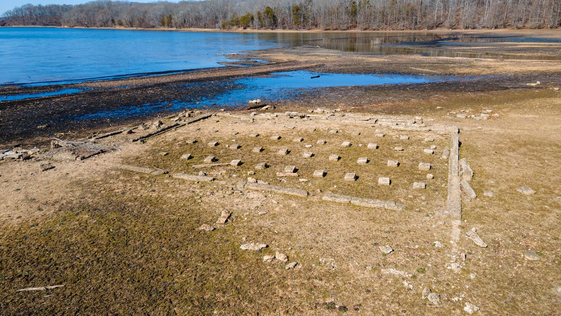
Yet there is another peculiar formation in the back of Kentucky Lake’s Hughes Bay that surely catches the eyes of those wandering along the shorelines. With dozens of perfectly spaced stones surrounded by a barrier, is this Kentucky Lake’s version of Stonehenge? Or is this another forgotten cemetery?
Drone photo from 400 feet showing the beautiful colors of Hughes Bay among the mysterious structure at winter pool.
To find out, you have to dig a little bit into some Kentucky Lake history. When TVA built the gigantic Kentucky Dam on the Tennessee River and created Kentucky Lake in 1944, hundreds of families had to relocate to higher ground.
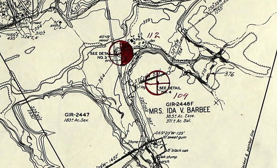
Mrs. Ida V. Barbee lived along Hughes Creek in Stewart County, Tenn., in present-day Land Between The Lakes. She had several hundred acres, many of which would be flooded by Kentucky Lake. According to historical accounts, her home was large and beautiful for this part of the countryside. Although just one-story, it boasted around 1,800 square feet of living space plus a porch that wrapped around the corner of the home.
TVA Land Acquisition Map showing Mrs. Barbee's property along Hughes Creek.
Many residents in the future reservoir opted to literally pick up their houses and move them to higher ground. Mrs. Barbee reportedly chose to do this, moving her home up a hill on her land, across from the new TVA road bypassing the flooded bay. That road is today’s Lake Front Road. Aerial imagery from 1957 may confirm the relocation, showing a home near Hughes Bay on the new TVA road.
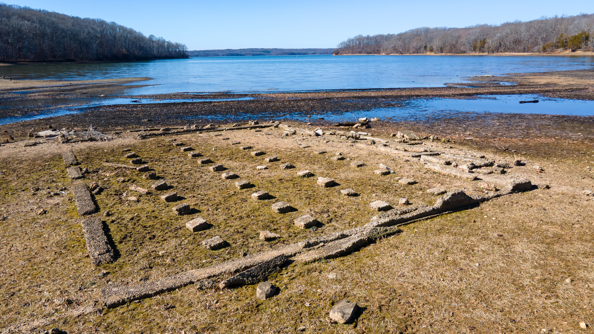
The Stonehenge-looking structure isn’t an old cemetery or something ancient Native Americans placed – it’s simply the intricate arrangement of stones for Mrs. Barbee’s foundation.
From our drone photos, Google Earth, and the TVA Land Acquisition Maps, we are to tell that the home was about 48 feet wide by 36 feet long. The stones are perfectly placed four feet apart longways and about seven feet the other direction. The concrete walls show the edge of the house with a porch on the west and north side of the house.
TVA’s map shows a well, smokehouse, barn, a couple of sheds, and a chicken house. There are some rocks about where the well was located and a scattering of other stones perhaps indicating the smokehouse.
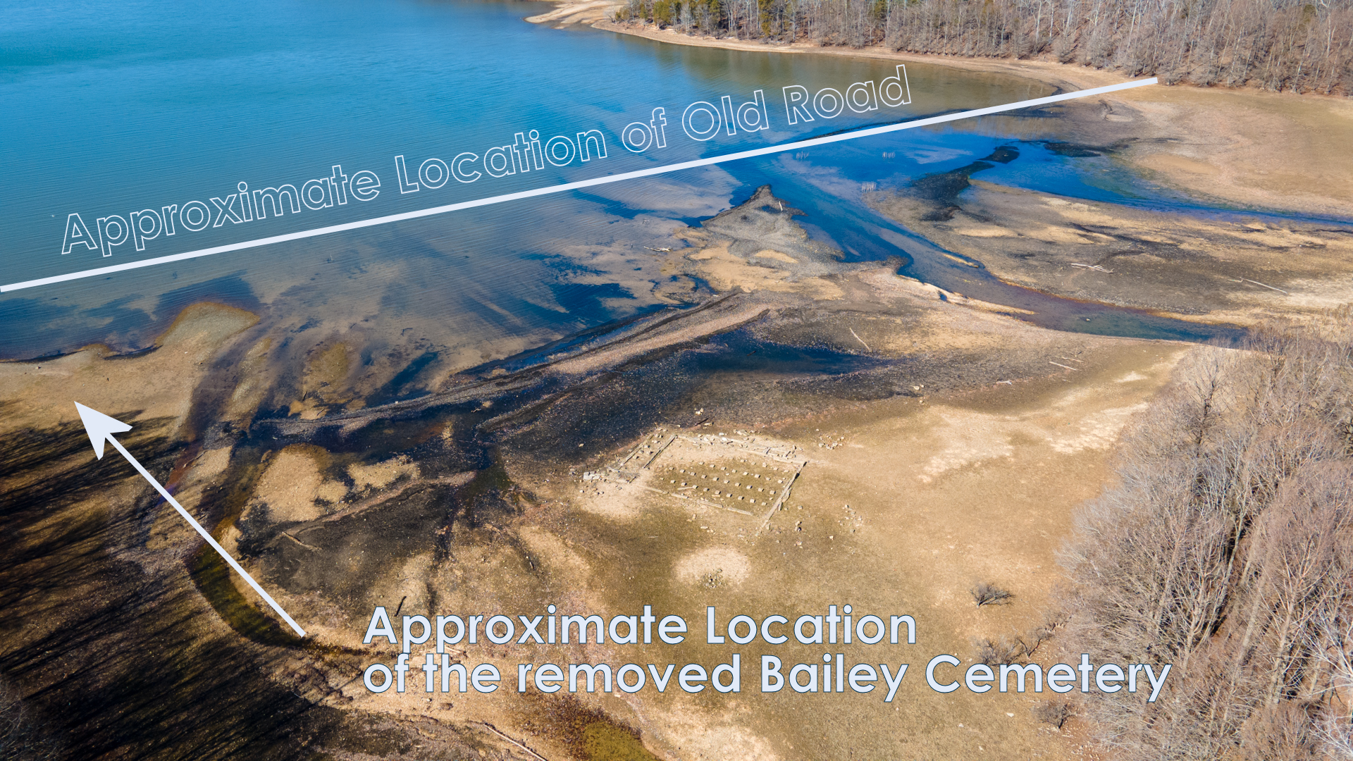
An old county road ran across the bay that featured a 40-foot-long wooden bridge crossing Hughes Creek. While you can tell where the road runs into the bay on each side, the road and any remains of the bridge have been obliterated by 80 years of Kentucky Lake.
When TVA created Land Between The Lakes in the 1960s, some 25 years after Kentucky Lake, the home was likely destroyed. Historical accounts on social media suggest that the foundation of that home also still remains in the woods of LBL today.
Another interesting note. At first glance, while this place looks like an old cemetery, there was a family cemetery about 200 feet to the southwest of the house. Eleven burials are on record for Bailey Cemetery.
Like many other cemeteries (but not all), TVA moved all 11 known graves up the hill to Crook-Wallace Cemetery in 1942. The people buried in the old Bailey cemetery died between 1858 and 1884, according to TVA records.
Looking across the bay today at Kentucky Lake’s winter pool, no signs of a graveyard, a road, or anything else remains except for Mrs. Barbee’s foundation. And just like any well-built foundation, it will be there for sets of 80 years to come.
Graphic showing the approximate locations of the old road and former cemetery.
Drone Footage
Location
The former home of Mrs. Barbee is only visible when Kentucky Lake is below 355′, typically during October through March. Check the current lake levels here. It is located in the back of Hughes Bay in Land Between The Lakes, accessible by vehicle along Lake Front Drive. There is not a good trail or path to this location, although there is a vehicle pull-off here.