After seeing some posts on Facebook about Blue Spring in Land Between The Lakes potentially being visible at winter pool, I had to go check it out myself.
There were two springs at this site – one bigger than the other. A lot of water flowed out of here, measuring 5,500 gallons per second. Prior to the creation of Kentucky Lake, Blue Spring was a popular spot for locals to gather water and pose for photographs.
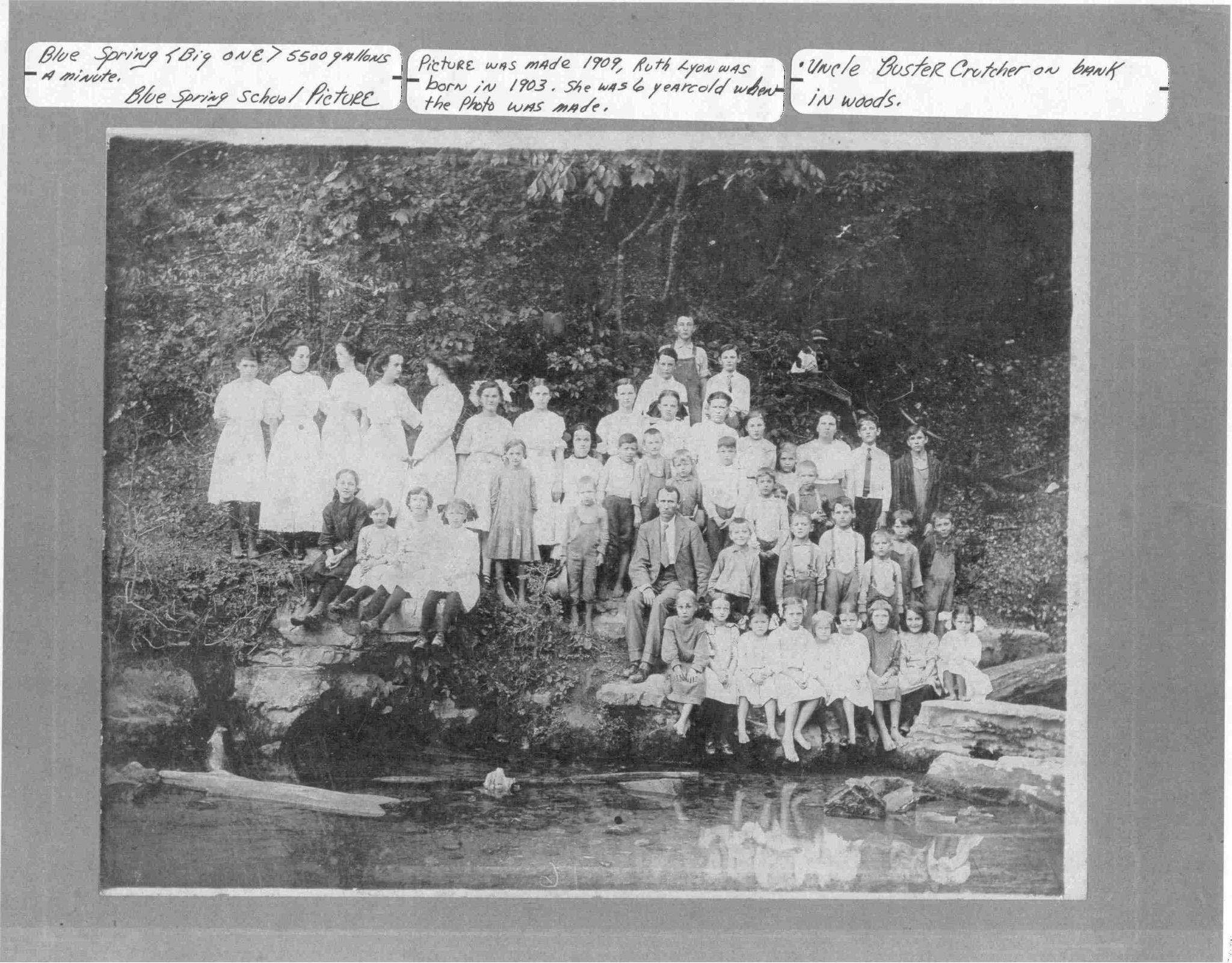
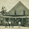
Photo of kids from Blue Spring School on top of the spring in 1909. Courtesy Terry Crutcher / Land Between The Rivers - Stewart Co. Facebook group
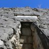
Gushing out of a large rock formation that is seemingly misplaced among the hills and hollers, the spring provided the backbone for a tight knit community. Up the hill and to the east sat the Blue Spring Church of Christ and Blue Spring School. Locals would travel to this spot from the Pine Bluff & Mouth of Sandy roads to gather, learn, and worship.
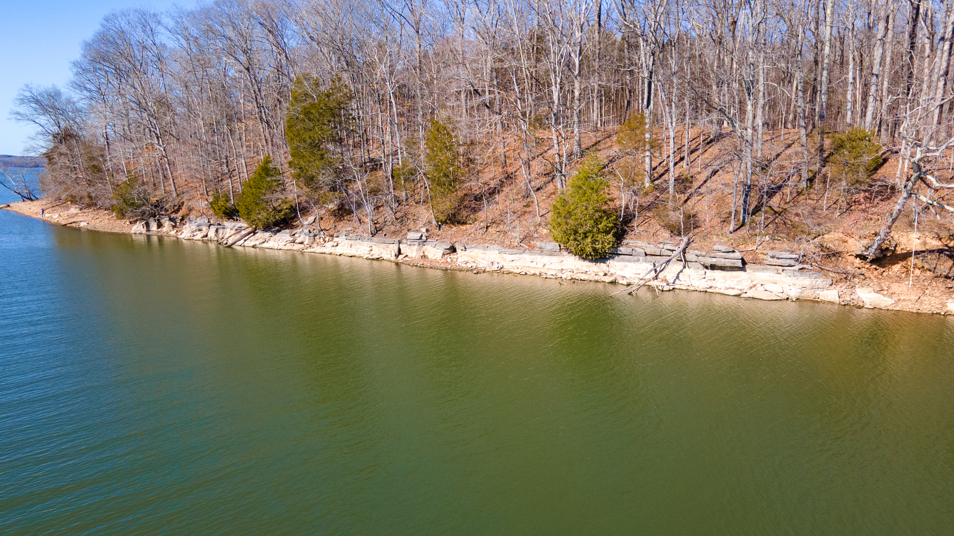
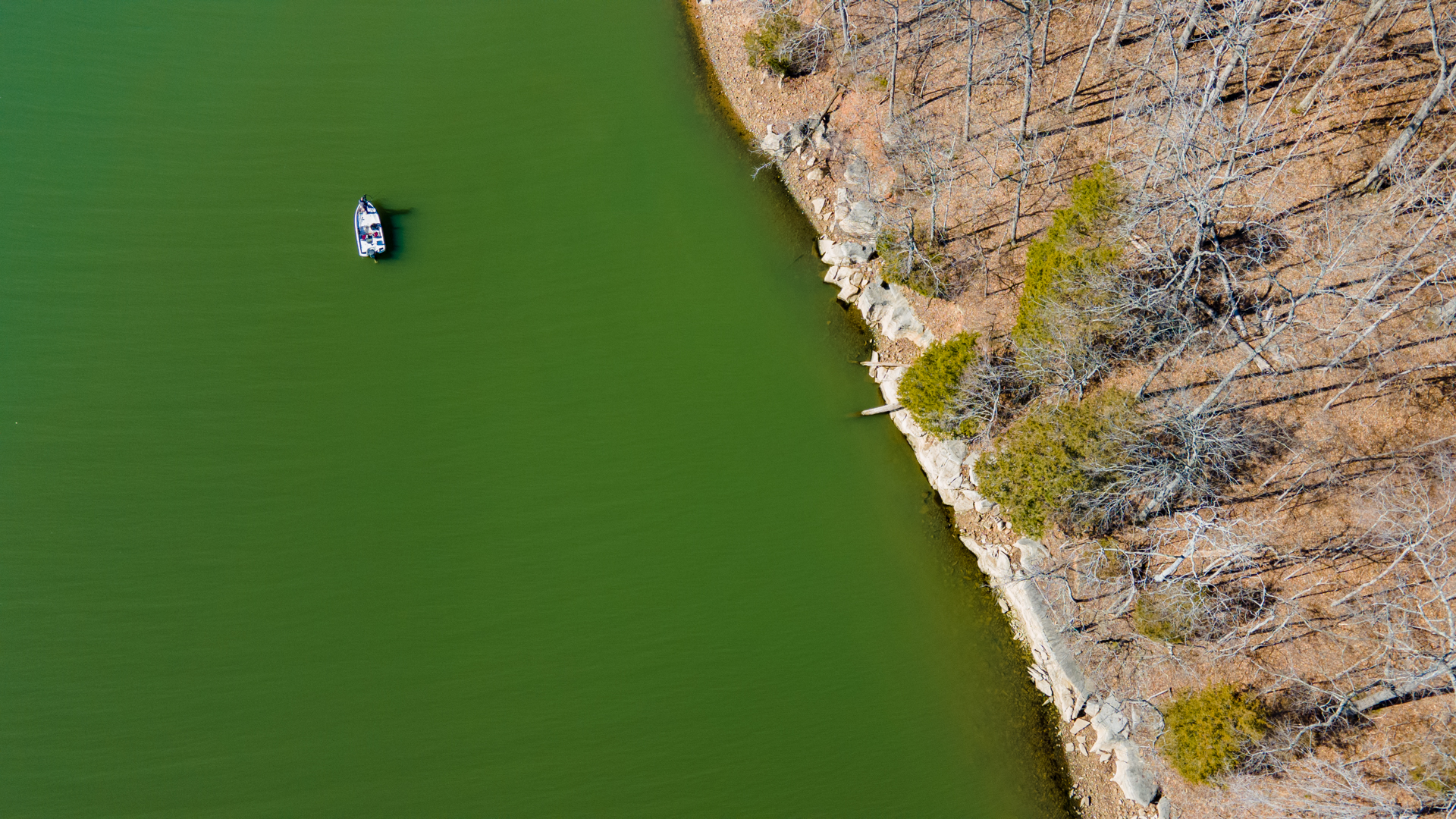
Aerial showing the former site of Blue Spring, Tennessee.
Several photos and even incredible video clips of this community can be found on Facebook in the group Land Between The Rivers – Stewart Co., many of which are contributed by Dennis Mills.
Videos of anything in this region from the 1940s are very rare, so seeing actual footage of Blue Spring is quite stunning. Dennis Mills provided the video in the Facebook group.
“This is a video recorded by Clyde Lyon in the early 40’s before Blue Spring was flooded by Kentucky Lake. Clyde worked for the military and had access to a video camera,” Mills says in his post.
“You are also going to see something that most people in our generation have never seen. Thanks to John and Terry Crutcher who told me to look for this little segment on their daddy’s video tape. You are about to see the only video I’ve ever seen of the actual Blue Spring.”
Included in our drone footage of Blue Spring a part of Mill’s 1940s video of Blue Spring. You can watch below.
When TVA flooded the Tennessee River in 1944, the waters covered up Blue Spring. While looking at the old TVA Land Acquisition Maps, I thought there might be a chance the spring would be visible at winter pool. After finding the former site, I was a bit frustrated to see the lake still covering it up. But the beauty of the landscape quickly shifted my disappointment to great appreciation.
Other than ample social media postings of memories and photos, there isn’t a lot of online information regarding the community of Blue Spring. However, I did find that a post office operated off and on in Blue Spring from 1836 to 1866.
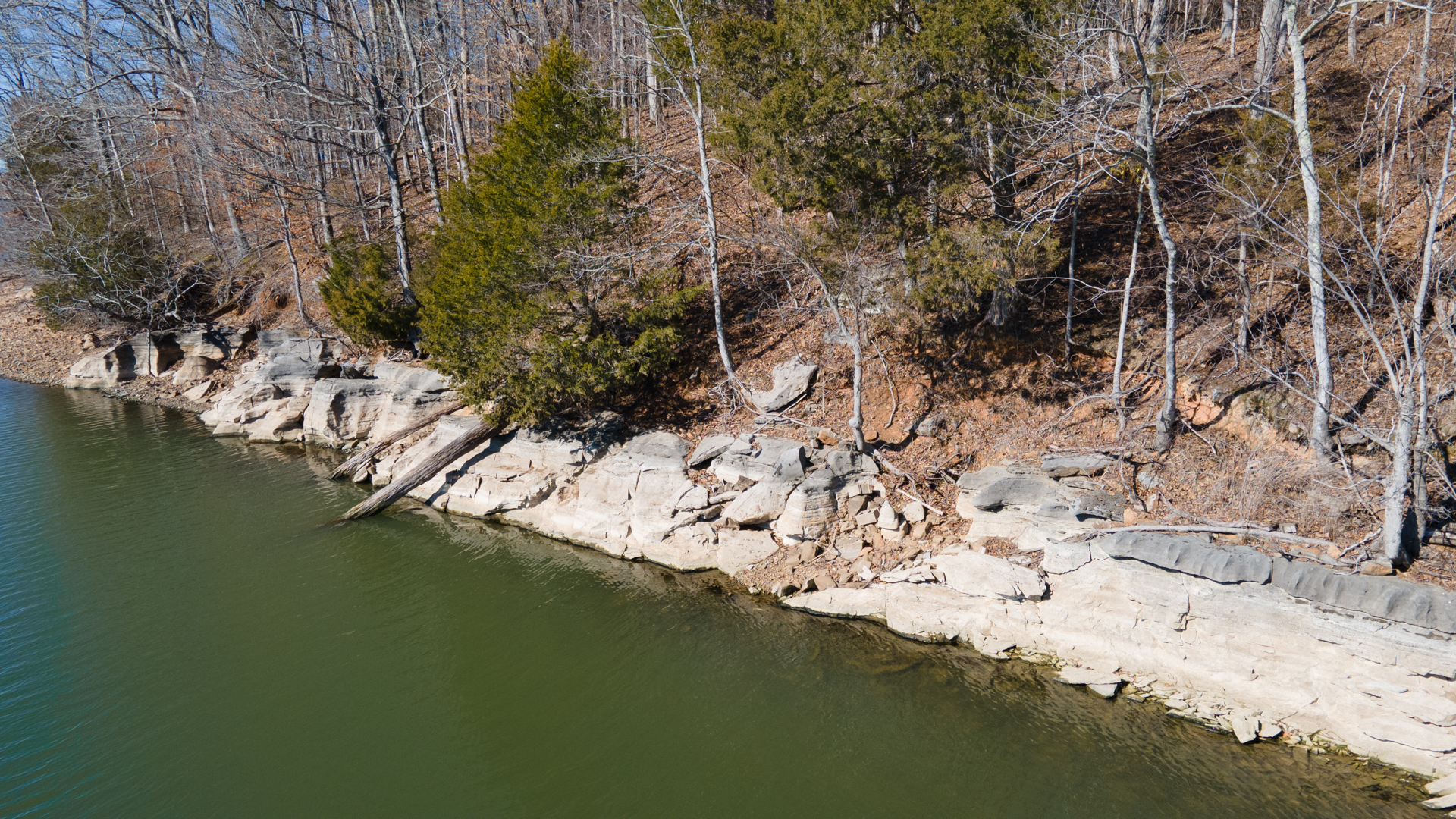
Closeup of the rocky shorelines along Dry Fork & Panther bays.
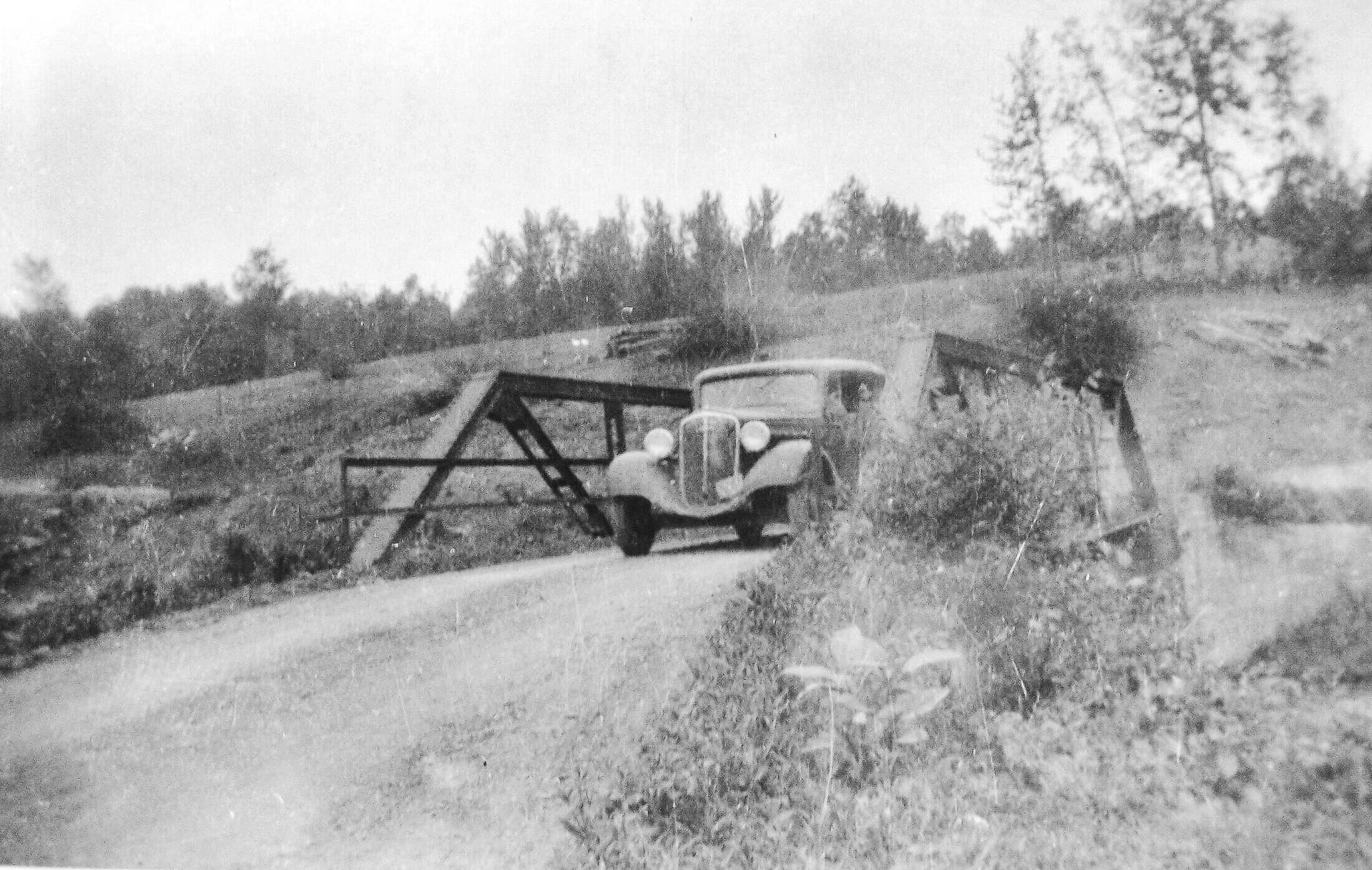
The relocated and now abandoned Pryor Creek Bridge we’ve covered here was located at Blue Spring before Kentucky Lake. The bridge, seen in the photo below from 1923, crossed Panther Creek. TVA relocated the bridge to its current location before Kentucky Lake and was probably abandoned sometime after Land Between The Lakes formed in the 1960s.
From 1923, a car crosses Panther Creek in the Blue Spring community. Courtesy Christian Greco / Land Between The Rivers - Stewart Co. Facebook group
A handful of rock formations along the lake, especially in the north around Hillman Ferry, have been defaced. So if you visit this site, please remember to leave no trace and respect the centuries-old history of this beautiful place.