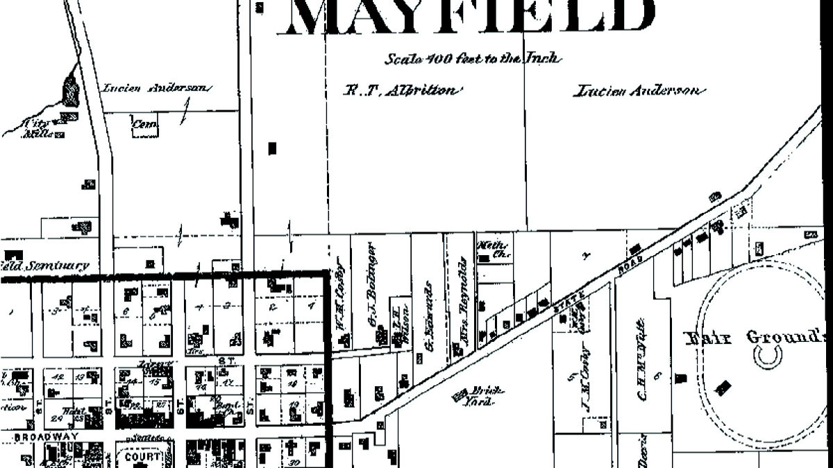
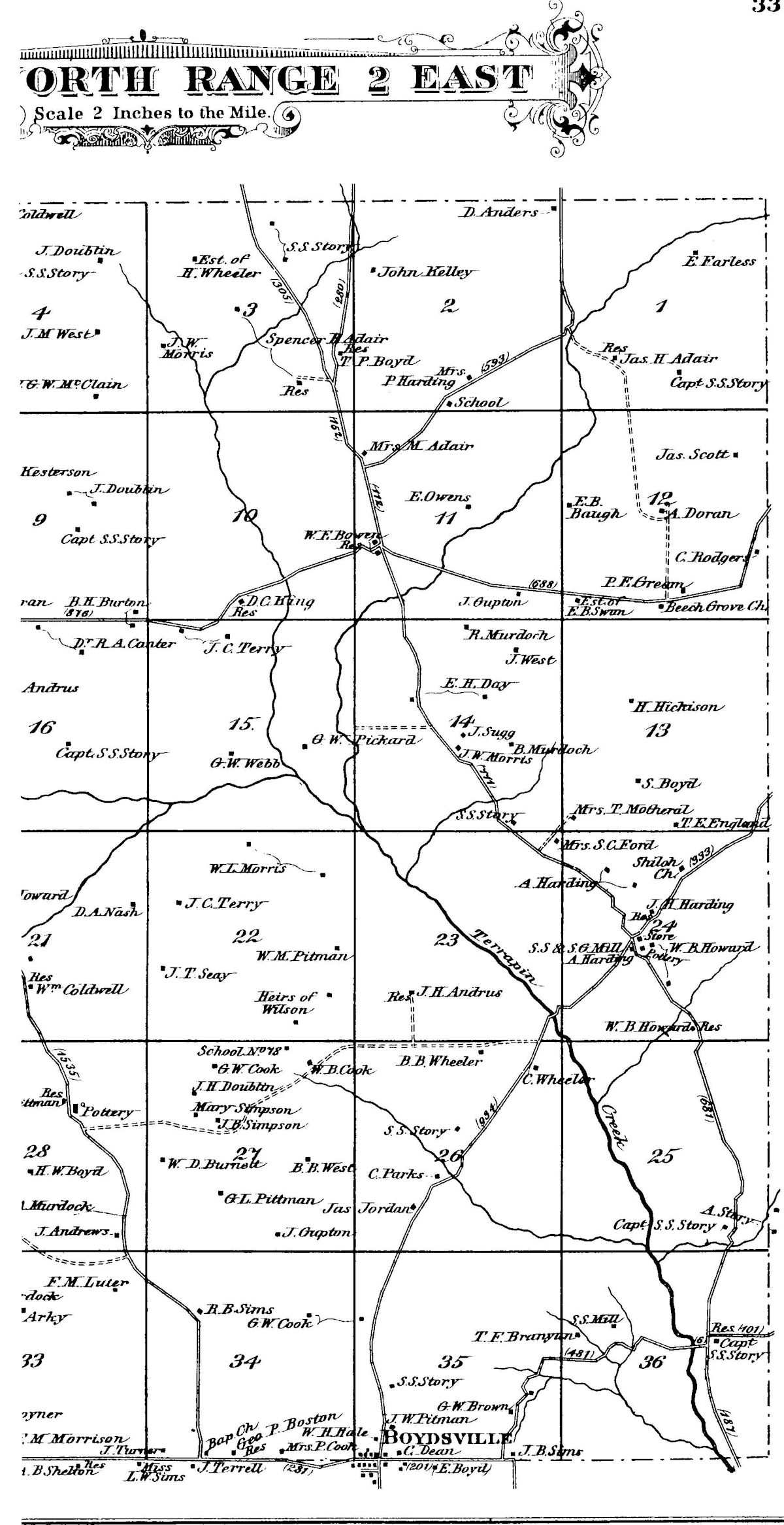
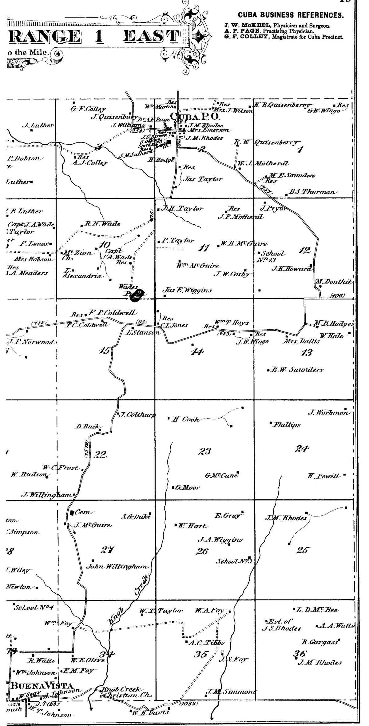
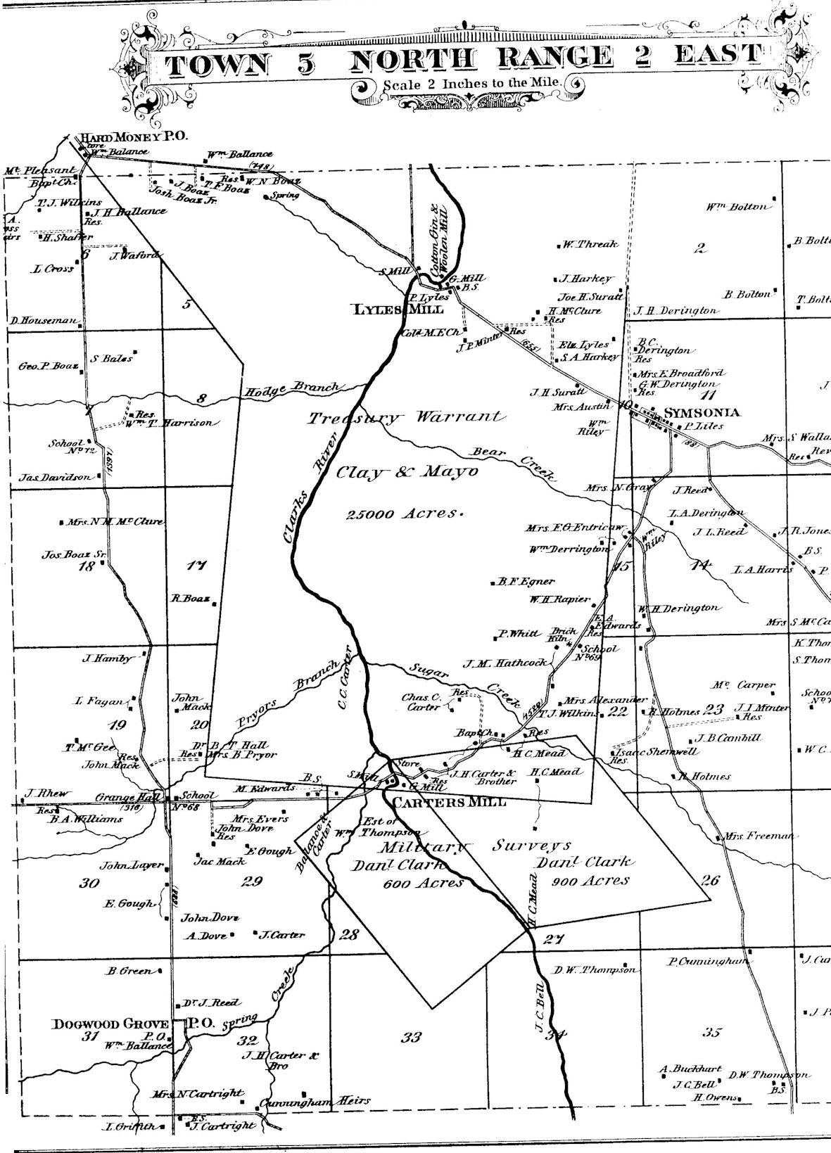
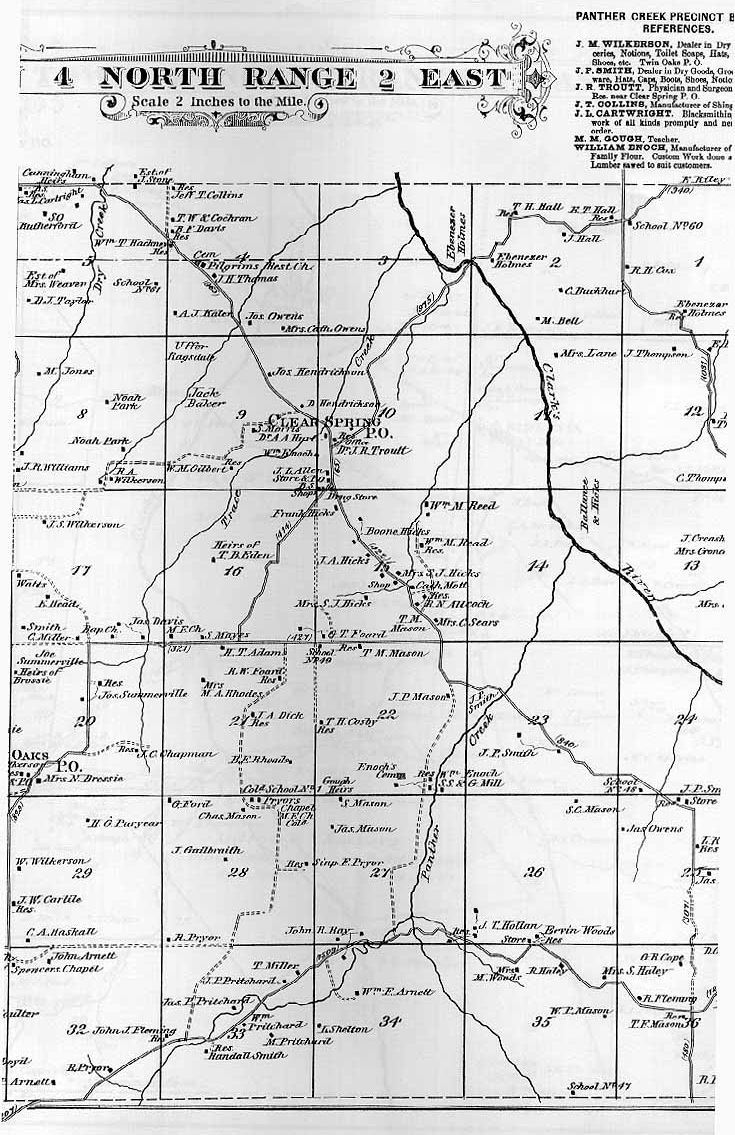
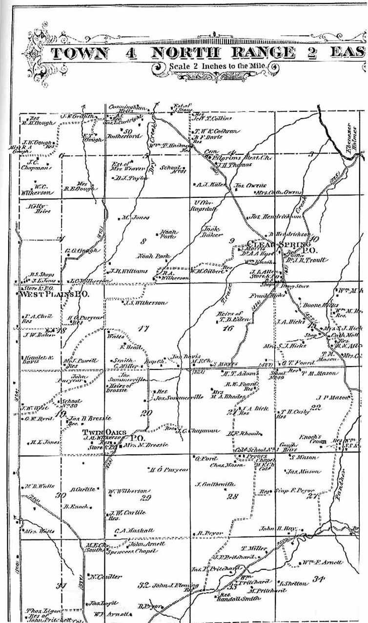
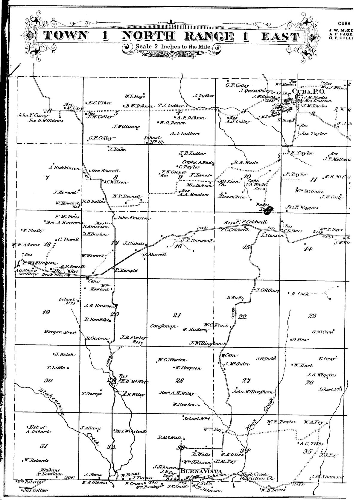
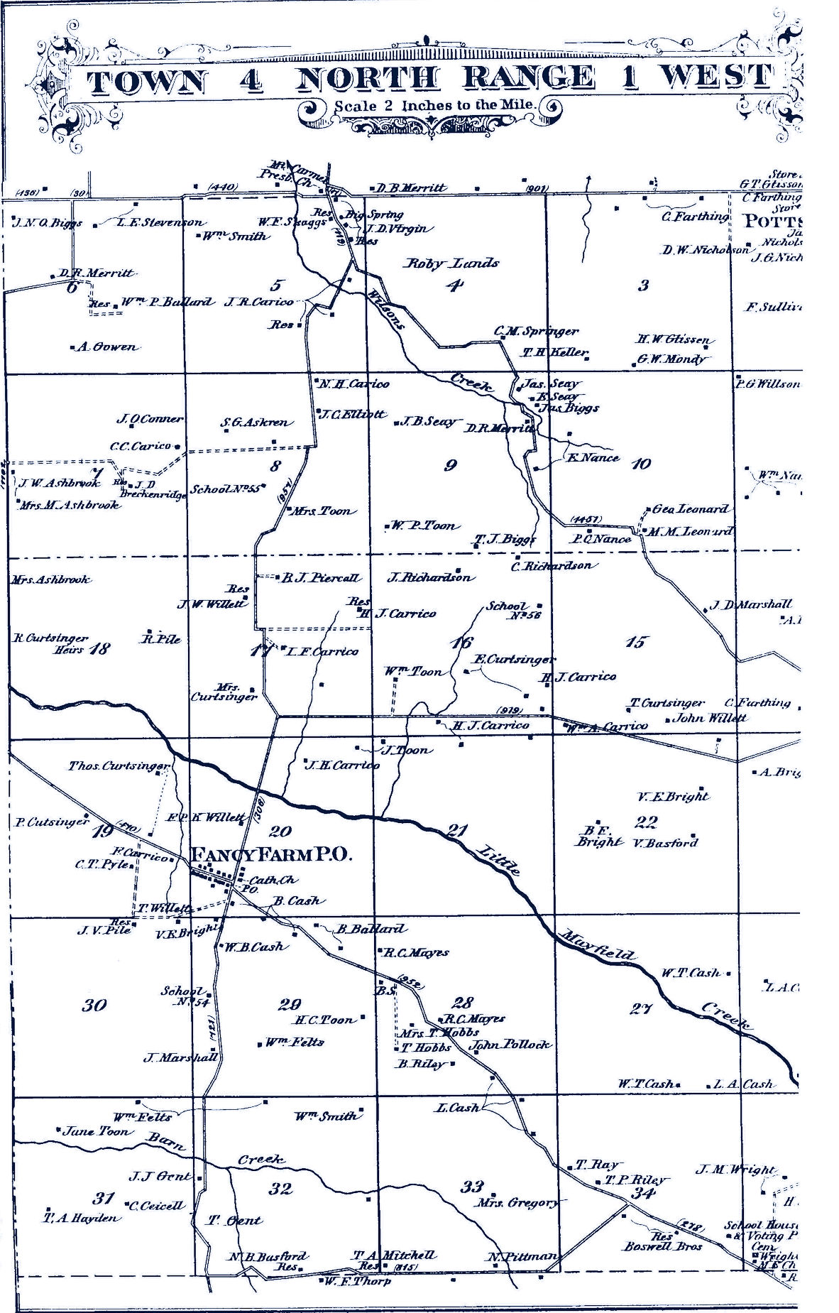
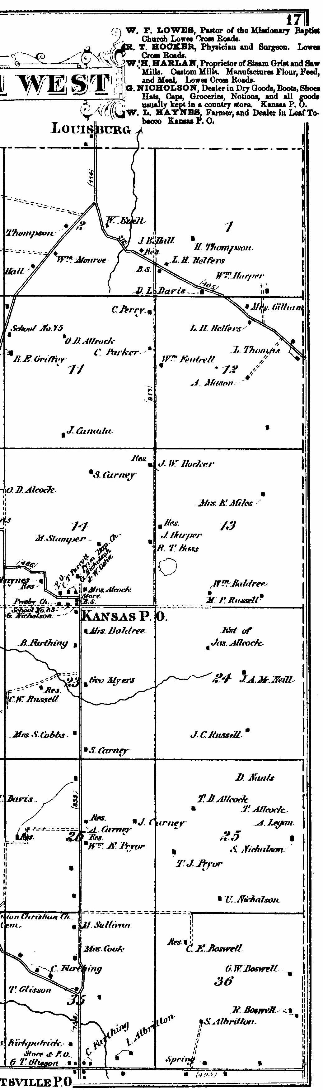
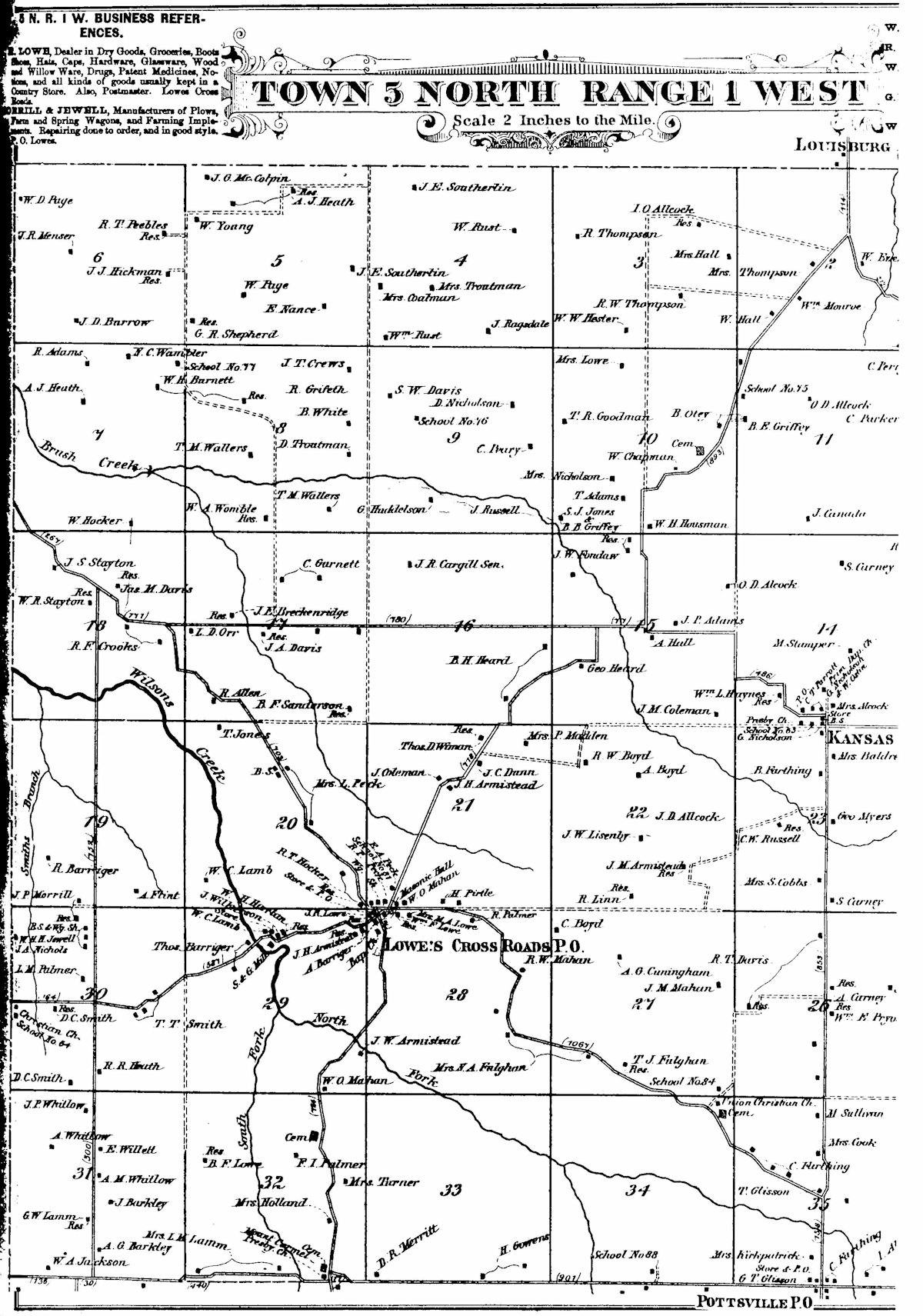
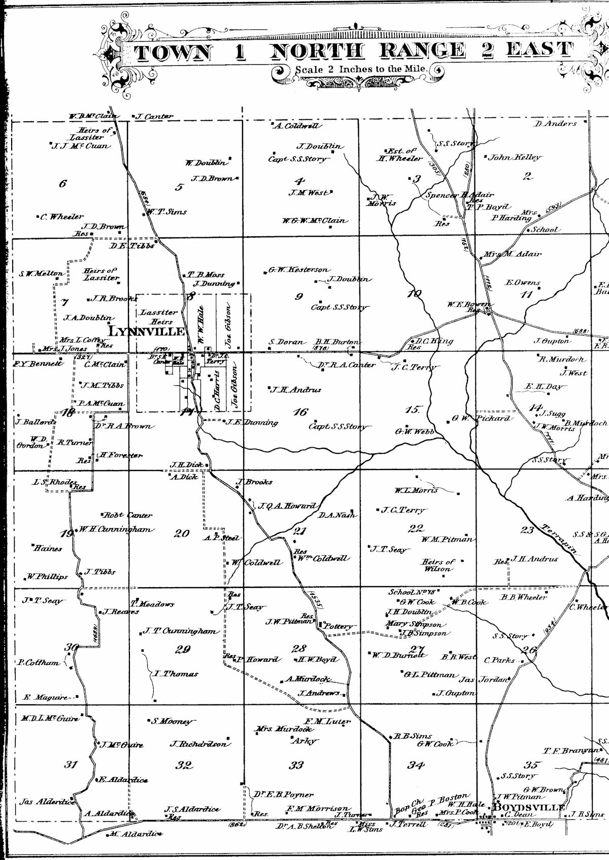
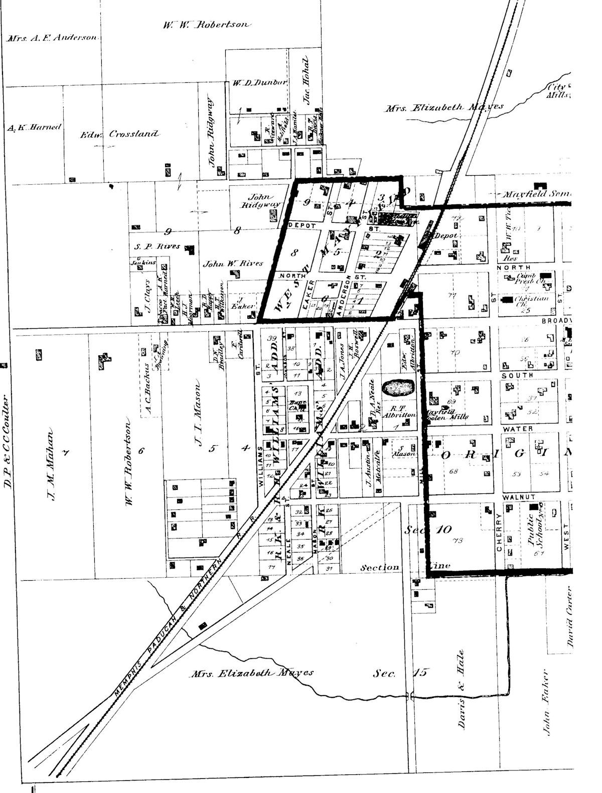
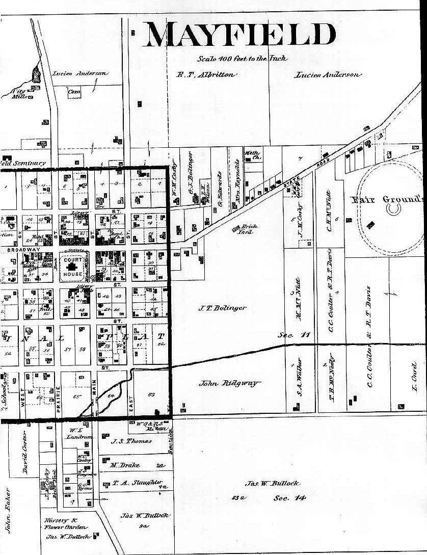
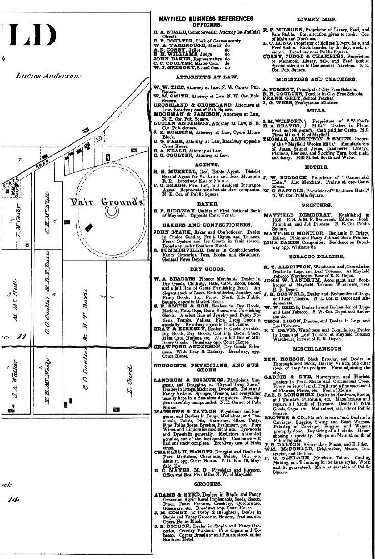
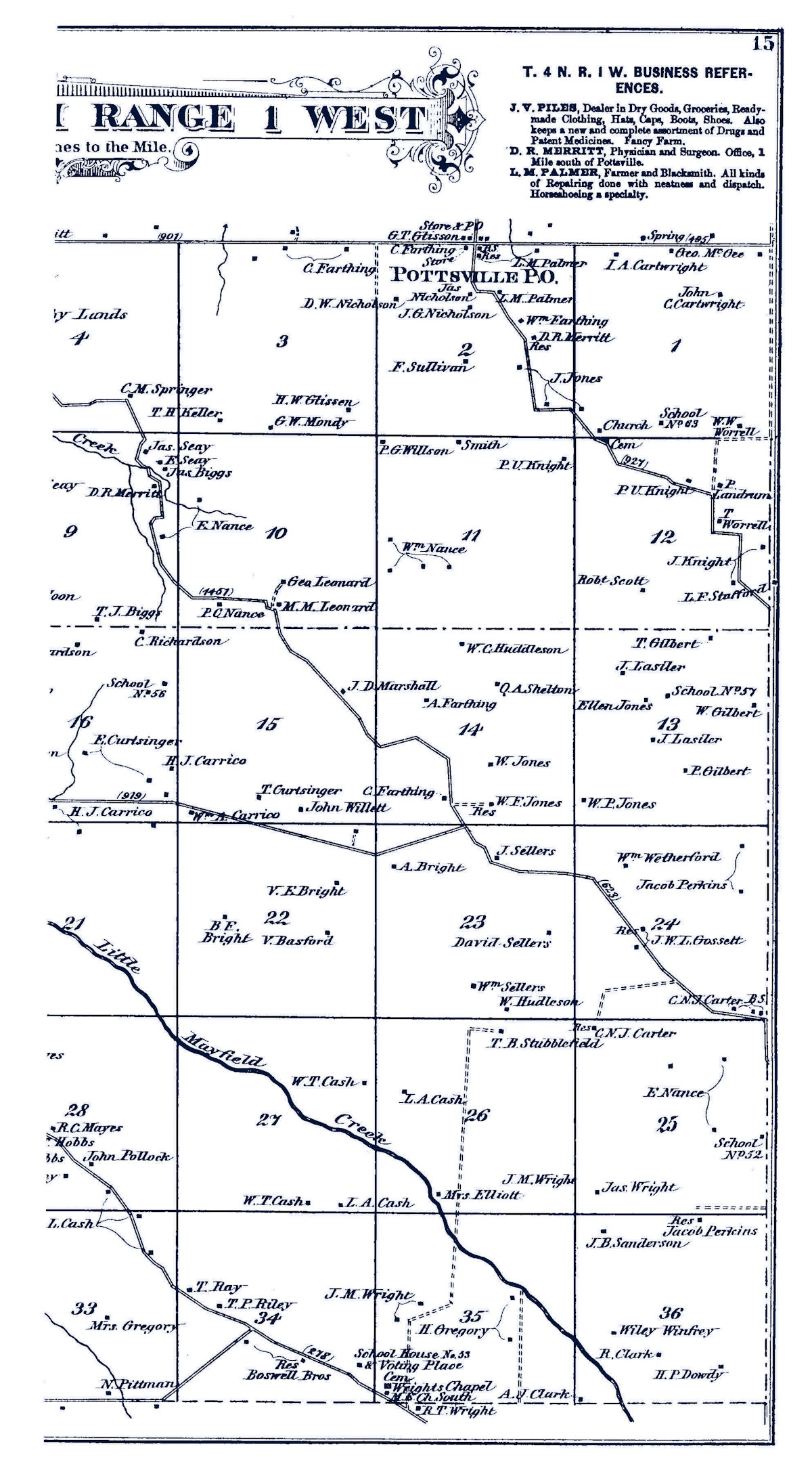
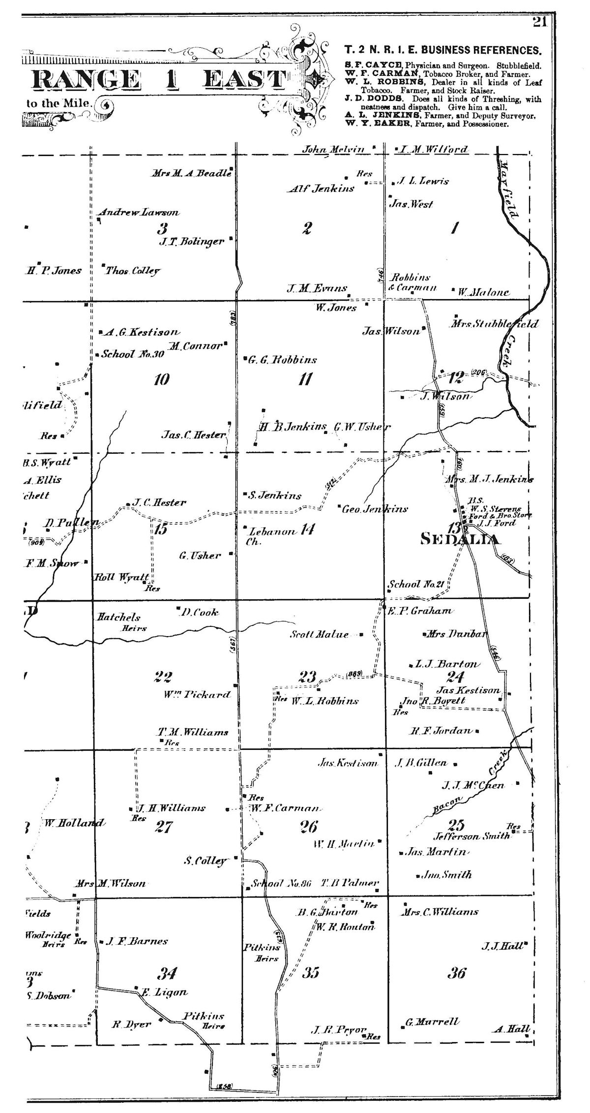
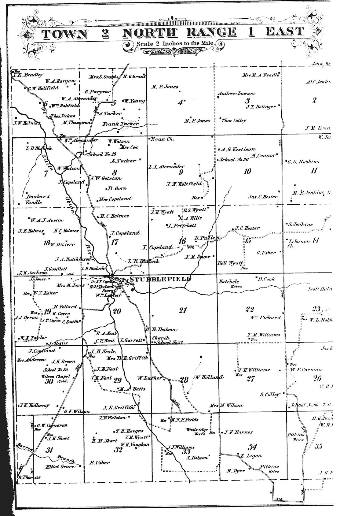
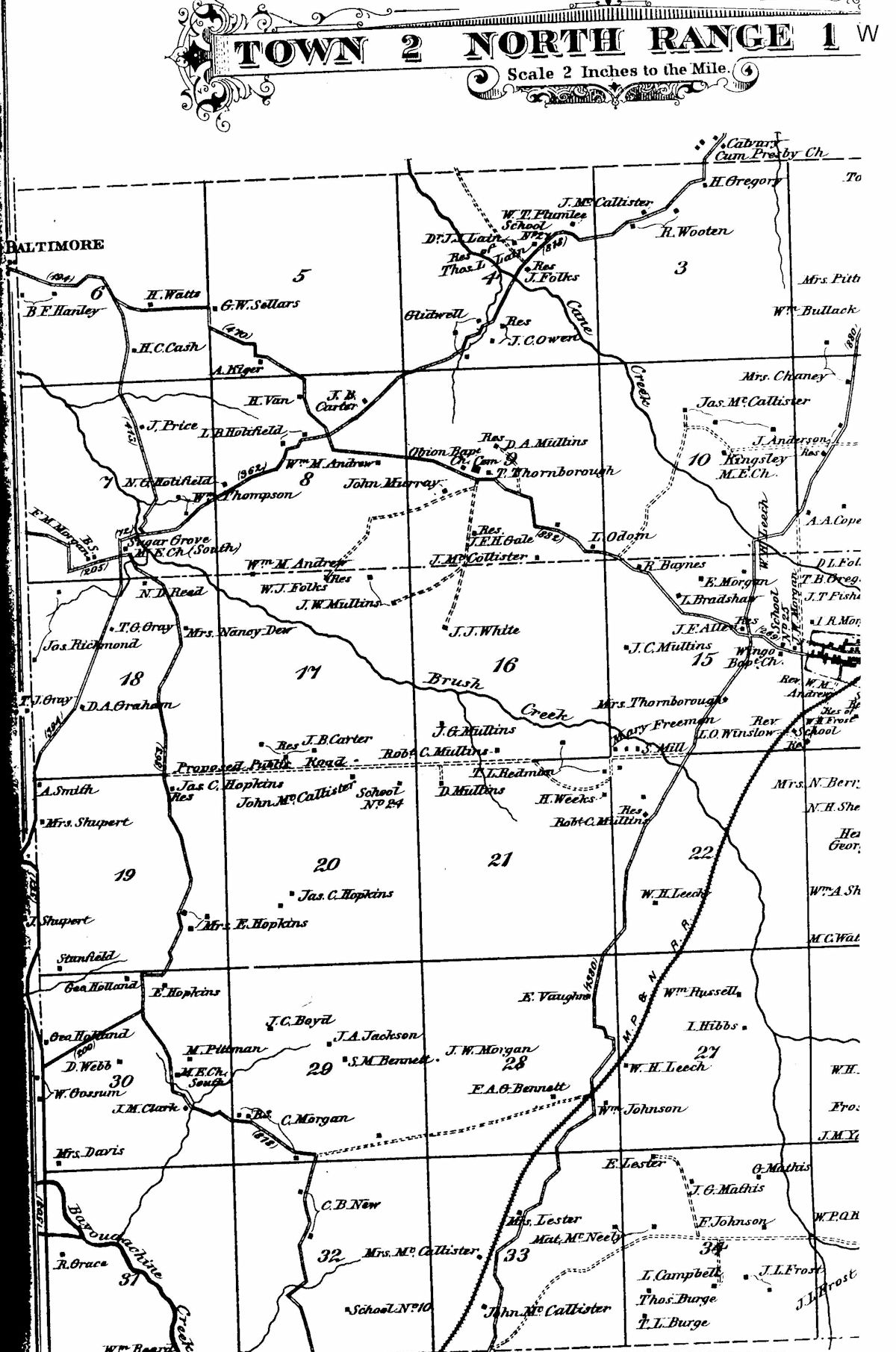
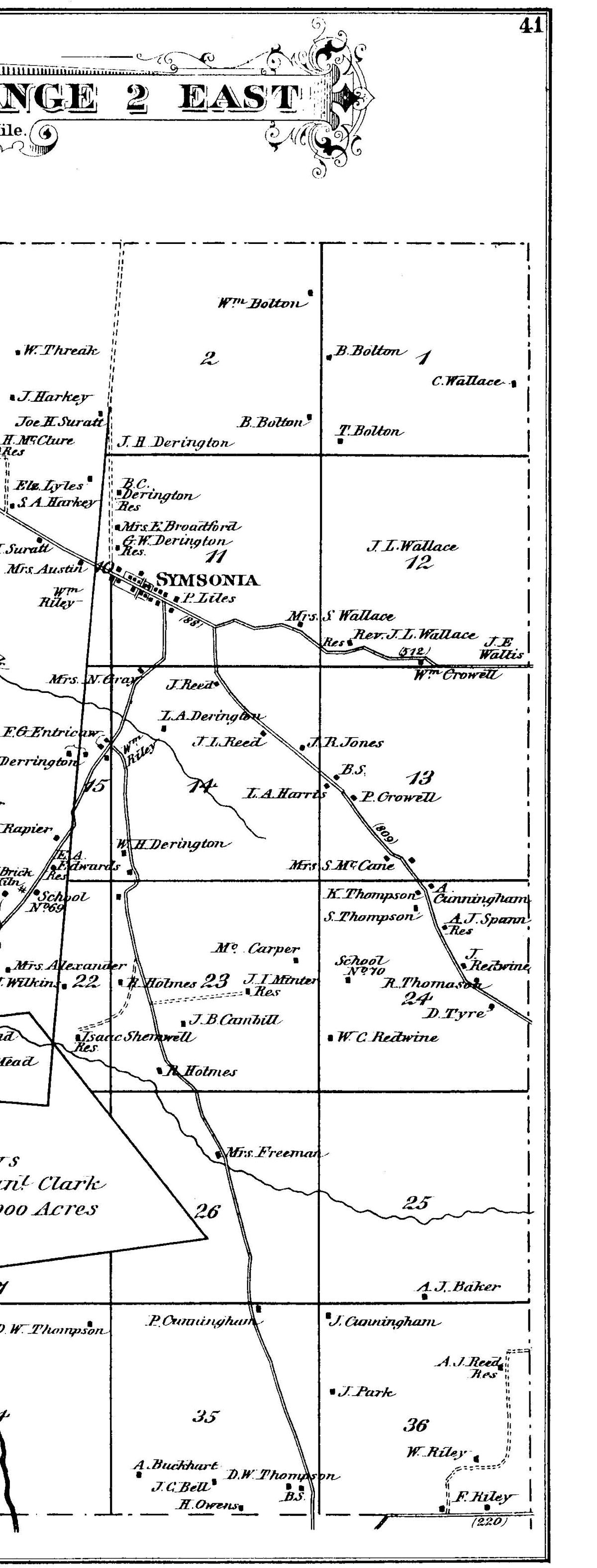
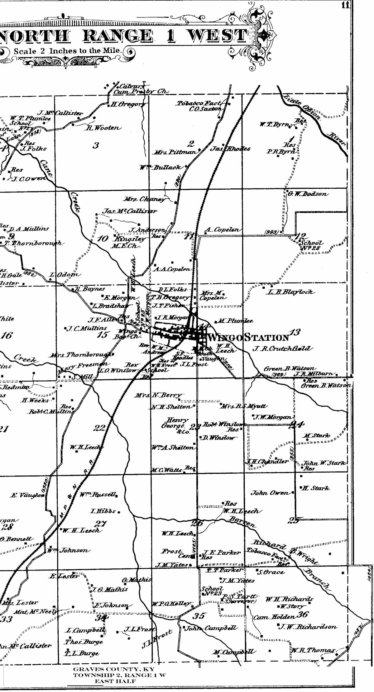
Few detailed maps exist at the county level from the 19th Century. Graves County, Kentucky is lucky to have a highly detailed atlas from 1880 showing the entire county.
Featured in the 1880 Graves County Atlas is all the communities and towns that were in existence 140+ years ago, roads, railroads, creeks and rivers as well as individual landowners’ names.
Some businesses are also index, especially in Mayfield. Below are scans of the atlas. The source is not known, although it was republished by D.J. Lake & Company in the 1970s. It was originally published by B. N. Griffing using actual surveys of Graves County.

