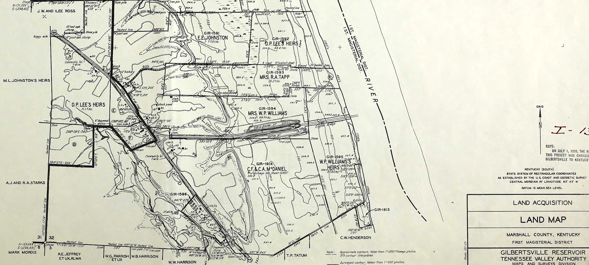
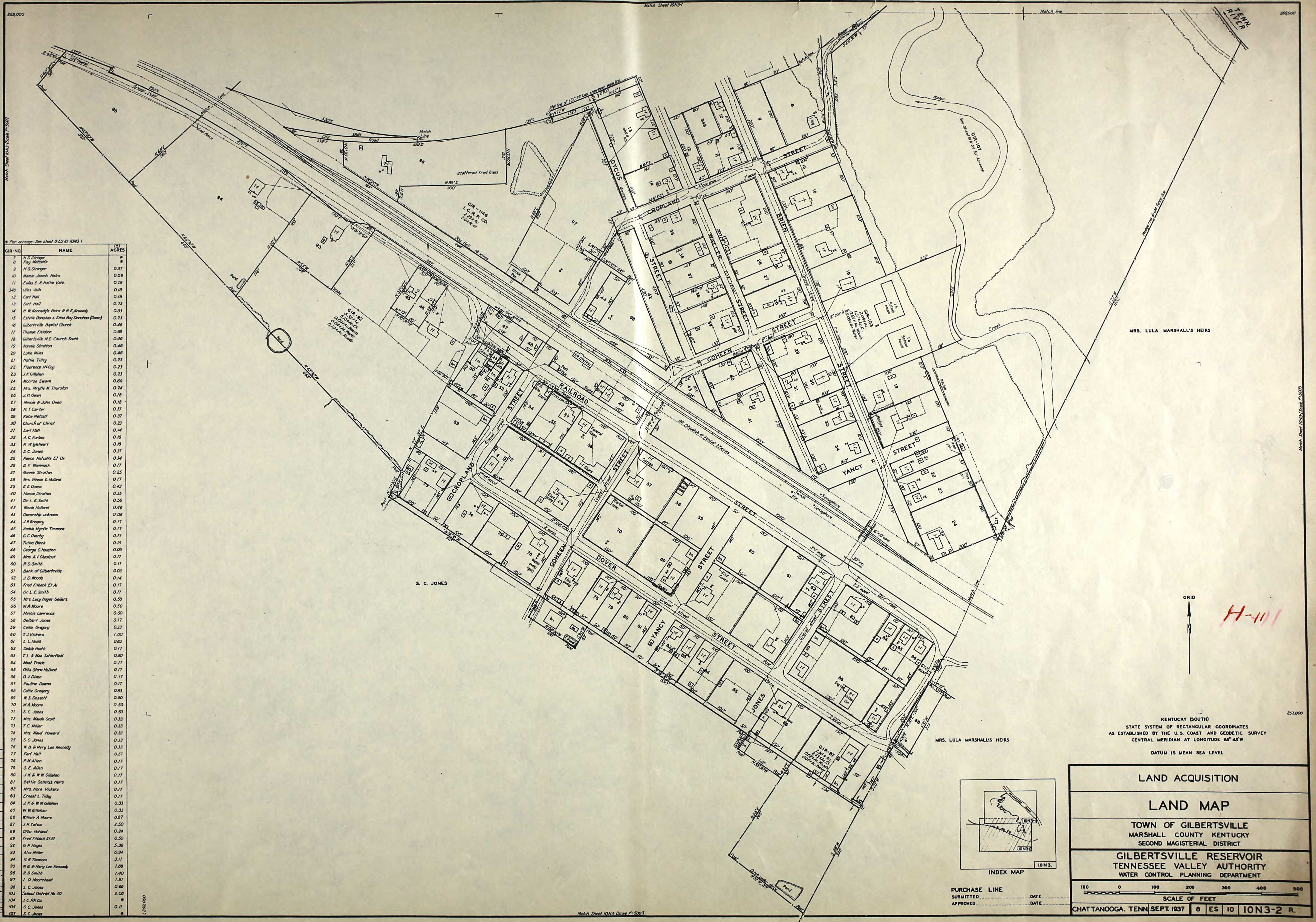
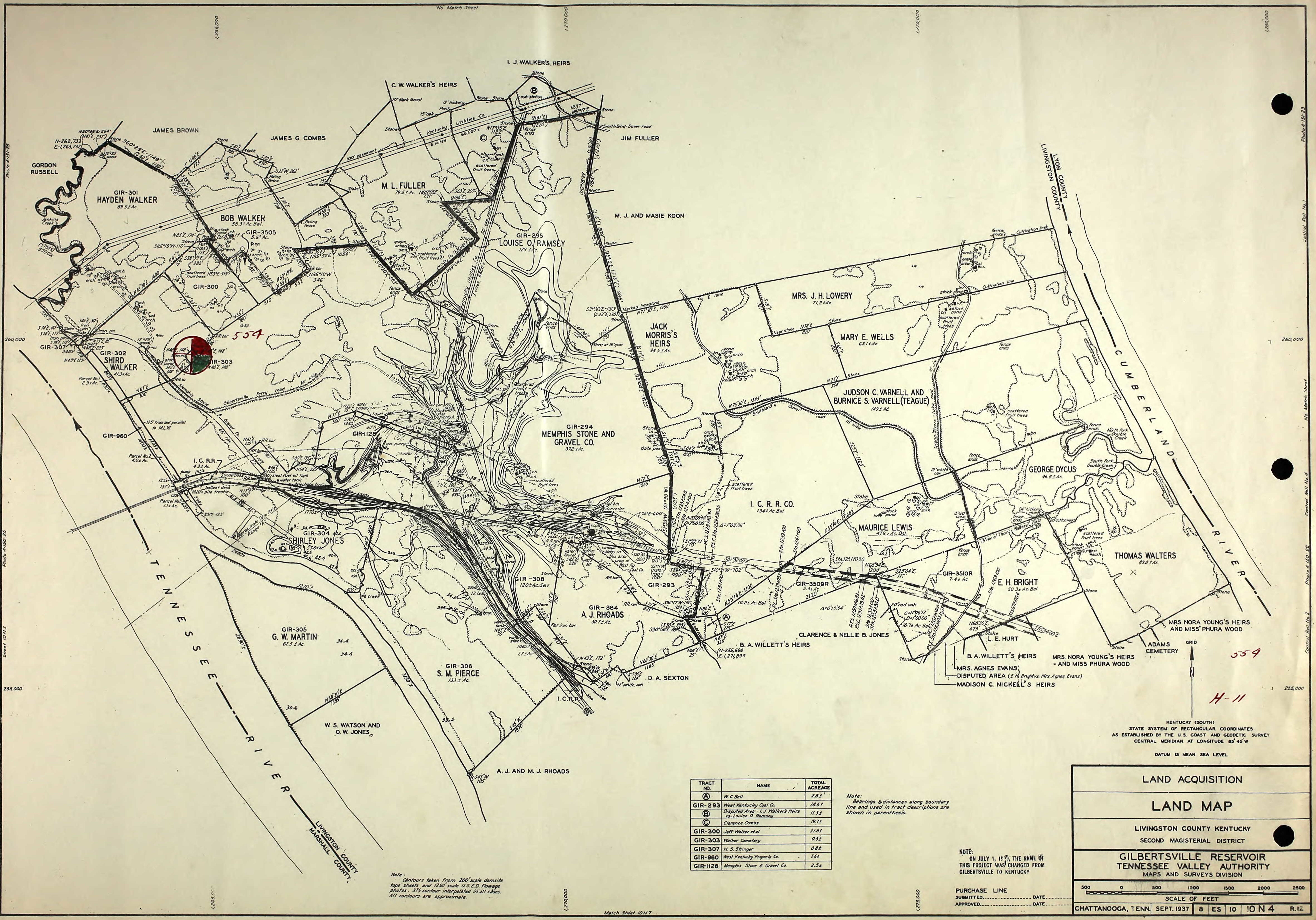
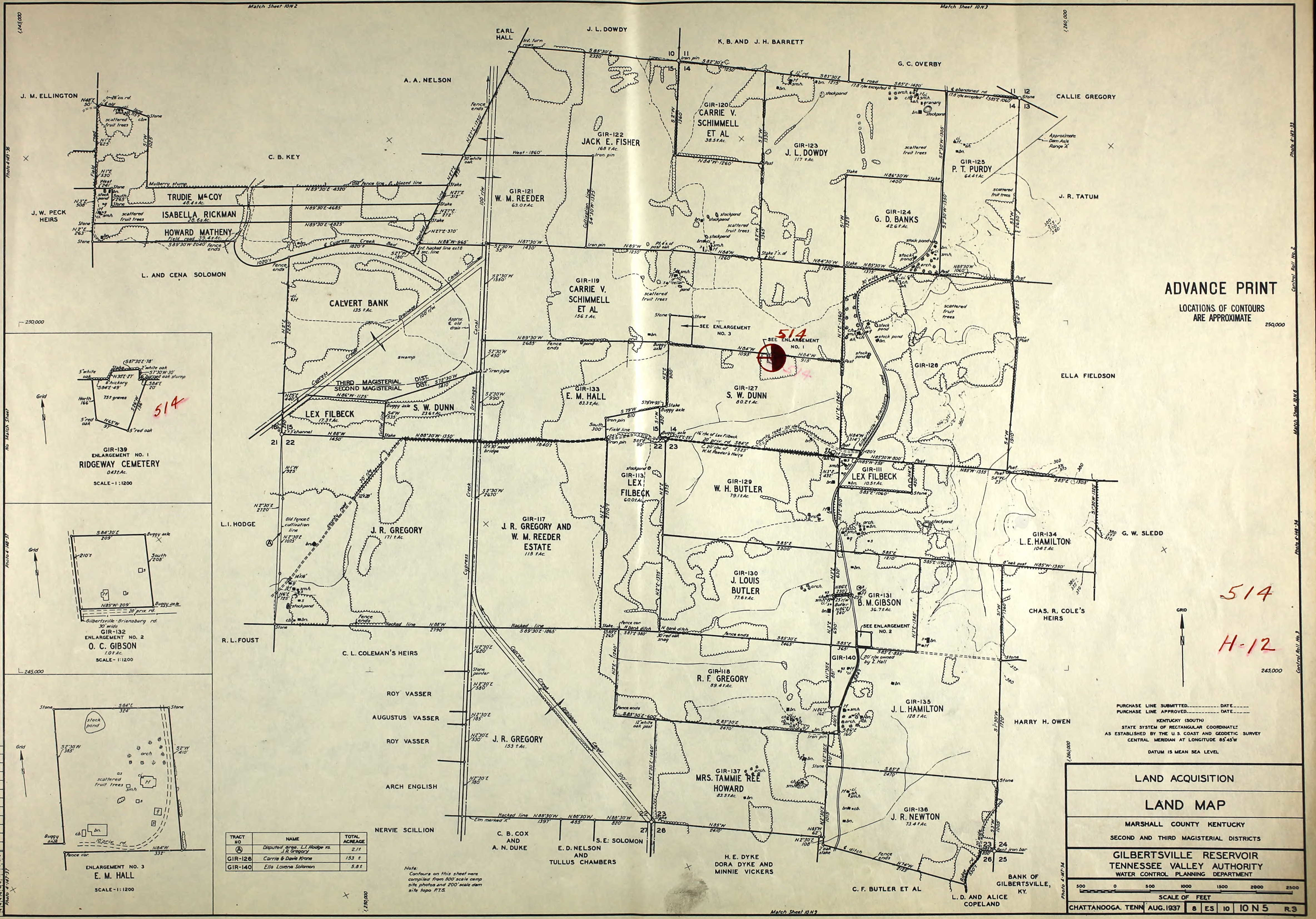
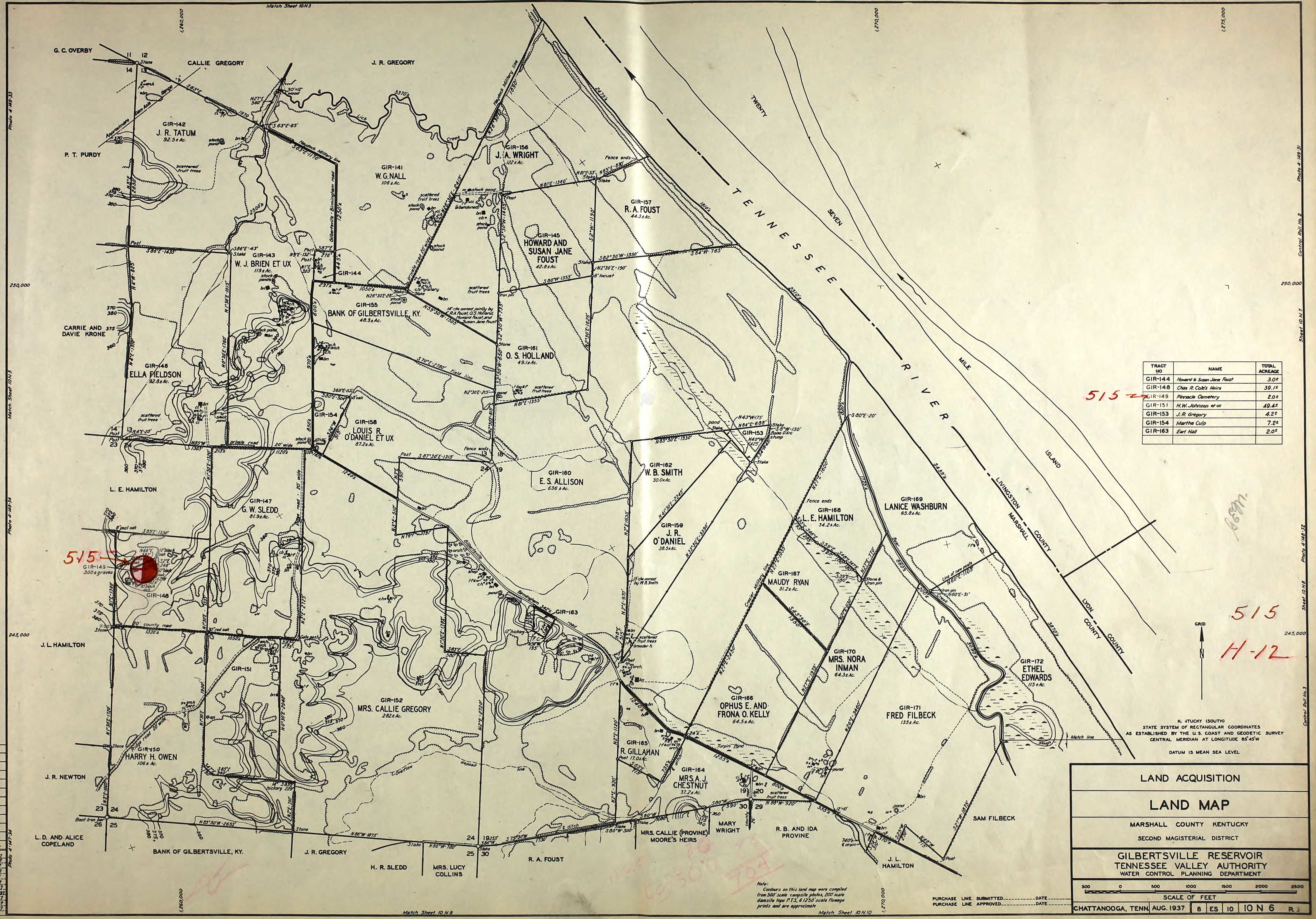
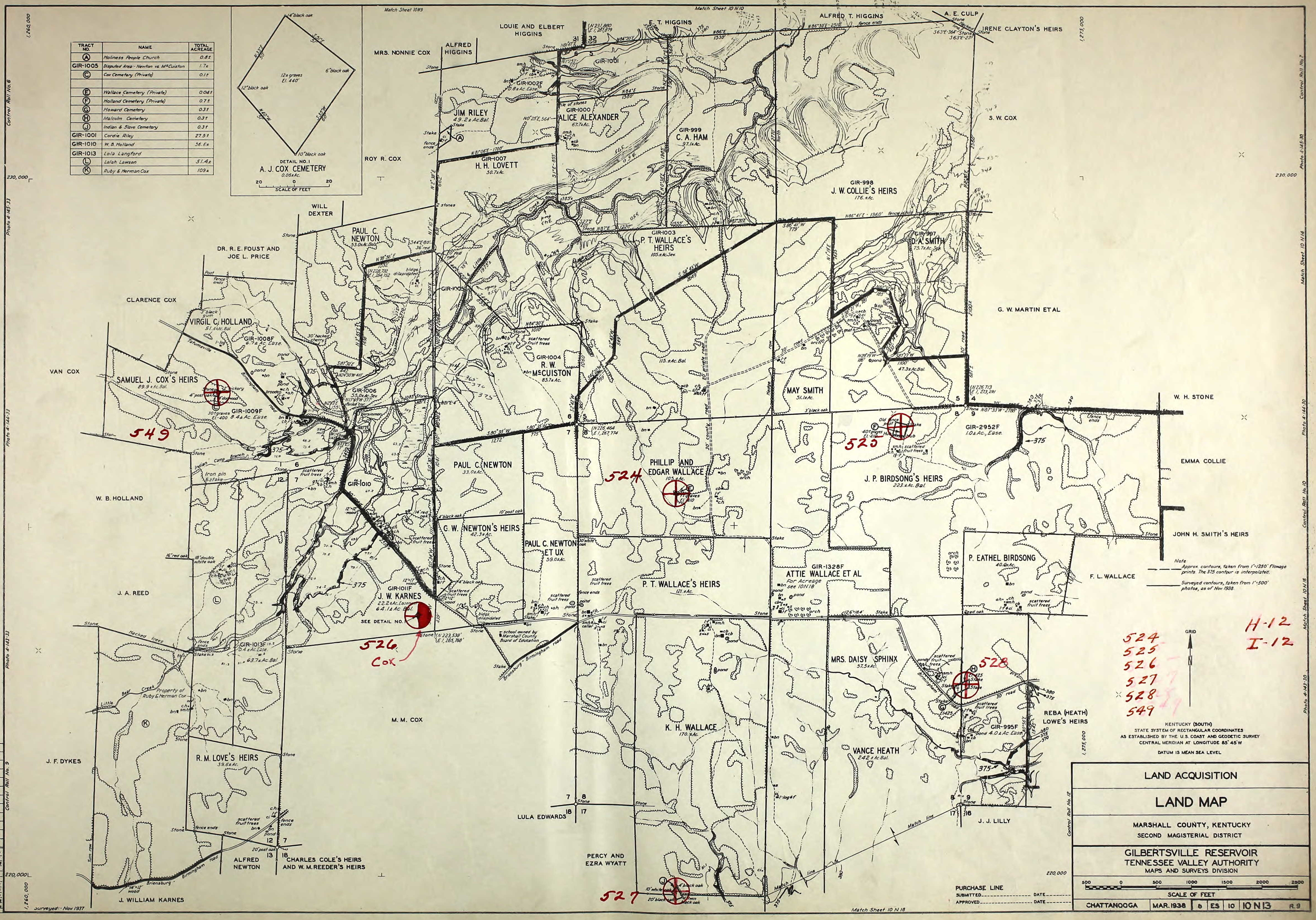
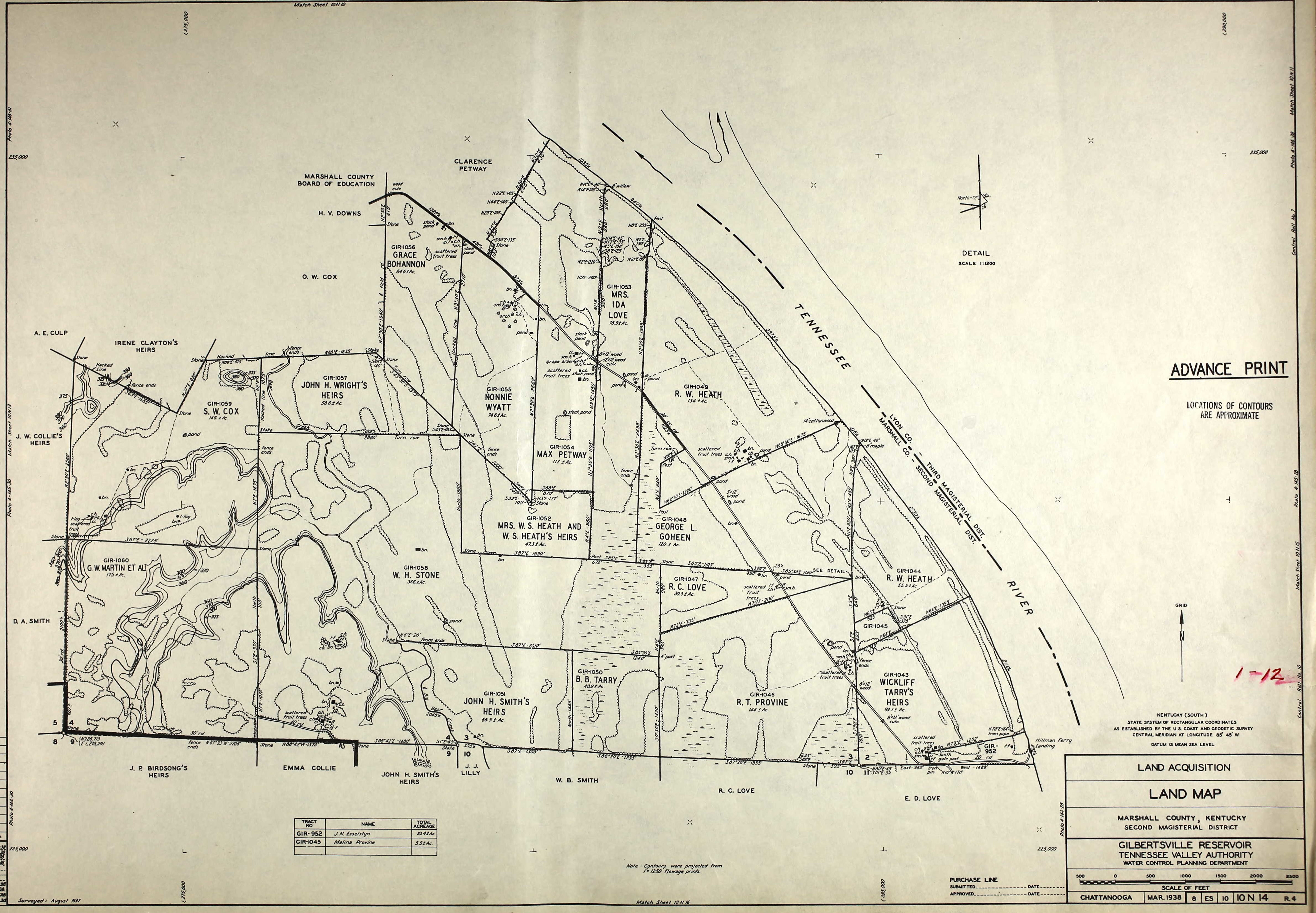
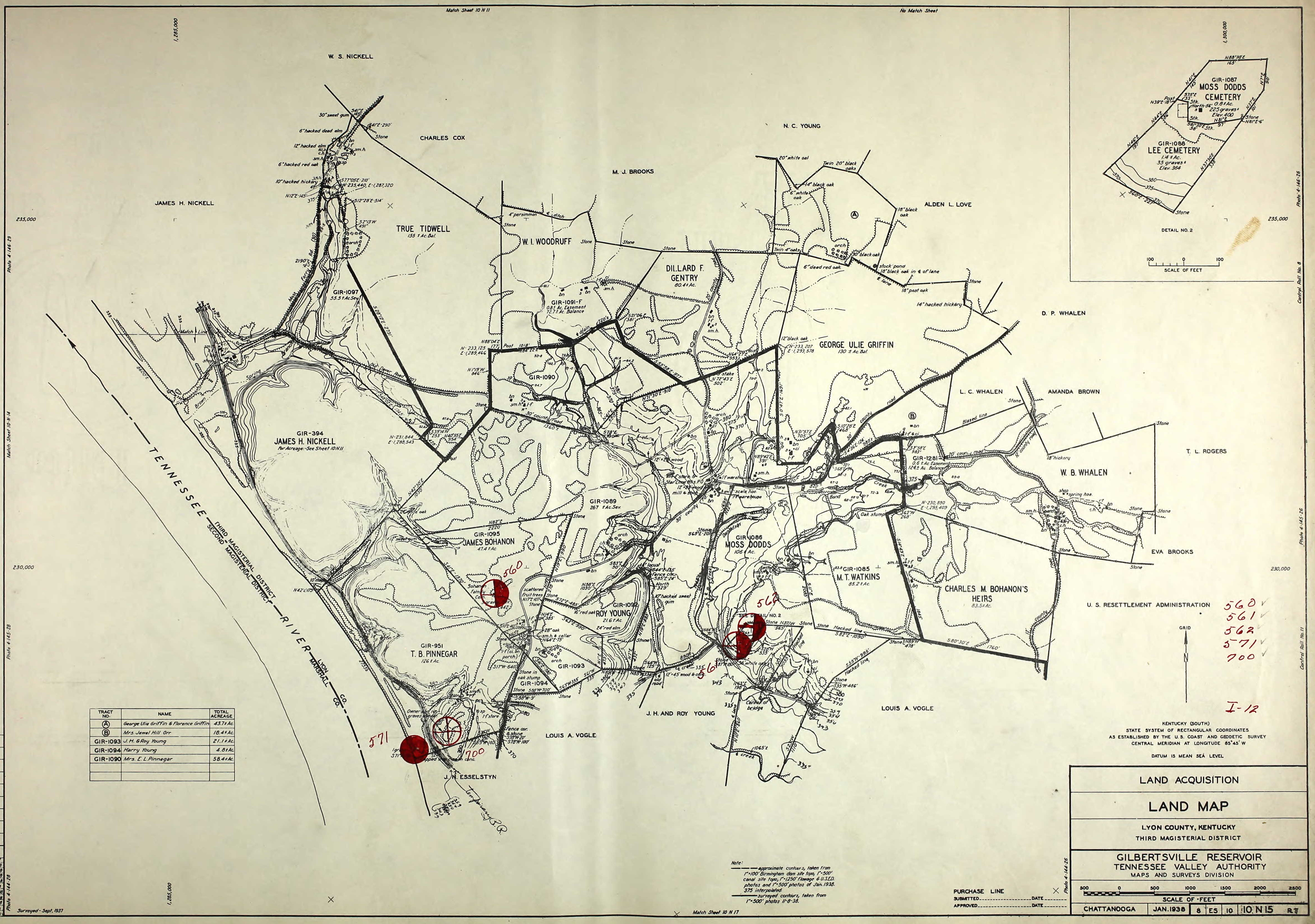
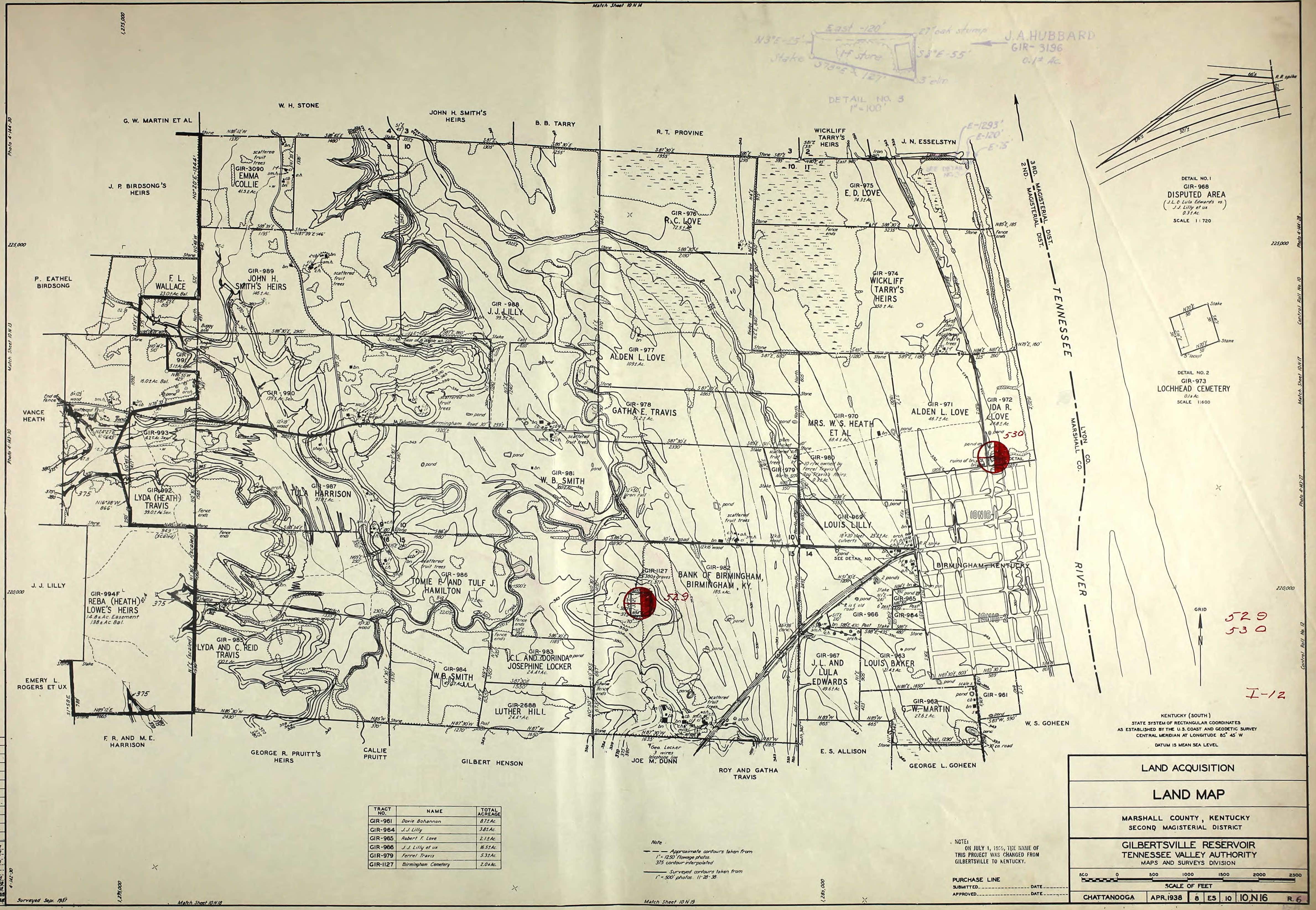
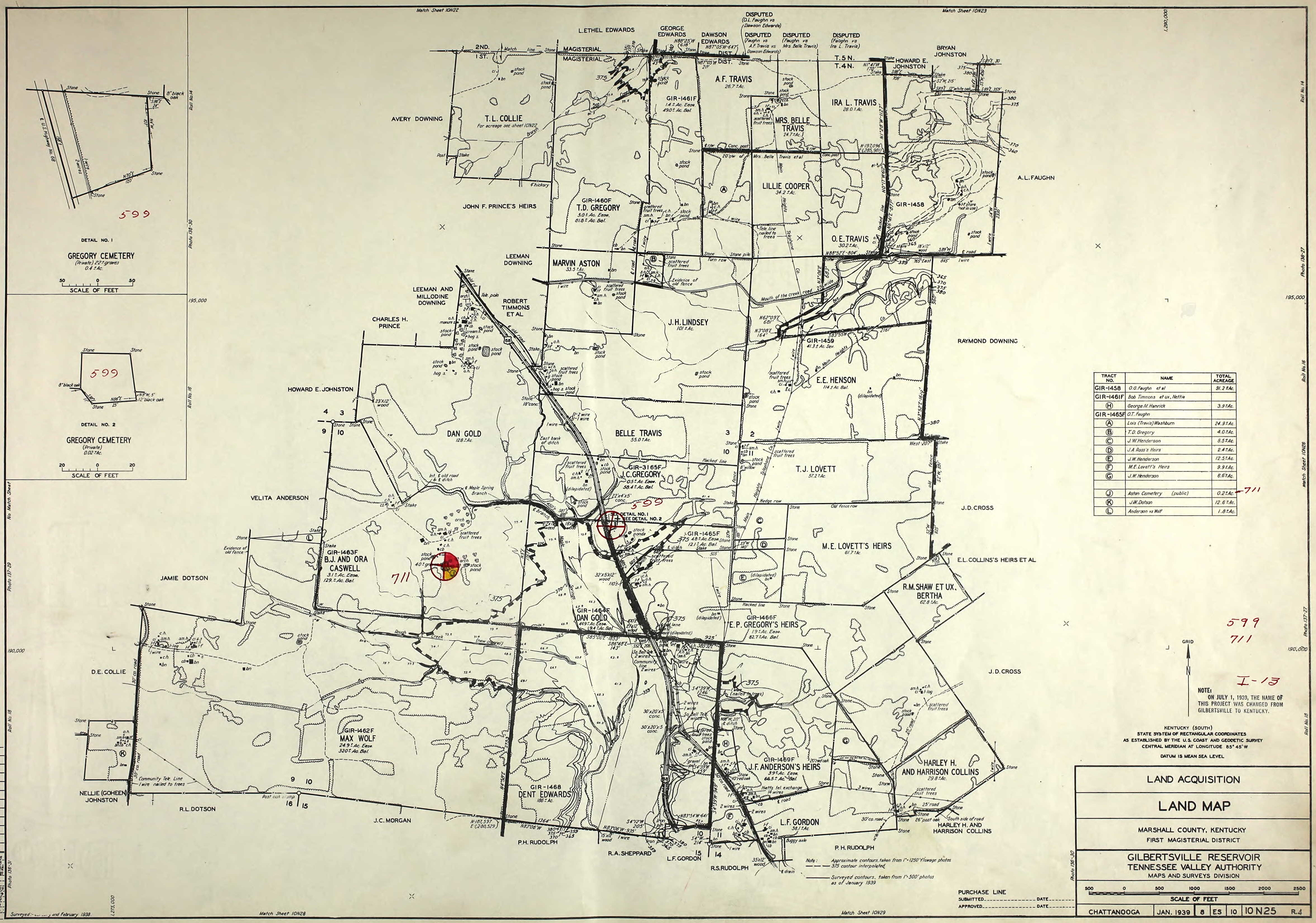
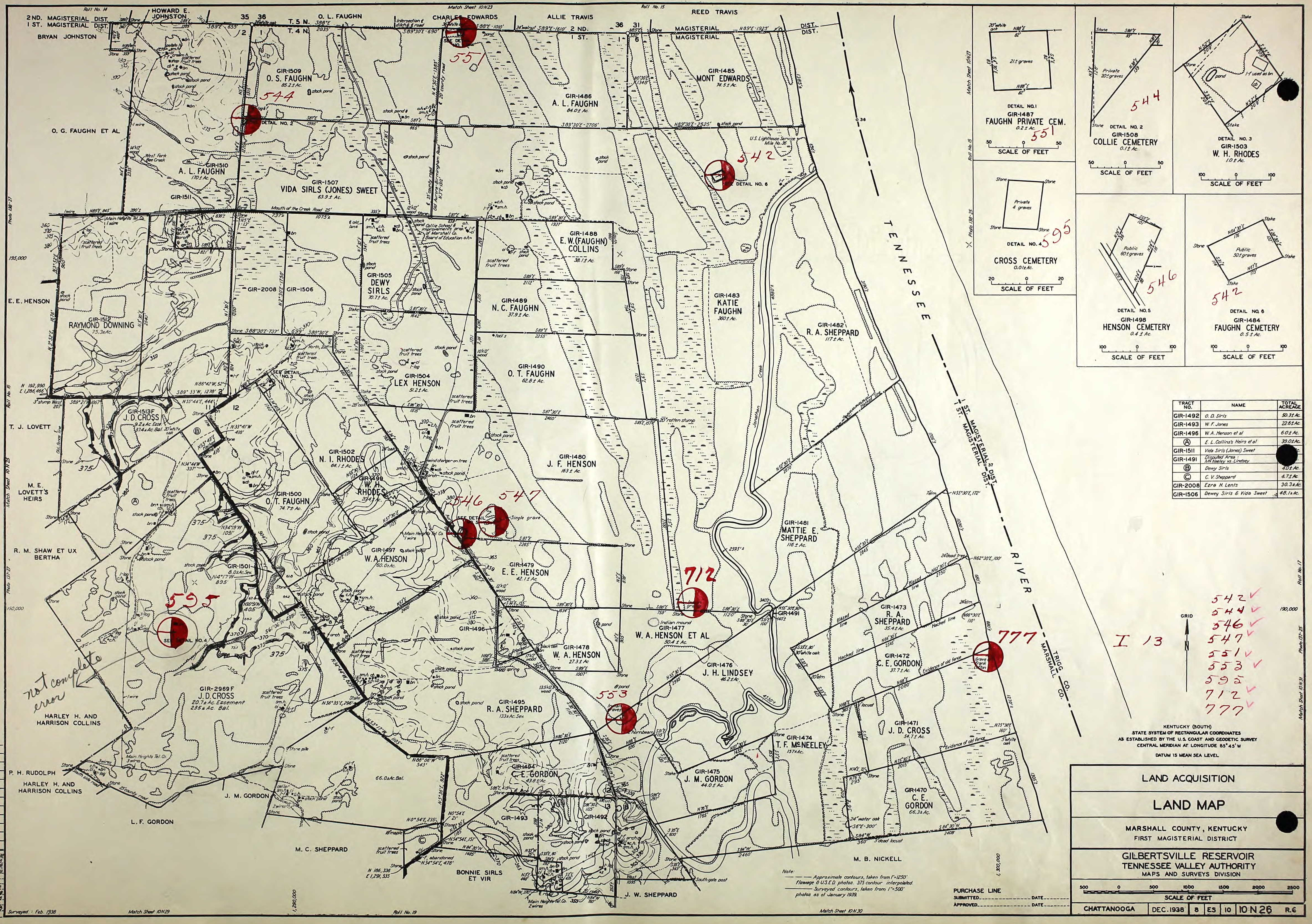
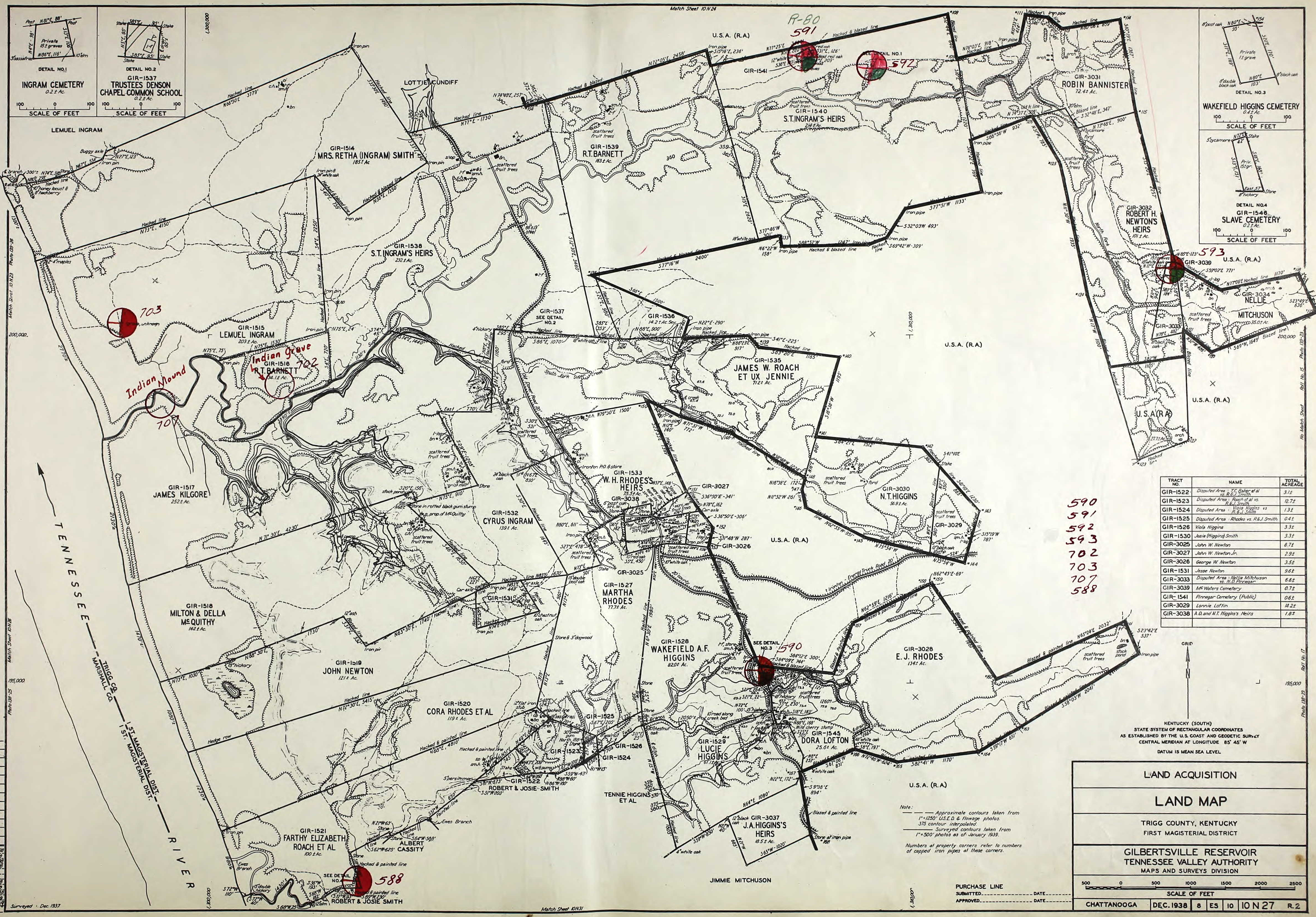
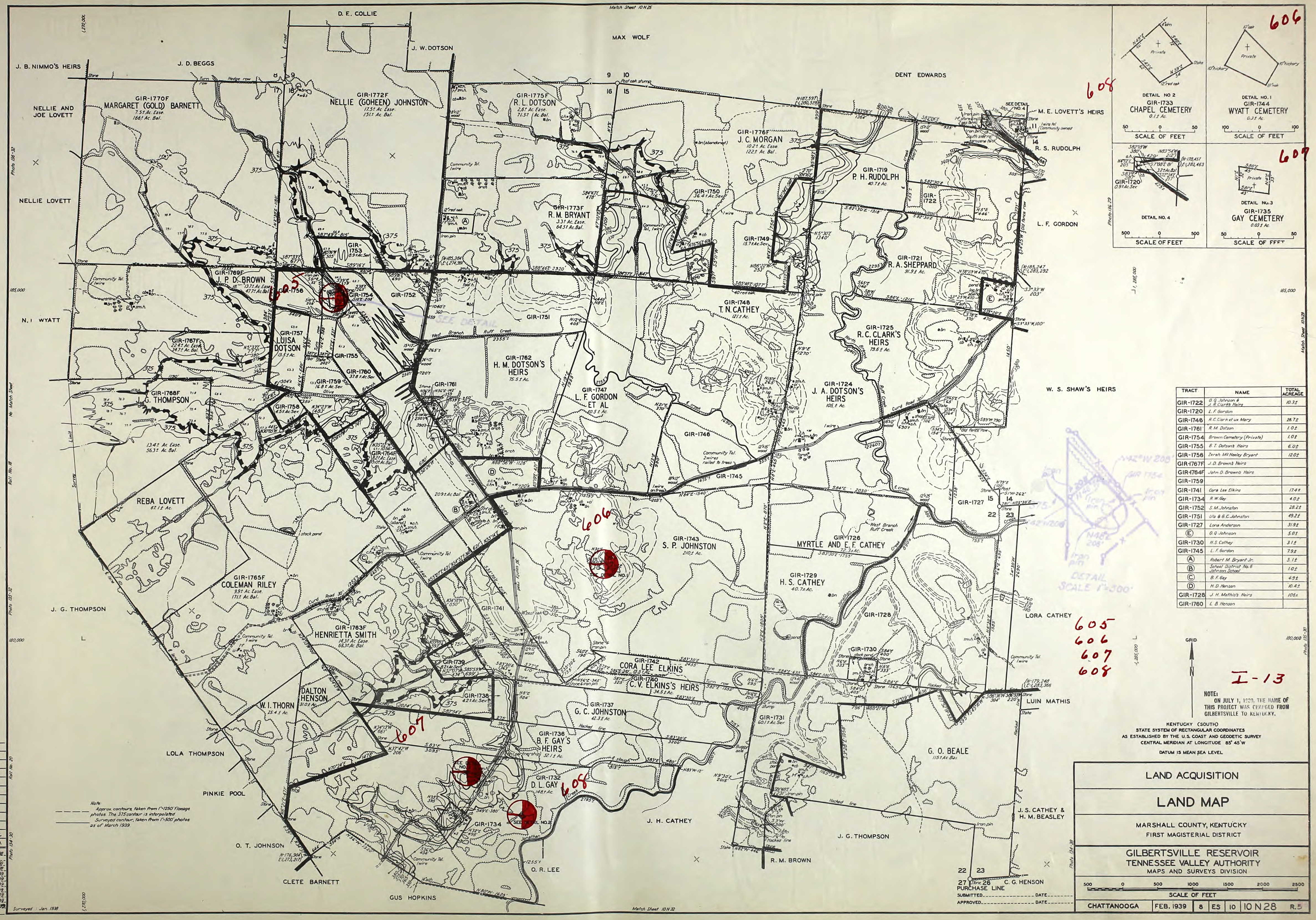
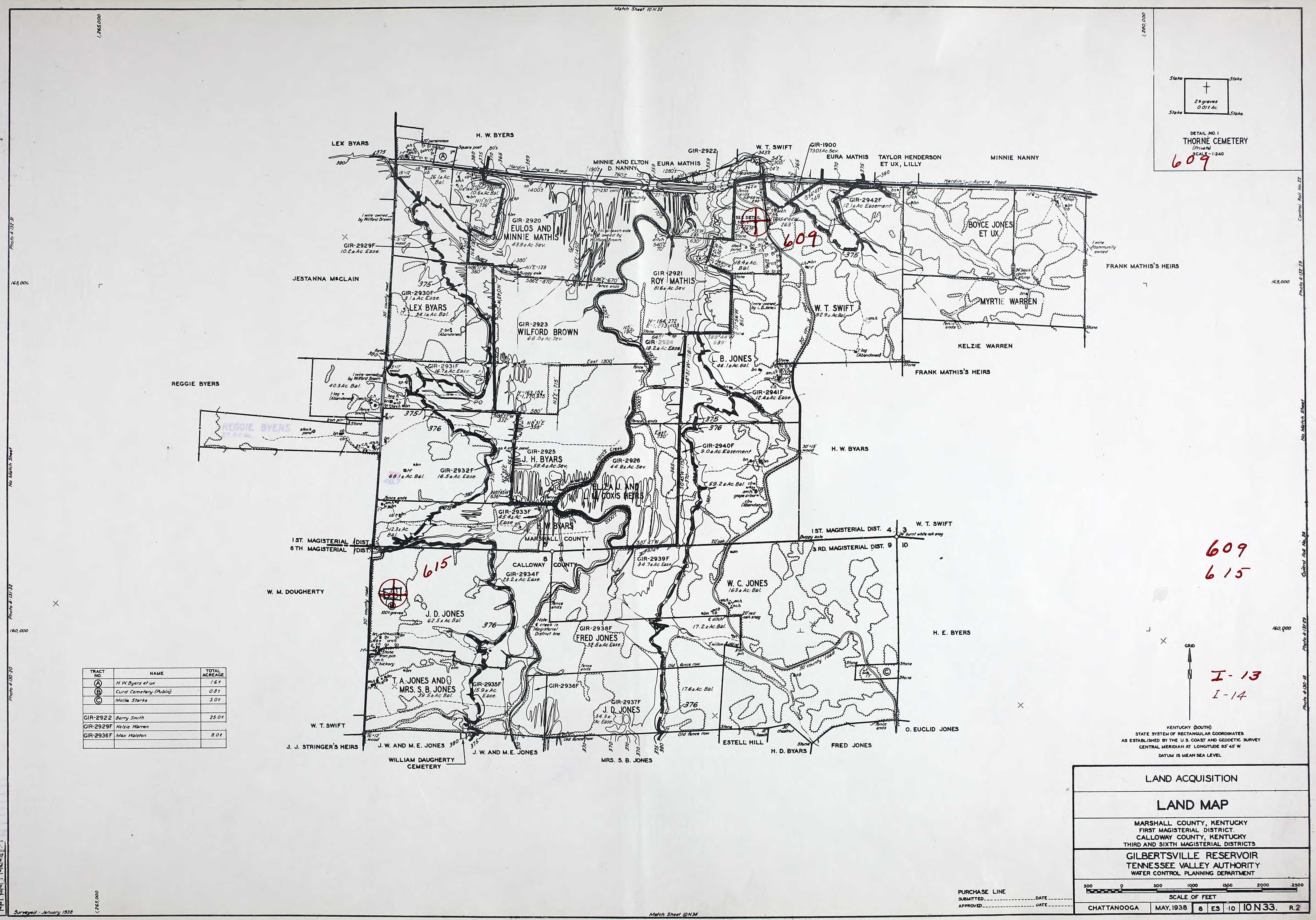
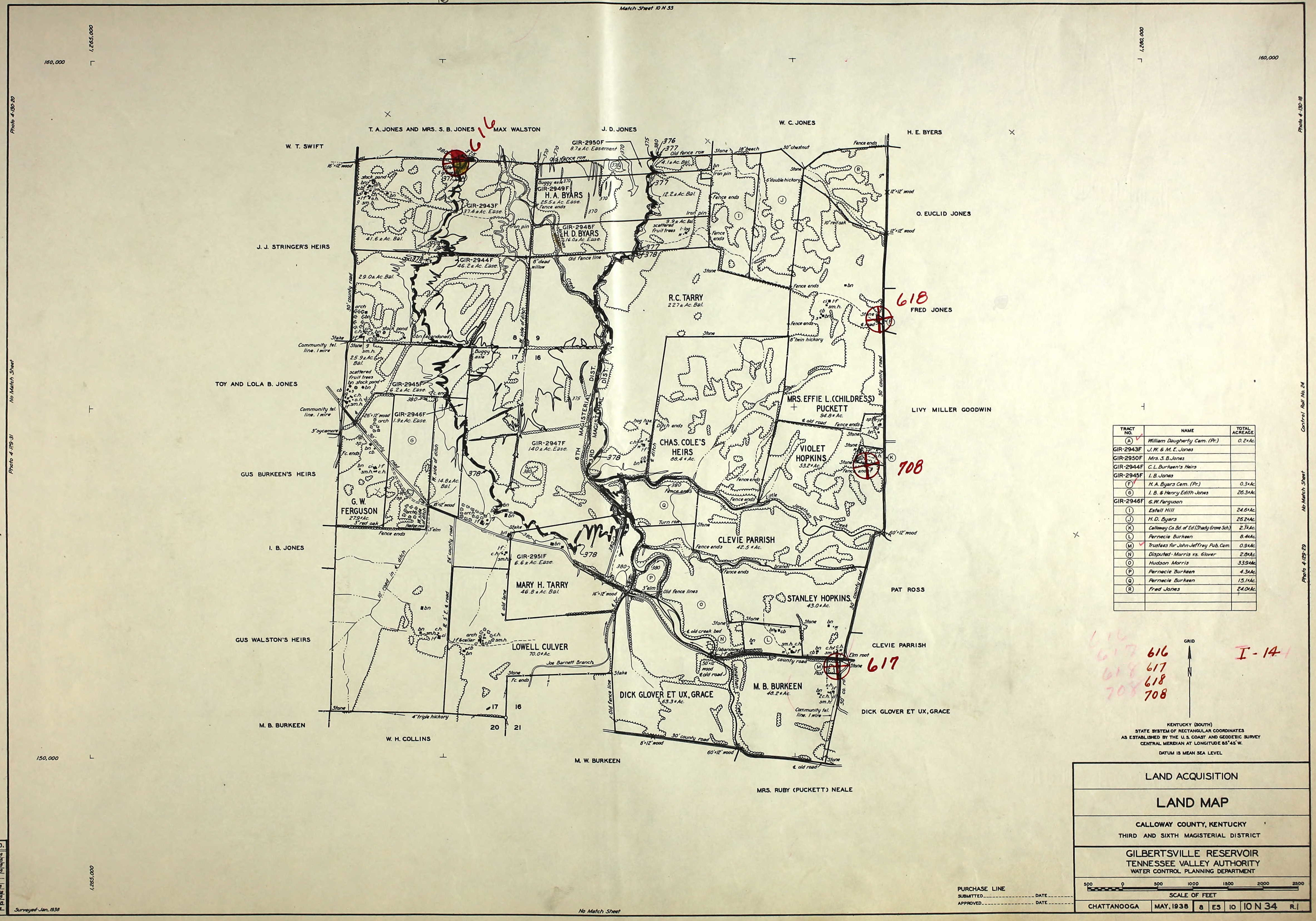
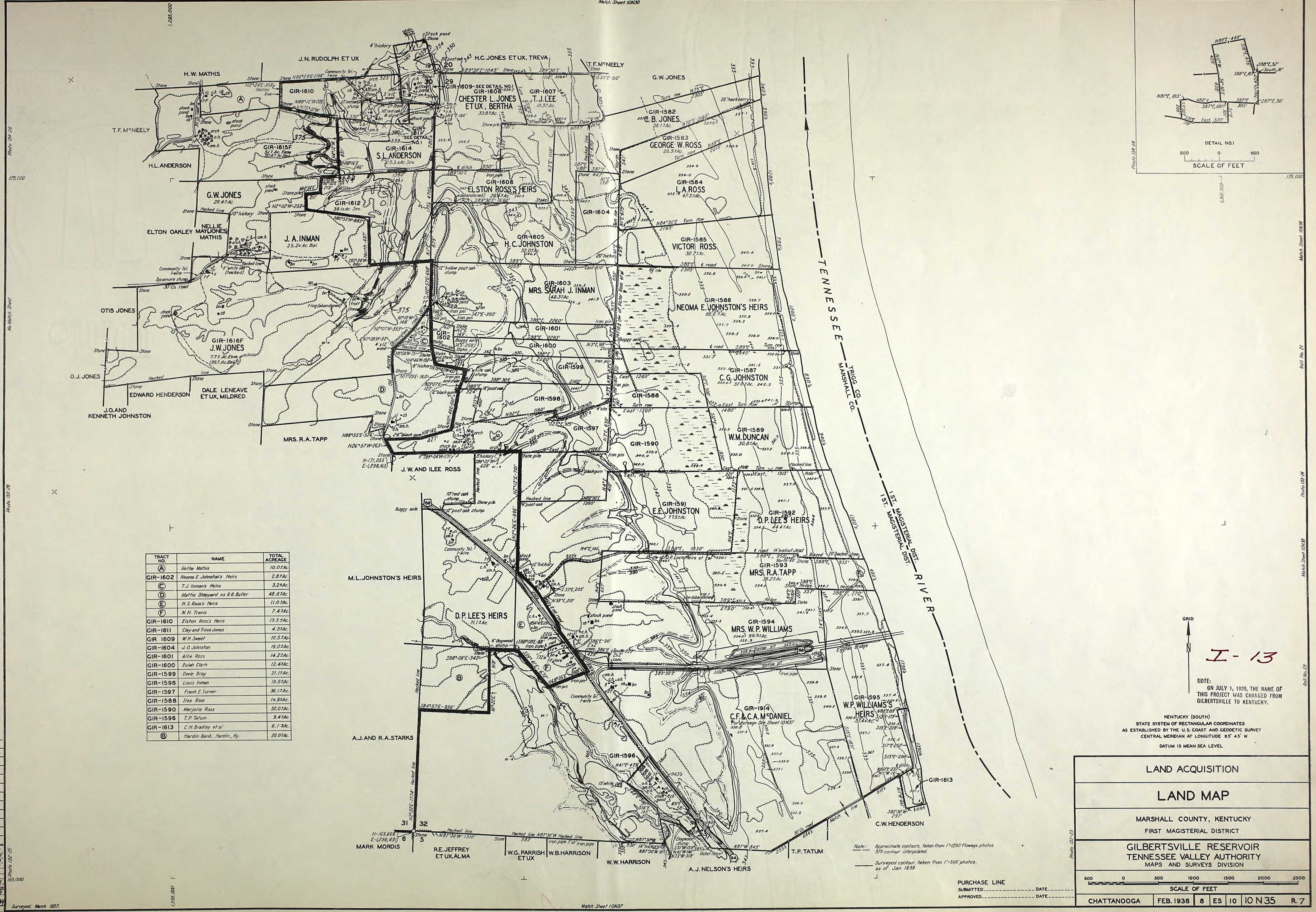
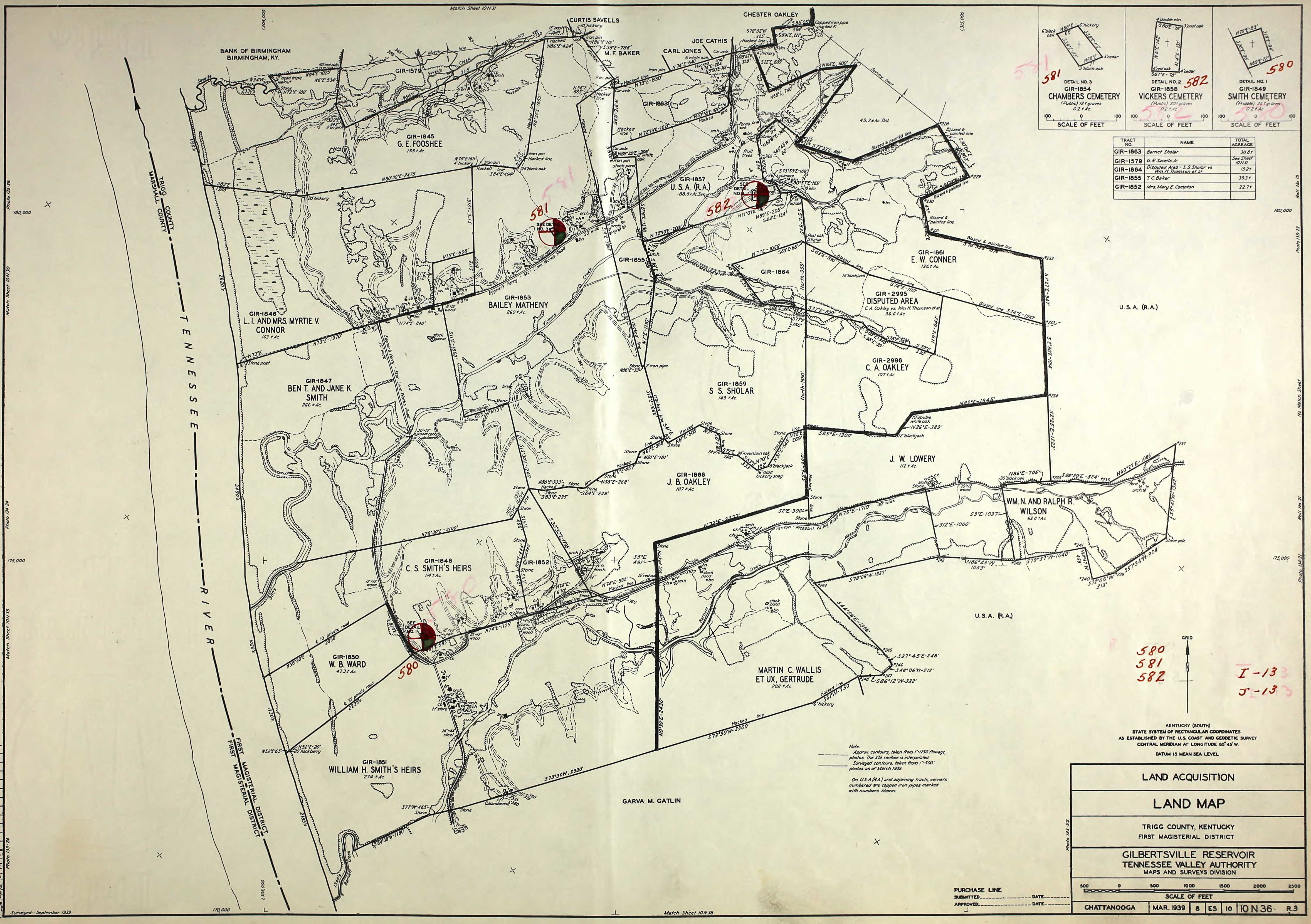
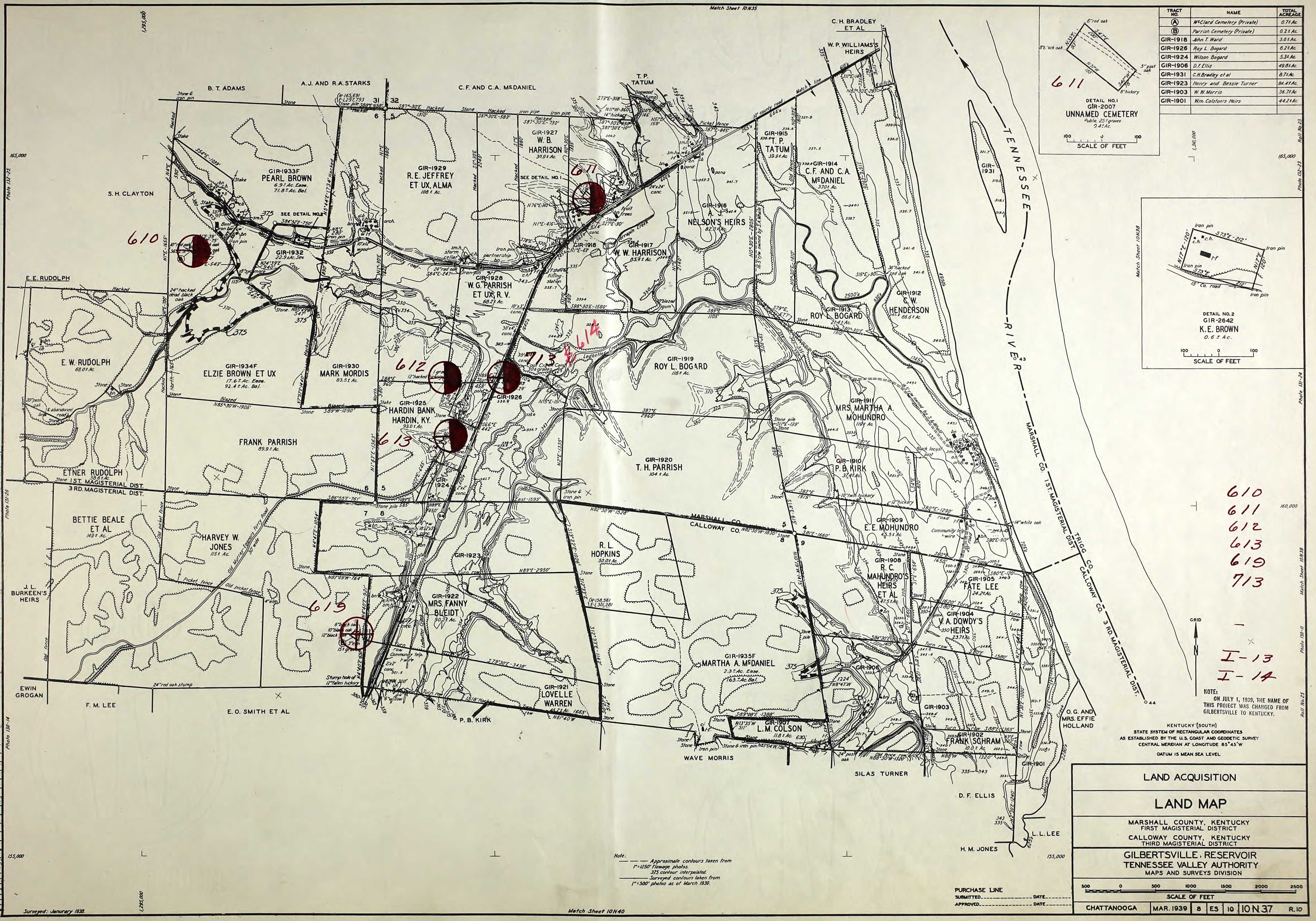
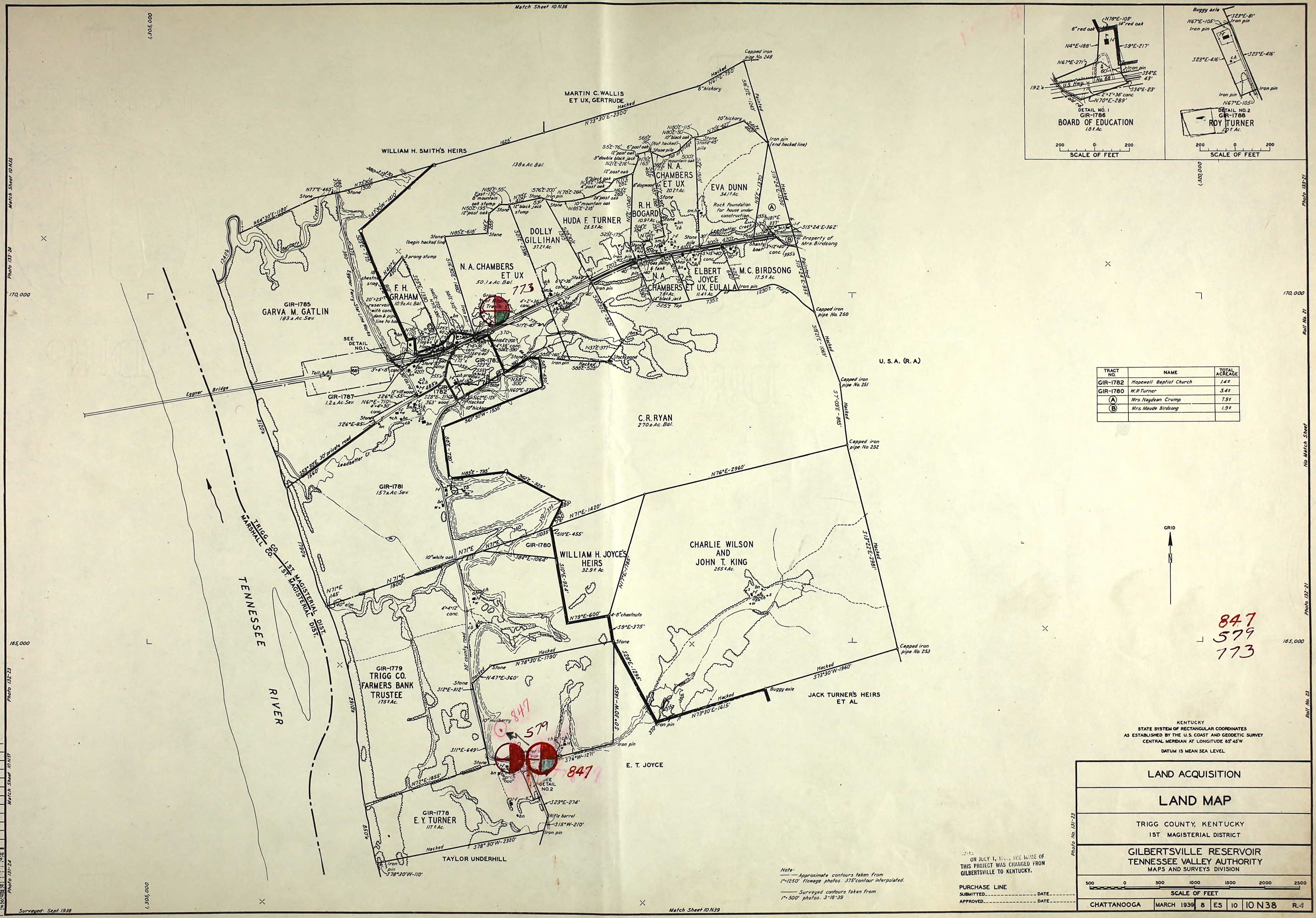
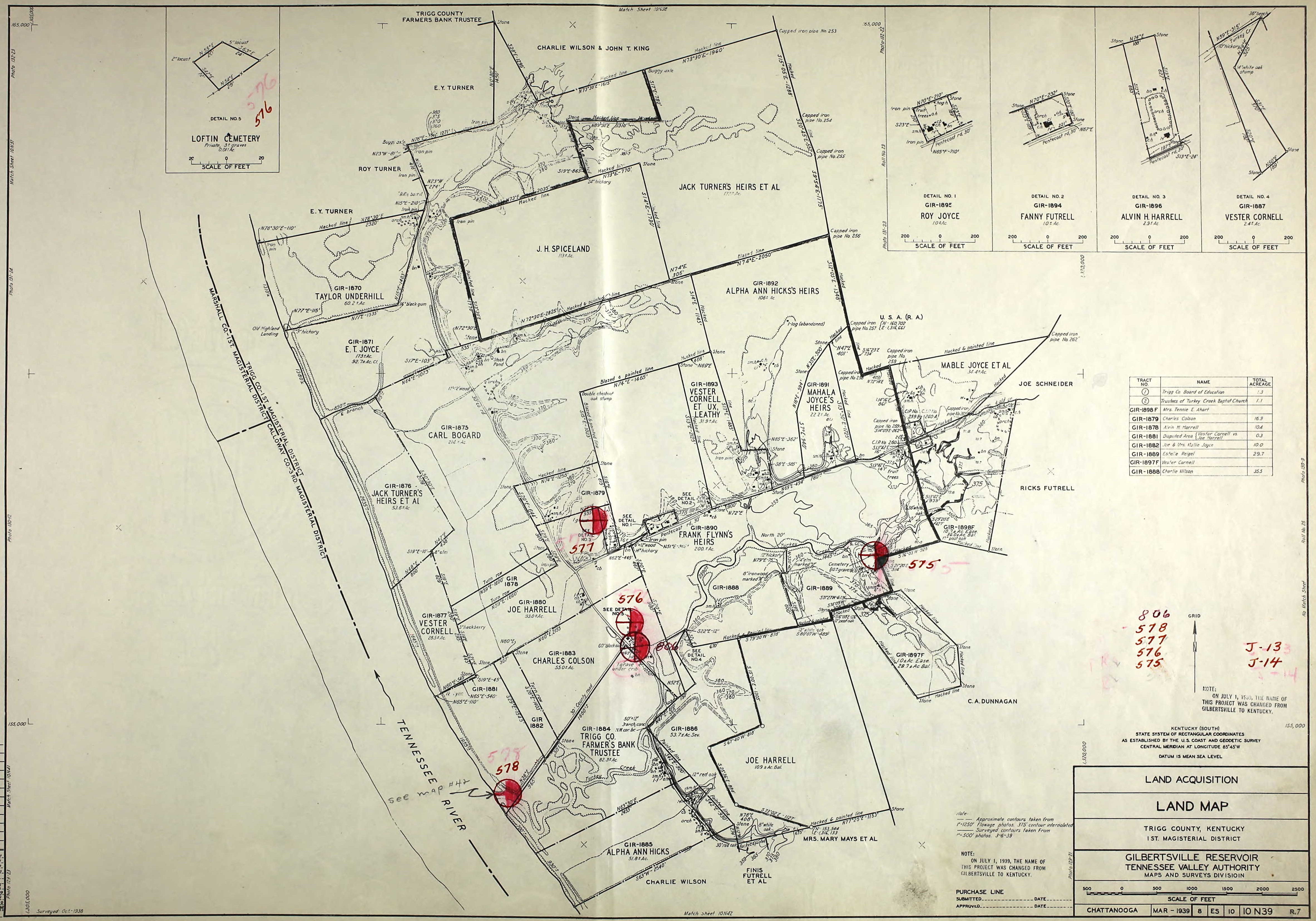
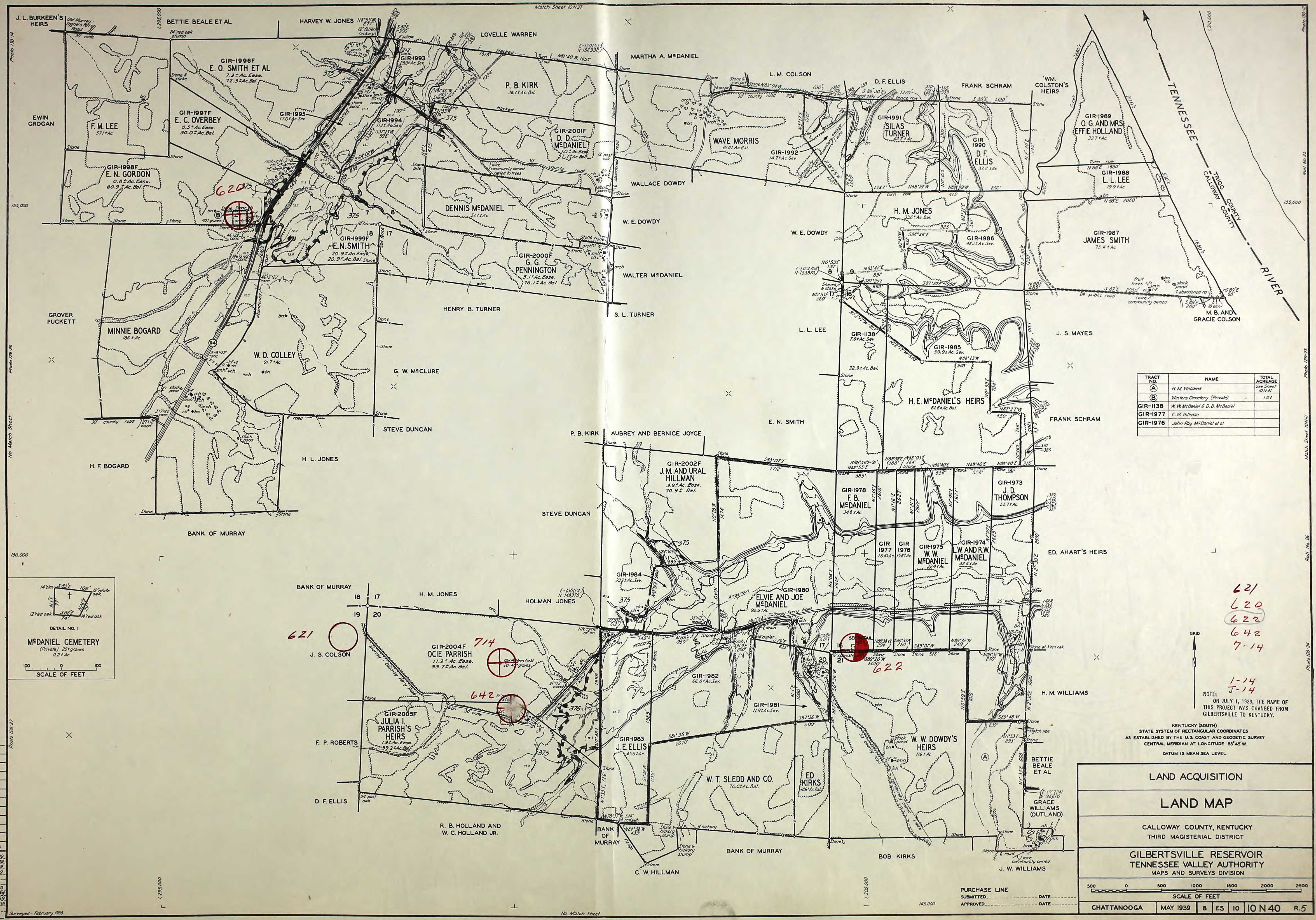
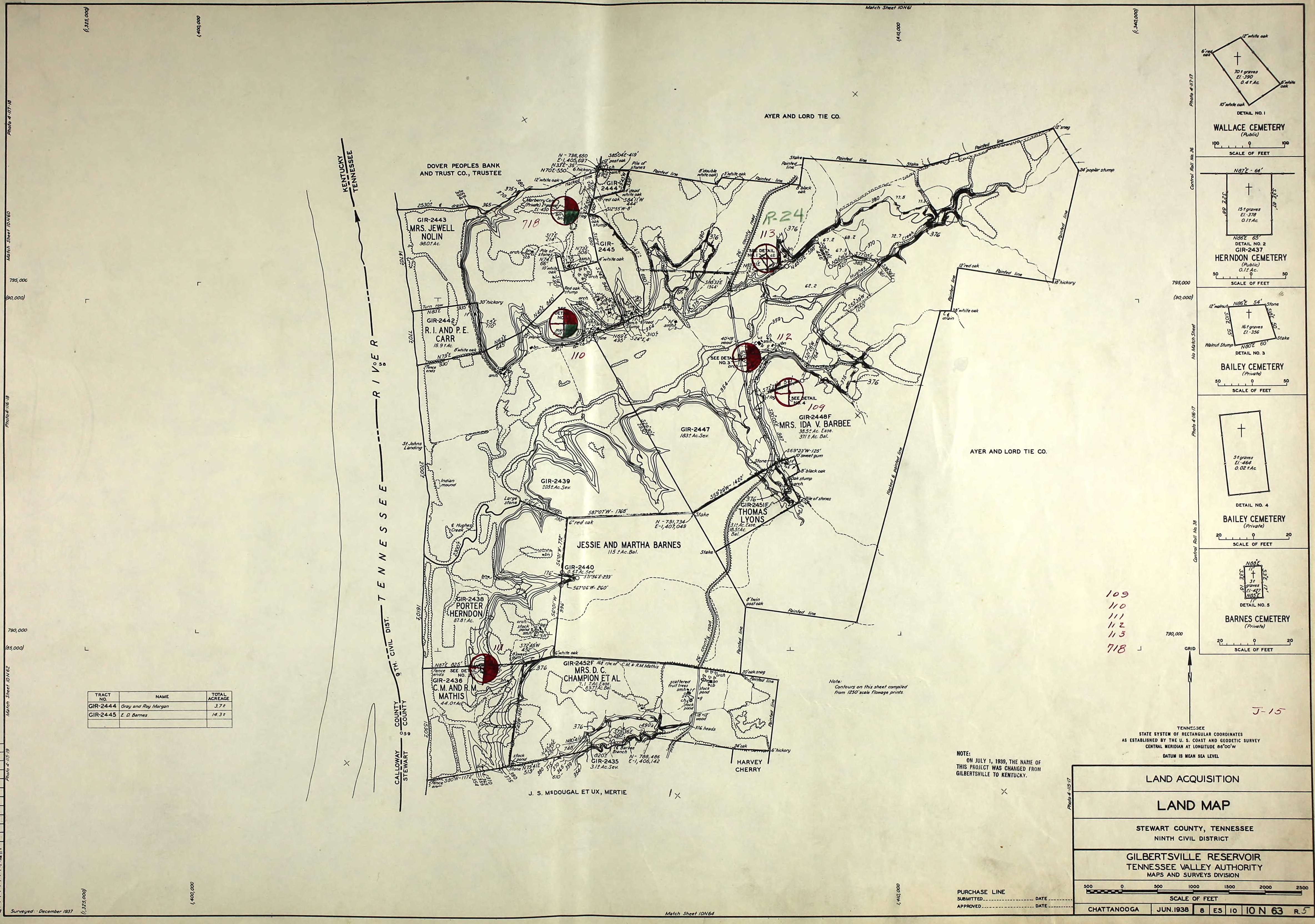
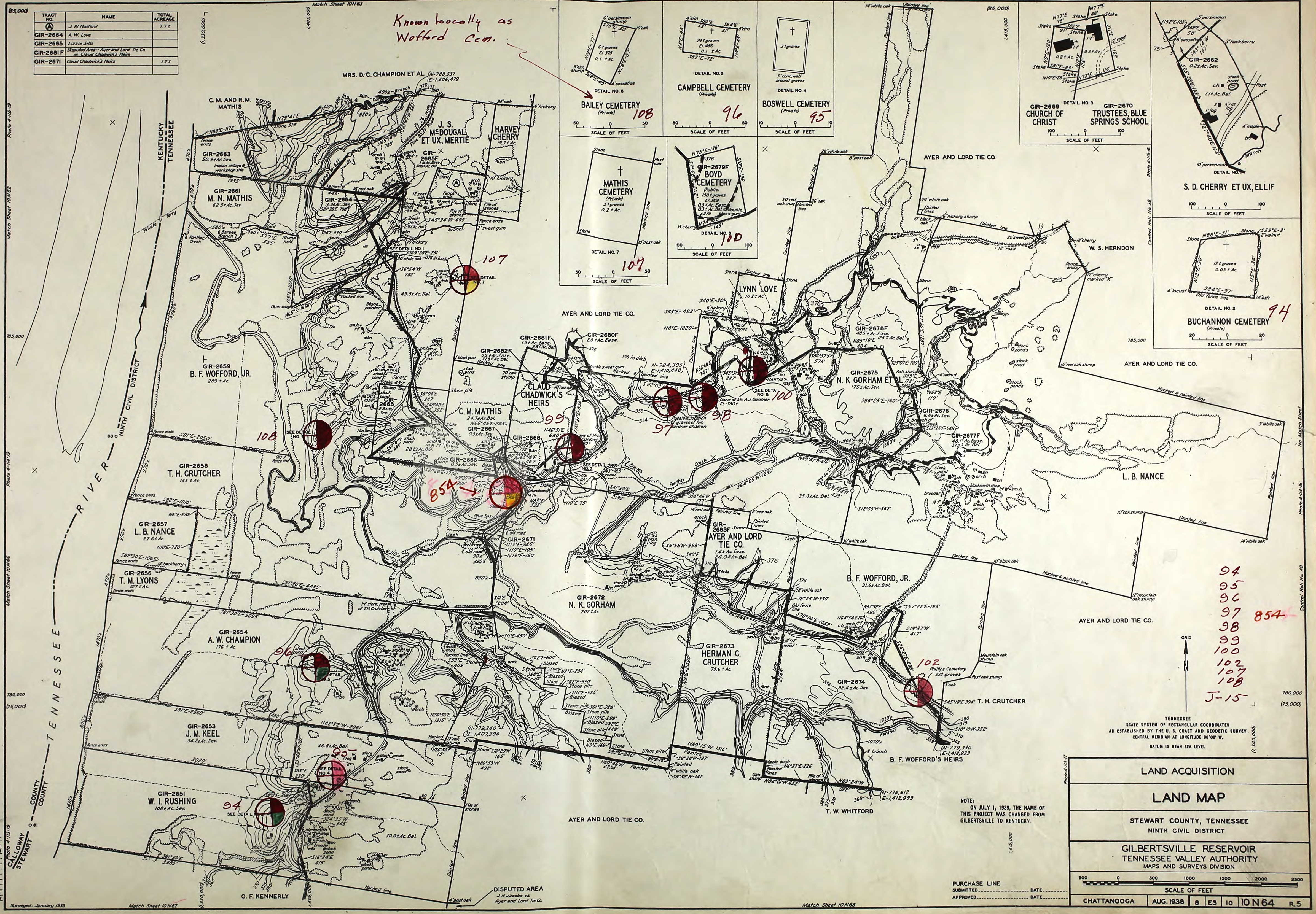
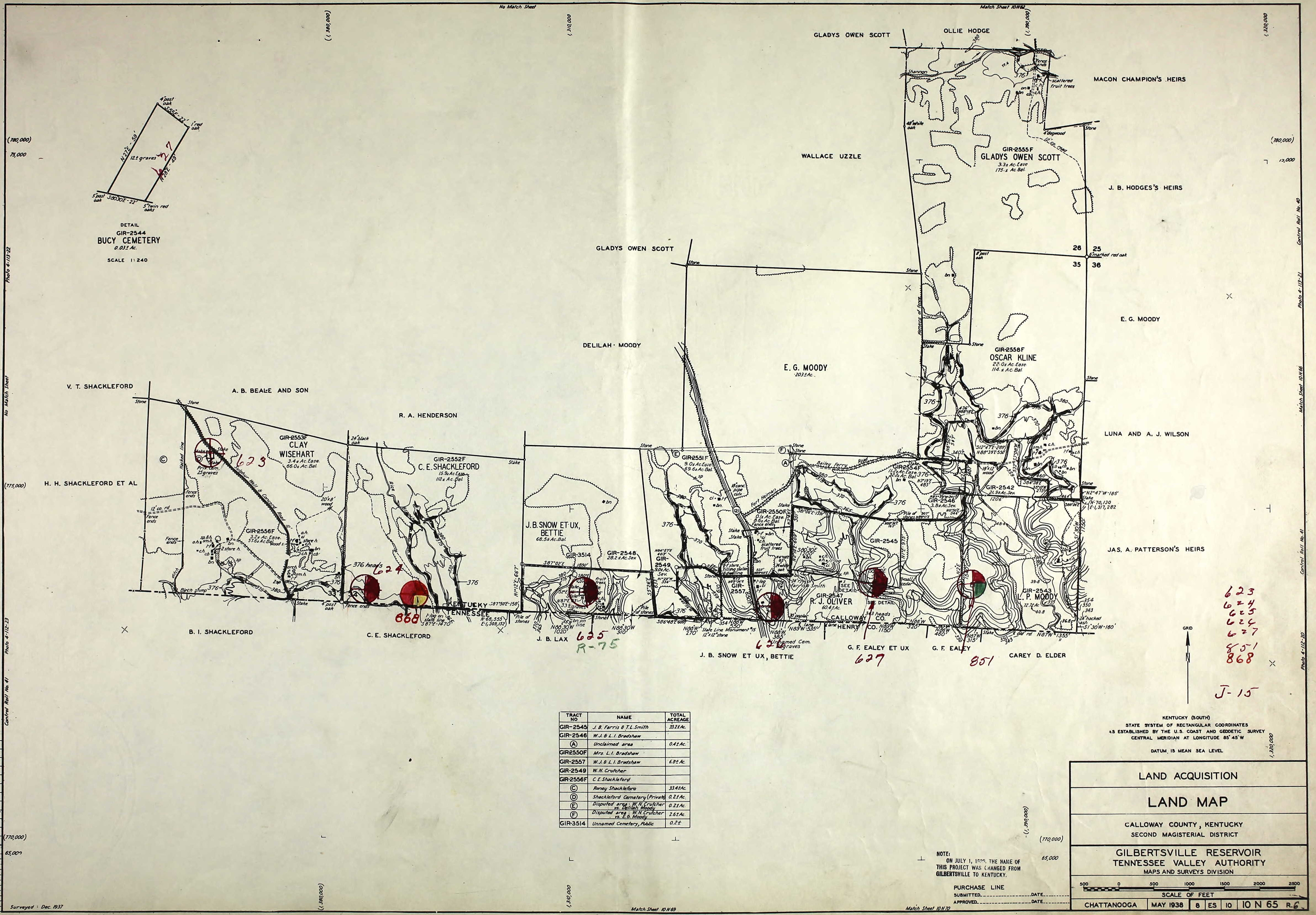
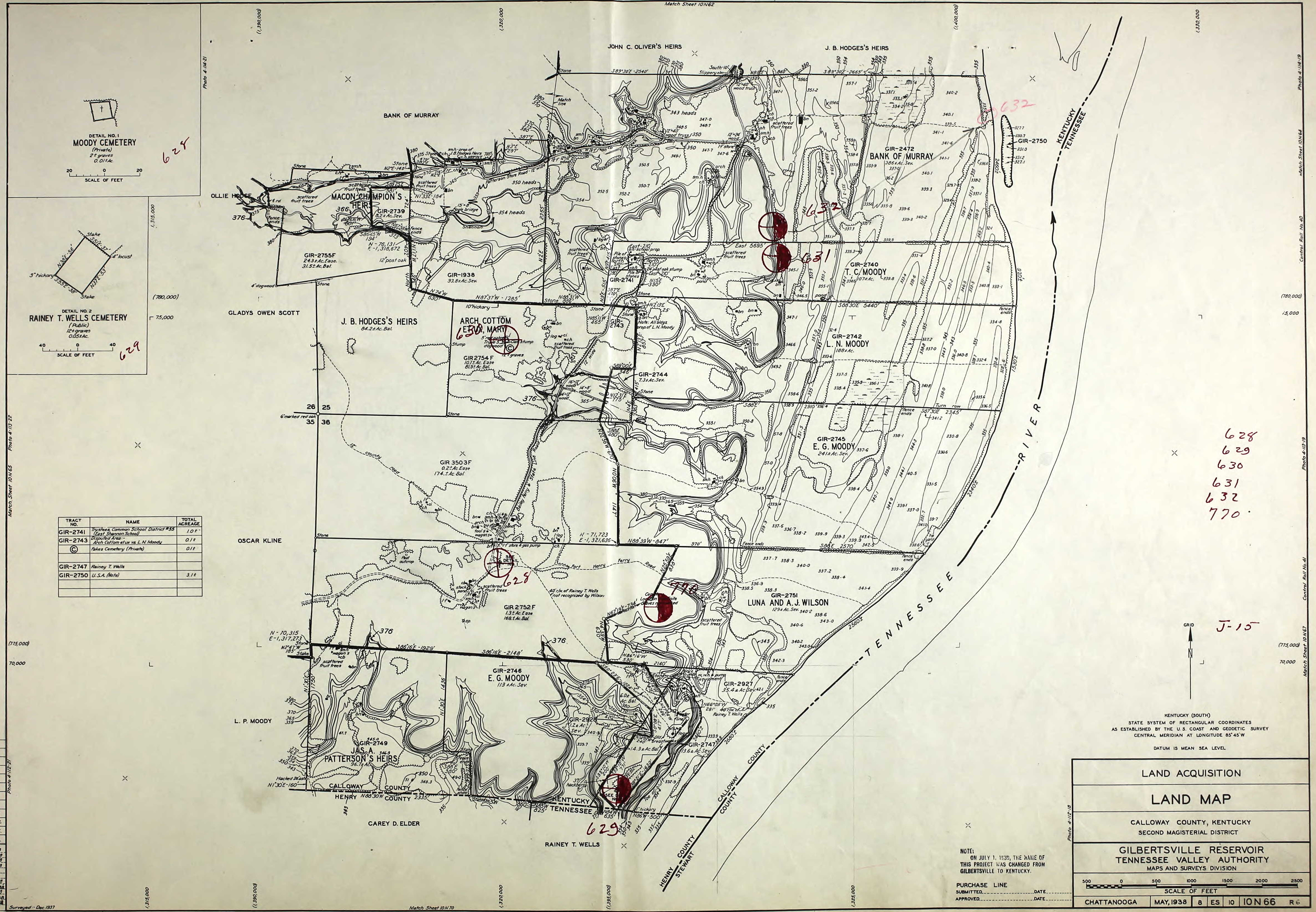
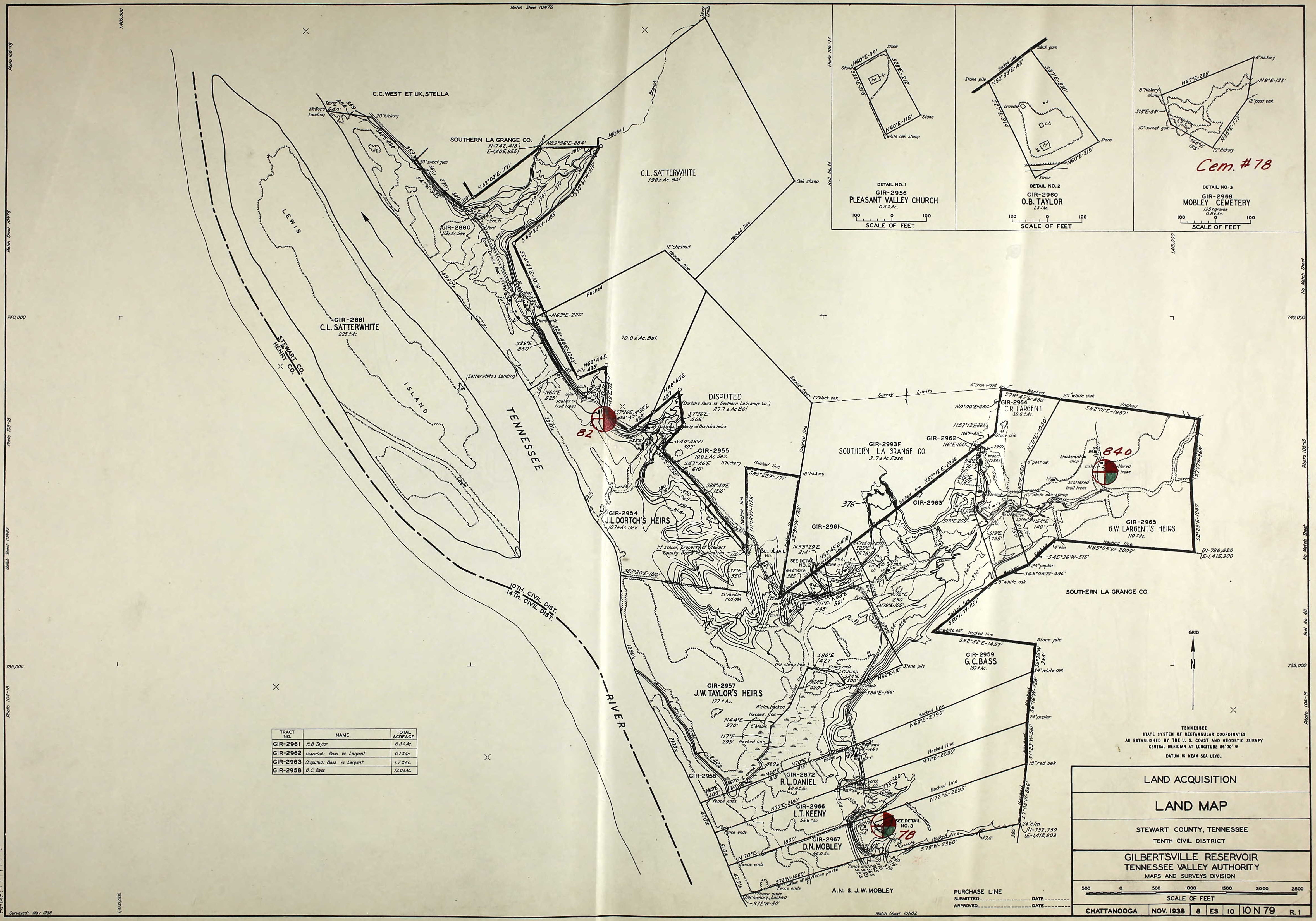
The Kentucky Dam project was the largest and most ambitious from the new deal era of the Tennessee Valley Authority. The creation of Kentucky Lake would take years of planning and hard work, not to mention the relocation of hundreds of families that lived in the future reservoir.
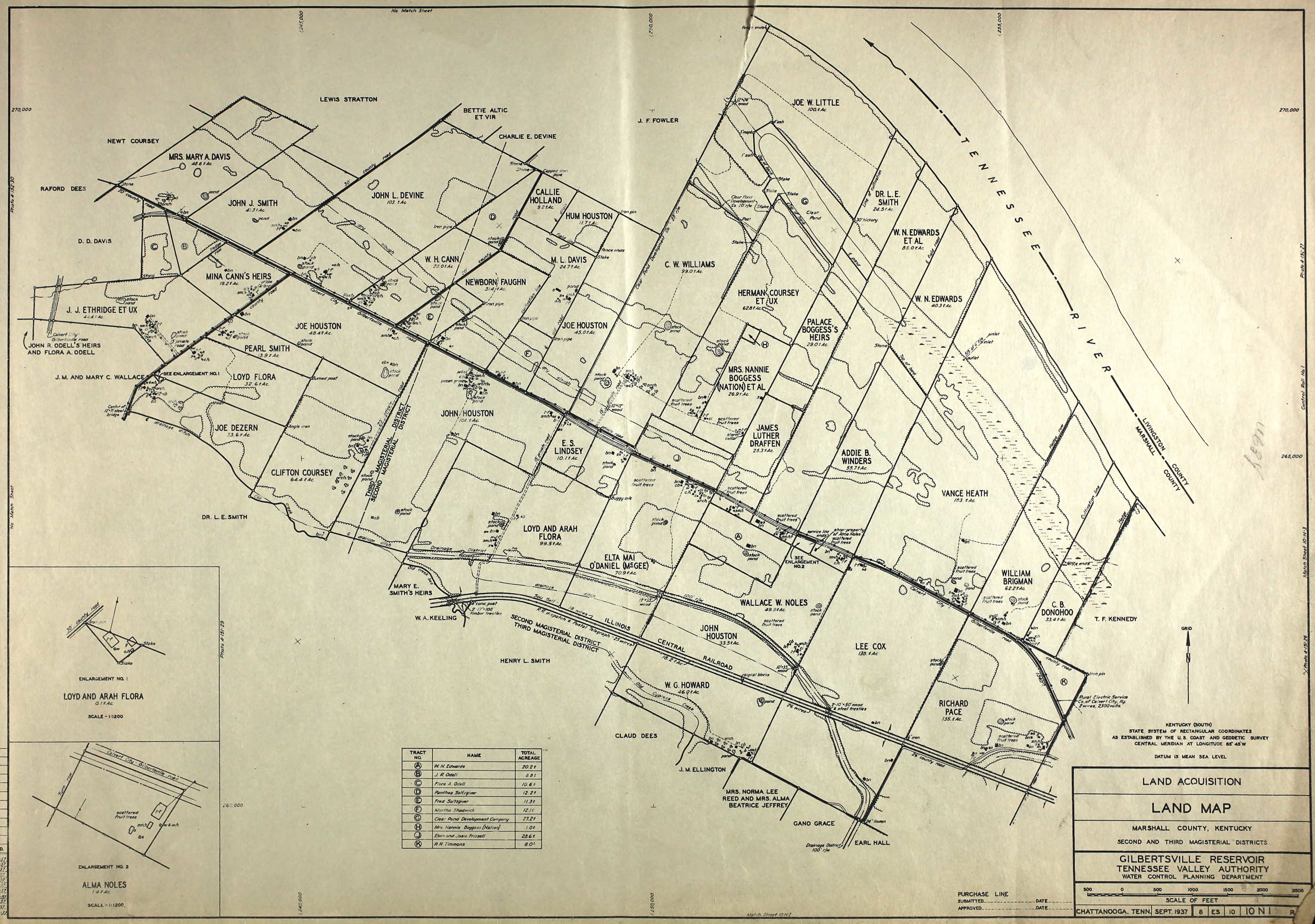
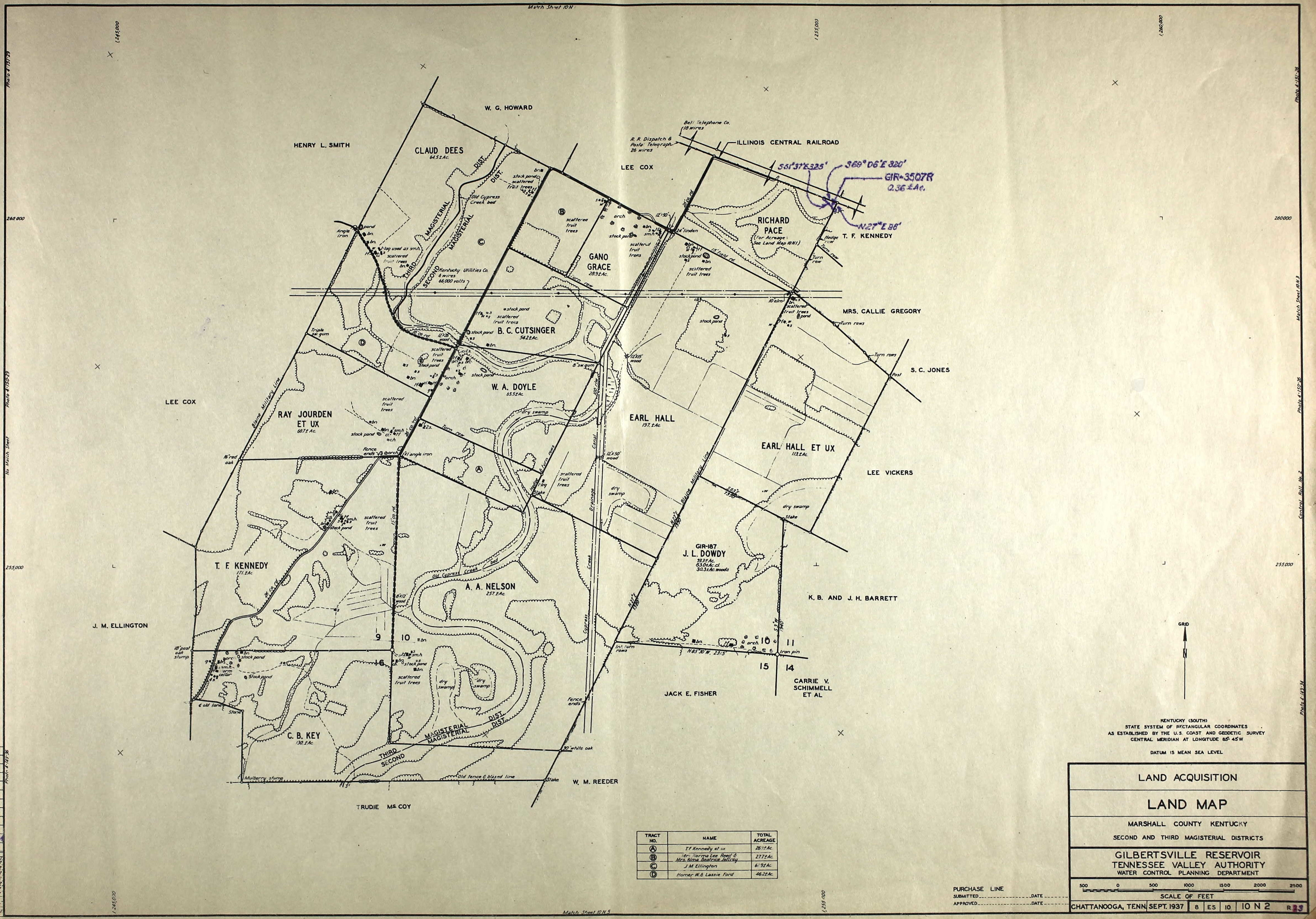
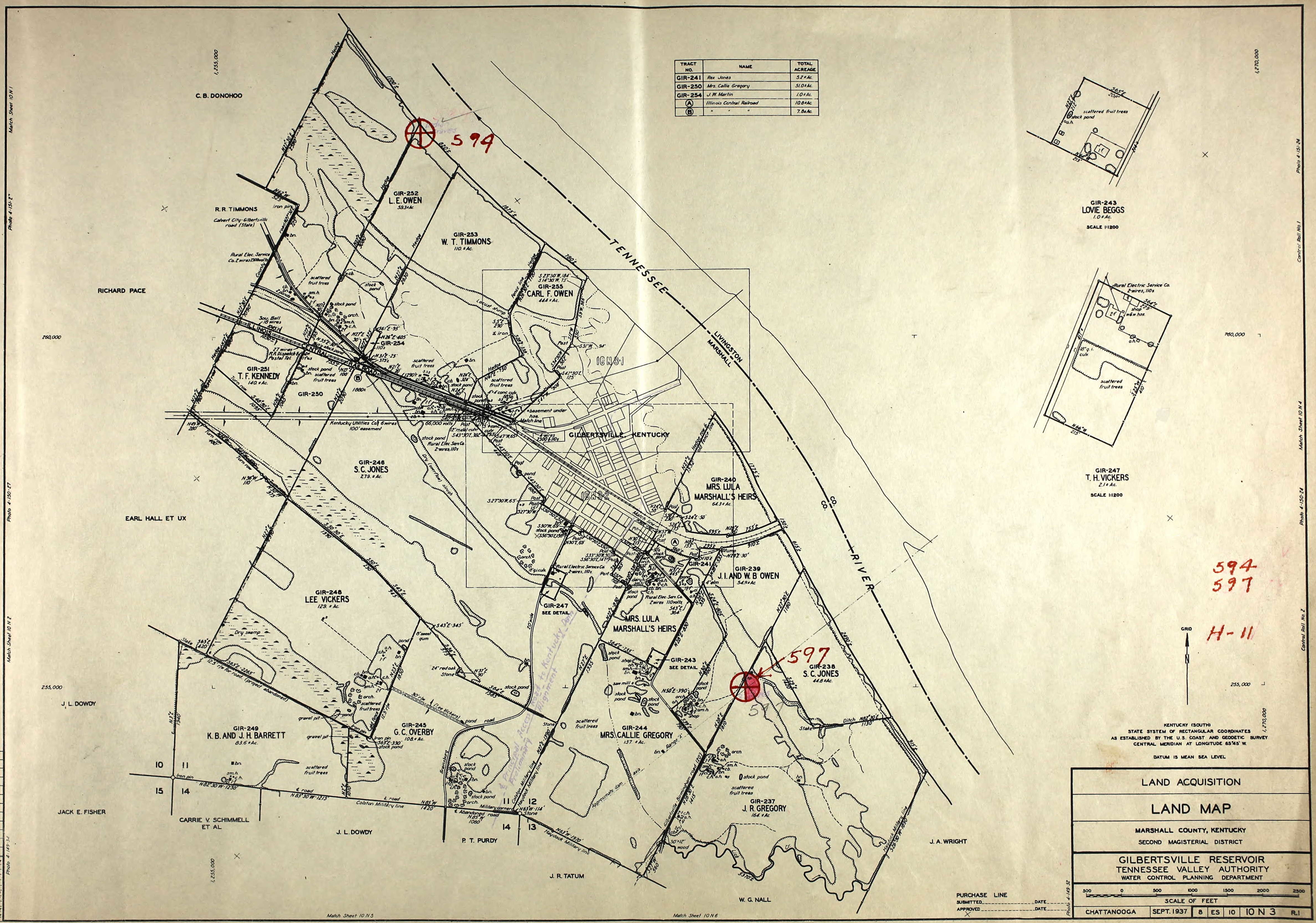
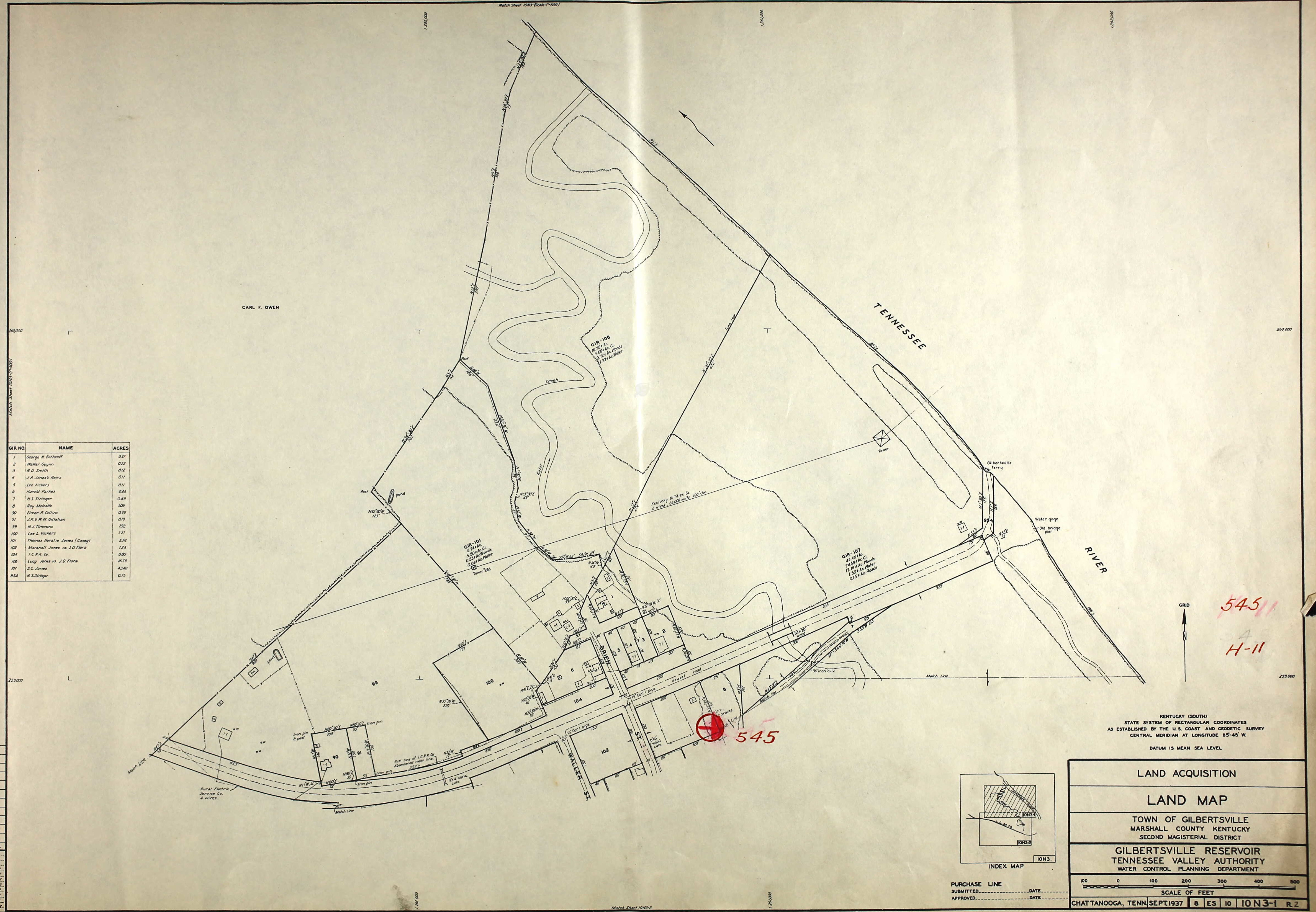
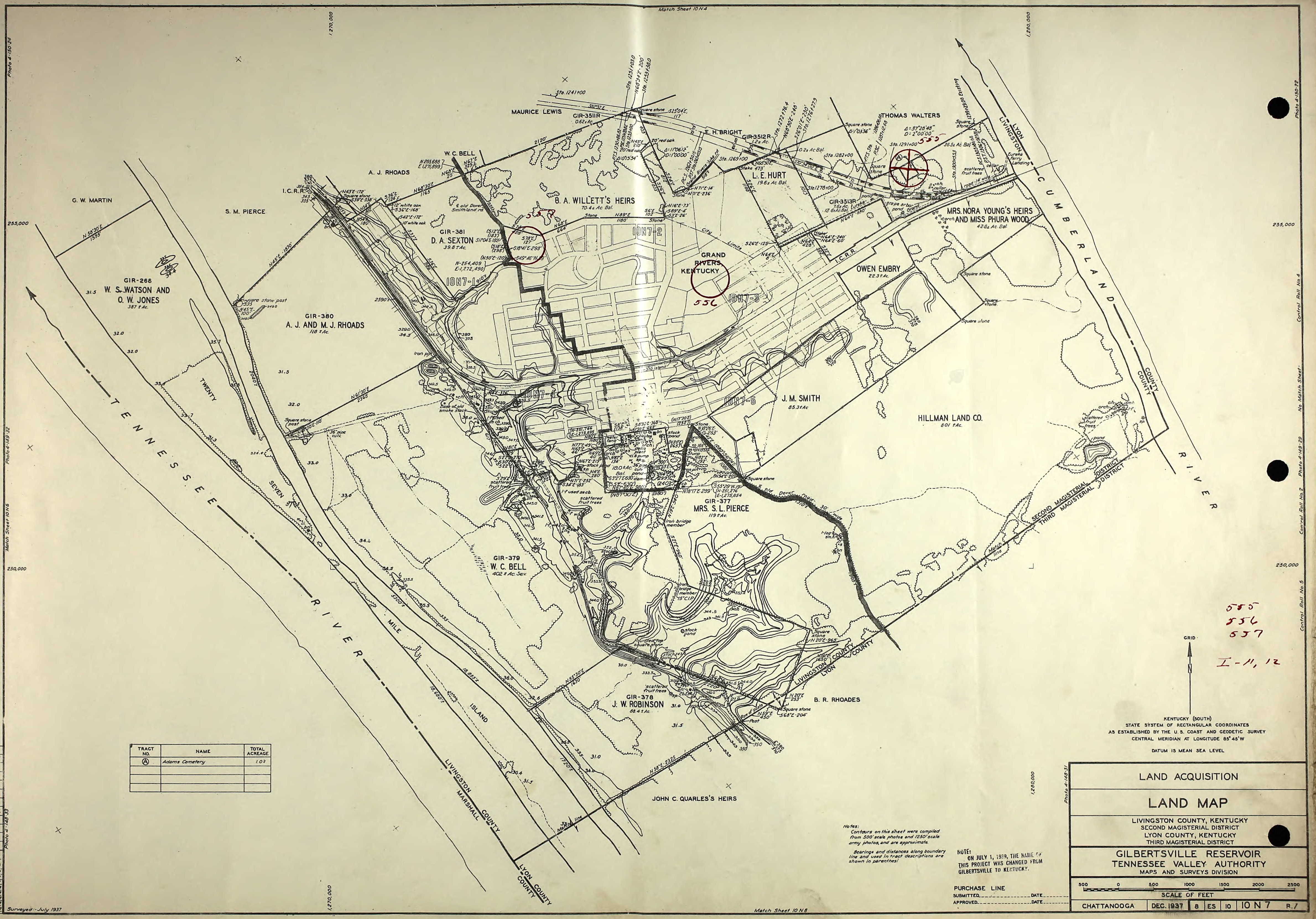
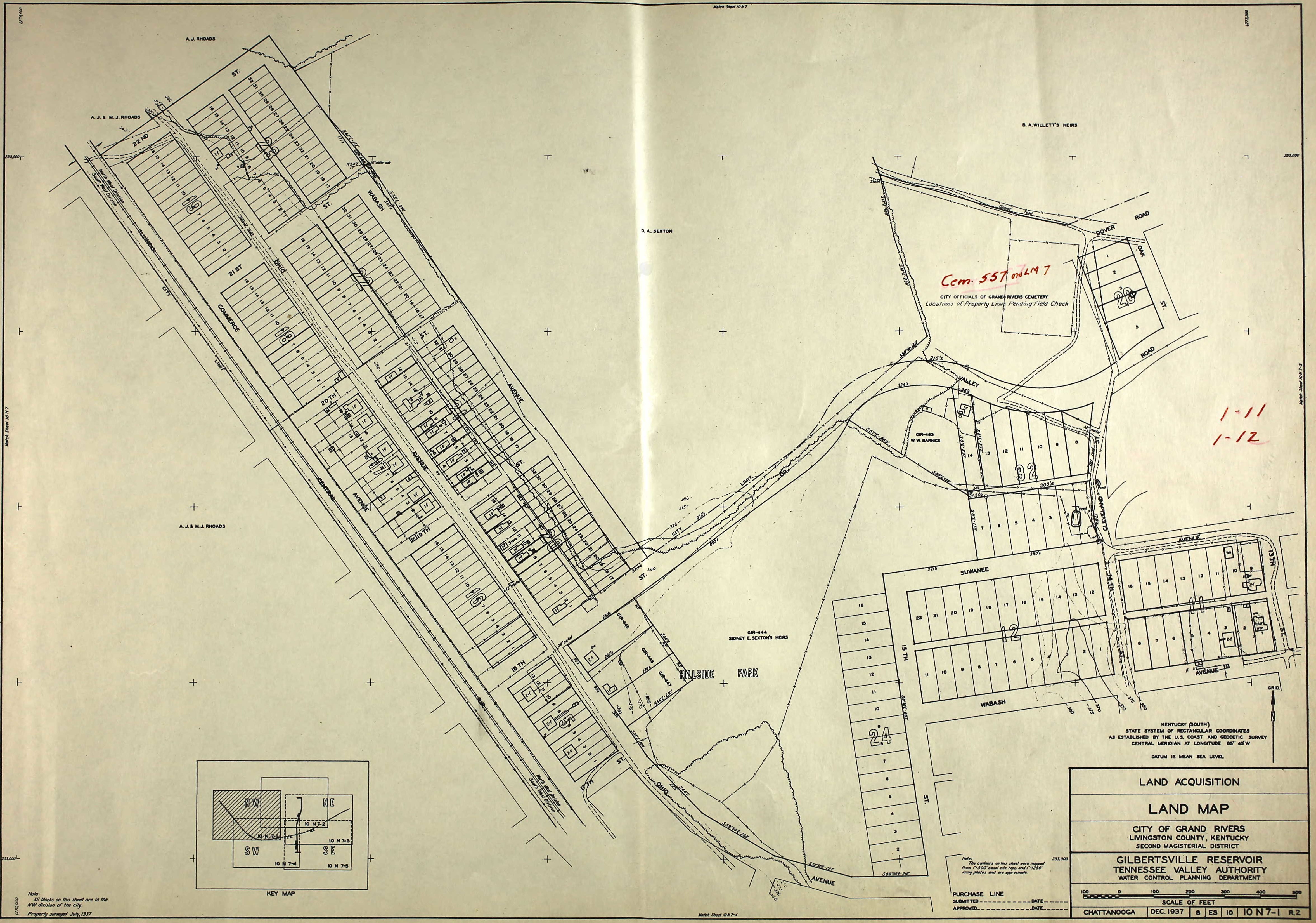
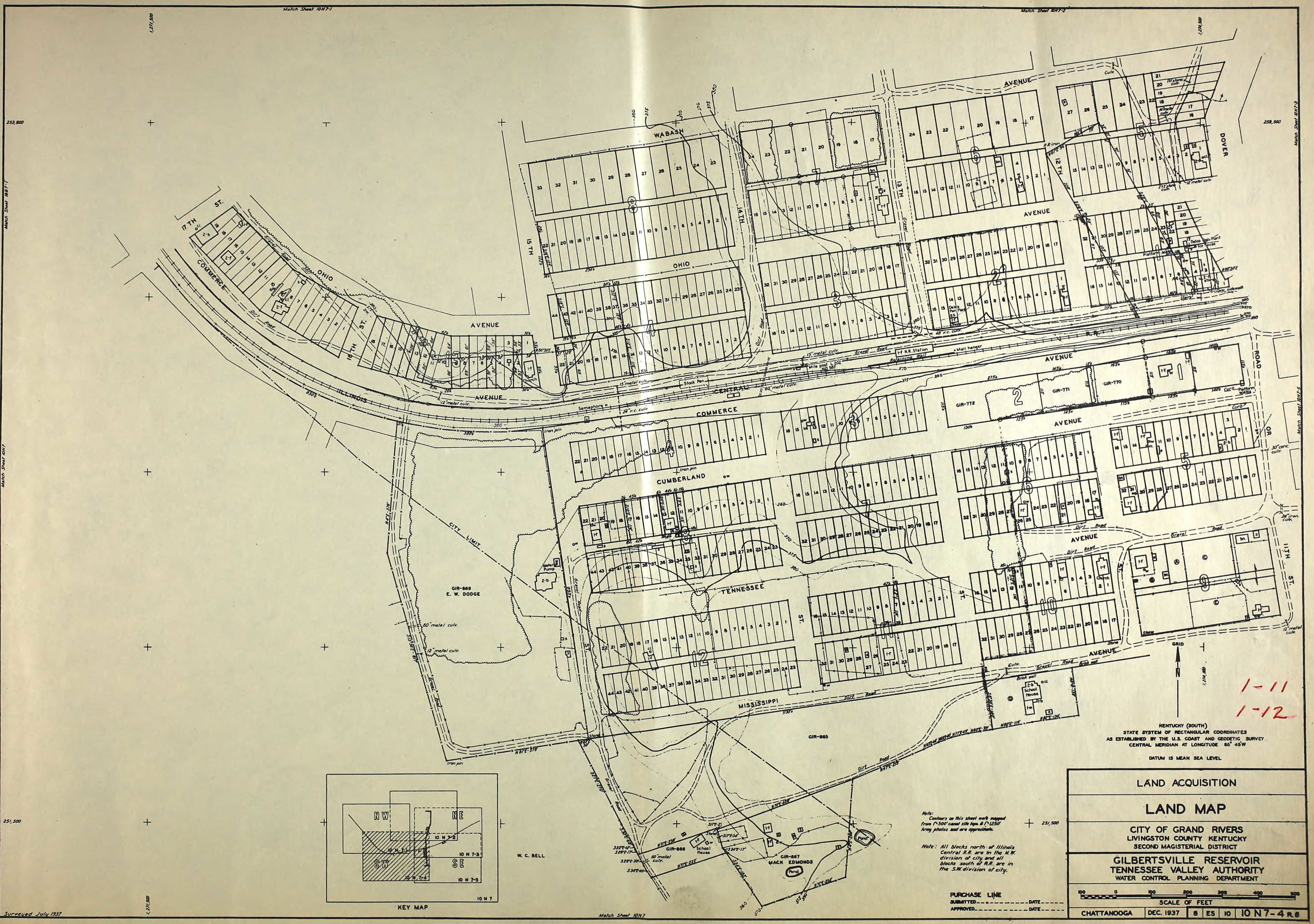
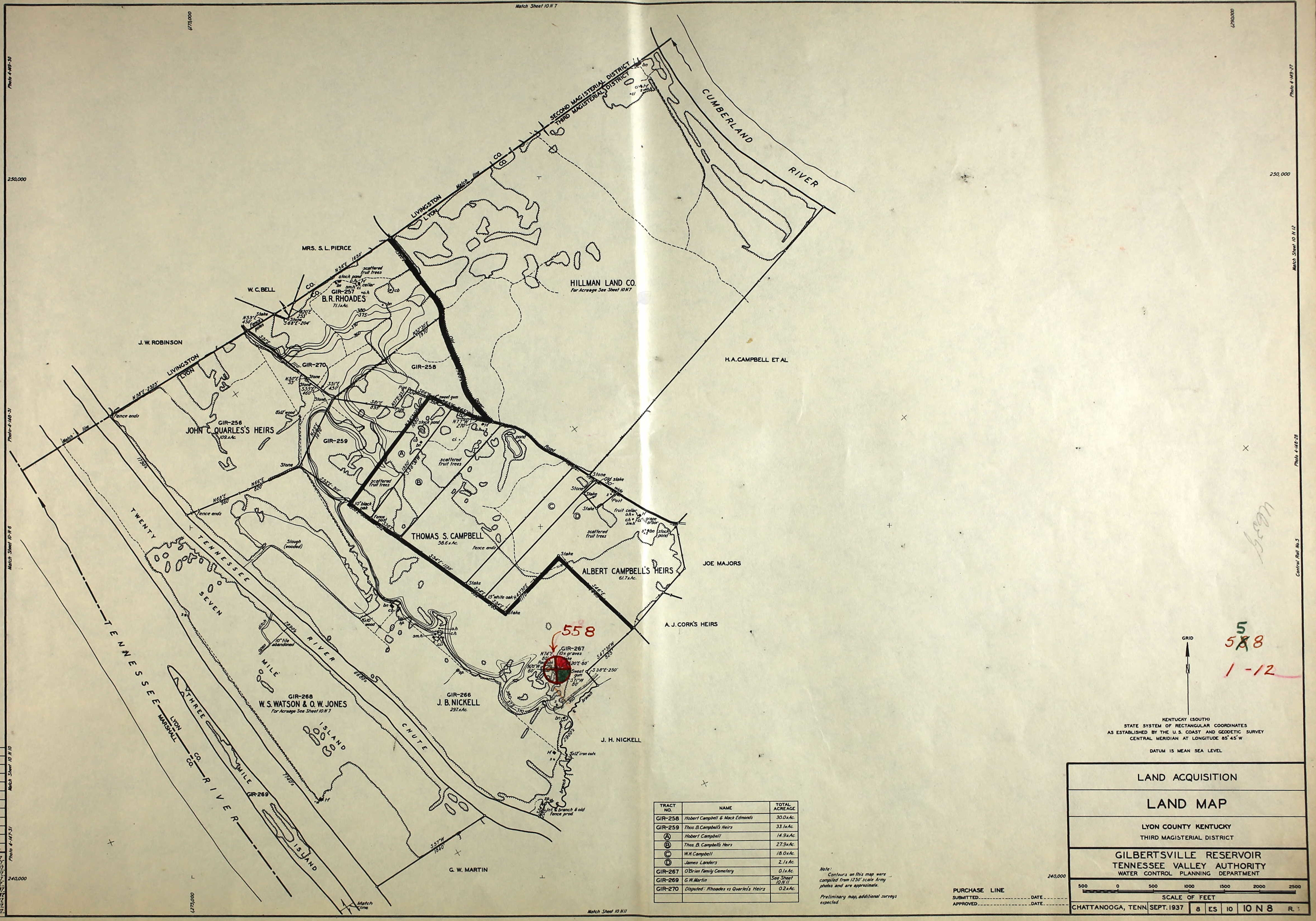
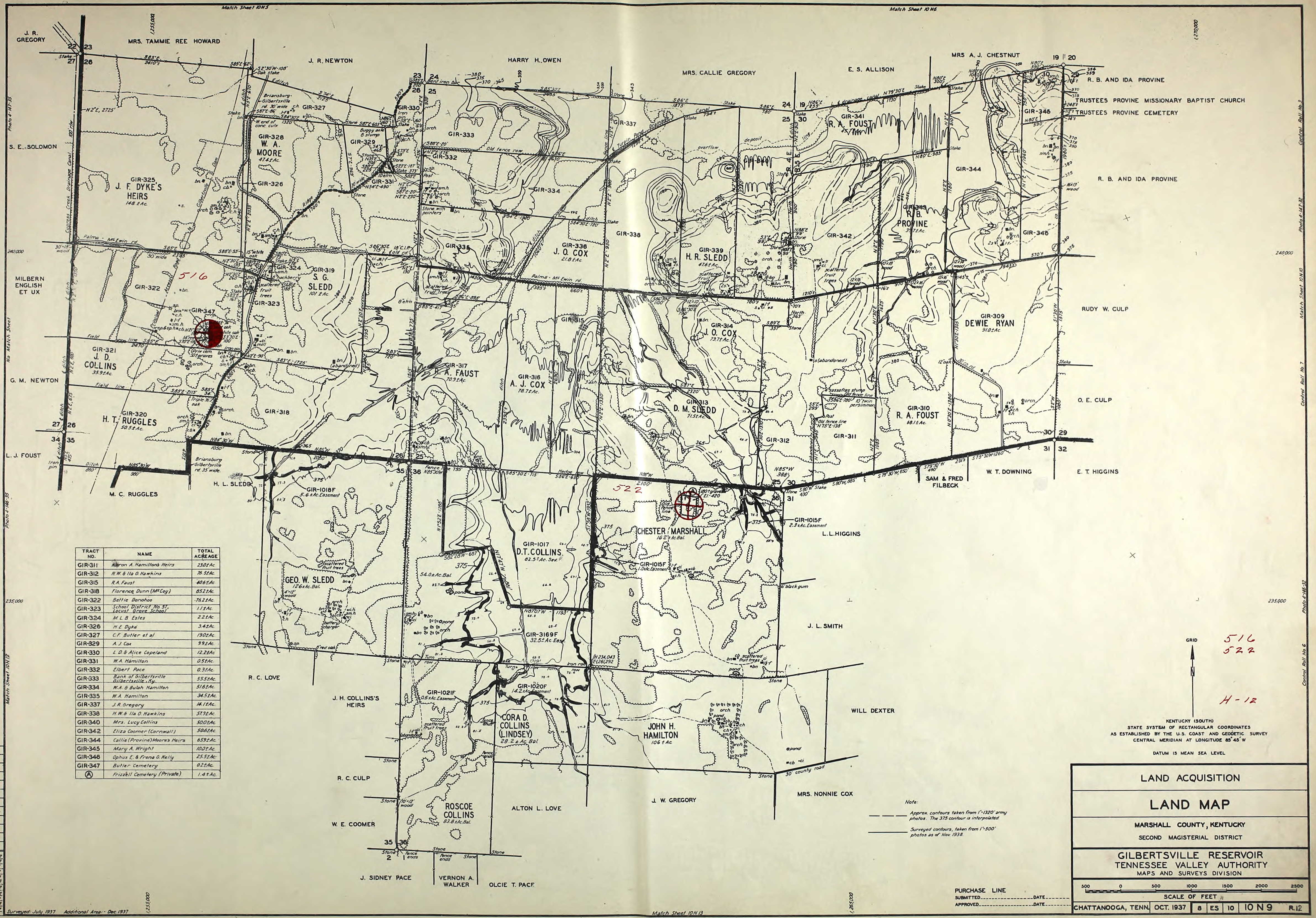
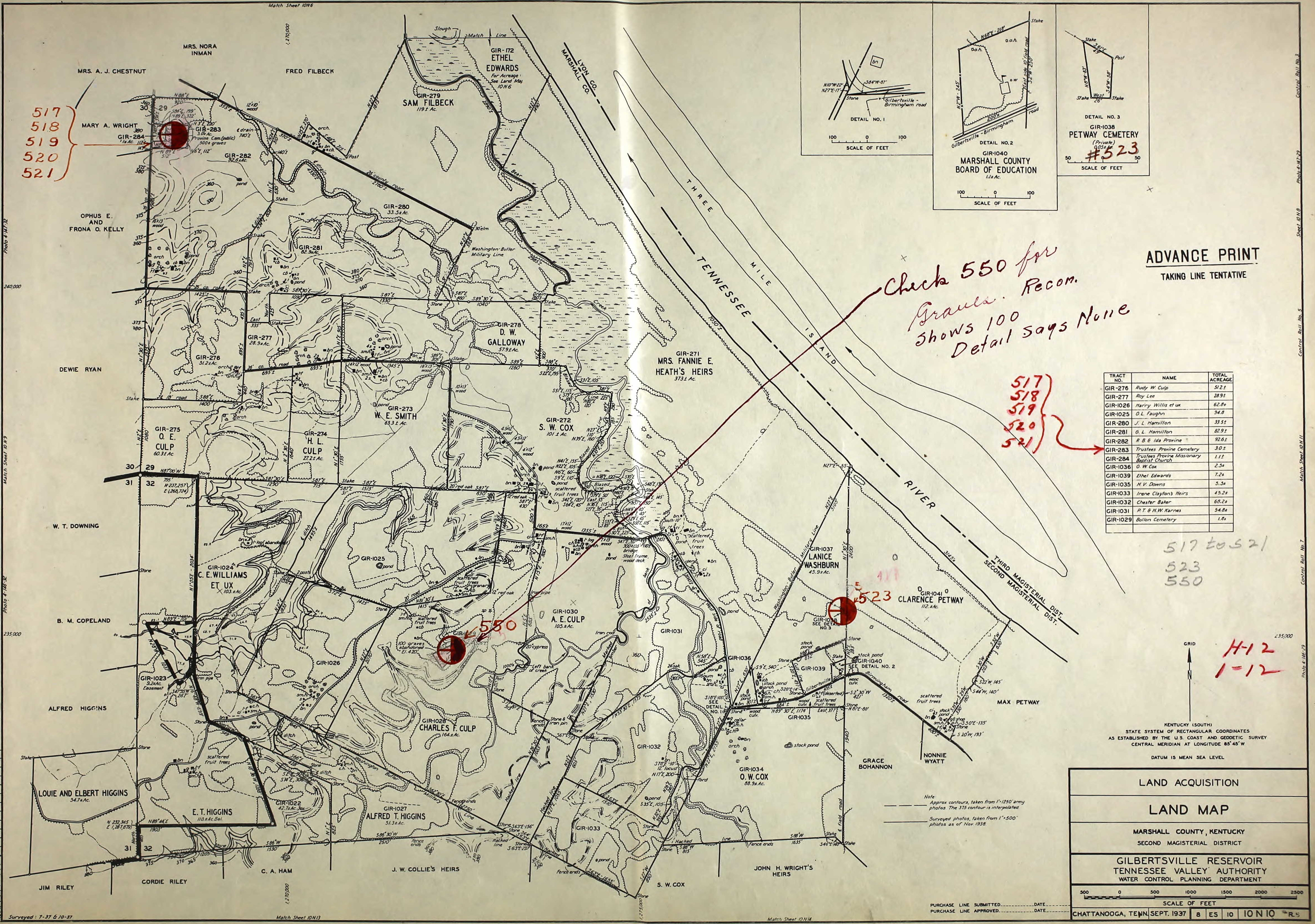
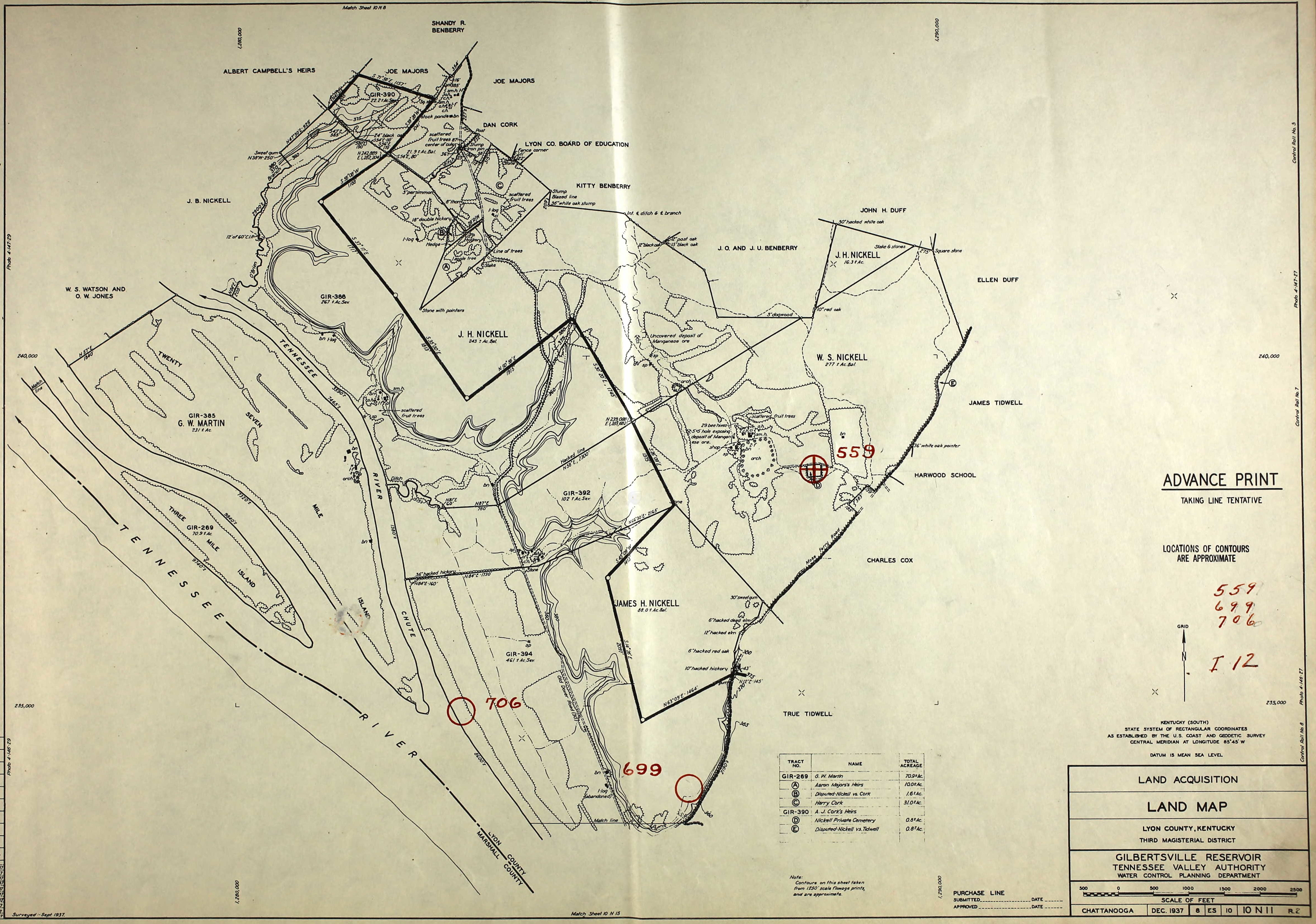
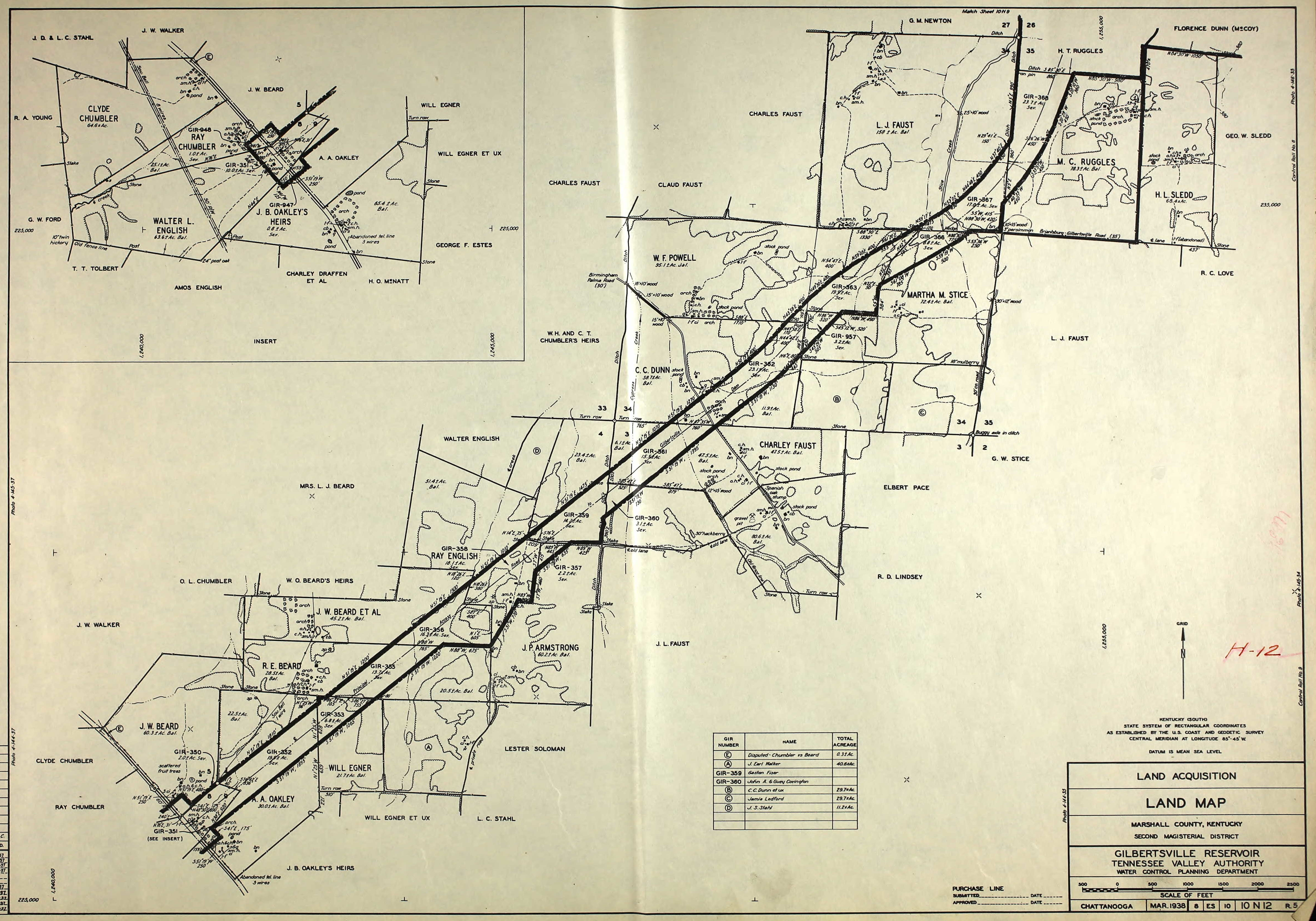
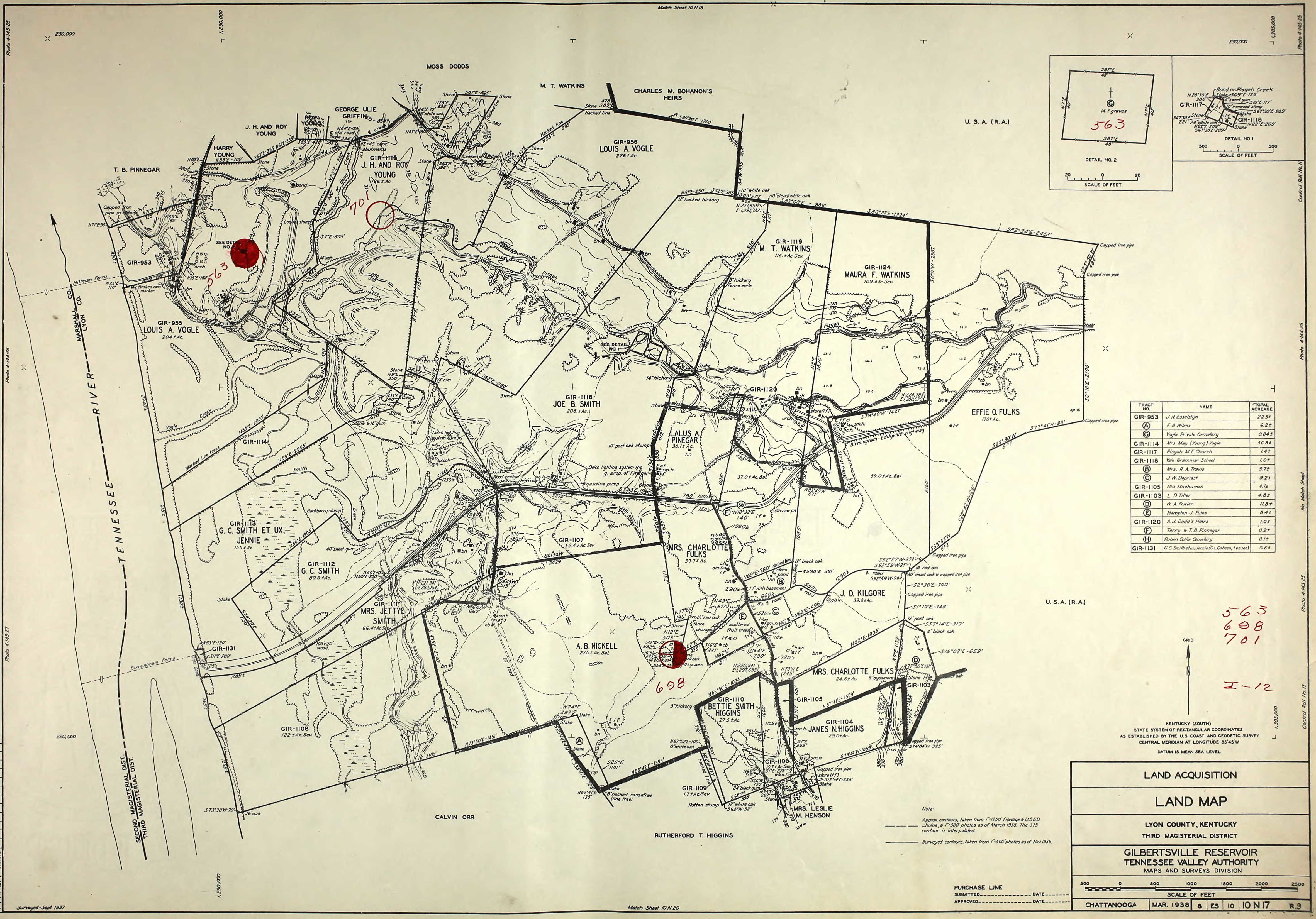
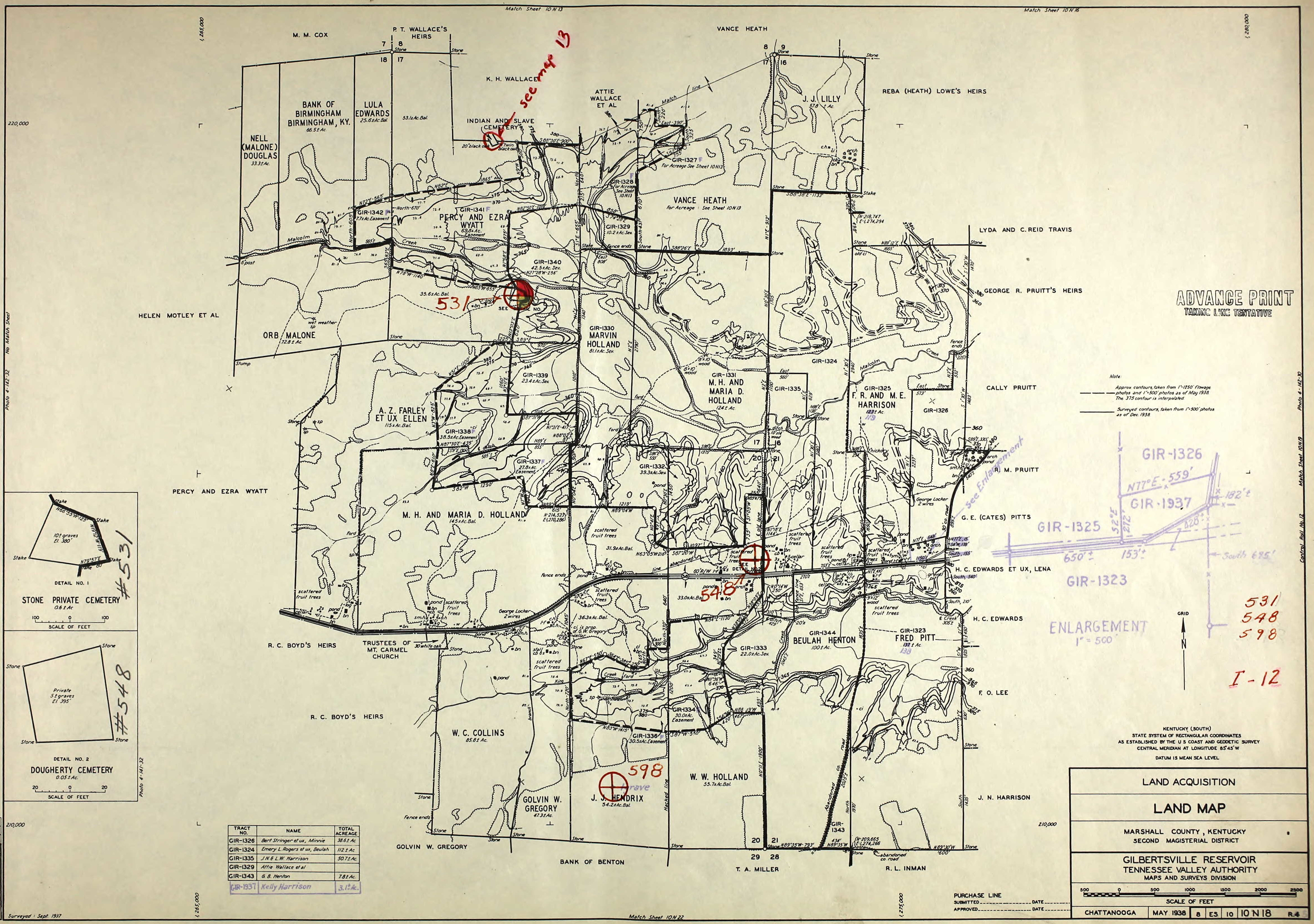
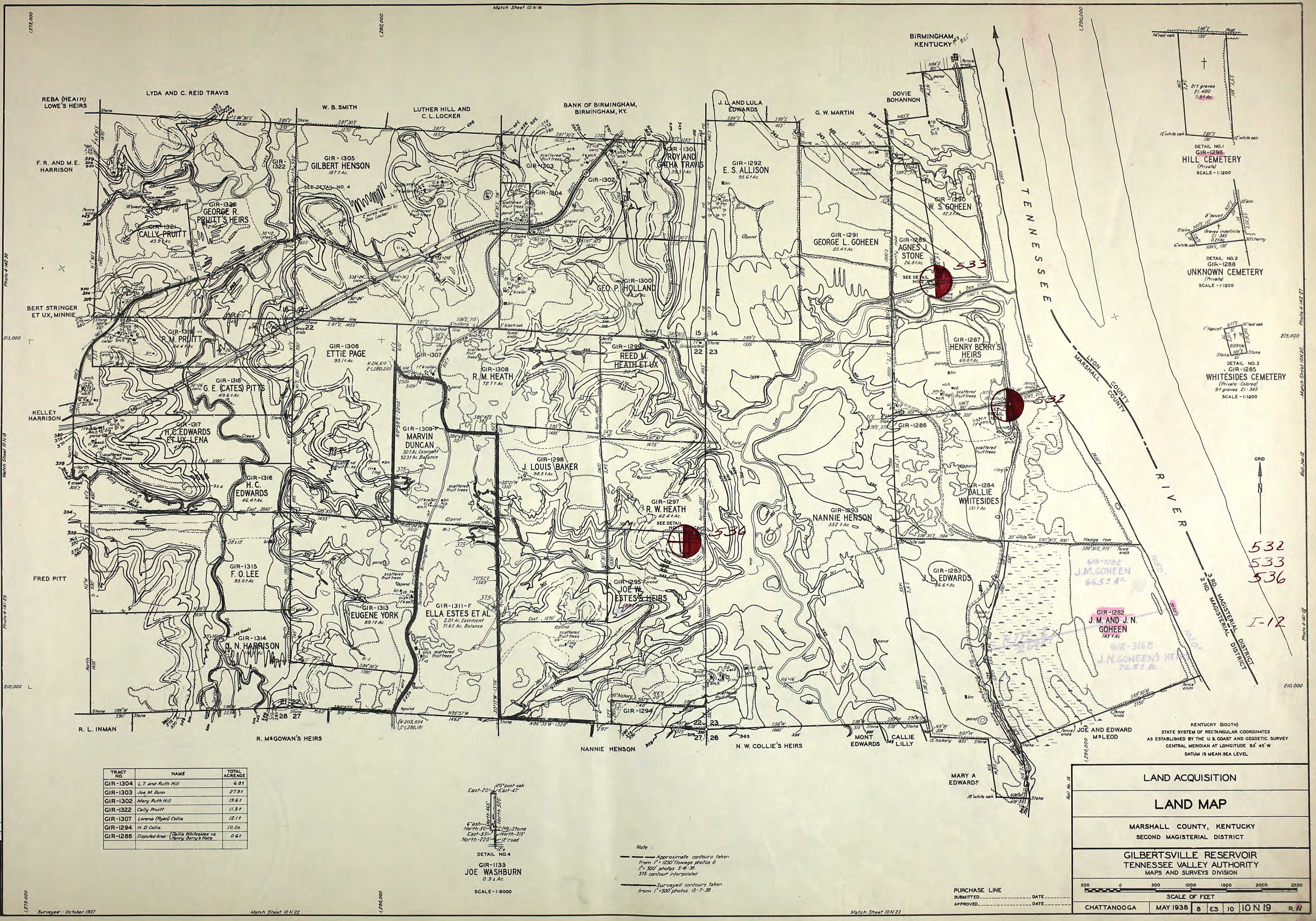
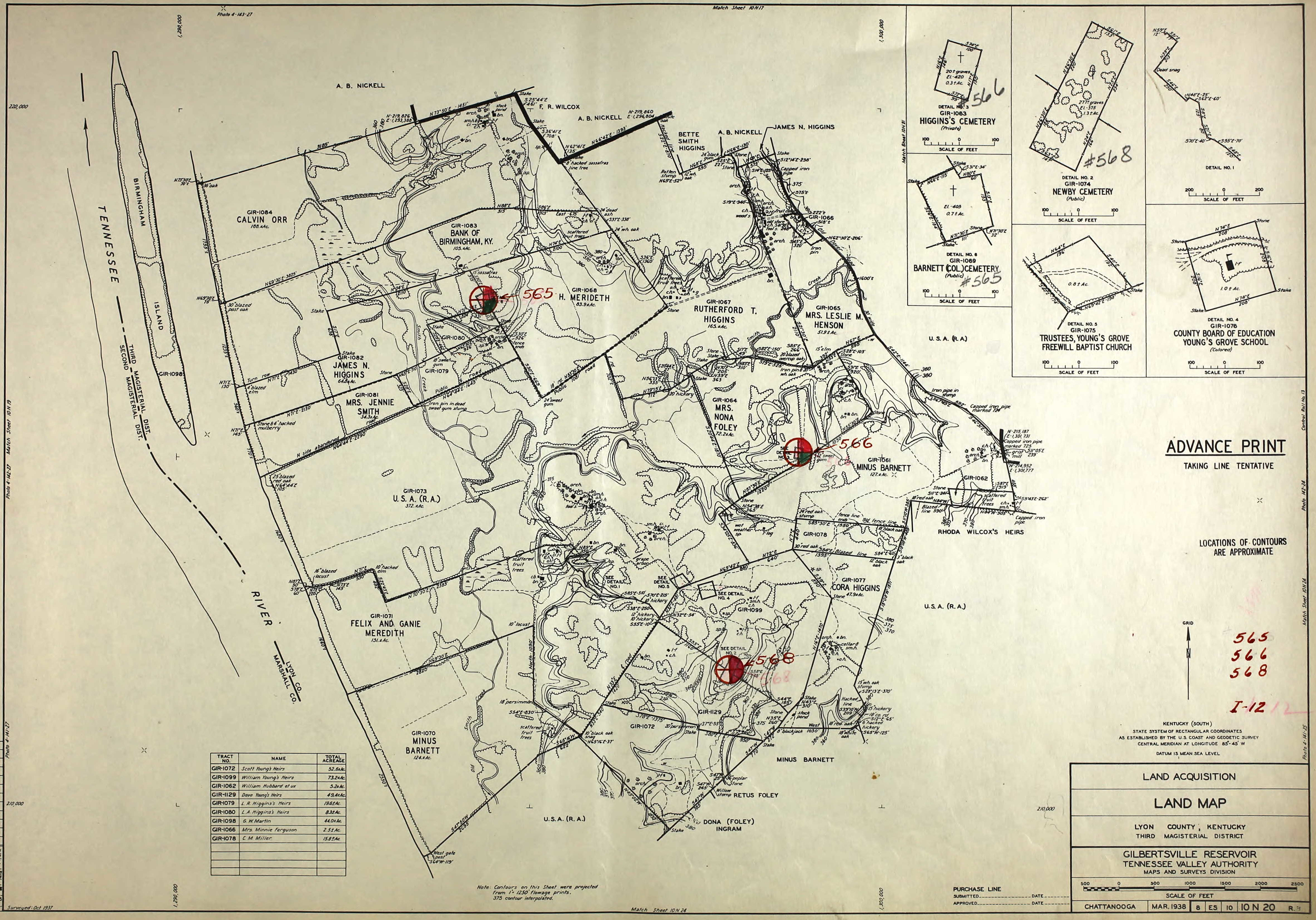
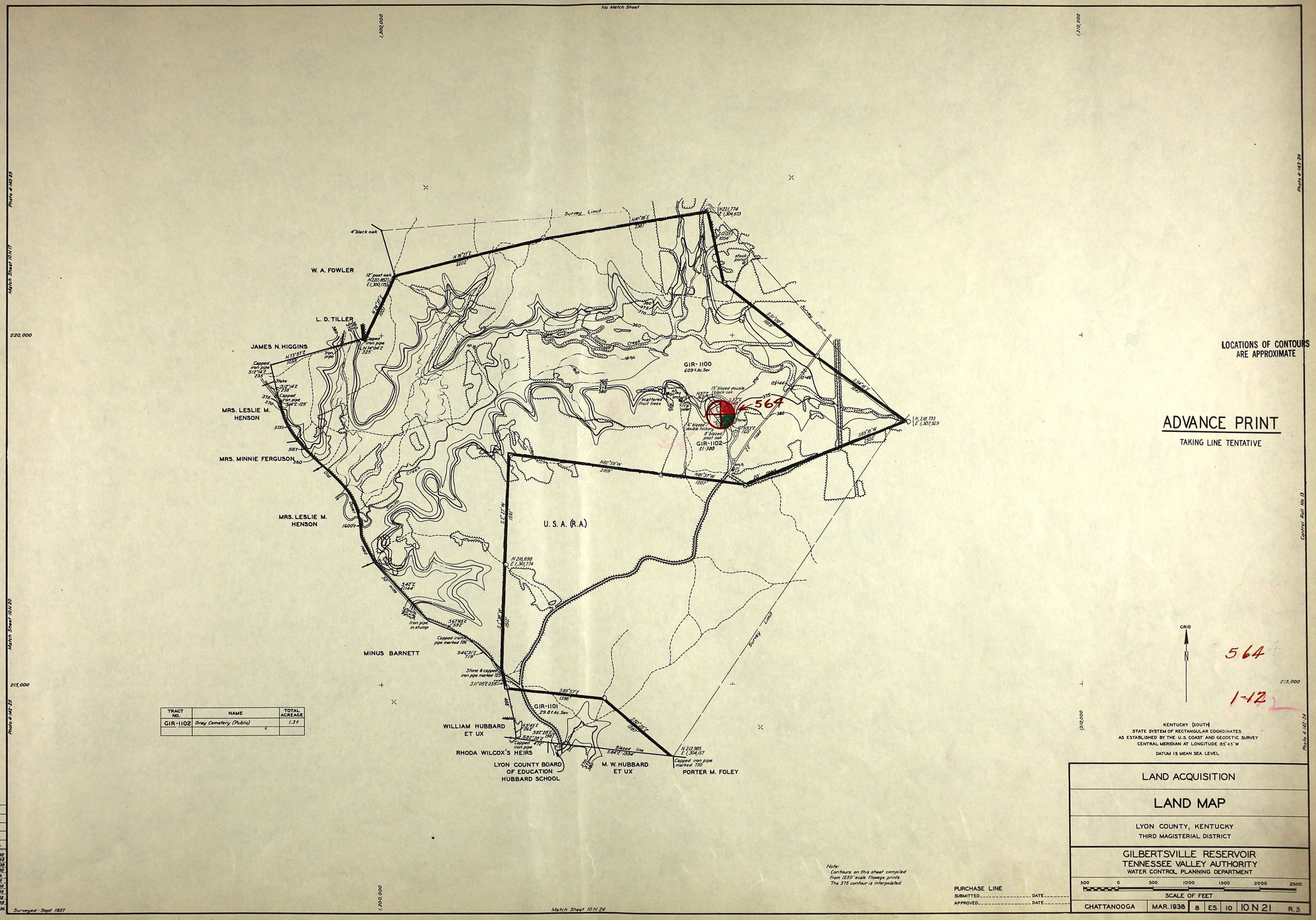
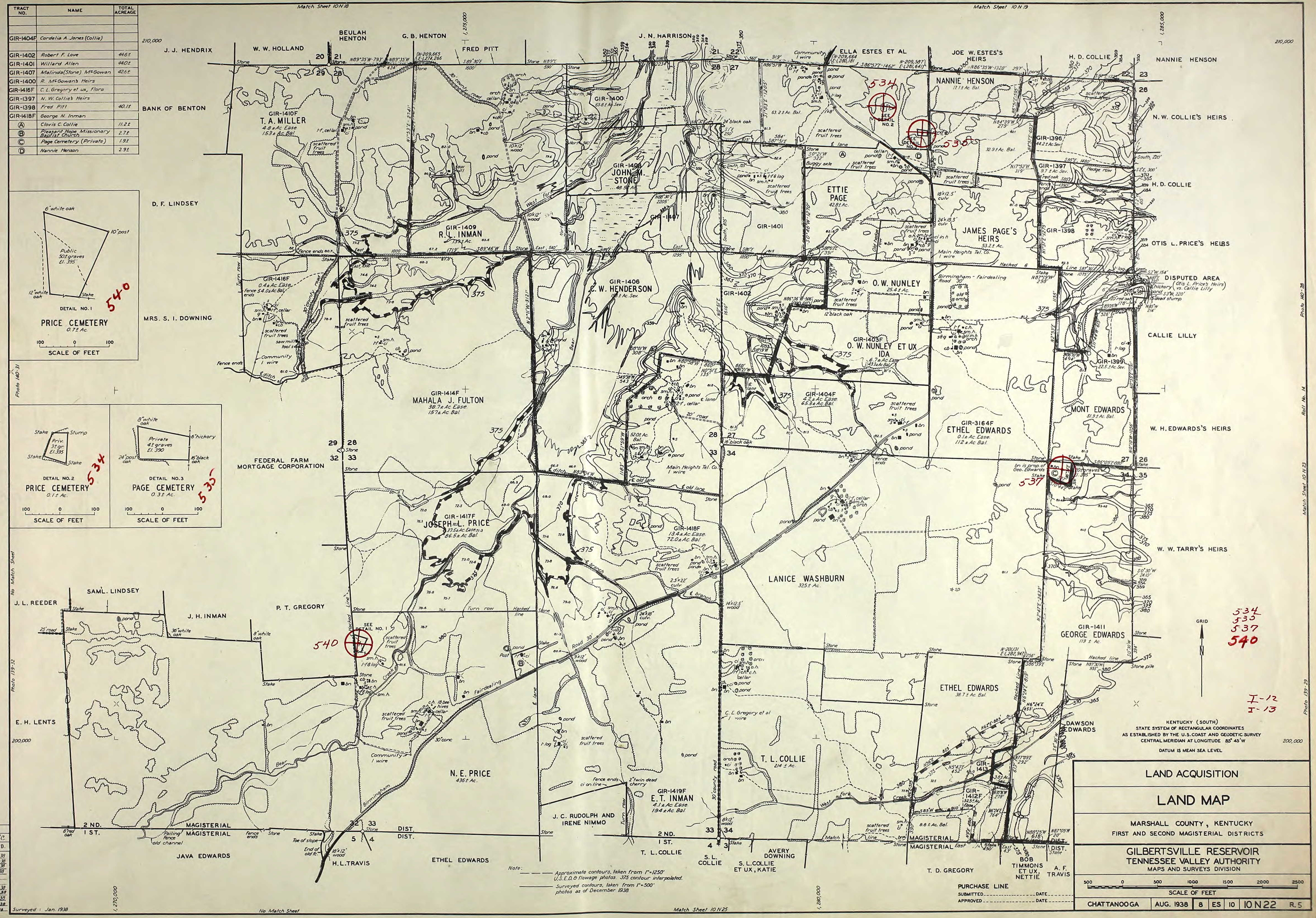
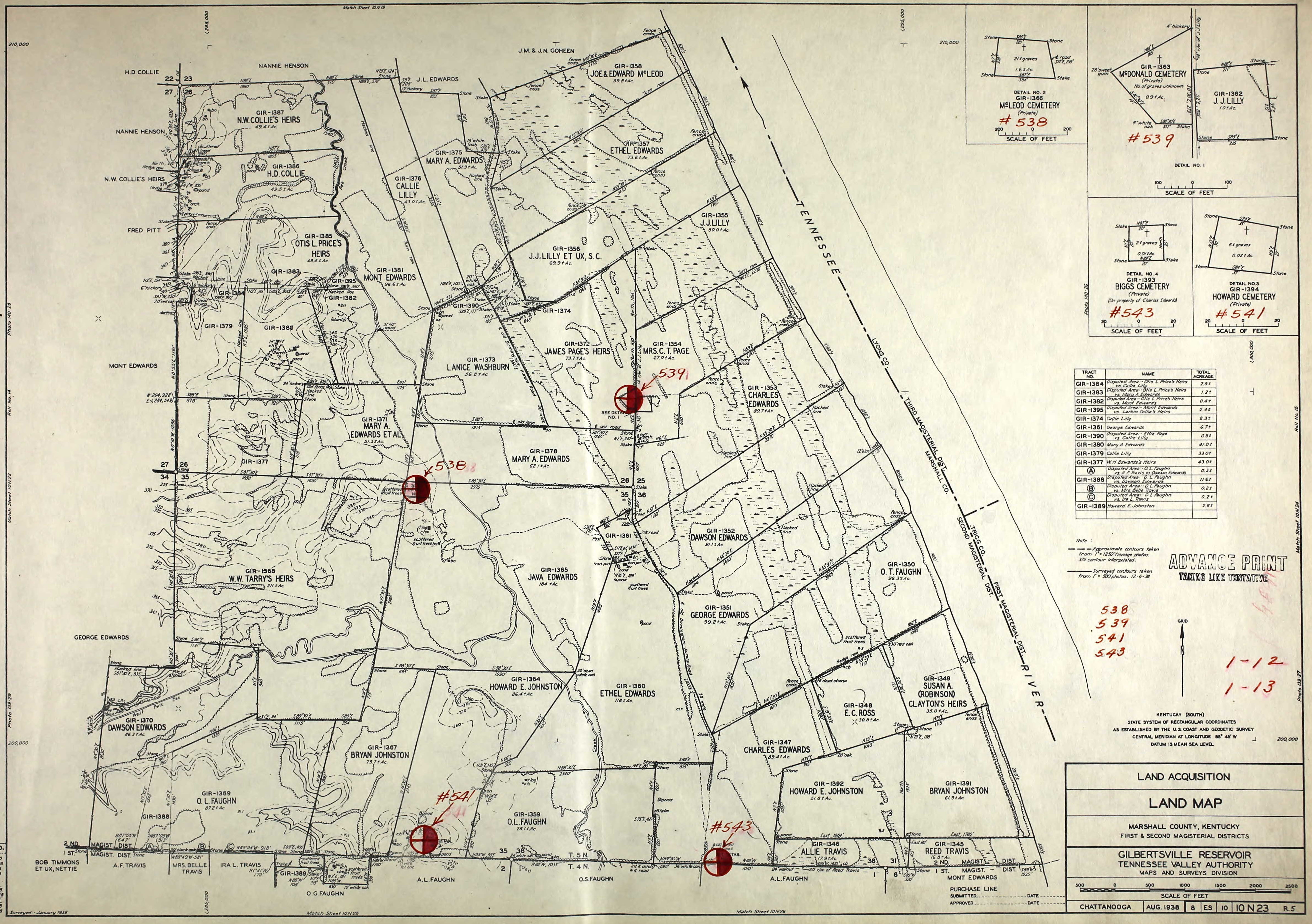
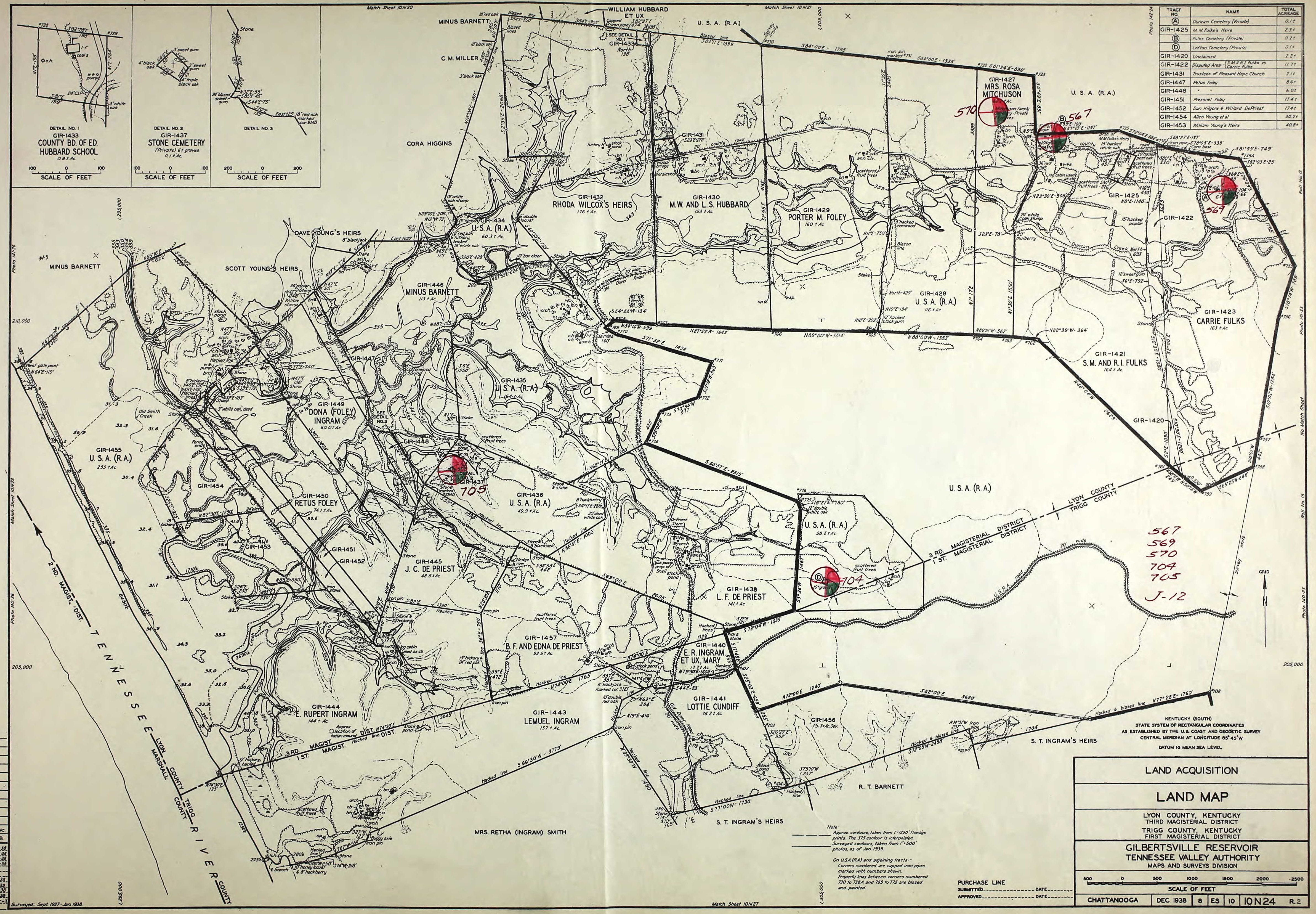
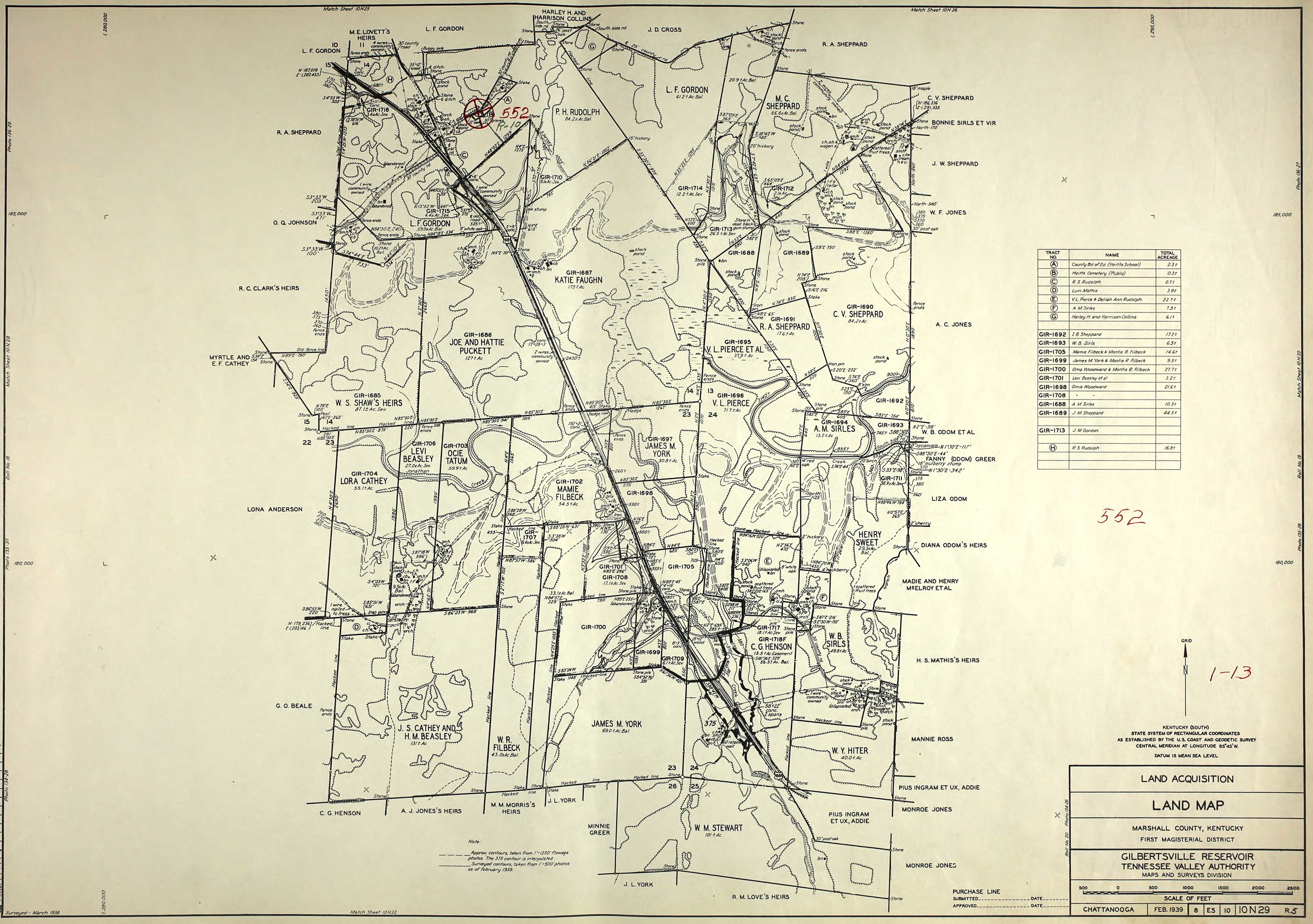
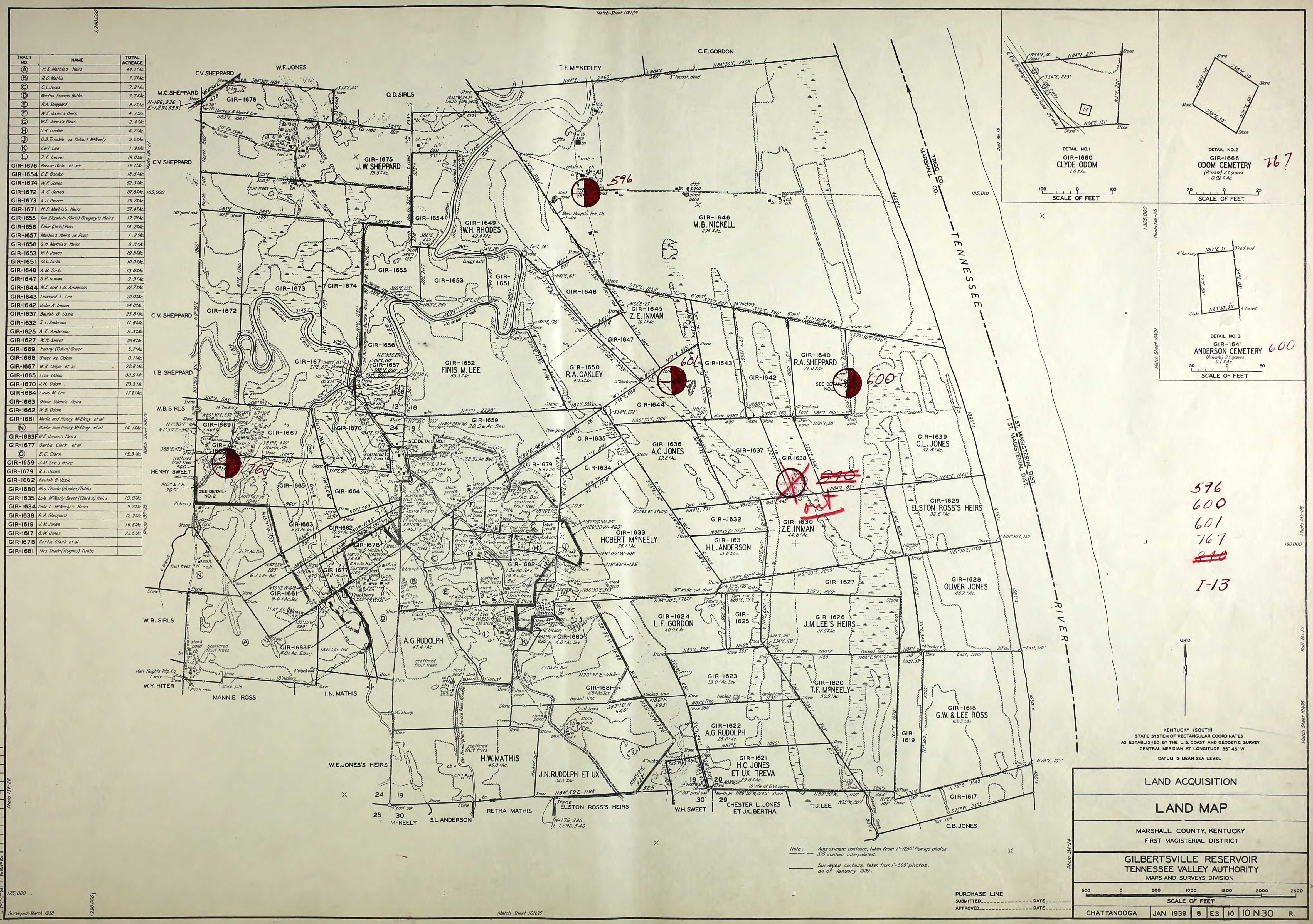
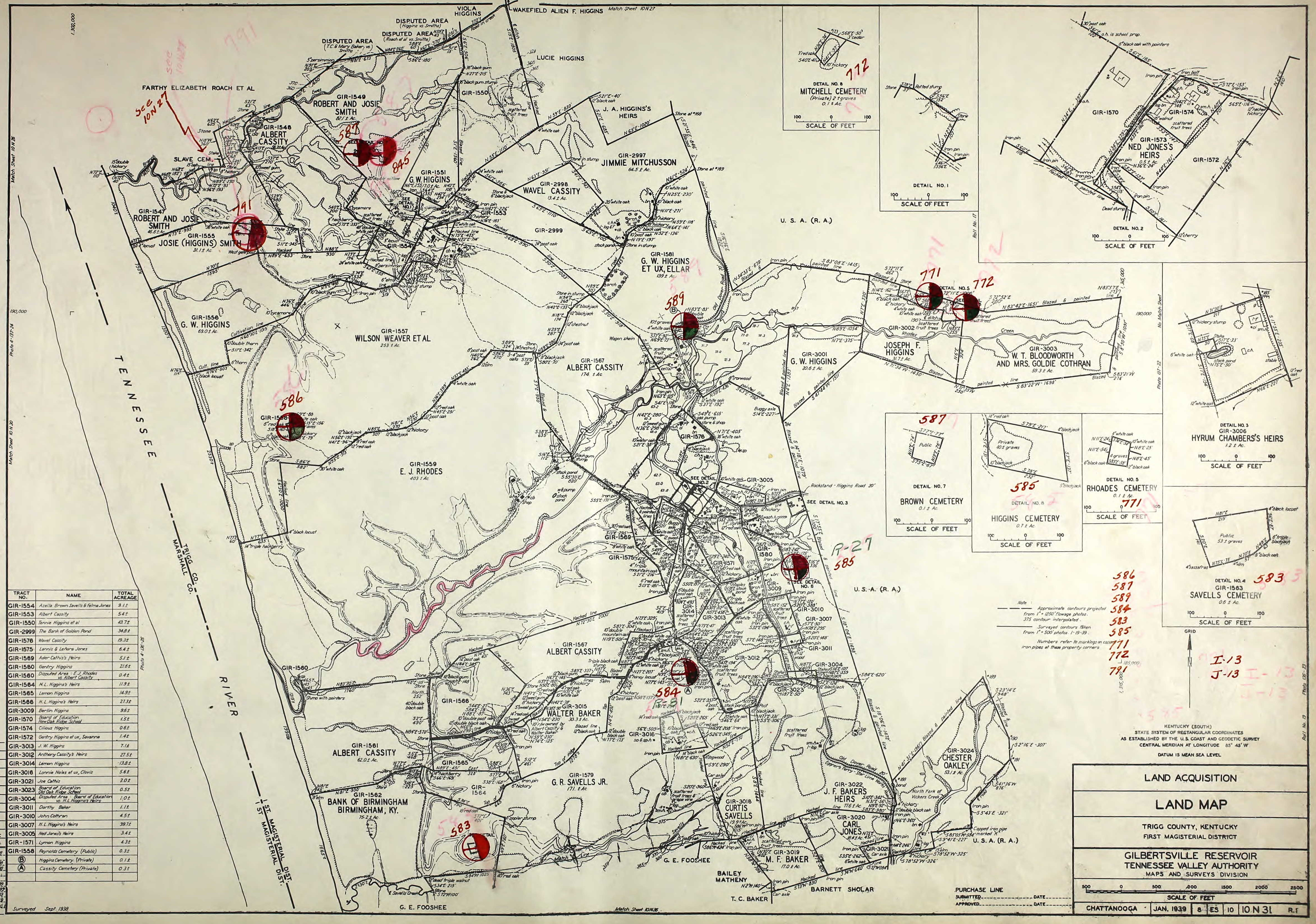
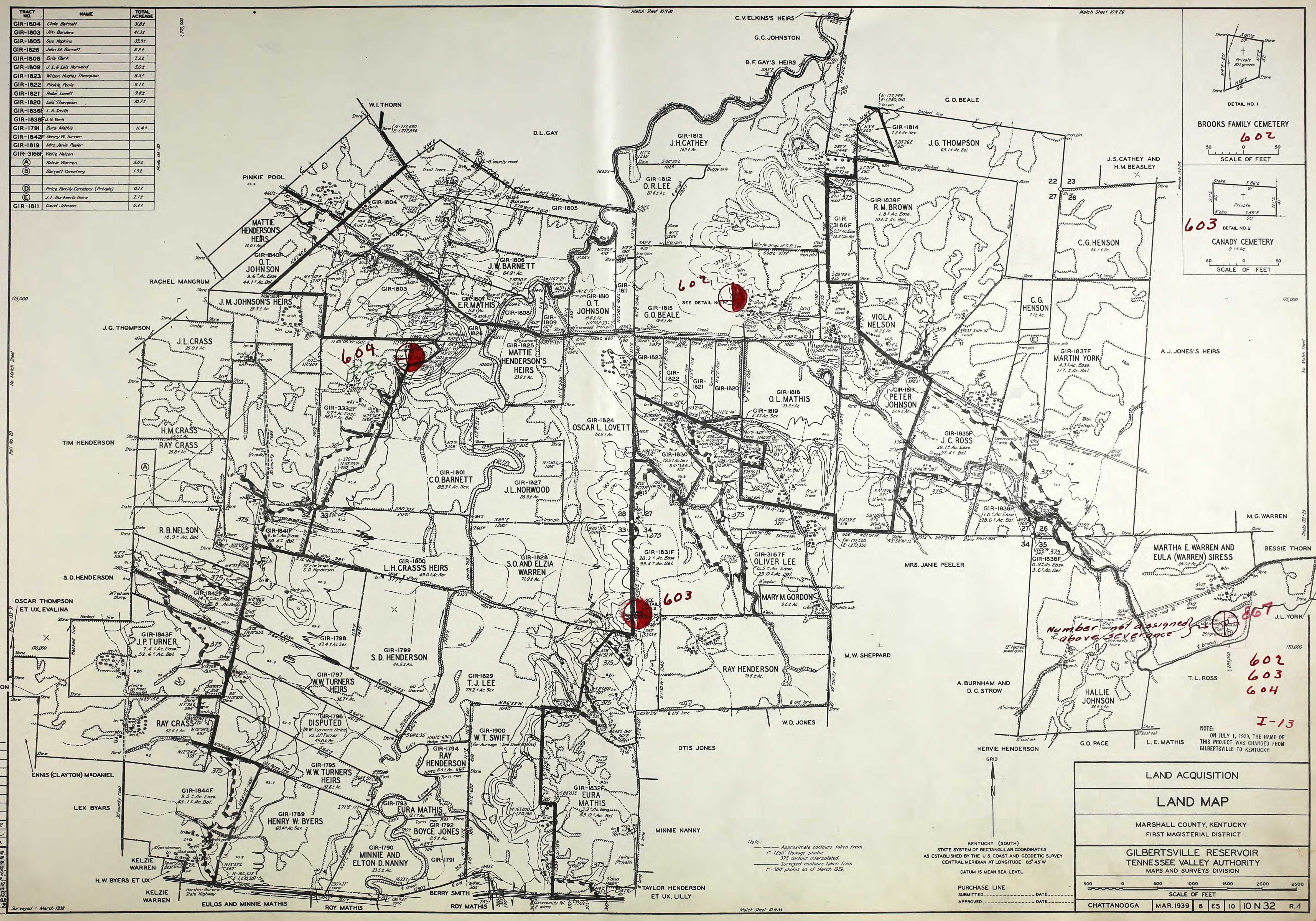
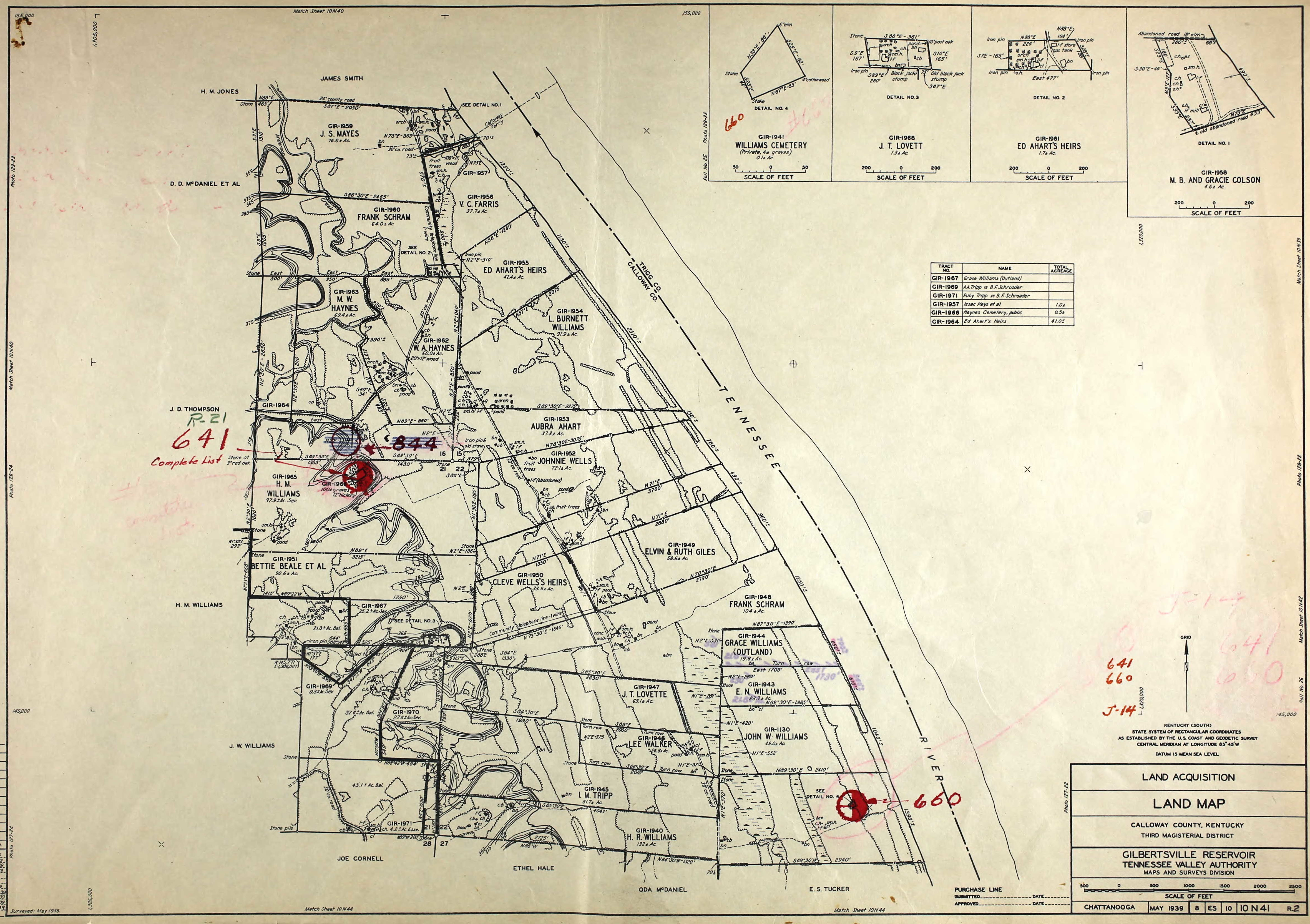
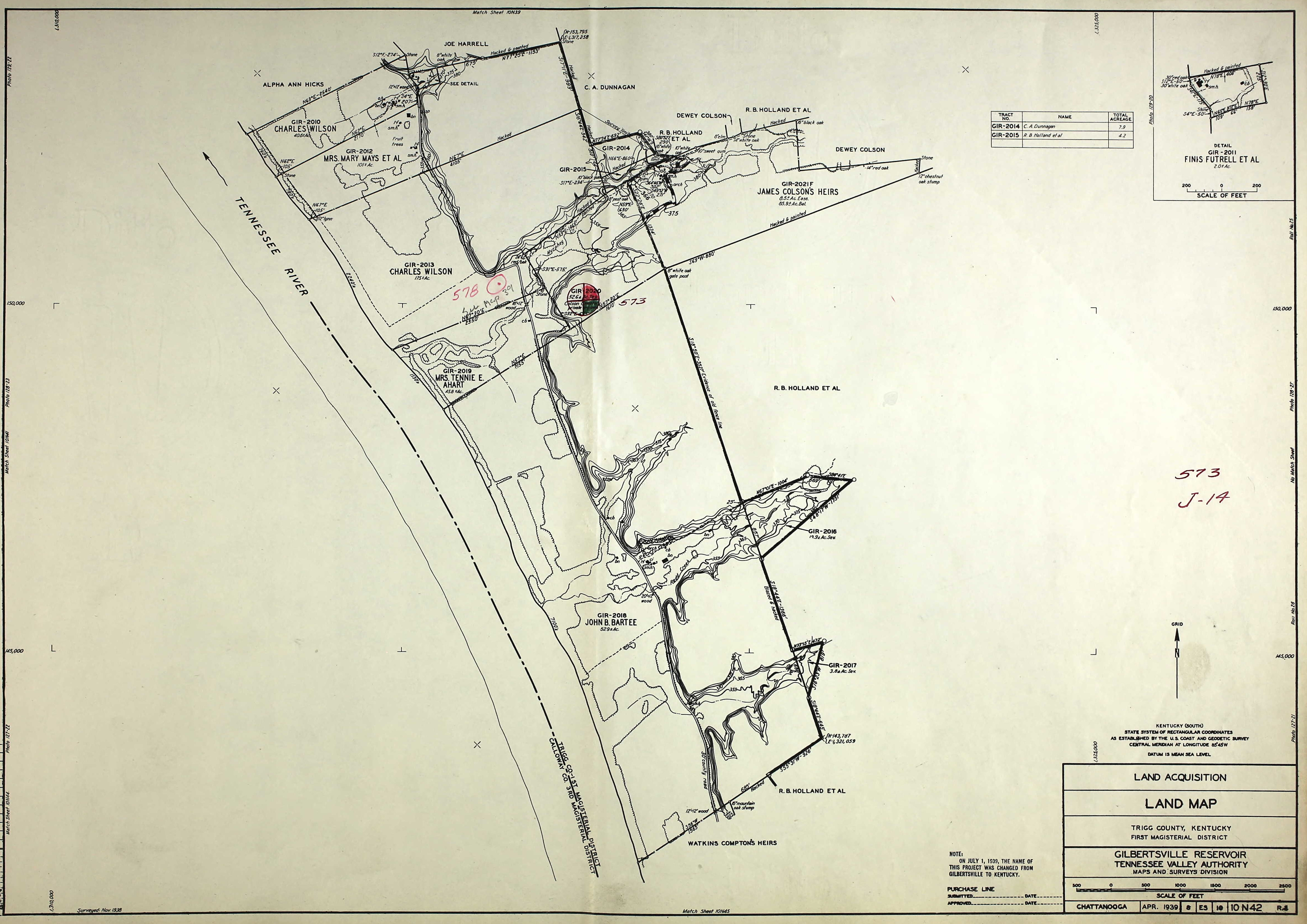
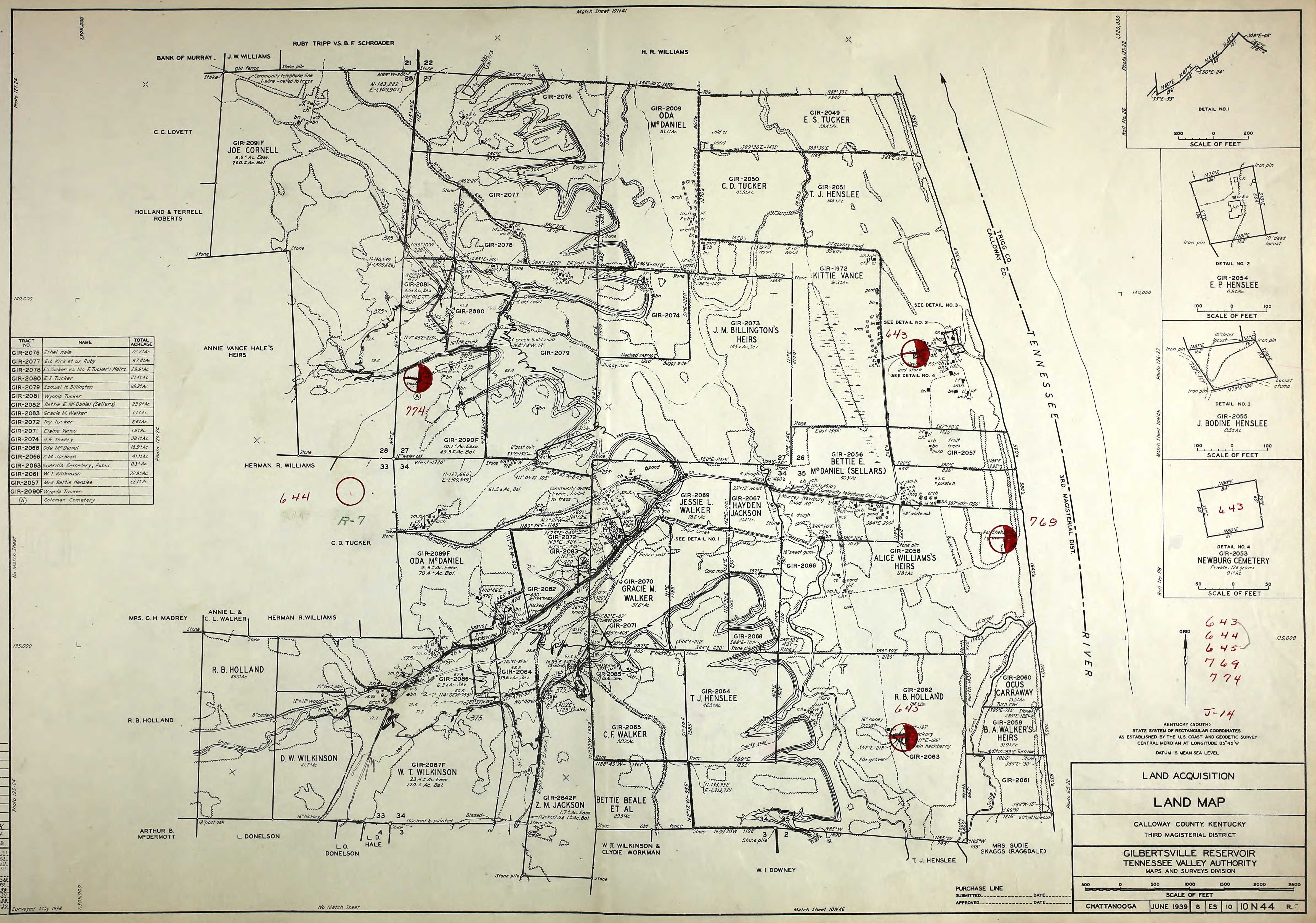
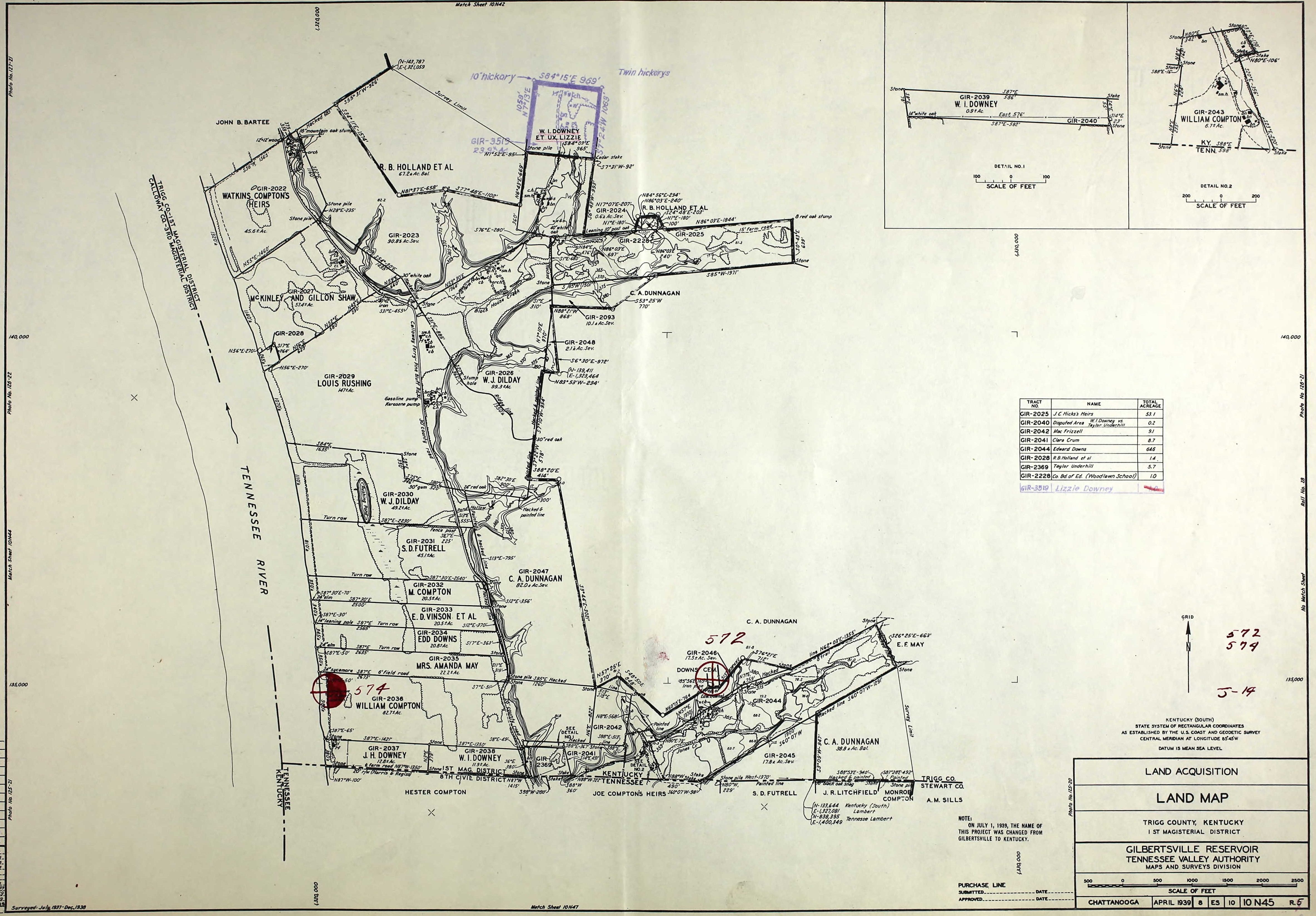
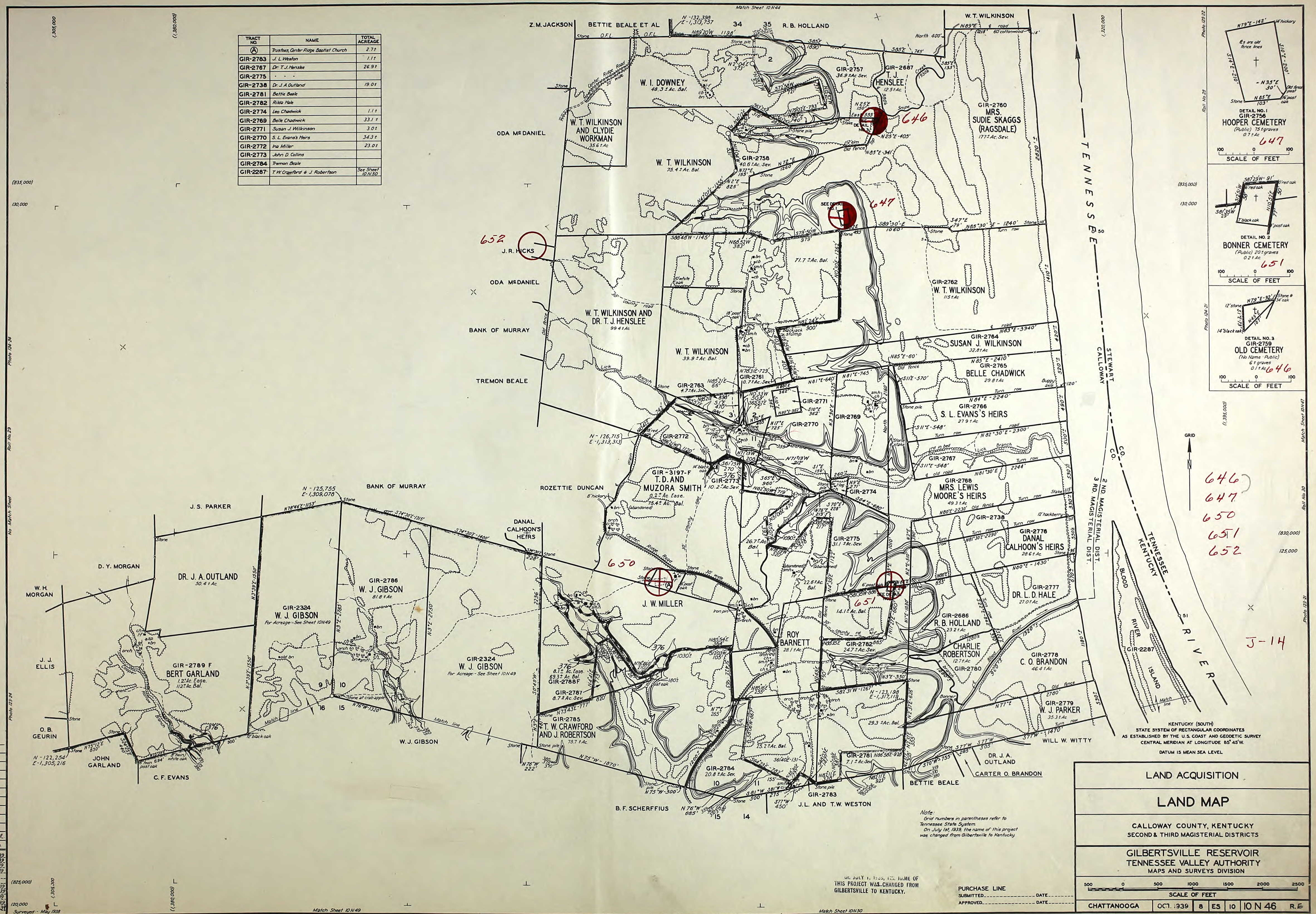
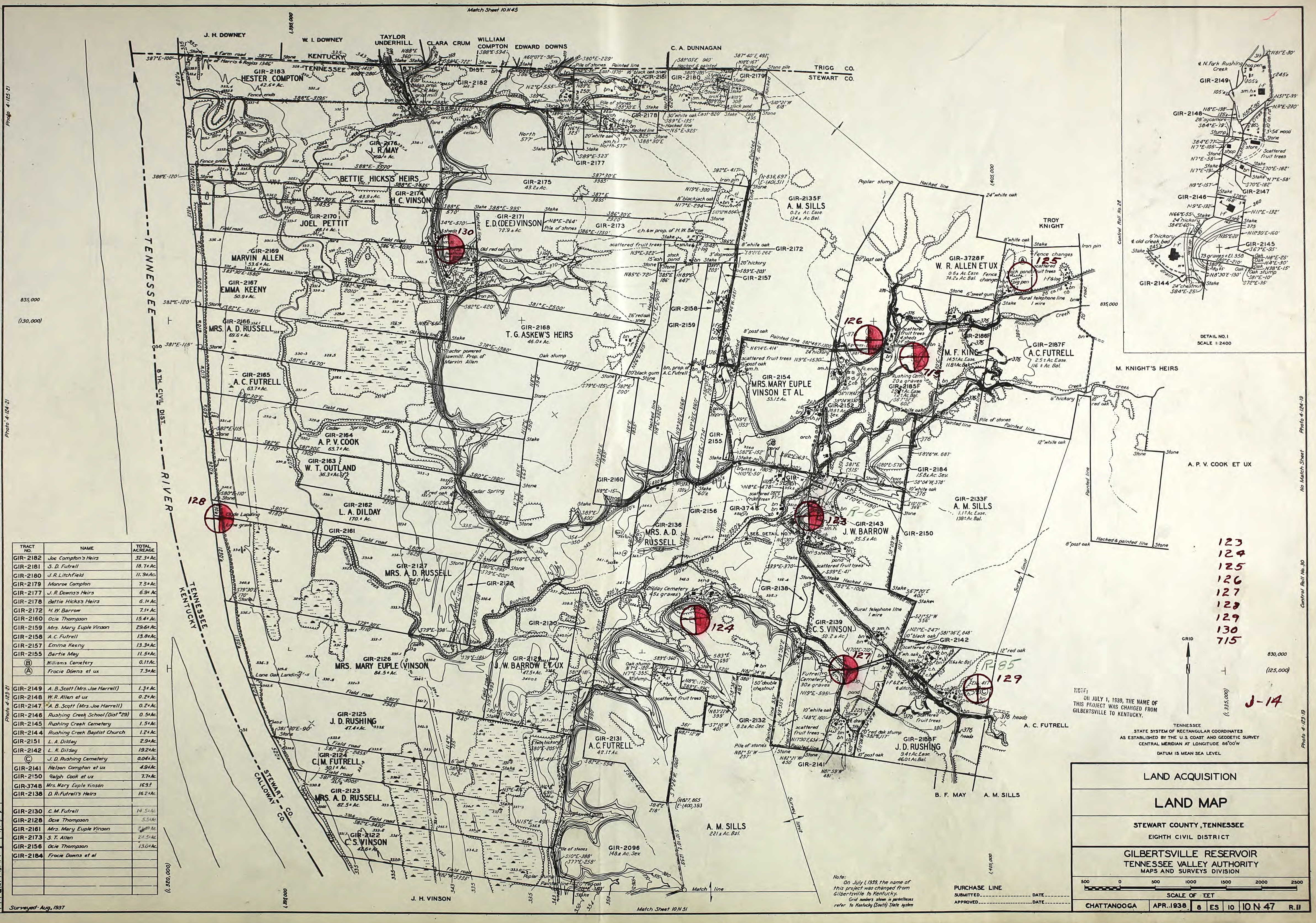
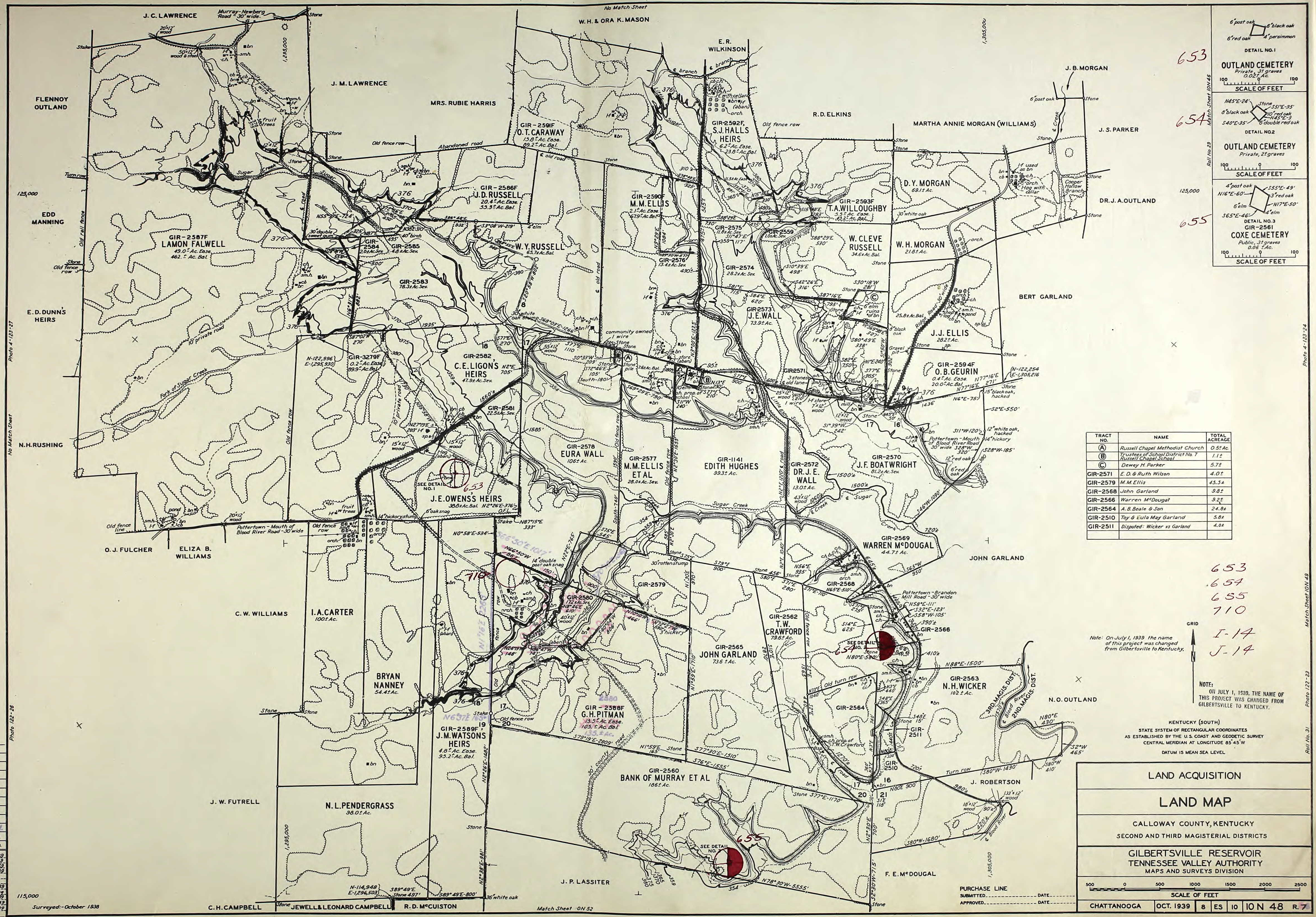
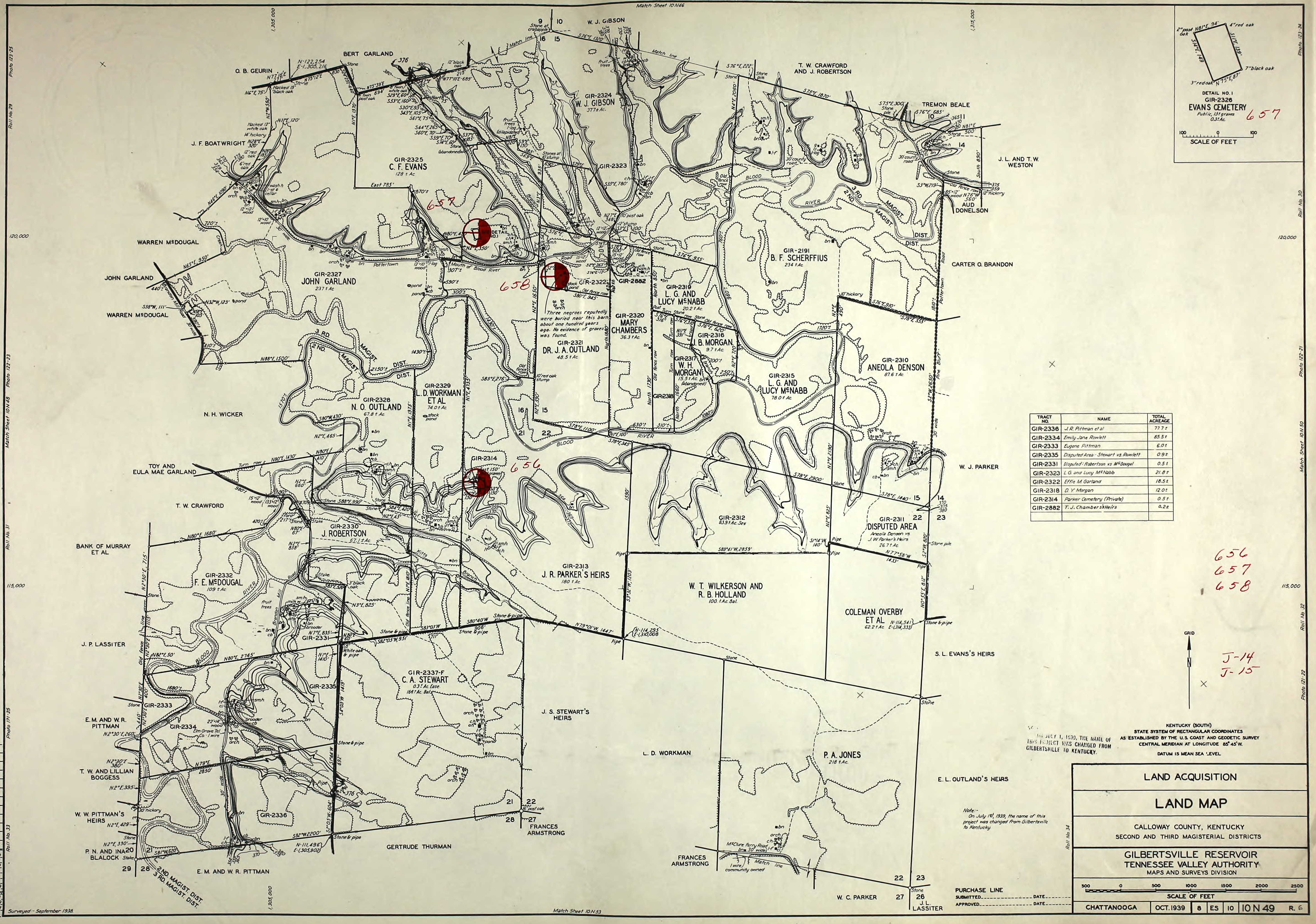
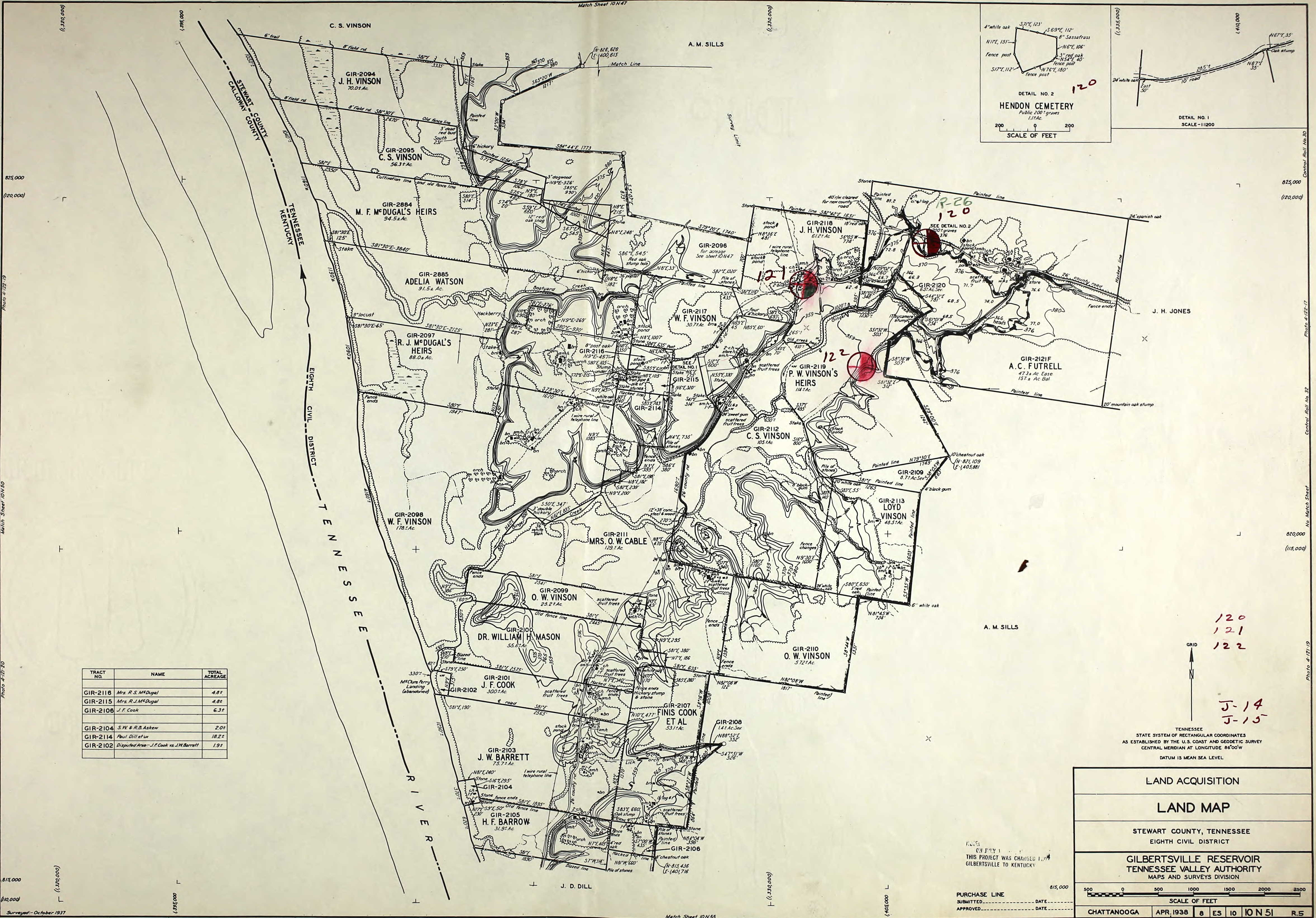
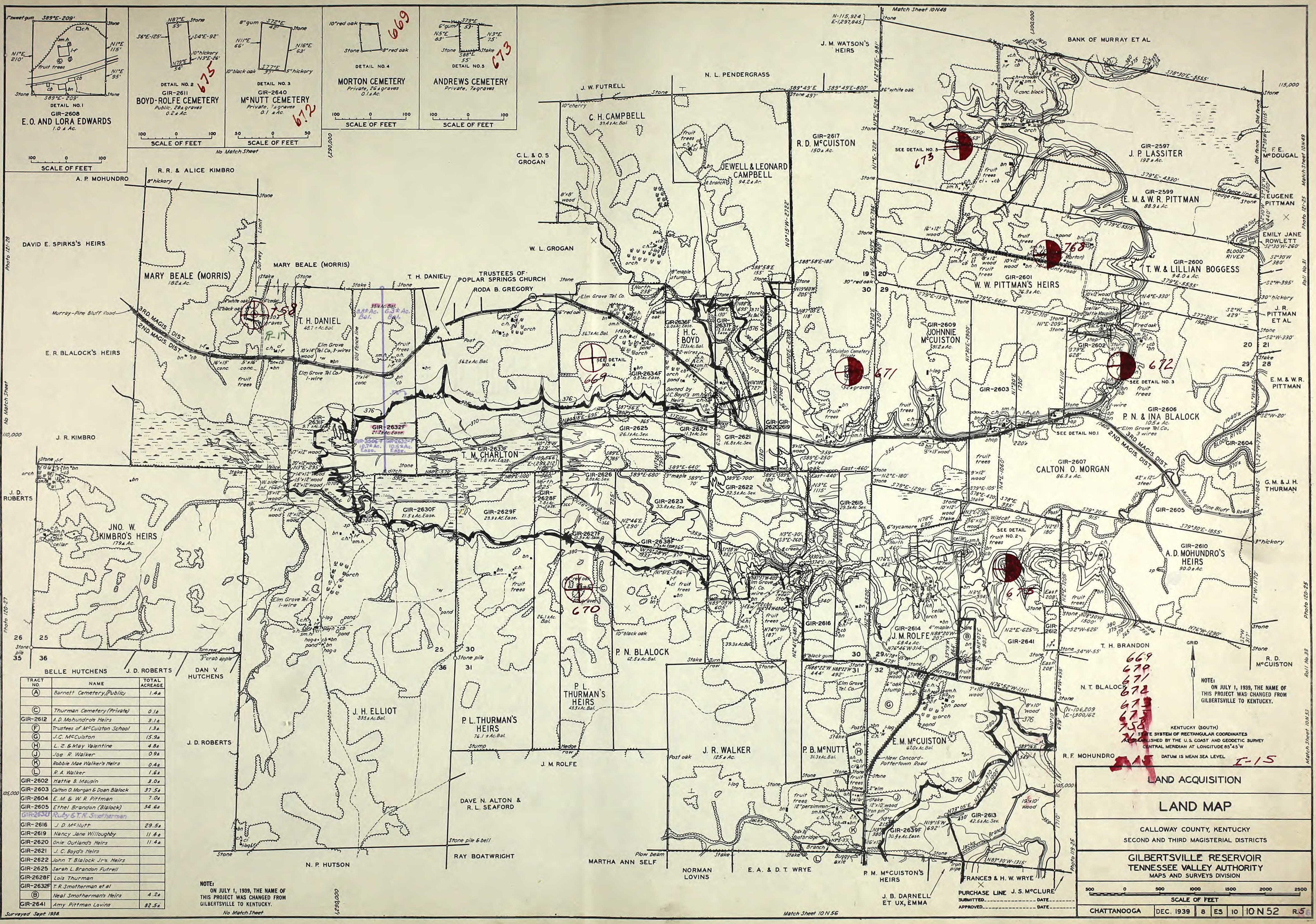
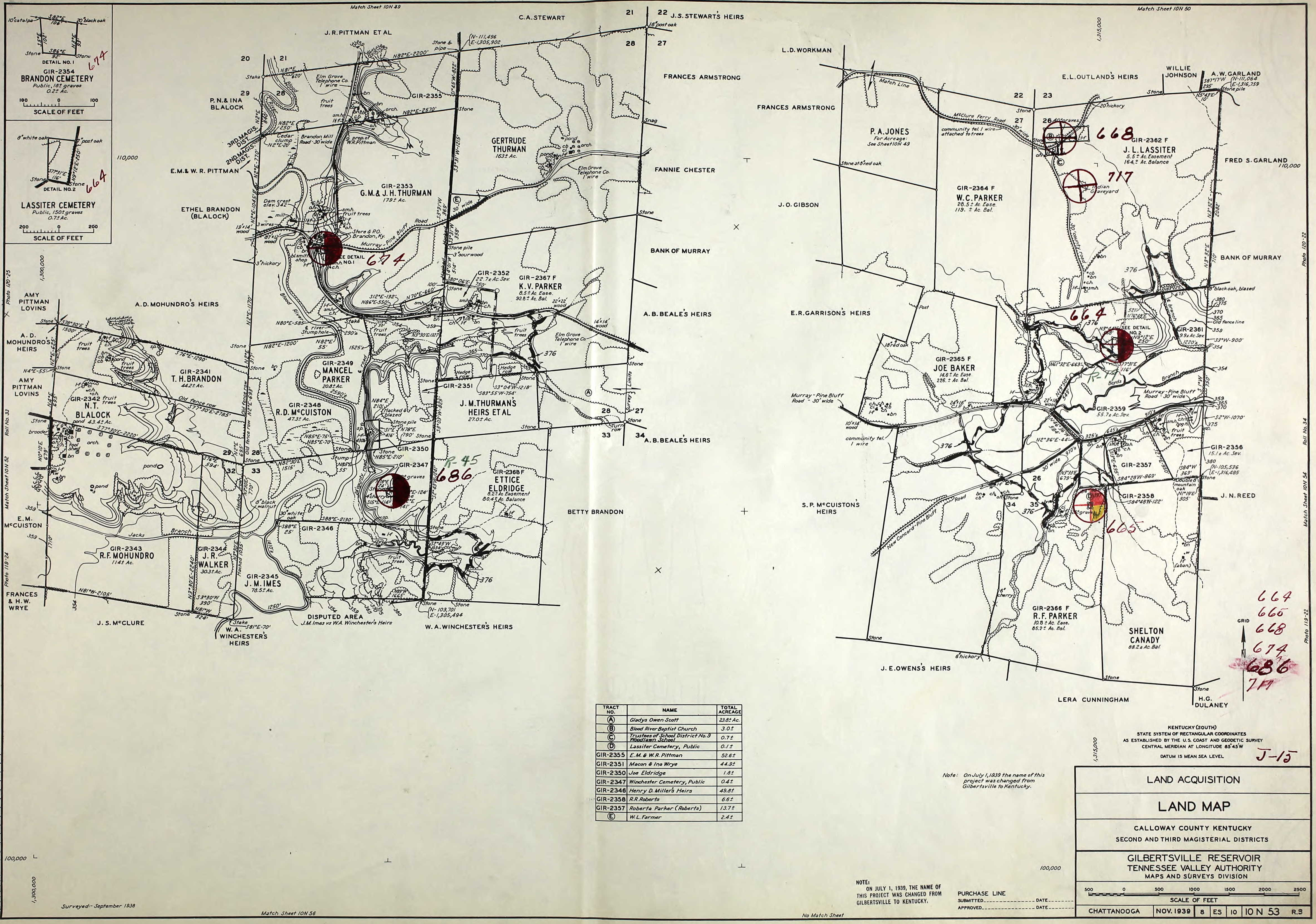
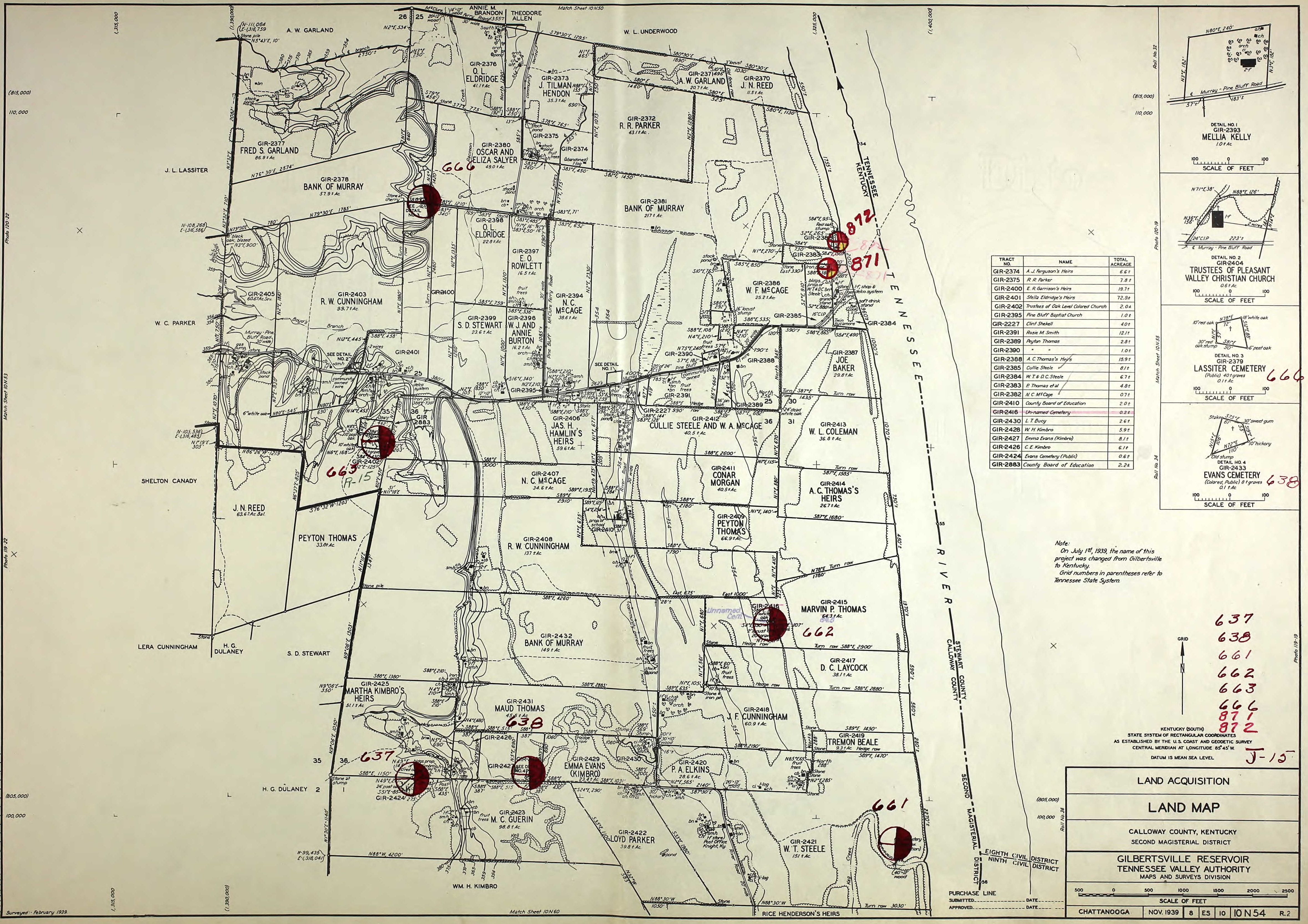
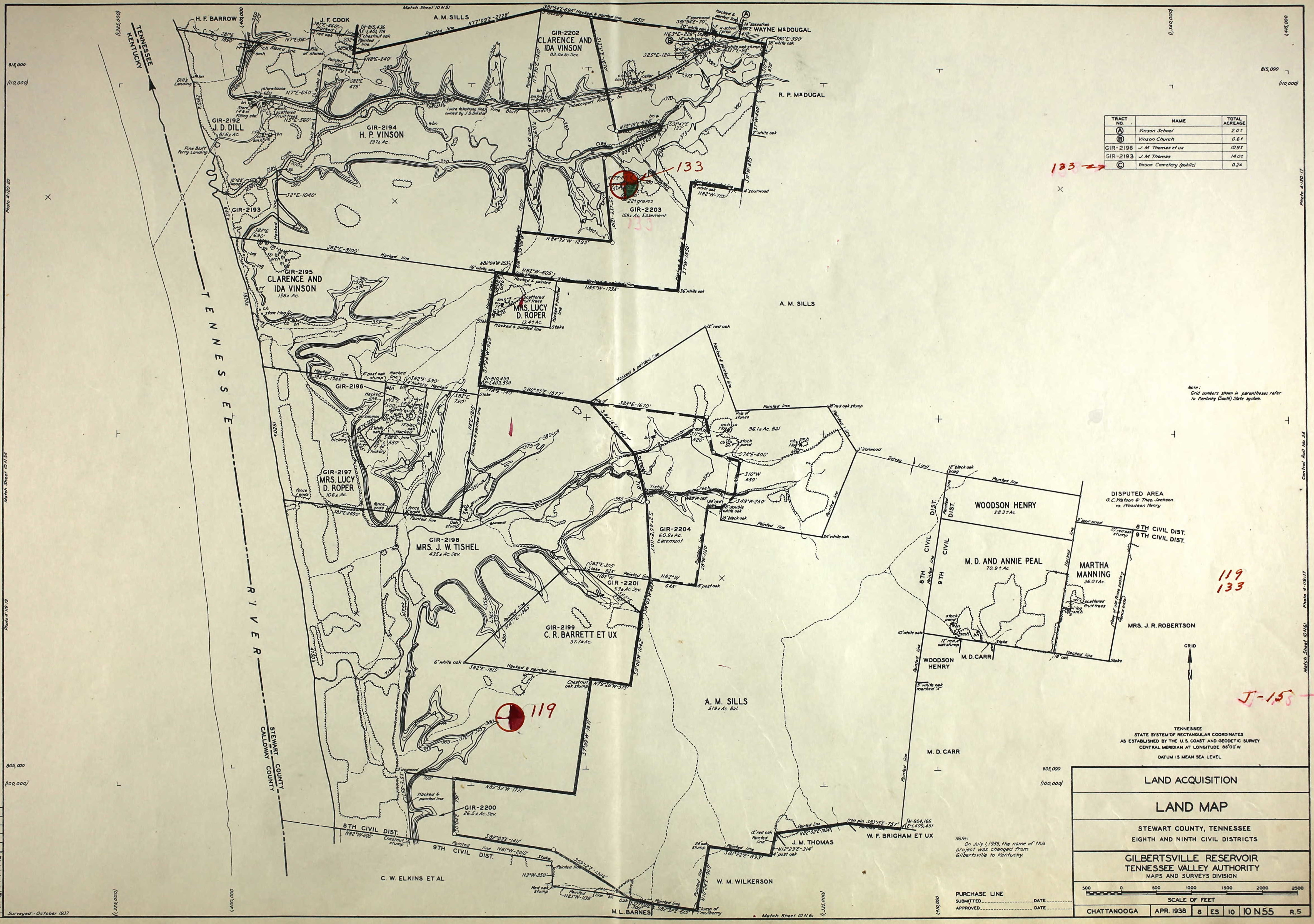
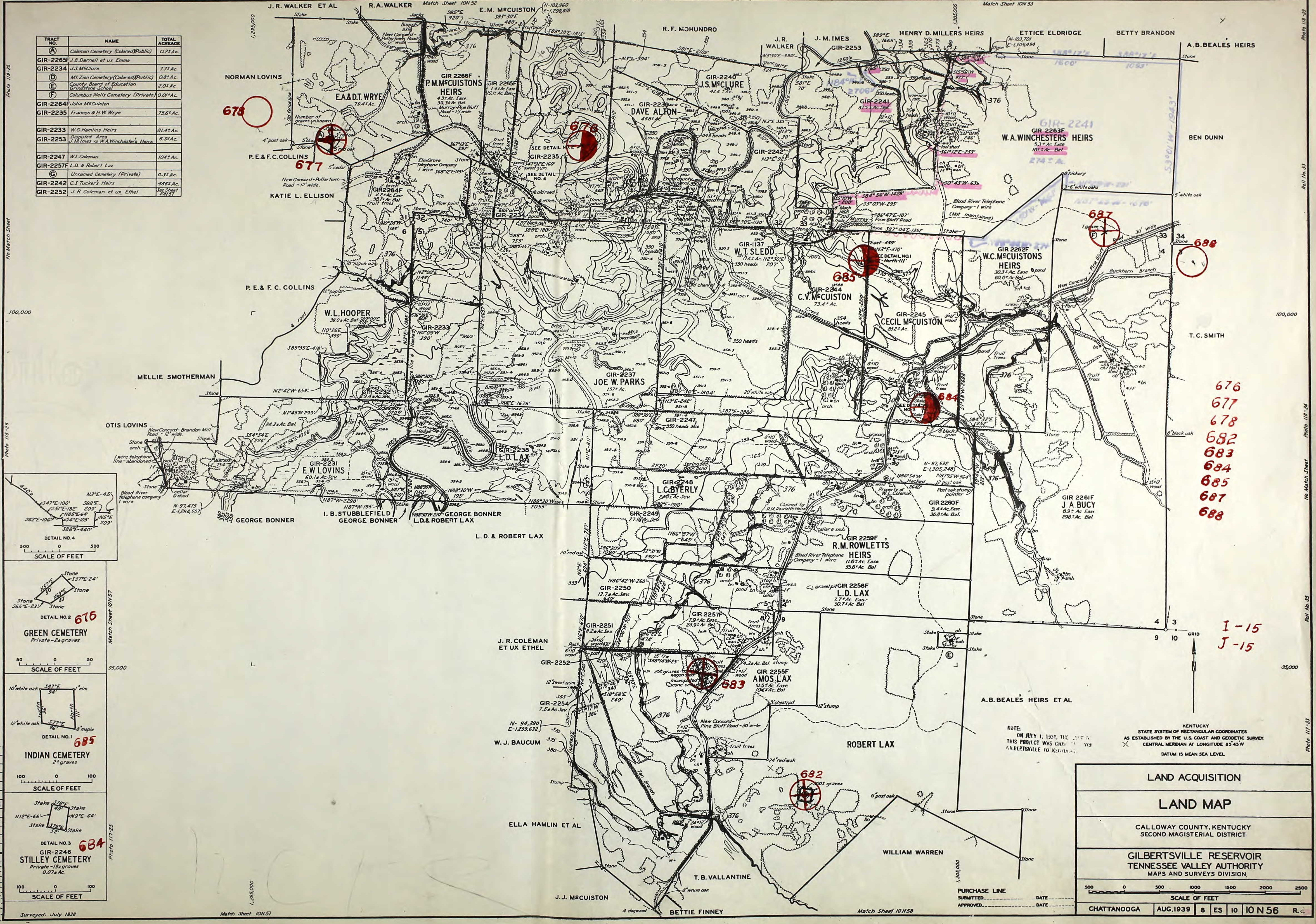
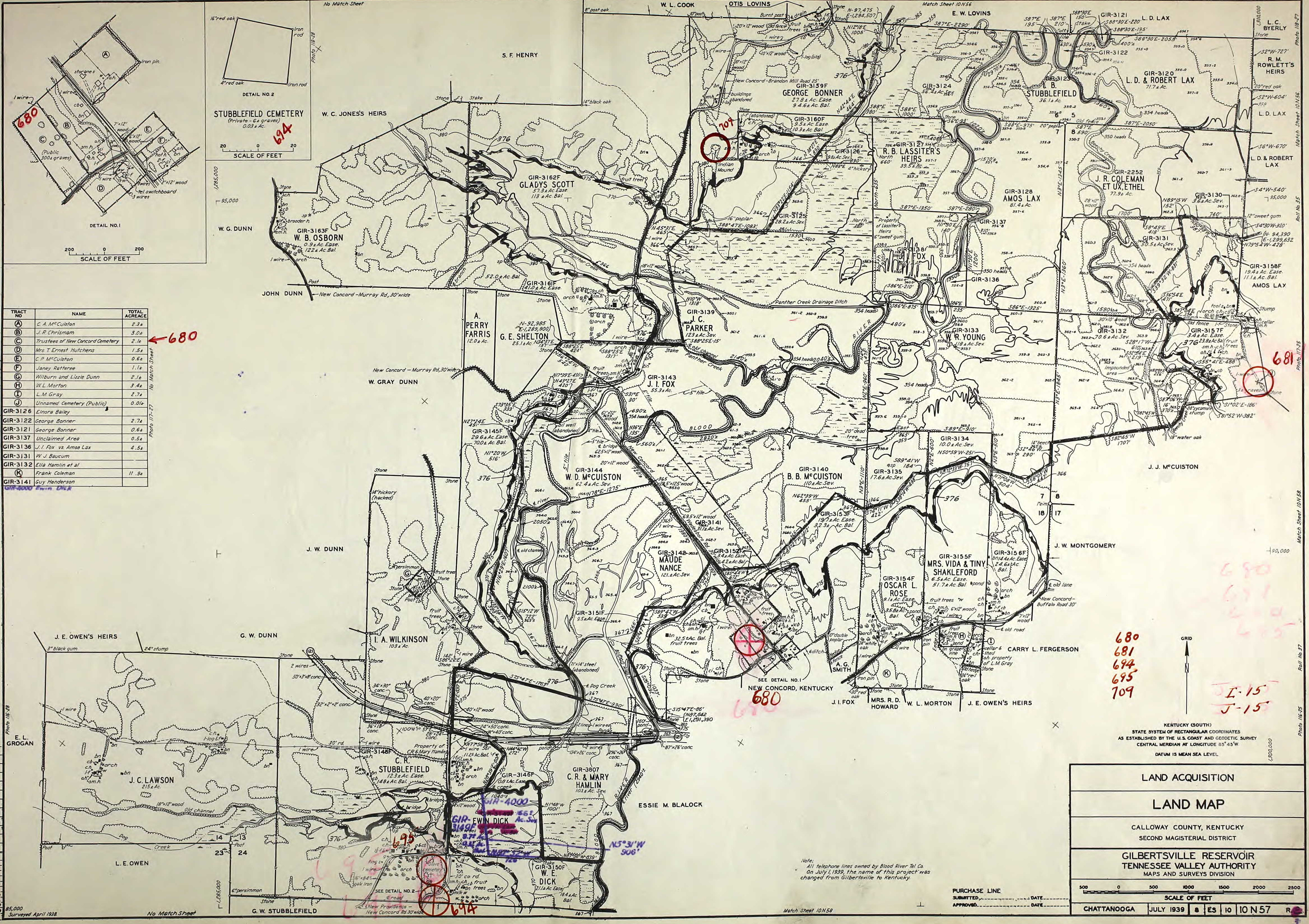
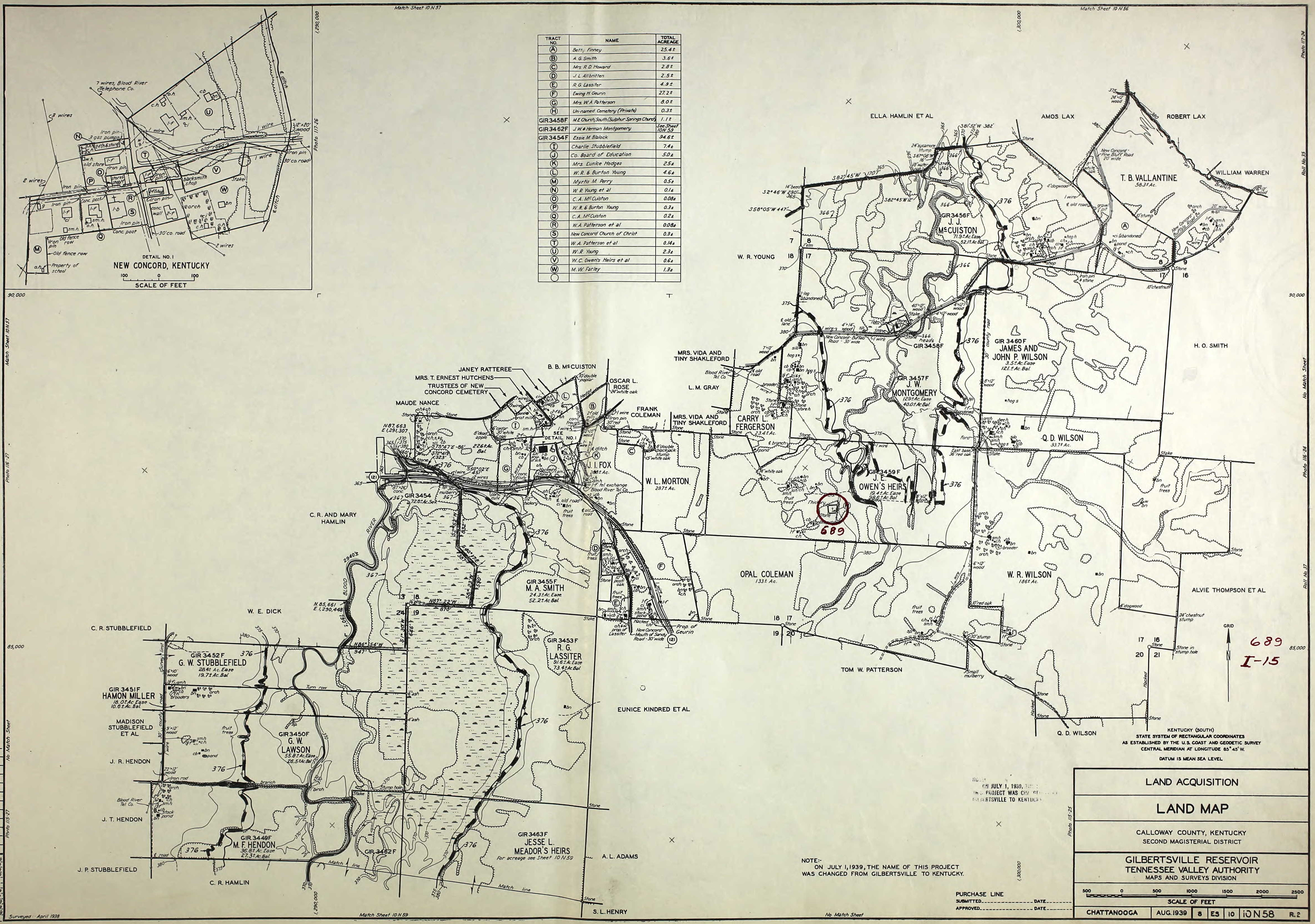
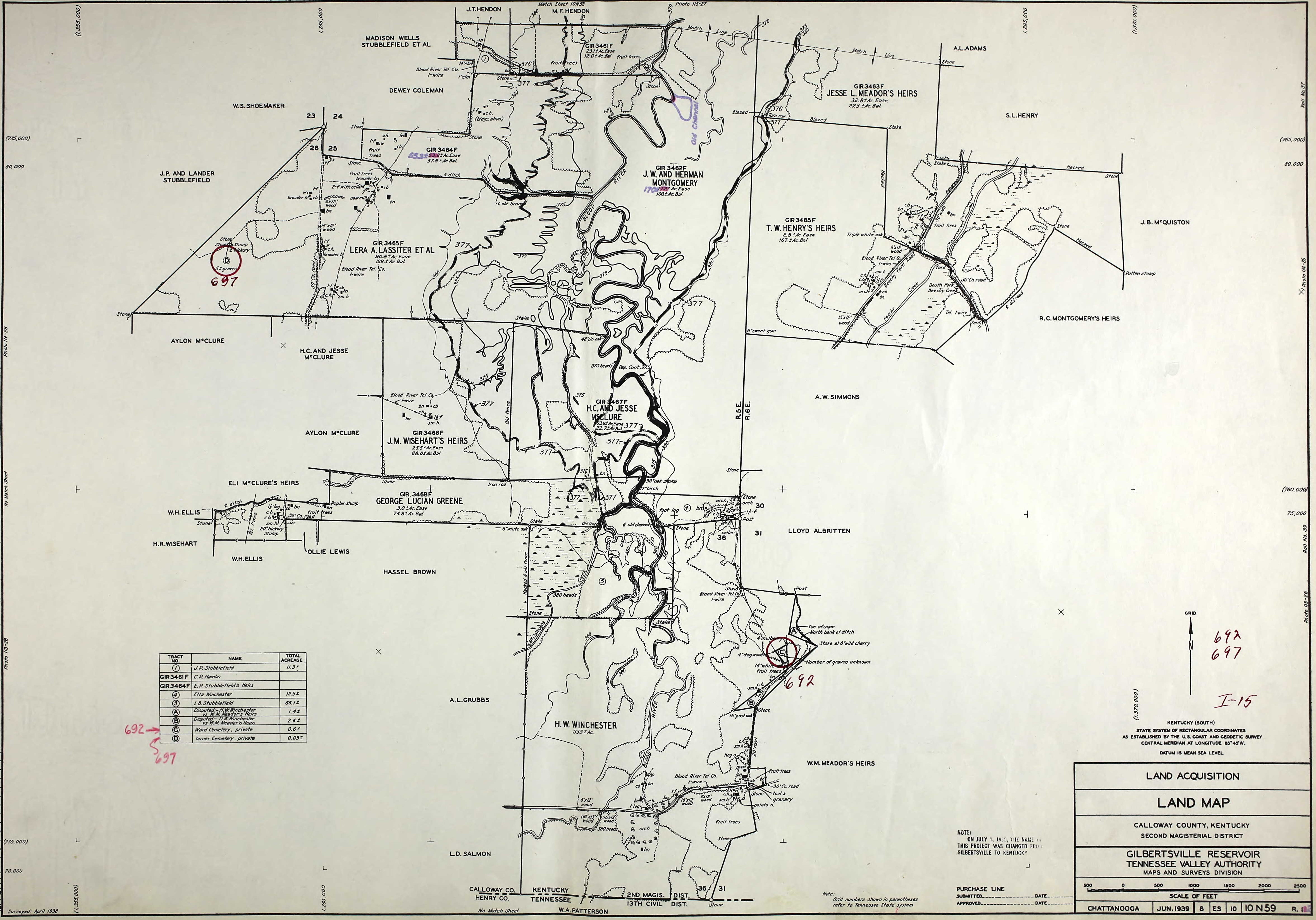
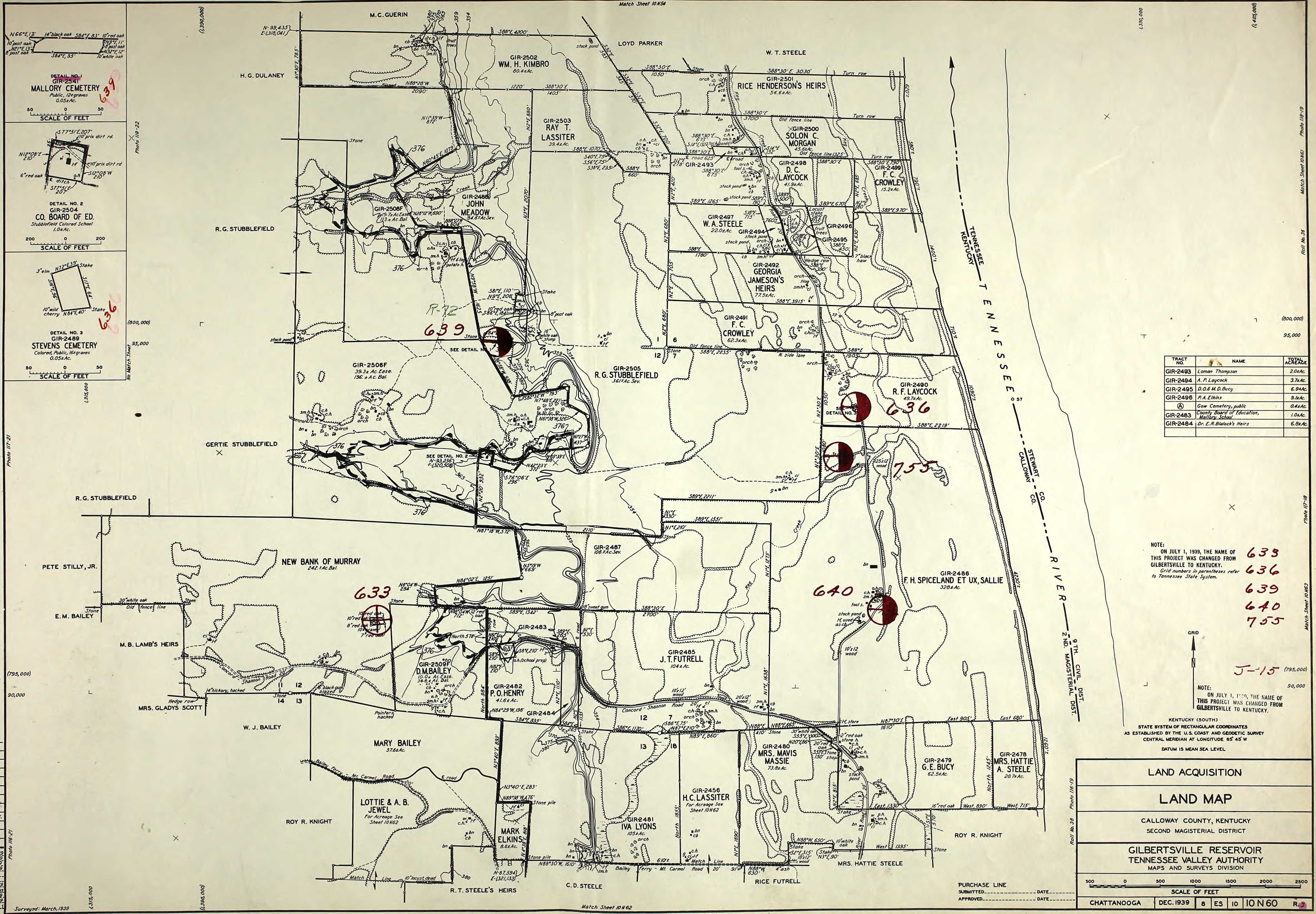
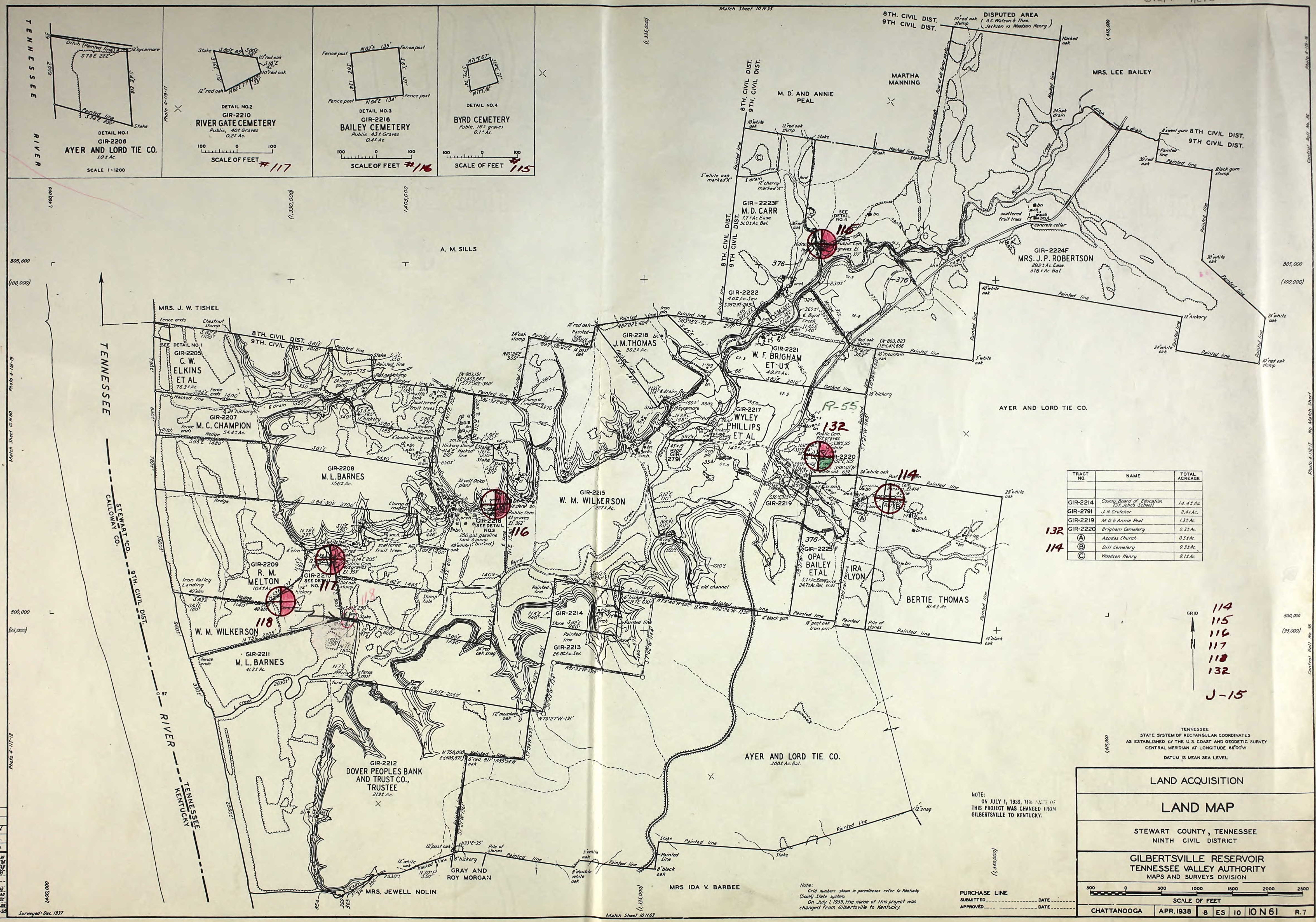
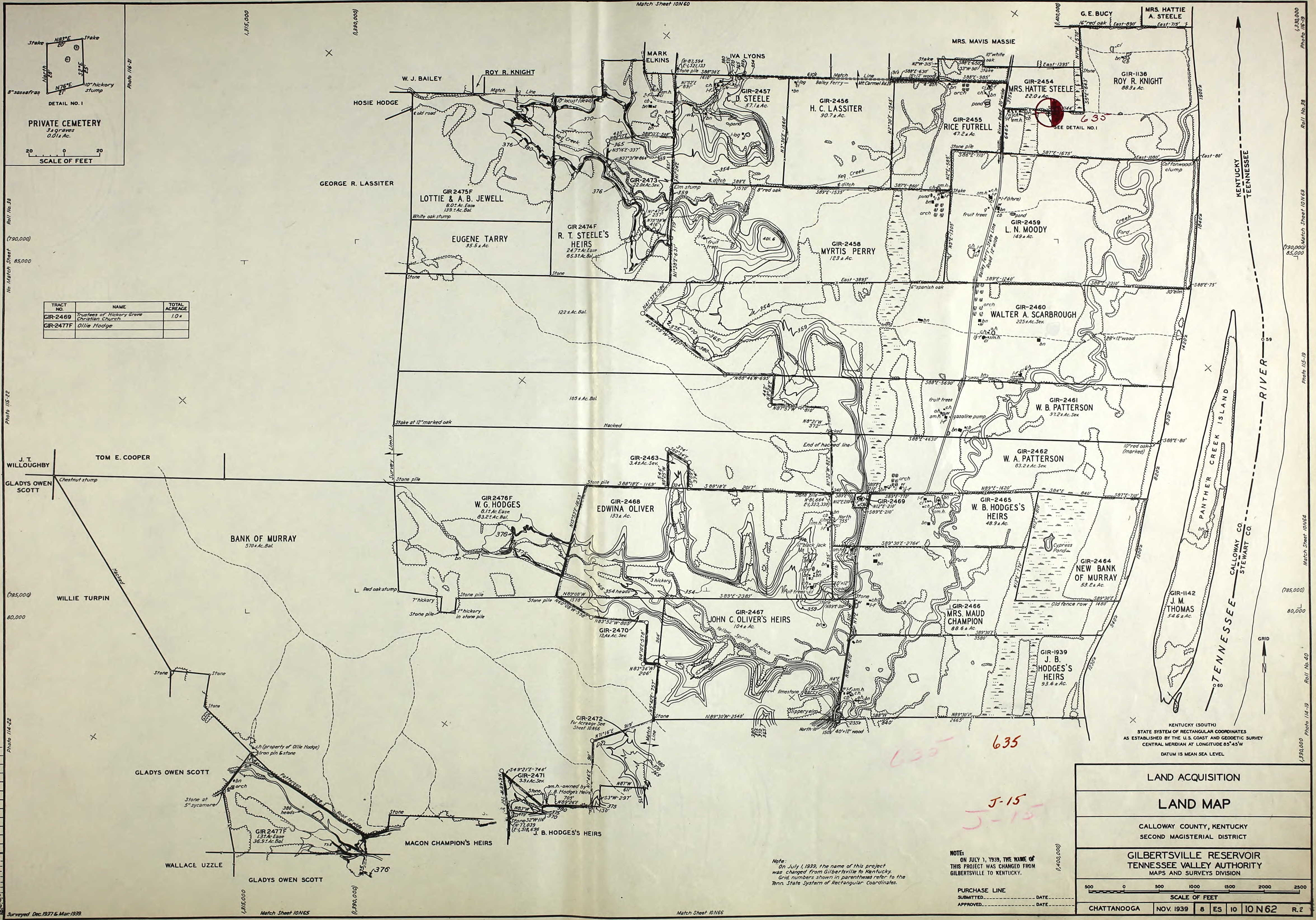
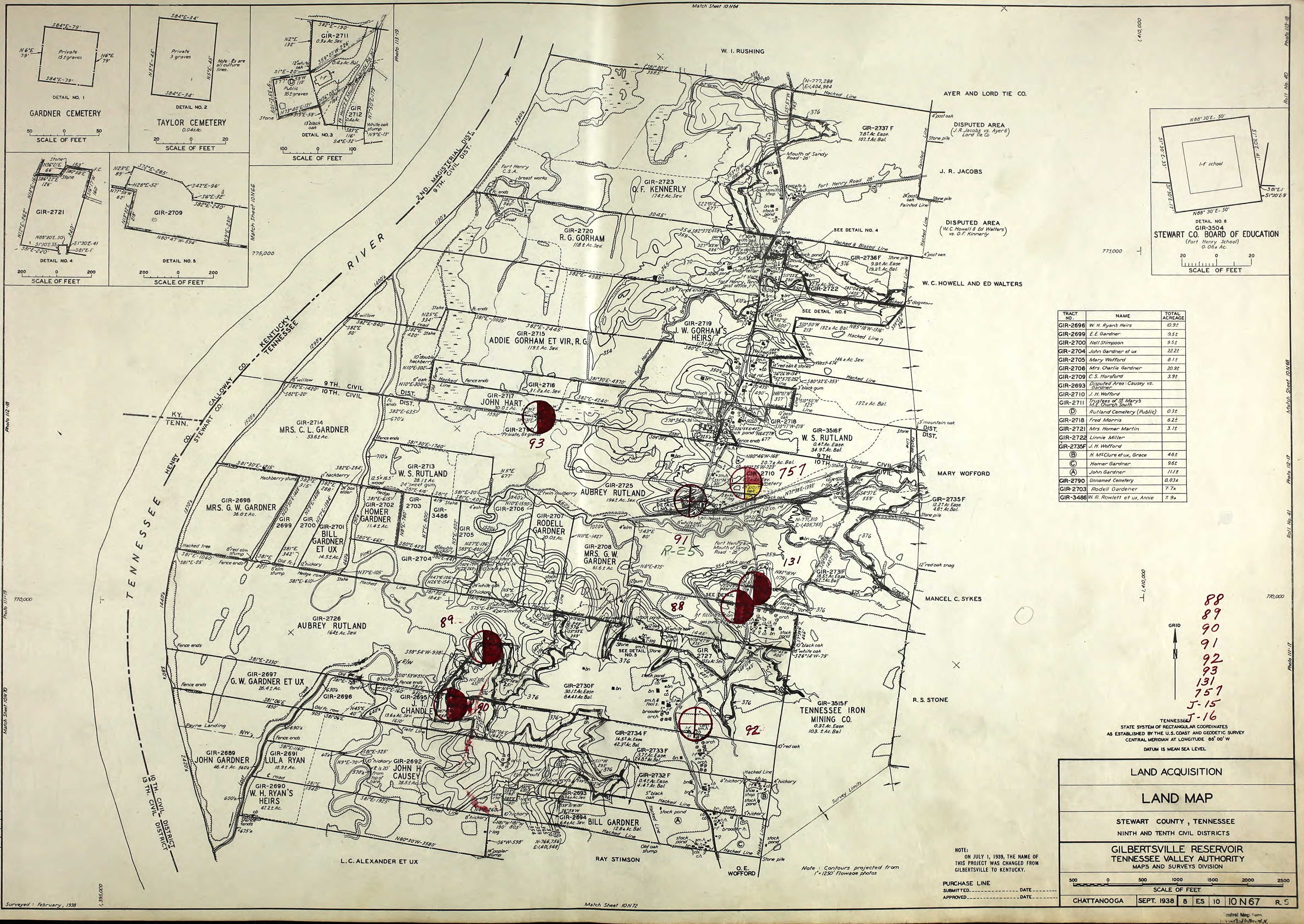
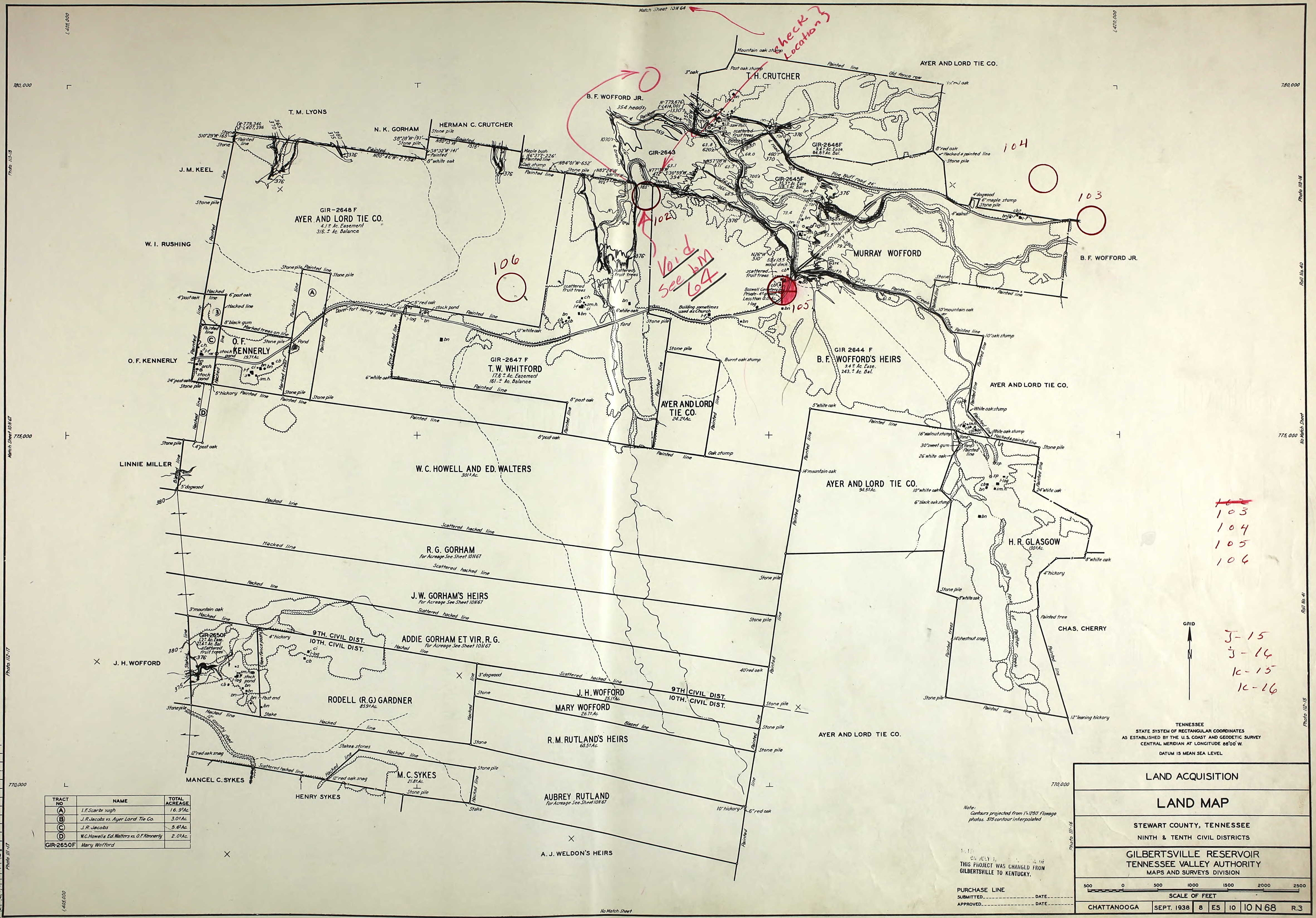
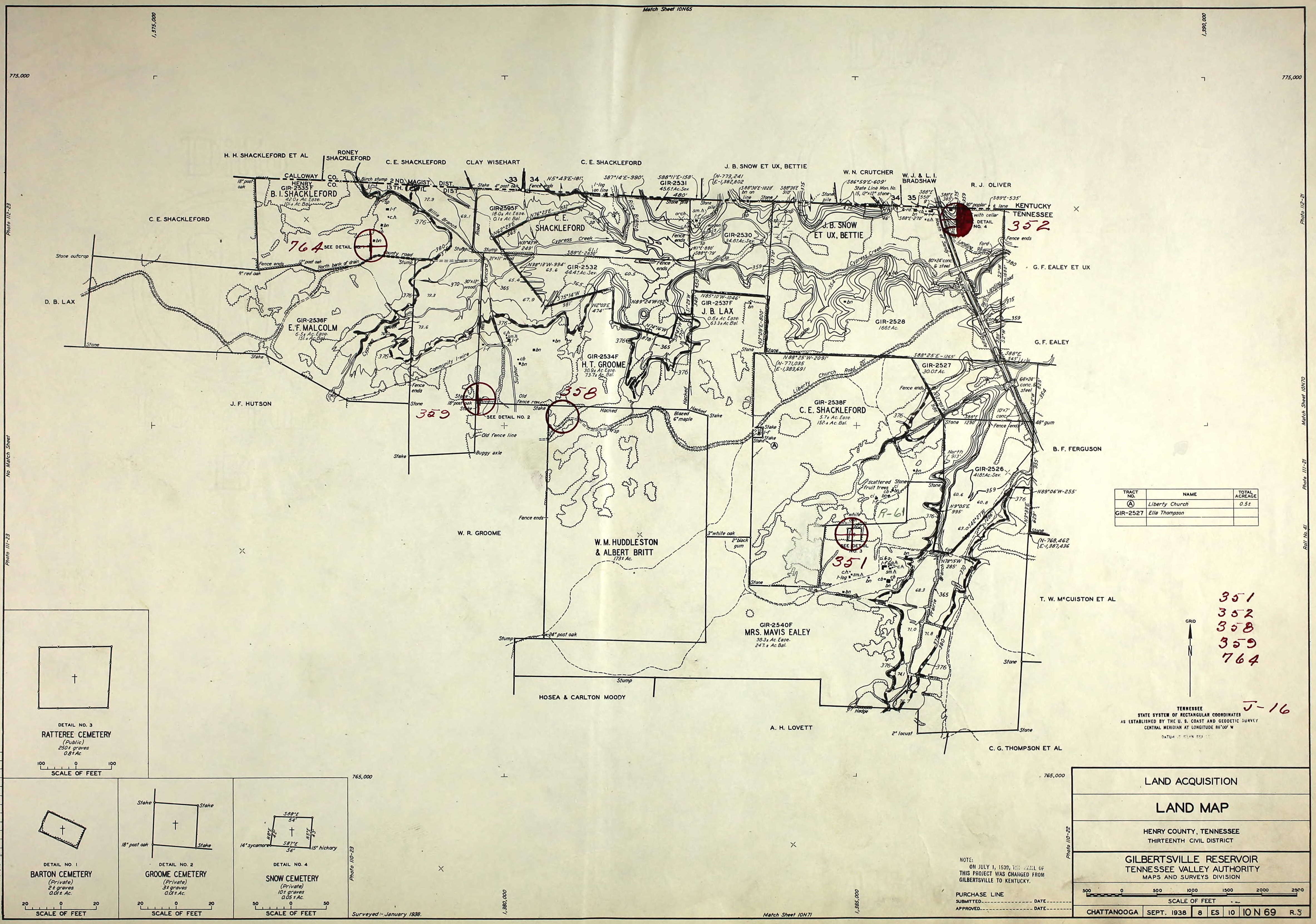
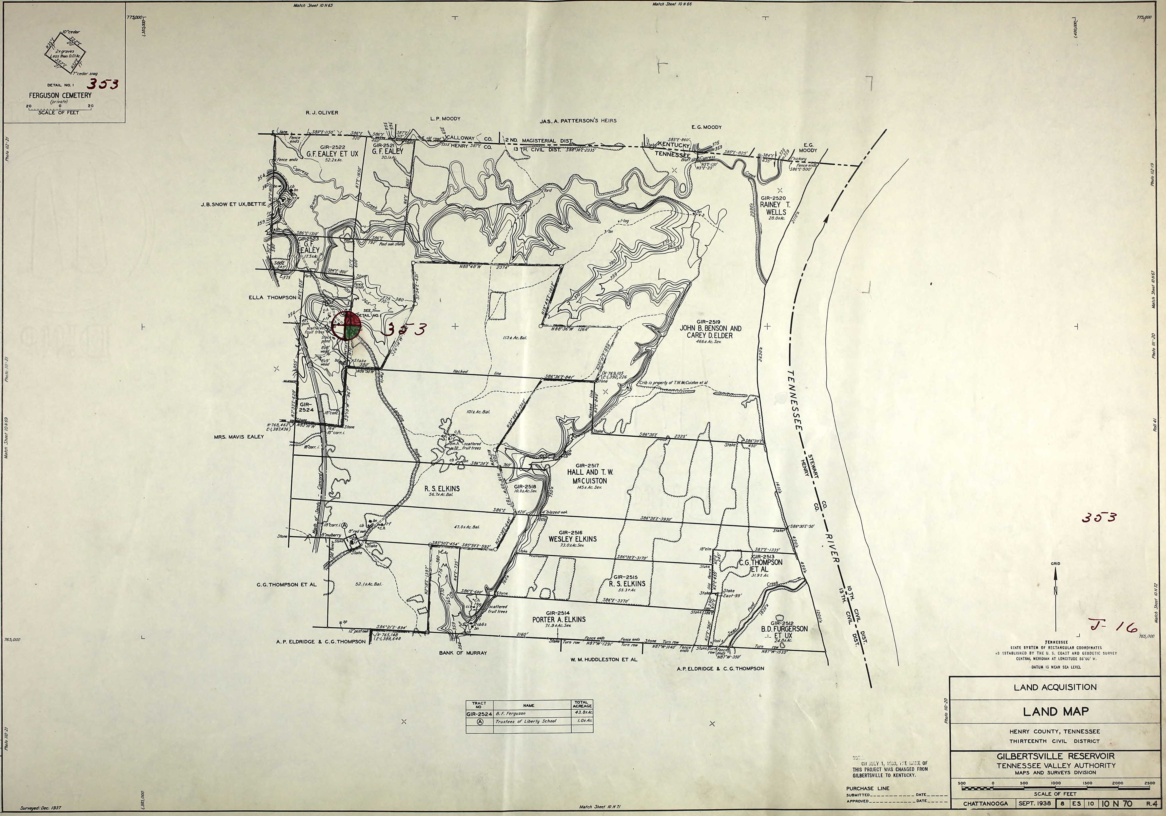
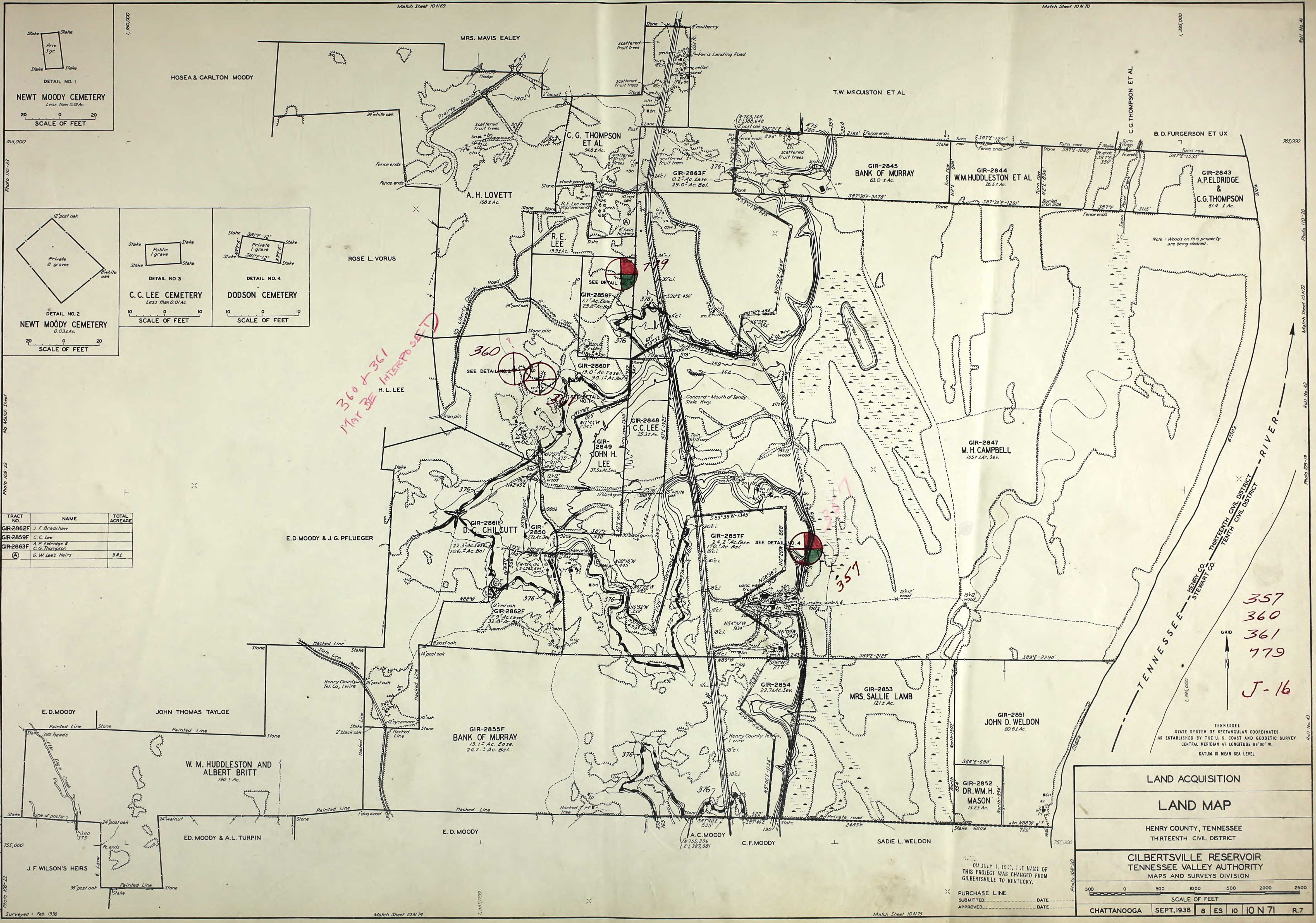
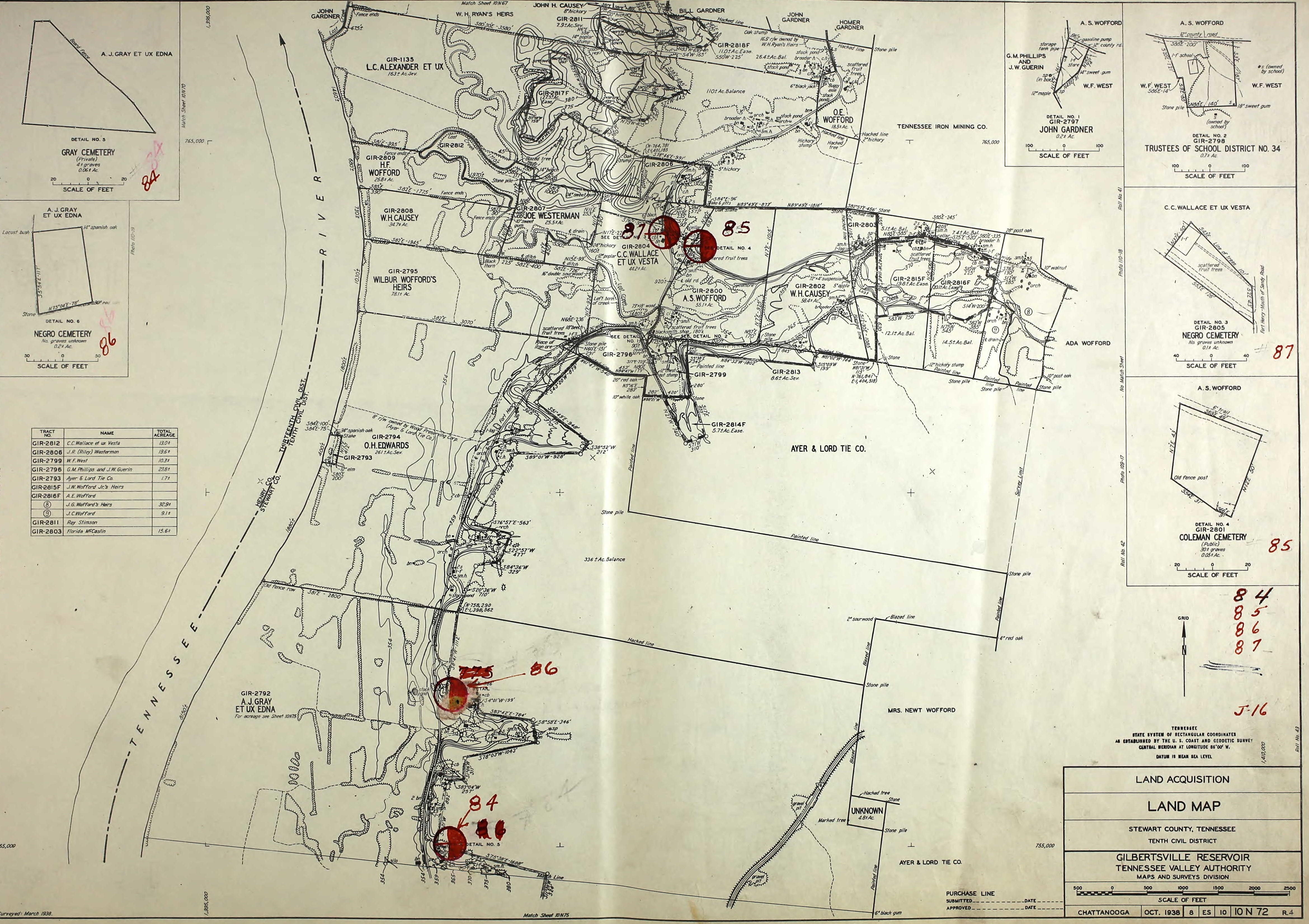
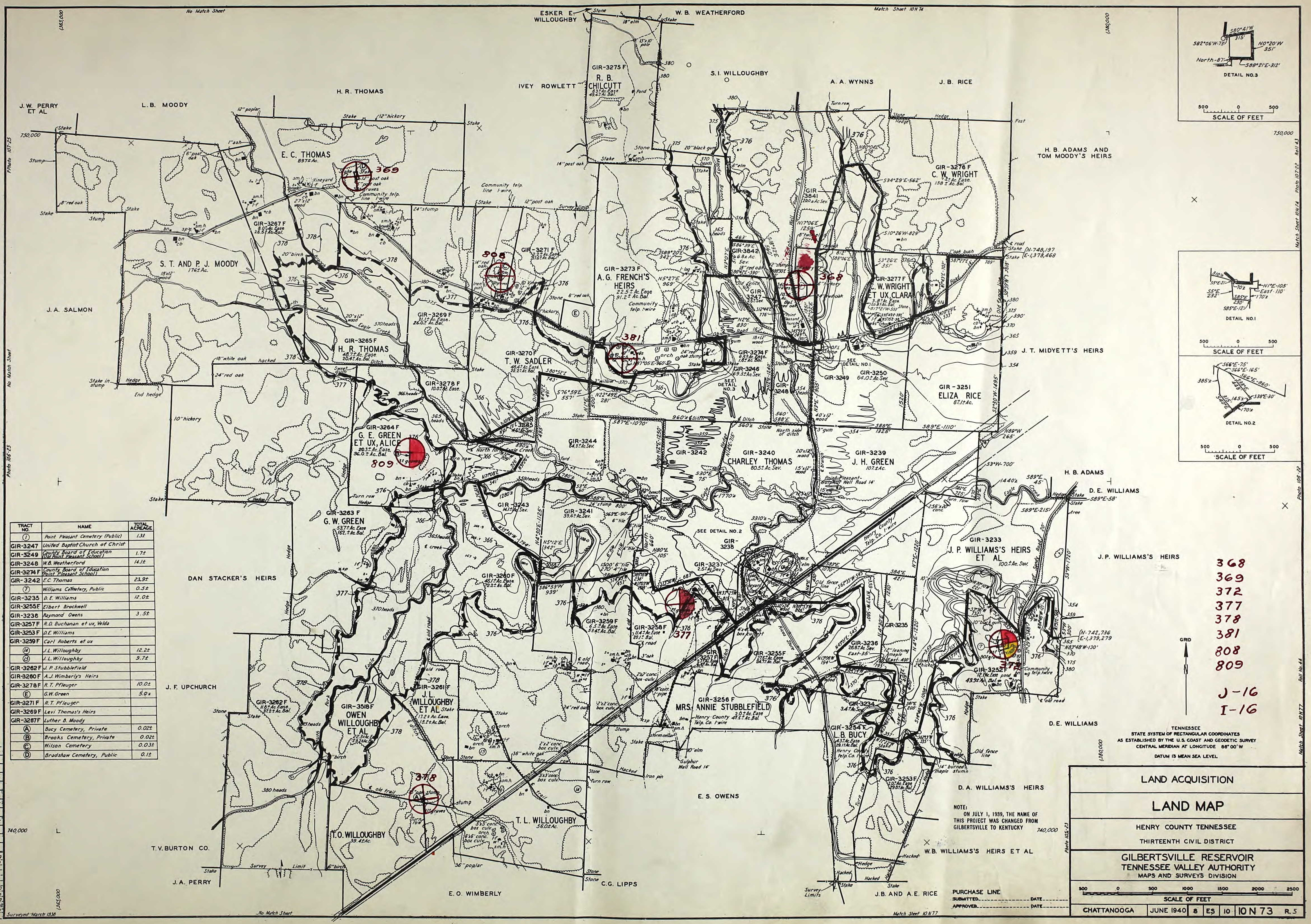
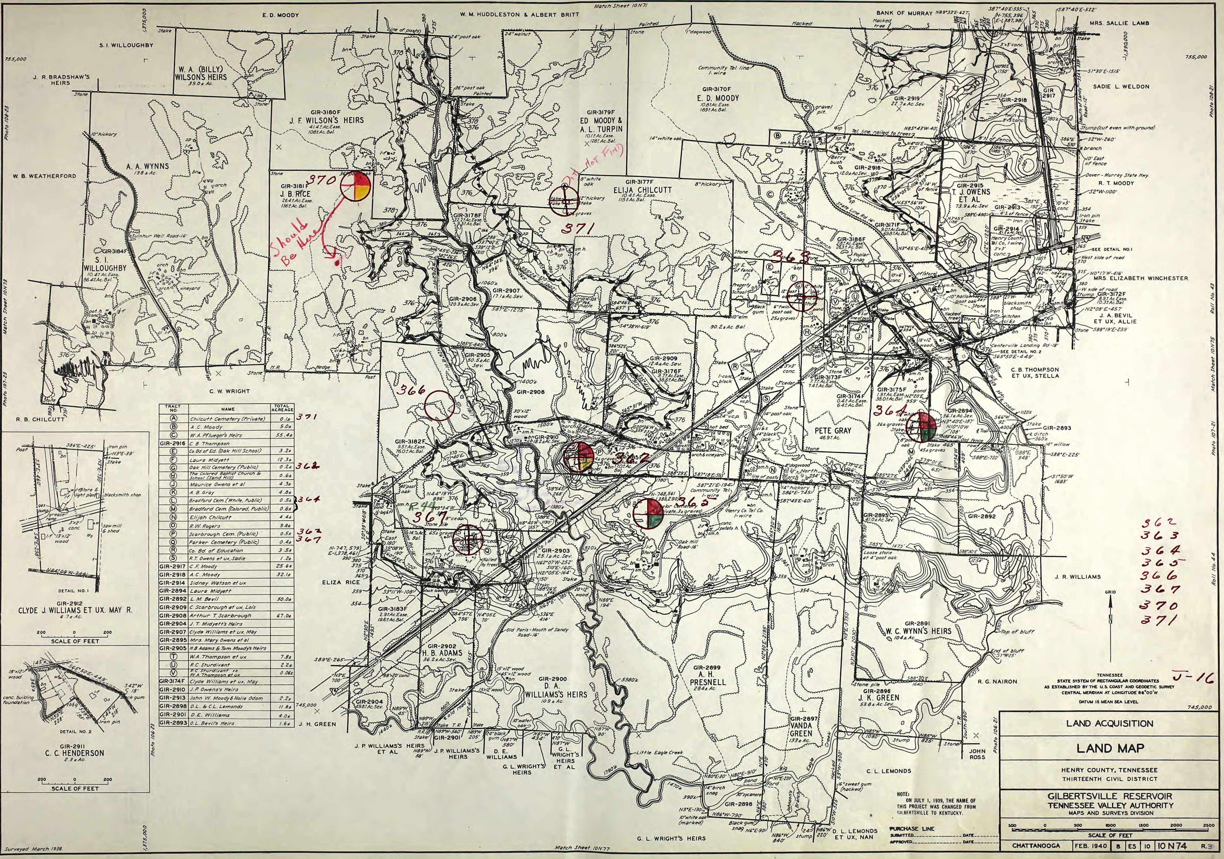
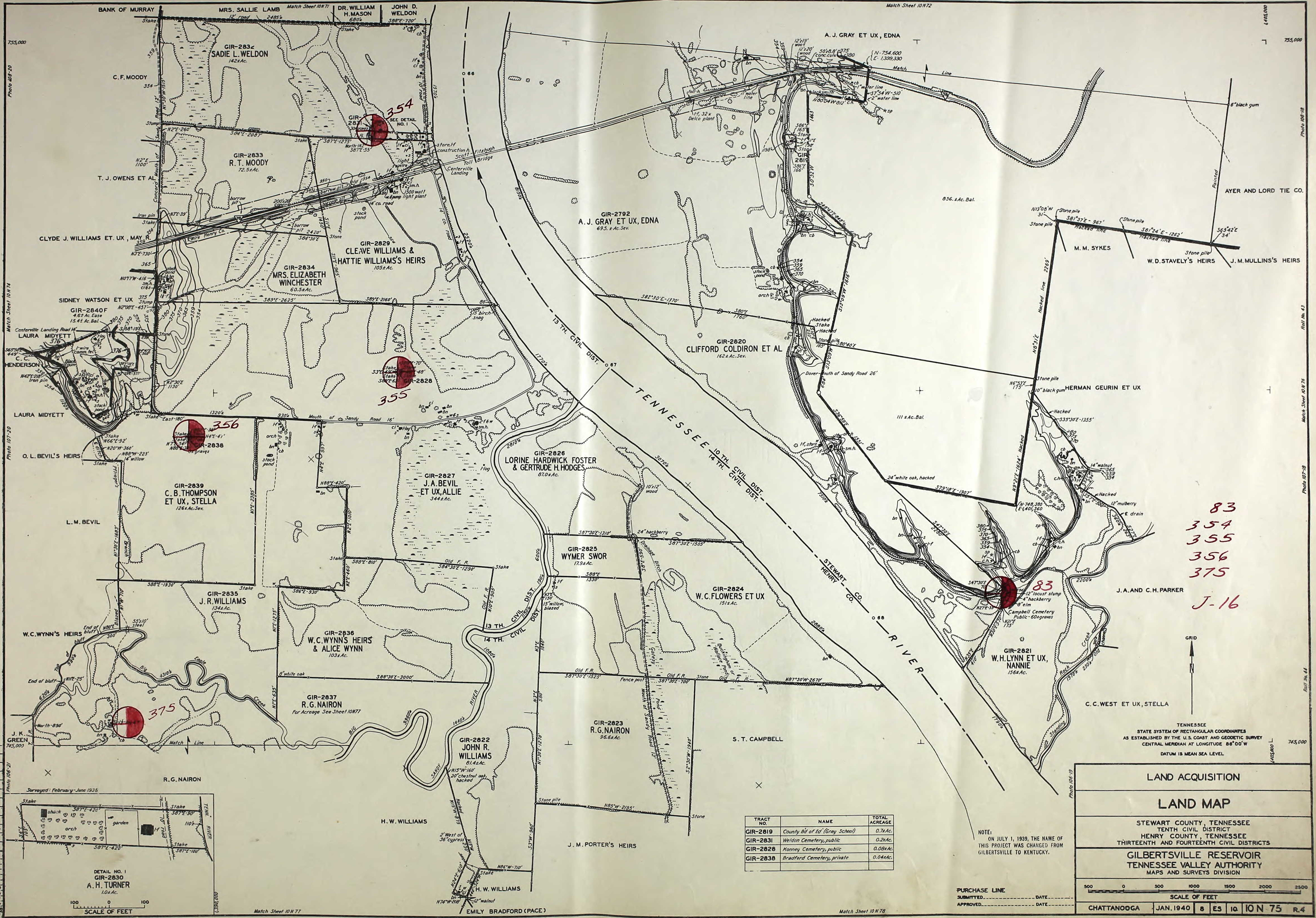
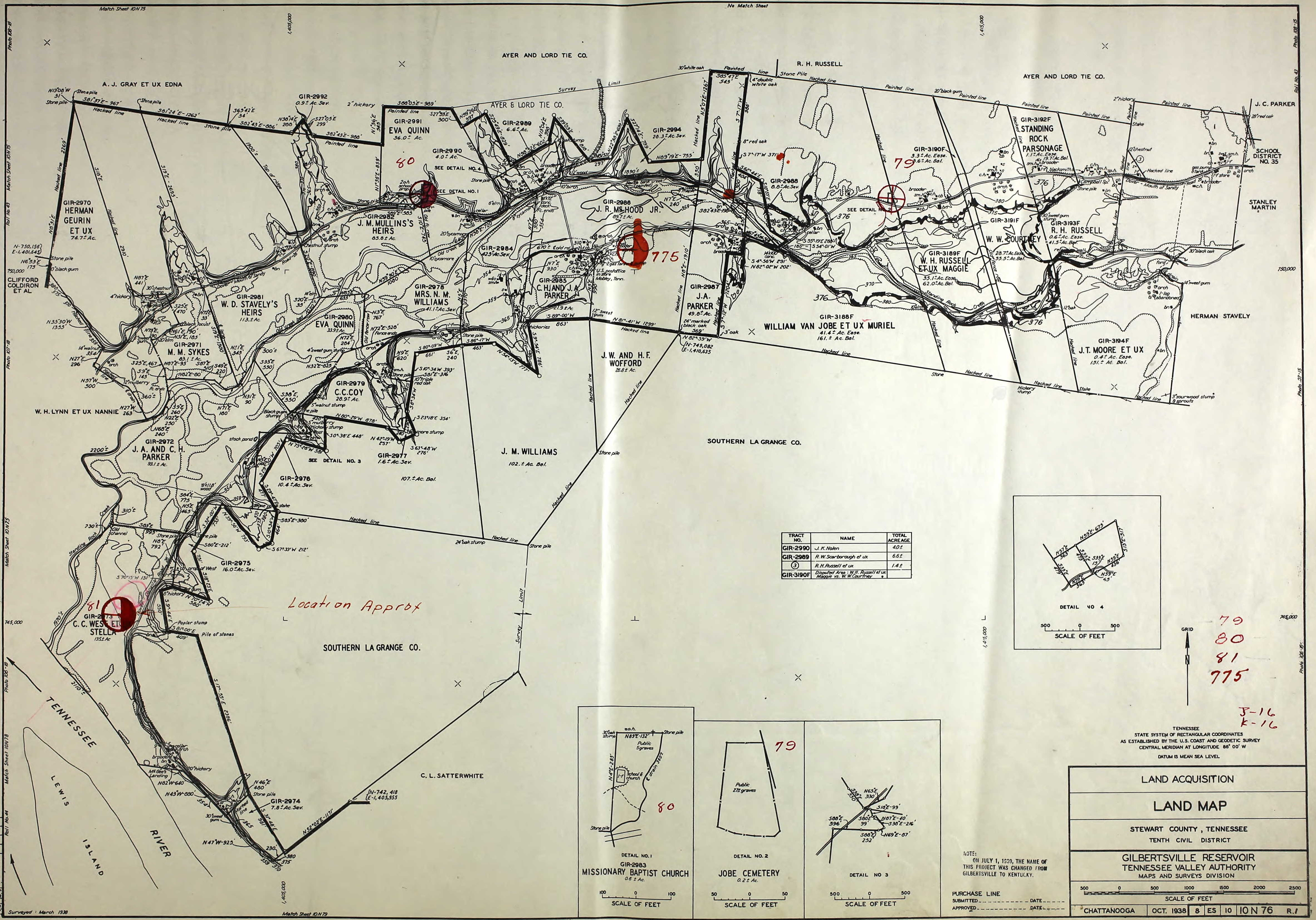
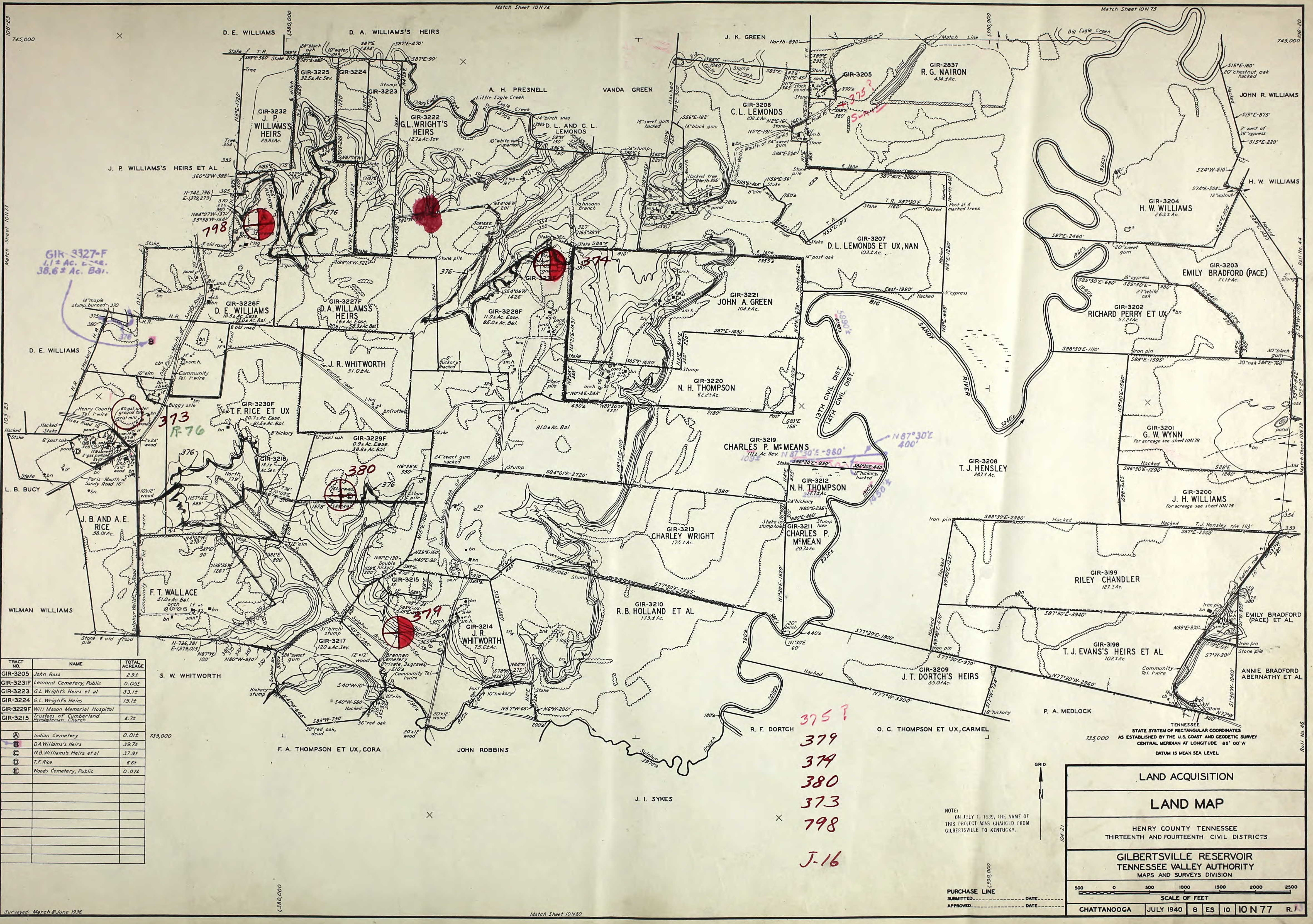
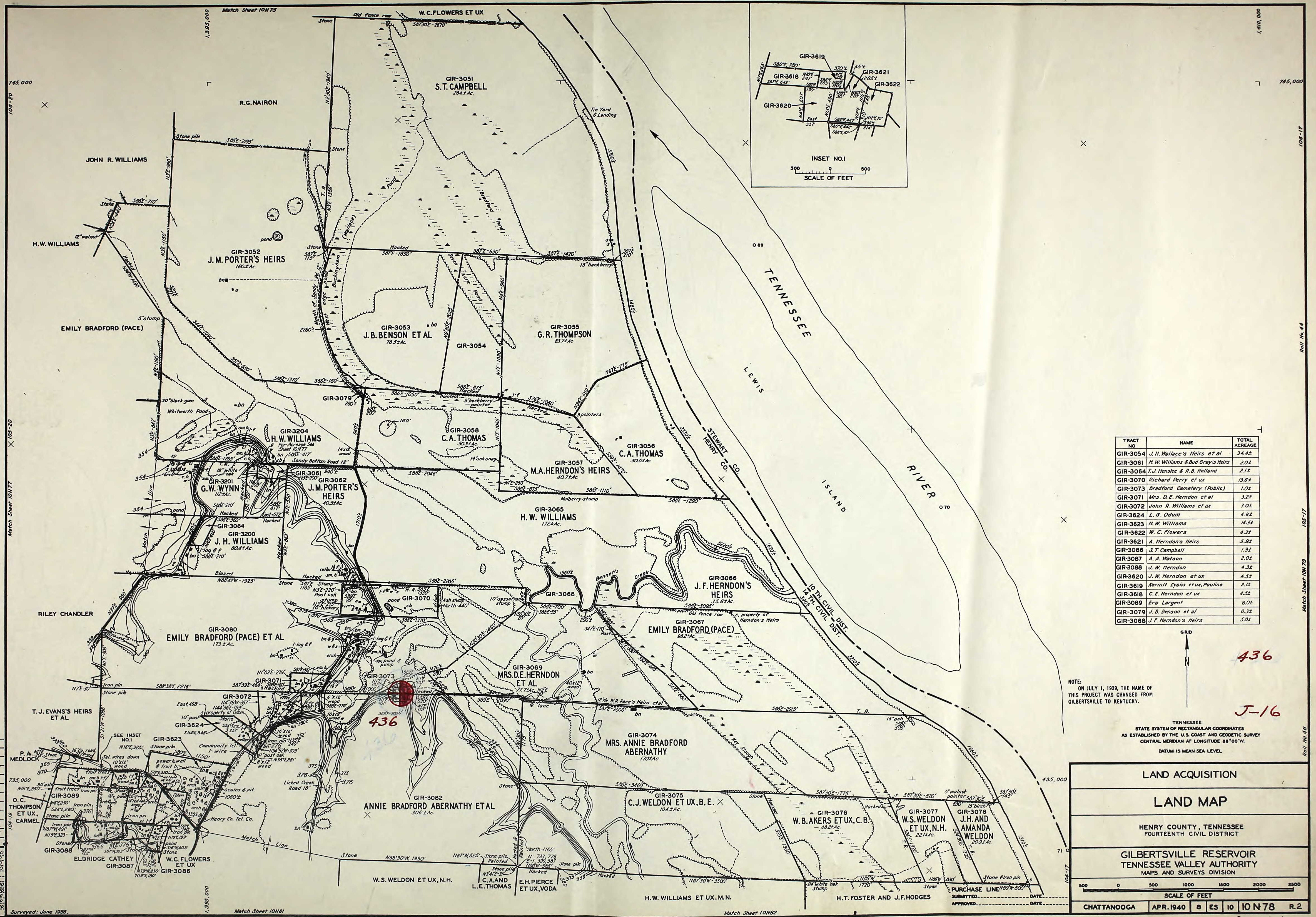
TVA produced detailed Land Acquisition Maps in 1938 and 1939 that displayed property lines, buildings, cemeteries, infrastructure and even fruit trees and picket fences. These maps were necessary to acquire the land from residents to make way for the permanent flooding of the Tennessee River.
Mark Garland scanned several of these TVA Land Acquisition Maps and has graciously allowed us to provide them for viewing. These are invaluable tools for genealogists and local history enthusiasts. The maps represent the northern and central part of Kentucky Lake, from Kentucky Dam to Paris Landing, Tennessee.
Download & View the Maps
Use the key below to determine which map you would like to download, then click the corresponding number of the map. The maps are high-resolution JPG images.
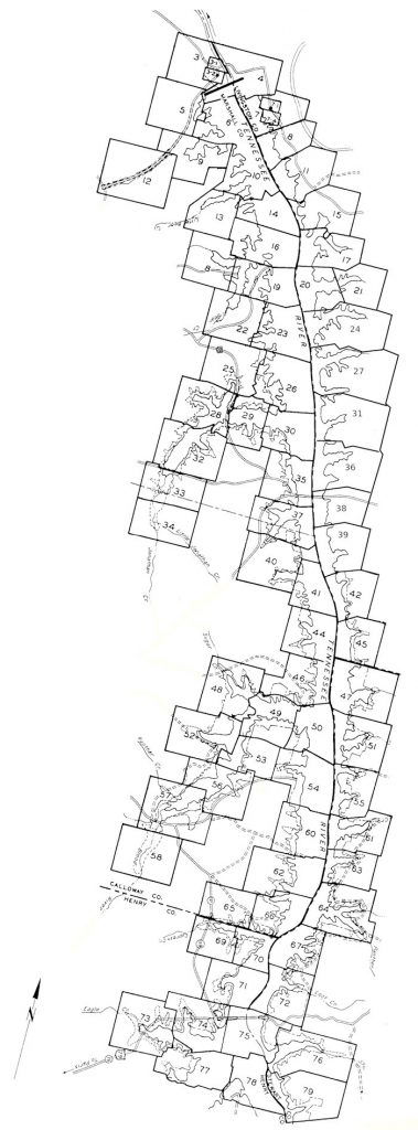
Map Numbers & Location:
- 1 – Gilbertsville Area
- 2 – Gilbertsville Area
- 3 – Gilbertsville Overview
- 3-1 – Gilbertsville – North
- 3-2 – Gilbertsville
- 4 – Lake City Area
- 5 – Kentucky Dam Village Area
- 6 – Sledd Creek Area – North
- 7 – Grand Rivers Overview
- 7-1 – Grand Rivers Detail
- 7-2 – Grand Rivers Detail
- 8 – Canal Area
- 9 – Sledd Creek Area – South
- 10 – Lower Little Bear Creek Area
- 11 – LBL – Nickell
- 12 – Kentucky Dam Village Area – South
- 13 – Upper Little Bear Creek Area
- 14 – Cambridge Shores Area
- 15 – LBL – Star Lime Works Area – North
- 16 – Birmingham Area
- 16-1 Birmingham Detail
- 16-2 Birmingham Detail
- 17 – LBL – Star Lime Works Area – South / Pisgah Creek
- 18 – Malcolm Creek Area
- 19 – Bee Creek Area
- 20 – LBL – Smith Creek – West
- 21 – LBL – Smith Creek – East
- 22 – Bear Creek Area – South
- 23 – West Fork Bee Creek Area
- 24 – LBL – Duncan Creek Area
- 25 – Maple Spring Area
- 26 – Hiatt Area
- 27 – LBL – Sugar Bay Area
- 28 – Jonathan Creek – Cedar Knob Area
- 29 – Jonathan Creek – Central
- 30 – Jonathan Creek – East
- 31 – LBL – Rhodes Bay Area
- 32 – Jonathan Creek – South to KY 402
- 33 – Jonathan Creek – South of KY 402
- 34 – Jonathan Creek – North Calloway Co.
- 35 – Aurora Area / Eggners Ferry Bridge
- 36 – LBL – Vickers Bay Area
- 37 – Ledbetter Creek Area
- 38 – LBL – Fenton Area
- 39 – LBL – Turkey Creek Area
- 40 – Anderson Creek Area
- 41 – Western Shores Area
- 42 – LBL – Colson Creek / Redd Creek
- 43 – (no map numbered 43)
- 44 – Snipe Creek / Newburgh Area
- 45 – LBL – Blockhouse Creek Area
- 46 – Blood River – Lynnhurst Area
- 47 – LBL – Rushing Creek Area
- 48 – Blood River – Sugar Creek Area
- 49 – Blood River – Kitts Branch Area
- 50 – Blood River – Mouth
- 51 – LBL – Ginger Bay Area
- 52 – Blood River – Wildcat Creek Area
- 53 – Blood River – Brandon Mill / West Boyd’s Branch
- 54 – Boyd’s Branch / Pine Bluff Area (KY)
- 55 – LBL – Pine Bluff (TN) / Tischel Bay Area
- 56 – Blood River – Grindstone Creek Area
- 57 – Blood River – New Concord Area – North
- 58 – Blood River – New Concord Area – South
- 59 – Blood River – South to Tennessee State Line
- 60 – Shannon Area
- 61 – LBL – Byrd Creek Area
- 62 – Yellow Spring Branch Area
- 63 – LBL – Hughes Creek Area
- 64 – LBL – Panther Creek Area / Dry Fork Area
- 65 – West Cypress Creek Area (KY)
- 66 – East Cypress Creek Area (KY) / Fort Heiman
- 67 – LBL – Fort Henry Area
- 68 – LBL – East Panther Creek
- 69 – West Cypress Creek Area (TN)
- 70 – East Cypress Creek Area (TN)
- 71 – Swan Bay Area
- 72 – LBL – Gray’s Landing Area
- 73 – West Eagle Creek Area
- 74 – East Eagle Creek Area
- 75 – Paris Landing / Scott Fitzhugh Bridge Area
- 76 – Standing Rock Creek Area
- 77 – Big Sandy River – Mouth
- 78 – Pace Point Area
- 79 – Short Creek Area
LEGEND
While there doesn’t appear to be an official legend/key for these maps, with the help of reader Tim Belcher, we’ve been able to assume the following:
1-f, 2-f – number of floors on a structure
w = well
bn = barn
smh = smokehouse
cb = corn crib or cabin
s = shed
24’x10′ wood – a wooden bridge, in this case 24 feet long by 10 feet wide
Ac. Sev., Eas., Bal – Acres, Surveyed, Easement, Balance
Pingback: Newburg, Kentucky - Four Rivers Explorer
Pingback: Kentucky Lake’s Stonehenge? - Four Rivers Explorer