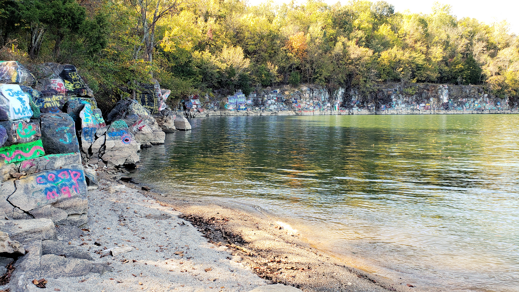
A favorite among boaters on Kentucky Lake, the Rock Quarry, is also known as the “Party Cove”. Recently we had the opportunity to hike to the quarry while the lake was below summer pool.
Located about eight miles south of Kentucky Dam near Pisgah Bay, the Rock Quarry is a popular hot spot for boaters in the summer. Scores of boats typically crowd the 16-acre quarry, tying up together to hang out and have a good time.
The face of the quarry has been peppered with graffiti over the years. Unfortunately, some of the graffiti has spilled outside the quarry with some of the rocks around the bend being defaced. The graffiti, for better or worse, has shaped the culture of the quarry and has contributed to its character.
Daredevils and thrill-seekers will occasionally jump off the cliffs at the quarry, falling some 30 feet to the water. It is a dangerous activity and has resulted in some injuries, even with one death in 2018.
The History of the Quarry
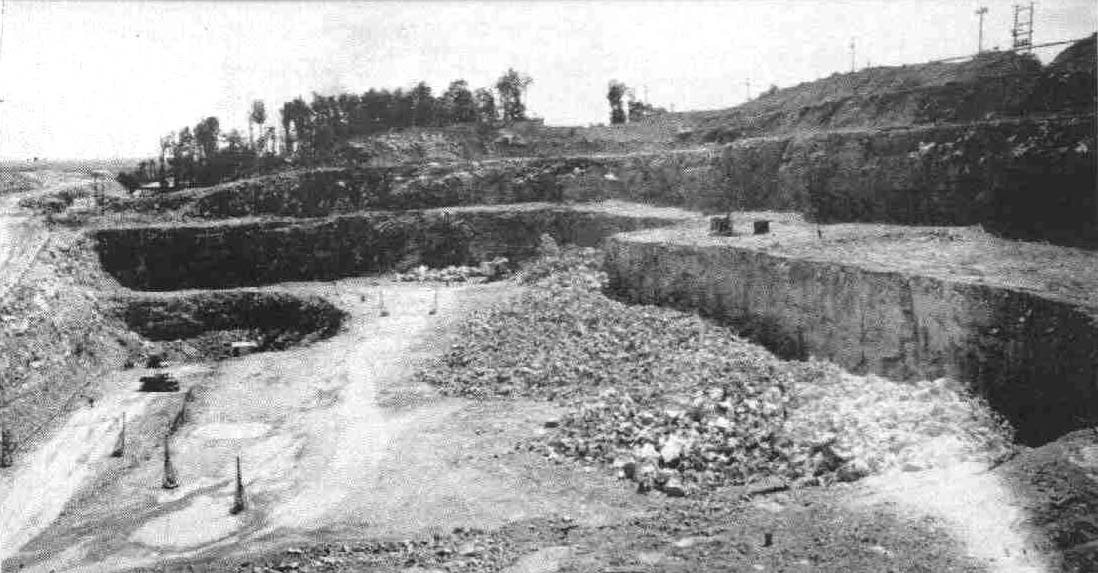
TVA official photo of quarry operations in the early 1940s. The photo was taken looking approximately north.
The area around the quarry is rich in limestone. In fact, a community called Star Lime Works sprang up nearby after the Civil War. Lime was mined, produced, and shipped all across the region.
When TVA (the Tennessee Valley Authority) selected Gilbertsville, Kentucky as the site for the new Kentucky Dam in the 1930s, they needed a place to get literally billions of pounds of limestone to construct the dam.
TVA acquired the area around the present-day quarry and began making plans to excavate. However, before digging began, TVA had to move the Vogle Cemetery out of the site. The graveyard received its namesake from the family who settled there and began the lime extraction trade in the 19th Century.
The cemetery, located in the middle of the dig site, was the first of thousands of graves that needed to be moved for the creation of Kentucky Lake. Although some other graves were not moved from other places around Kentucky Lake, 15 were relocated from Vogle Cemetery to a different cemetery.
The Quarry is the Deepest Part of Kentucky Lake
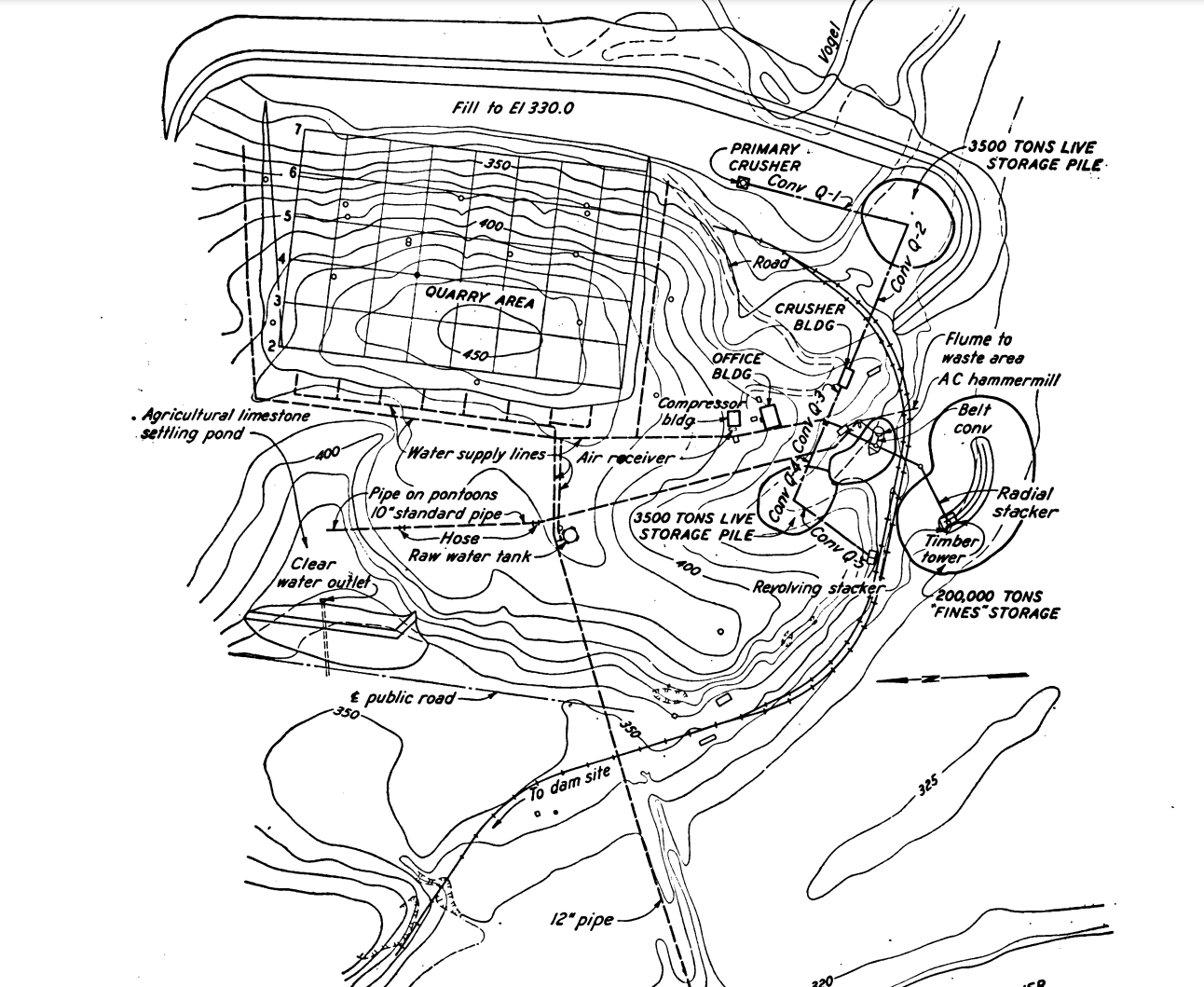
Drilling and digging began shortly afterwards. An intricate distribution system consisting of conveyor belts and crushing mechanisms fed limestone out of the quarry. TVA built a temporary seven-mile railroad from the dam site to the quarry to haul over 2.6 million tons of material out. That’s five billion pounds!
The large rock quarry featured three benches, one at sea level elevation 330’, another at 280’, and the deepest at 240’. This meant the lowest part of the quarry was 60 feet below the Tennessee River, but water seepage apparently was not a problem, according to a TVA report. This also means that today when Kentucky Lake is at summer pool levels of 359’, a part of the quarry is 120 feet deep!
TVA's plans for the large rock quarry.
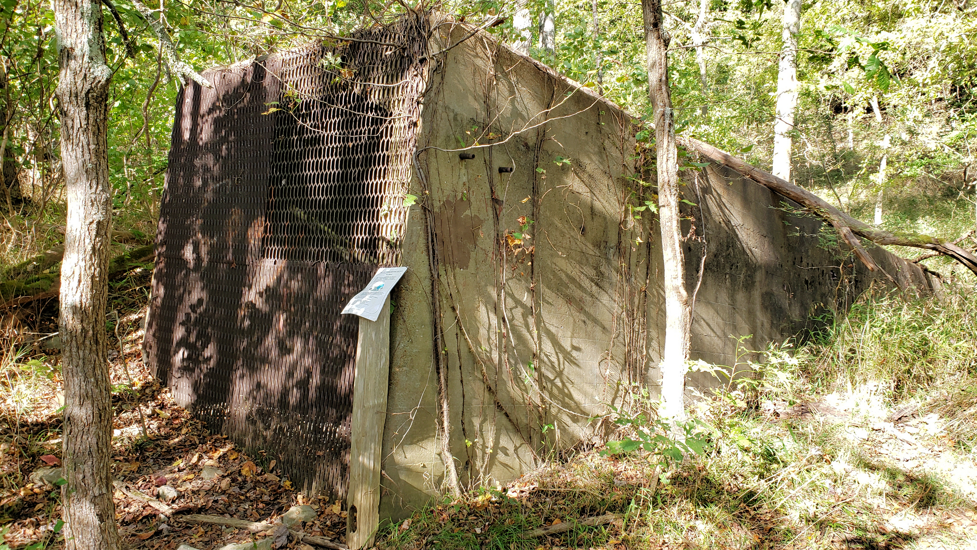
Remants of Conveyor System Still There
Along the shores of Kentucky Lake near the rock quarry, evidence of the old conveyor system used 80 years ago can be seen. Most notably is a large concrete tunnel along the Hillman Heritage Trail that we believe helped moved material along a belt. According to the TVA diagram above, we believe the tunnel served as a connection point between Q4 and Q5.
This concrete tunnel was used from around 1940-1944 during excavation of limestone during the construction of Kentucky Dam.
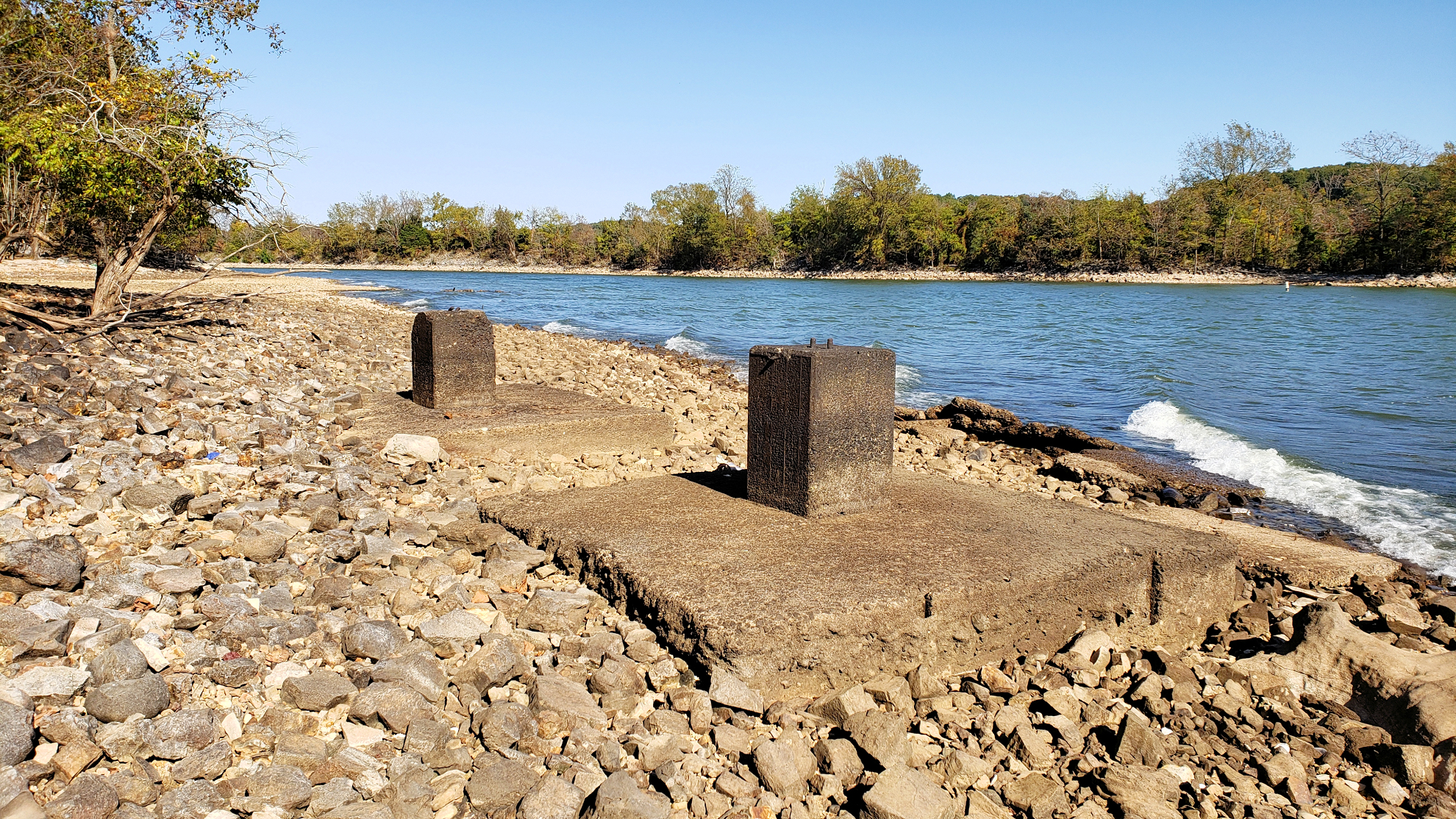
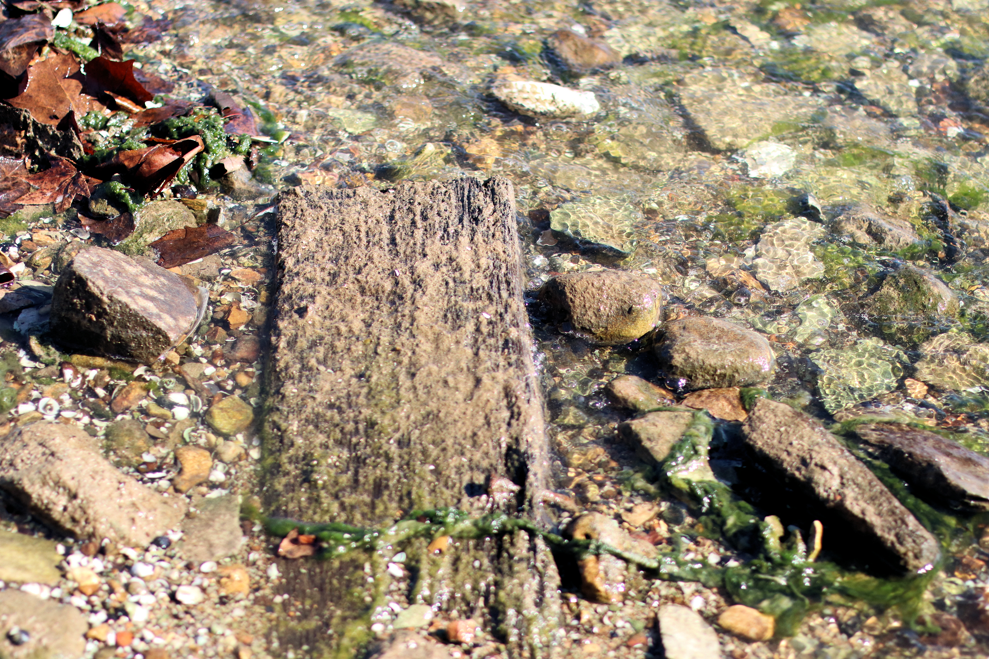
Other structures remain including a large concrete building shell that was a part of the conveyor system and a few old concrete pilings that may have held up a part of the belt. We had heard that portions of the railroad could be seen when the lake is low, but we only saw a couple of buried cross ties and some spikes. The lake’s elevation (355’) the day we visited may have kept it covered, or perhaps nature has completely reclaimed it.
Footers for what was likely a part of the conveyor system can been seen along the shoreline at winter pool.
What appears to be a buried railroad crosstie. There were a couple of these crossties barely visible.
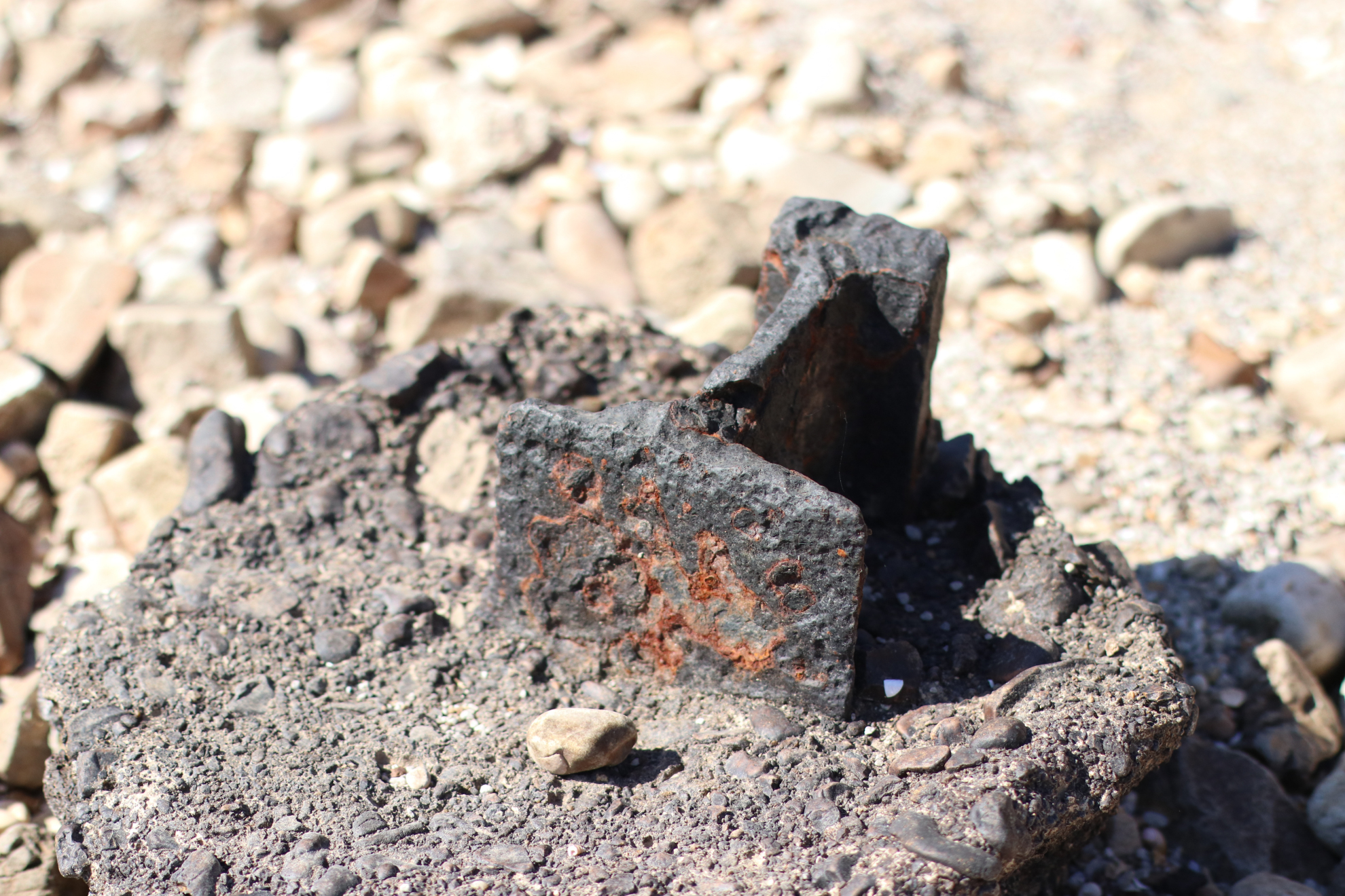
We found a small piece of rail cut and incased in concrete.
Most people go to the rock quarry by boat during the summer months. It can be accessed by foot by hiking the Hillman Heritage Trail at Hillman Ferry Campground, although registration is required at the gatehouse.
As we mentioned before, although the graffiti at the quarry gives it some character, some people have begun to spray paint some of the limestone rocks along the shore outside the quarry. This is reprehensible. Why people think it’s a good idea to deface natural beauty with graffiti is just beyond my reasoning.
If you visit the quarry, please do not deface nature, especially the uncut, undisturbed limestone along the shores outside of the quarry. Kentucky Lake is a beautiful place and spraying paint everywhere messes it up.
Pingback: New Historic Kentucky Lake Rock Quarry Photos - Four Rivers Explorer
Pingback: Old Hillman Ferry - Four Rivers Explorer