With the seasonally low lake levels, I recently had the chance to explore the former location of Star Lime Works, Kentucky. Star Lime Works was a tiny hamlet located in Land Between The Lakes near Hillman Ferry Campground and the Rock Quarry on Kentucky Lake.
A Brief History of Star Lime Works
One of the more interesting names in our region, the community became known for its rich limestone deposits. Louis A. Vogle arrived in the area shortly after the Civil War. He originally came from Brussels, Belgium to America and lived in various parts of the country before settling in Lyon County near the Tennessee River, sometime in the late 1860s.
Mr. Vogle began Star Lime Works, producing lime for the iron industry and for a network of distributors. Due to its proximity to the Tennessee River, the lime produced at Star Lime Works could be easily shipped to ports across the nation’s mid-section.
A post office was established on April 19, 1872 with Mr. Vogle as the first postmaster. The community remained very quaint, with reportedly just a handful of residents, a blacksmith shop, and a general store along with the post office. A Rand McNally atlas from 1905 listed “Star Limeworks” with a population of 50.
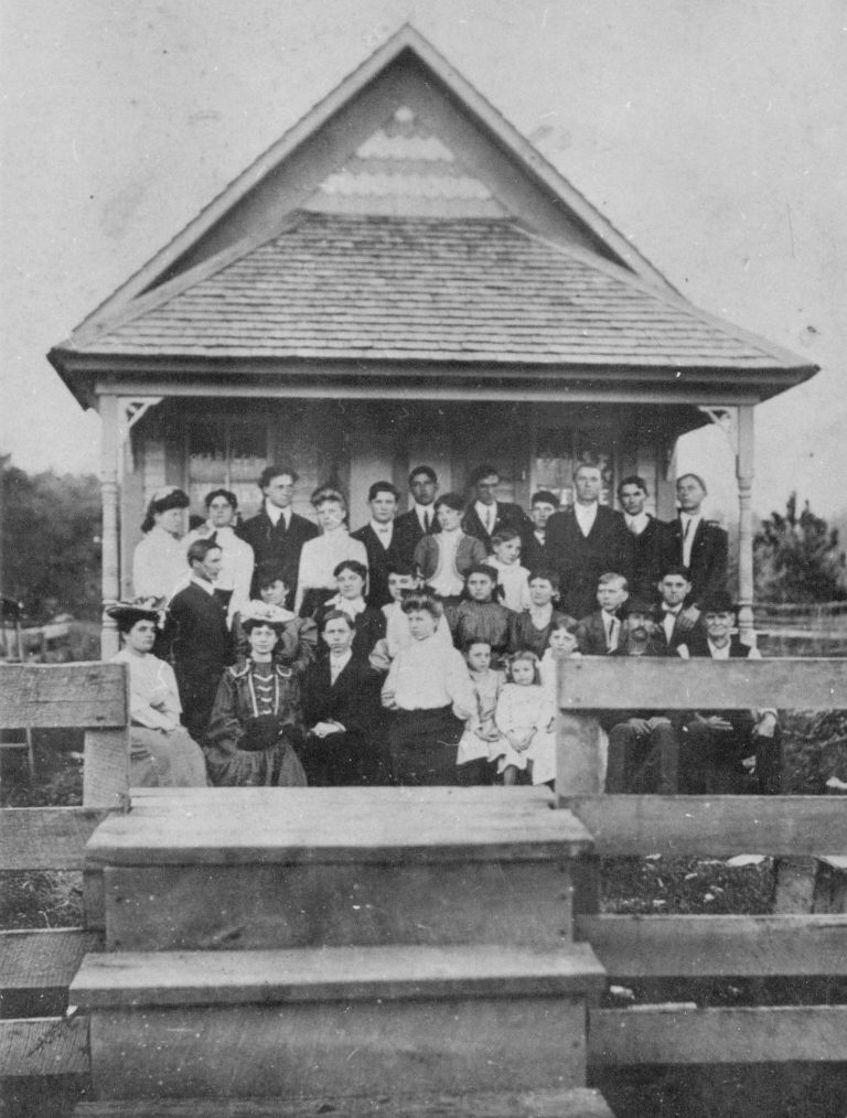
The lime operation continued until around the late 1930s when the Tennessee Valley Authority (TVA) chose nearby Gilbertsville, Kentucky as the site for Kentucky Dam. The town of Star Lime Works lay within the reservoir boundary, meaning Kentucky Lake overtook the town when the dam’s gates were closed in 1944. The town did not relocate, and when the post office closed in 1943, Star Lime Works became history.
TVA wanted the area containing the limestone deposits to construct Kentucky Dam. The agency acquired the property and began making plans for a large quarry at the site. Over the next five years, over 2.6 million tons of material was extracted from the quarry for the construction of Kentucky Dam.
When the dam’s gates shut in August 1944, the quarry flooded and has since become a hotspot of Kentucky Lake boaters – known as the Rock Quarry or the “Party Cove”.
Exploring the Remains of Star Lime Works
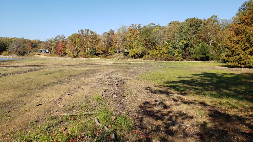
With Kentucky Lake at winter pool, the former site of Star Lime Works becomes visible. While researching, I read in a couple of places on social media that steps of the general store or perhaps an old foundation could be seen.
Taking advantage of the beautiful October day, I was feeling up for a good shoreline hike from Pisgah Point to the old site of Star Lime Works. With the lake’s level at 354.7’, the walk along the shore was easy, even crossing some exposed flats in the back of Dodd’s Creek. It was about one and a quarter mile round trip.
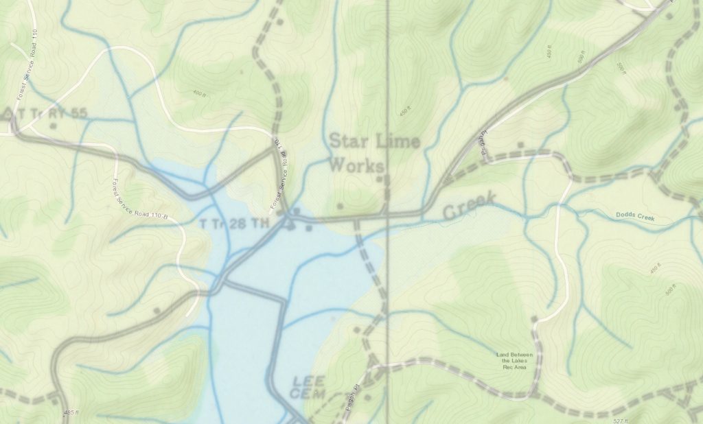
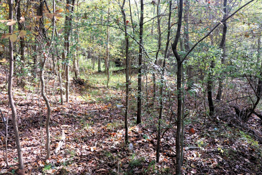
Based on old USPS topographical maps and some other research, I knew where the old community once stood. When I arrived at the site, a little disappointment came over me when I saw no evidence of Star Lime Works. No foundations, no steps – nothing but a couple of old tires.
Using my phone, a looked up the old map of Star Lime Works to make sure I had the right spot. I noticed a road on the map that traveled briefly along the northern shoreline. I trekked a bit into the woods across the old Dodd Creek channel and found the old one-lane roadbed, completely overgrown and not even hikable.
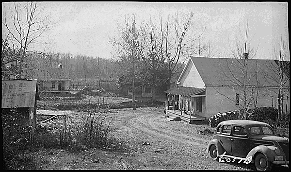
I followed the old road to where it met the lake and noticed a small hump in the inlet which is usually underwater. This likely was the old roadbed, the one you see in the old town photo with the car.
The small creek with the wooden bridge over it has been eroded down just about even with the inlet. There was a large cut piece of wood (like an oversized telephone pole) in the side of that small creek that may have been a part of the bridge in the photo, but I have no idea.
The only thing I could find today at the old site of Star Lime Works was that old roadbed. Maybe I missed something, I’m not sure – but I was hoping to see more.
Location of Star Lime Works, Kentucky
The former location of the town is underwater during Kentucky Lake’s summer pool season. It is within 50 yards of the Hillman Ferry Campground and can be explored by nearby campers easily when the water is low.
Resources
- USGS Topographical Map – Birmingham, Kentucky – 1936, 1938
- Land Between The Lakes
- National Archives – Atlanta
- Kentucky: A History of the State
- Kentucky Place Names
- Rand McNally (Map of Kentucky, 1905)
Contributions
If you have photos or information you’d like to contribute, please contact us. We’d love to learn more about Star Lime Works, Kentucky.
Articles Related to Star Lime Works
-
 Kentucky Lake’s ‘Party Cove’ – The Creation of the Rock QuarryOctober 23, 2020/
 -
 Hillman Heritage TrailOctober 23, 2020/


Pingback: Hillman Heritage Trail - Four Rivers Explorer
Pingback: Kentucky Lake's 'Party Cove' - The Creation of the Rock Quarry - Four Rivers Explorer