Guerilla warfare, a post office named “Blood” and a solitary tombstone in the heart of Kentucky Lake. Those are the eyebrow-raising storylines of Newburg, Kentucky’s history.
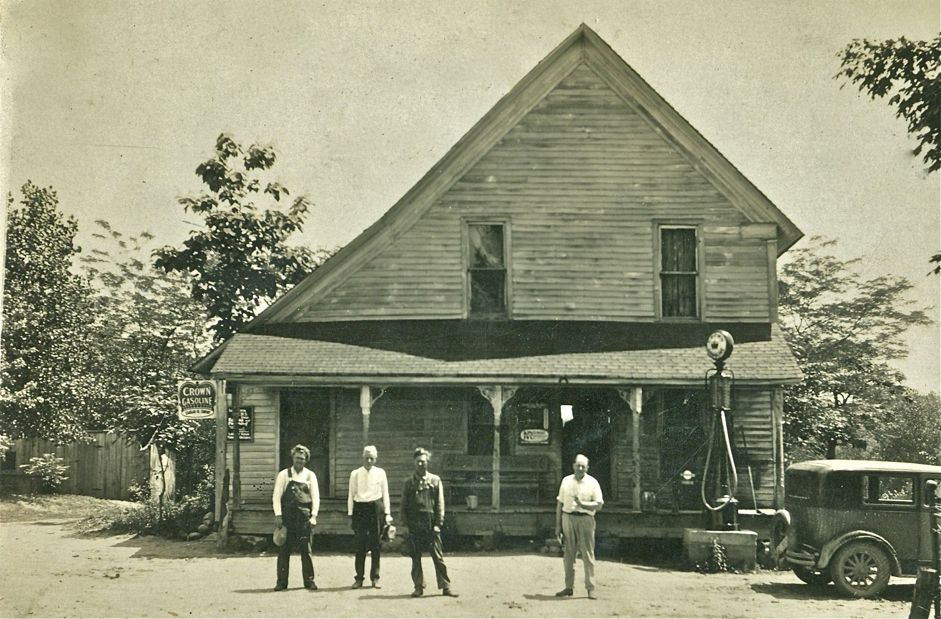
Located underneath the waters of Kentucky Lake, Newburg once served as a shipping point on the Tennessee River during the mid-1800s. Captain Levi Williams operated a ferry at this site from the 1850s through the 80s. A small community of homes and businesses sprang up at the landing.
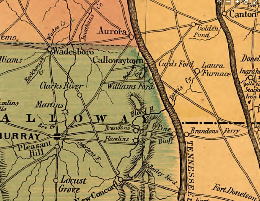
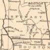
It’s unknown how or when the town got its name. The earliest reference to Newburg is on a Civil War map from 1865. Other prior maps refer to this place as Williams Ferry.
A map from 1862 showing Williams Ferry, later becoming Newburg.
The Civil War brought both prosperity and troubles for Newburg. The Union Army used the Tennessee River to advance their forces south. When they passed by at times, the army announced their presence by firing into the village. On one occasion, a cannonball was shot through Williams’ home.
Guerrilla warfare was quite common. Union sympathizers would target the community and some townspeople stood guard, defending themselves and their property from the agitators. Many of these guerrilla fighters perished at Newburg by getting shot up while attempting to cross the Tennessee River.
Legend says a mass grave with the bodies of many unknown insurgents were buried nearby. Some historical references suggest Blood River received its name from these events. However, maps before the Civil War feature Blood River and it’s not for certain how the river got its name.
Newburg became a center for smuggling goods into Calloway County and other parts of western Kentucky. Men worked under the cover of night and sank their flatboats during the day to keep them from being destroyed by Union forces.
Reportedly 1,000 barrels of salt were blown up at Newburg during the war. Salt was a precious commodity in western Kentucky at that time, with its value being doubled from $25 to $50 per barrel once it crossed the Tennessee River. Cannonballs along this area could still be found decades later.
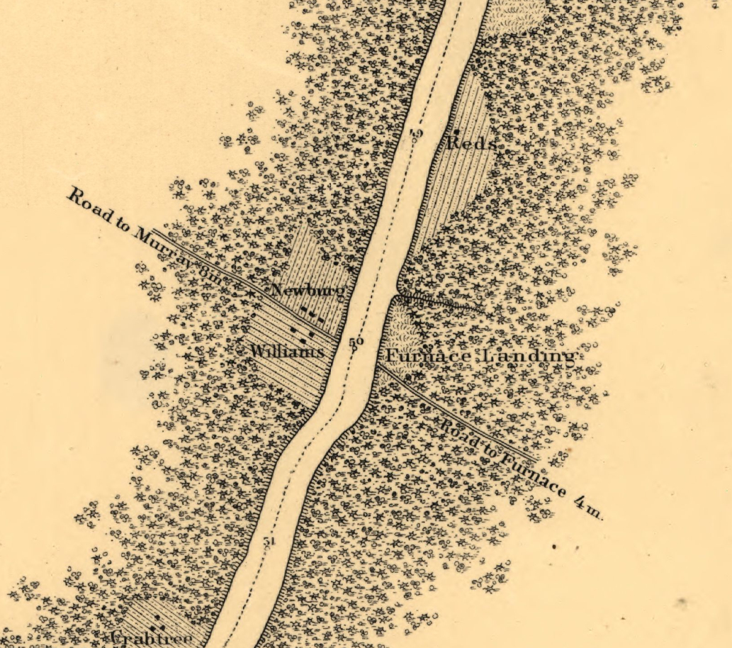
Civil War map from 1865 showing the Newburg area.
After the war in 1866, the town got its first post office but was called Warburg (or Warberg) – not Newburg – perhaps as a nod to all the action experienced there.
The post office shut down five years later but reopened in 1880 as Blood. It’s quite possible Blood was chosen to reflect the unsettling times of this community during the Civil War, considering Blood River doesn’t really flow near the town. The Blood post office continued for 40 years except for a brief seven-month interruption in 1894-95.
The US Postal Service wasn’t too excited about the name of Blood, Kentucky being on postcards and letters. On October 19, 1920, the post office changed names from Blood to Newburg at the request of the US Postal Service.
Calmer were the years around Newburg during the first part of the 20th century. That all changed in the 1930s when the Tennessee Valley Authority decided to flood the Tennessee River with Kentucky Dam. Once the gates of the dam shut, the waters of Kentucky Lake would cover Newburg permanently.
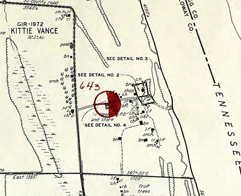
TVA Land Acquisition Map showing the area around Newburg.
The post office closed in 1943 and the few residents of Newburg moved out. Records show Newburg had either one or two stores and a blacksmith shop, the latter perhaps closed before the removal. TVA had the daunting task of clearing the vast Kentucky Lake reservoir – homes, barns, structures, and trees had to be removed. And so did the cemeteries.
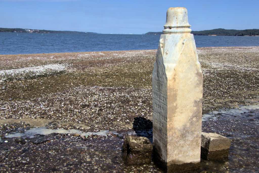
Newburg Cemetery had 28 known graves and TVA moved 23 of them, according to their records. Five graves were left, likely at the request of family members, with one of the graves clearly marked by a tall tombstone.
Eggners Ferry Bridge can be seen in the distance. The island is about six miles south of the bridge.
Location of Newburg
The community is now under Kentucky Lake. The lone tombstone, known as “Cemetery Island”, can be accessed at low lake levels by boat. Read more about Cemetery Island.
Contributions Wanted
If you would like to contribute information or photos of Newburg, Kentucky, please get in touch with us.
Resources
“The History of Calloway County”, 1931 – The Ledger & Times