Rather interesting things are revealed when Kentucky Lake is lowered this time each year. The lake, managed by the Tennessee Valley Authority (TVA), is lowered about five feet every July through the end of November, only to be raised in April to “summer pool” levels.
When the lake is low in the fall and winter months, you can find bits and pieces of history scattered along the shoreline – and even in the middle of the lake. With the lake about four feet below its summer level, we decided to hop on a pontoon to see if we could see “Cemetery Island”, a shallow spot in the middle of Kentucky Lake. We’ve heard about it on social media but had never seen it before.
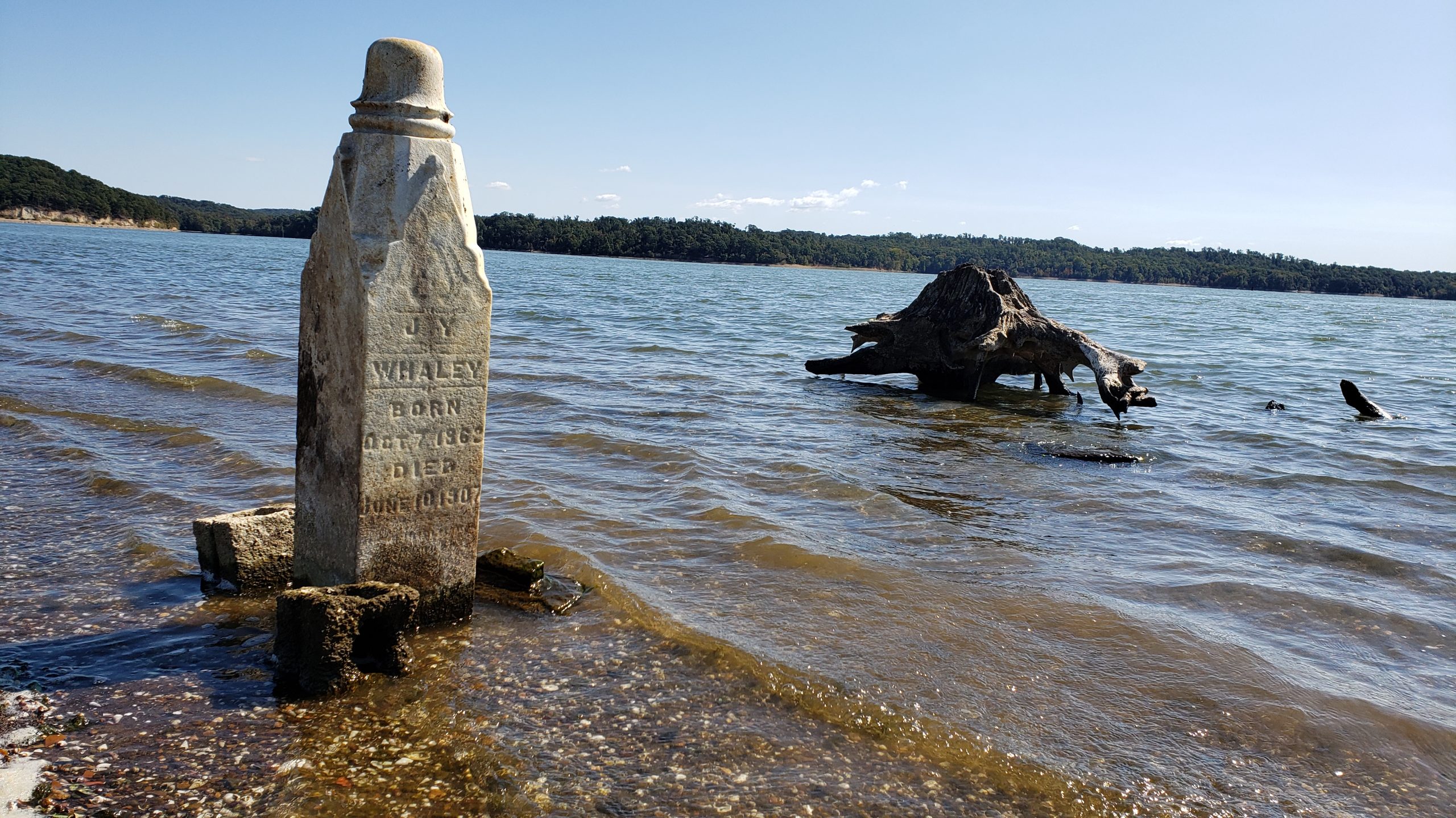
Some people call it “Cemetery Island” because it’s a very thin strip of land only visible when the lake is low – with one grave marker standing upright in the middle of the tiny island.
Scanning the distant horizon, we could see a small object and what appeared to be some land. As we approached, the water got shallower and we could see bottom. Raising the trim of the engine all the way up, we coasted until we landed on “Cemetery Island.”
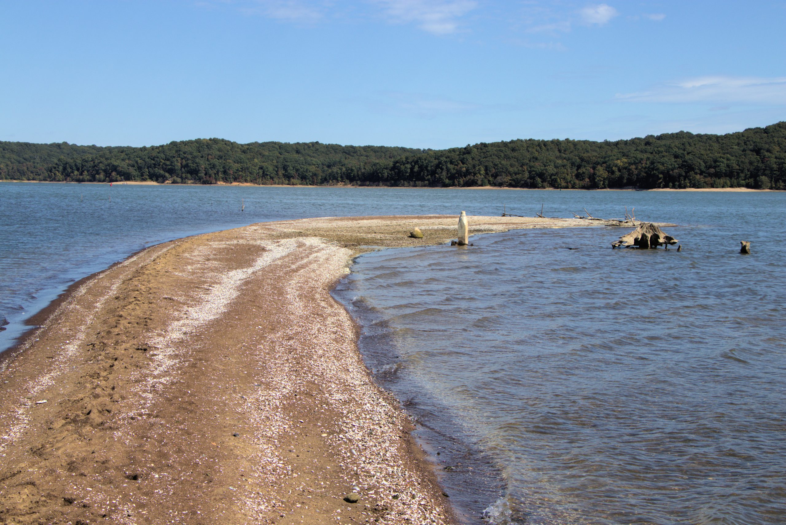
It’s quite the anomaly. A grave, literally in the middle of the lake, on a tiny island completely submerged nearly half the year. It’s similar to the “big building in the middle of the lake” down near Danville, Tennessee – but this is different, because the island is so small and most people pass by unaware.
Why is there a grave located on a tiny strip of land in the middle of Kentucky Lake?
Kentucky Lake hasn’t always been here. As we’ve documented in many of our articles, the lake is essentially a flooded Tennessee River. The lake was created by Kentucky Dam in 1944. Many families, farms, small businesses and cemeteries in the flood zone along the river had to be relocated permanently. Even entire towns were affected, such as Birmingham, Kentucky.
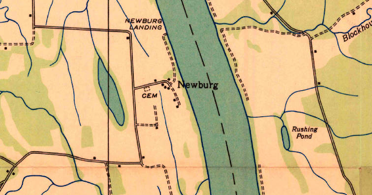
There were other small communities along the river impacted by the coming of Kentucky Lake. Newburg, in Calloway County, was one of those tiny hamlets. The community had a graveyard – aptly named Newburg Cemetery. TVA records show the graveyard contained 28 known graves of people who likely lived around the Newburg community.
When TVA created lakes, they usually relocated graves to other cemeteries on higher ground. Sometimes, family members of the deceased would not accept the relocation of the graves. Or it’s possible there were other reasons why graves were not moved. Of the 28 graves at Newburg Cemetery, 23 of them were relocated to the nearby Lone Oak Cemetery. Five remained.
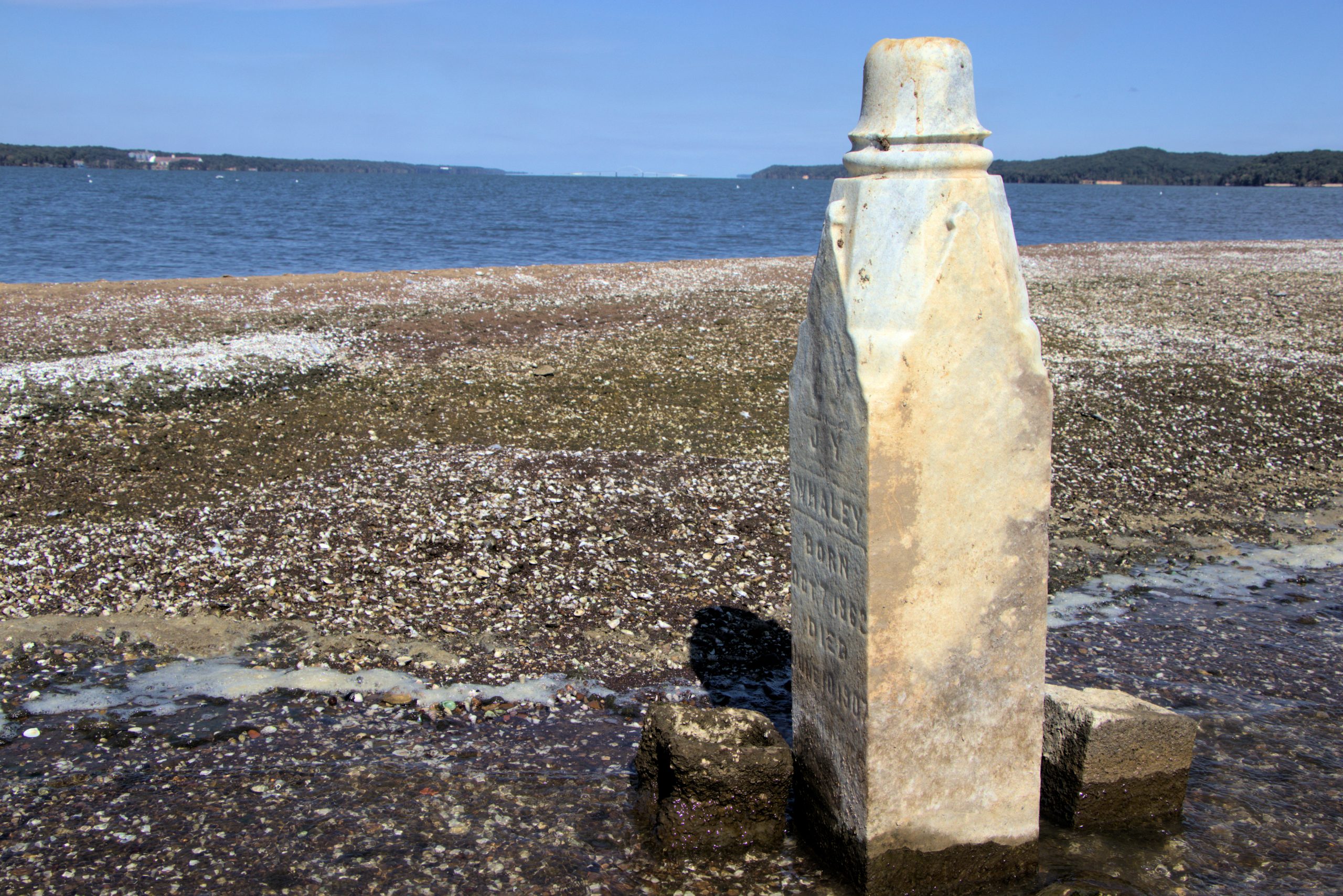
Today, at least one of those tombstones is still there on the tiny, isolated island. It belongs to a man named John Y. Whaley, who lived from October 7, 1862 to June 10, 1907. When we discovered the island, his stone stood upright. But countless times, the gravestone has been knocked over unknowingly by boaters. People familiar with the island will venture out there and reset his stone when the lake is low.
Another rock with some sort of lines carved out is also on the island, along with a tombstone base and one other base of a tombstone that had been broken off. We couldn’t see any other visible markers.
I imagine with five people still buried out there, it’s possible more grave markers remain – perhaps buried in the sand, gravel and shells. In addition to Mr. Whaley, TVA records show an infant, a toddler, and two others are still buried at the site.
Location of the Cemetery
The old Newburg Cemetery is in the middle of Kentucky Lake at 36.692299, -88.079608. It’s about eight tenths of a mile by boat from Paradise Resort, or about 1.5 miles from the Redd Hollow Backcountry Area and ramp in Land Between The Lakes.
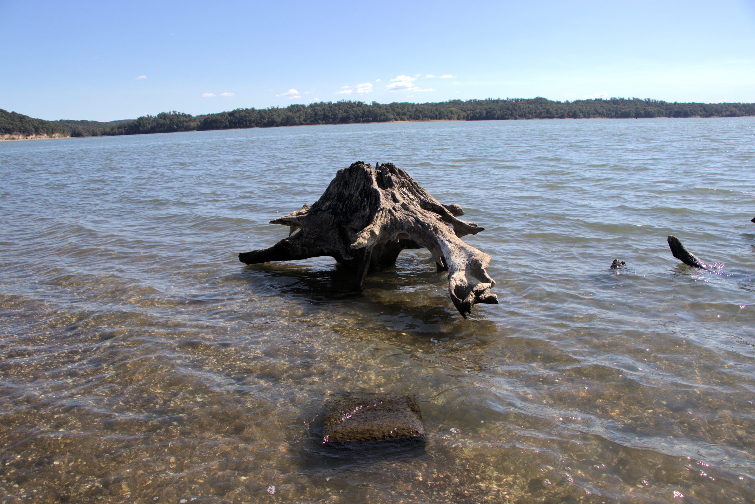
For boaters, the island is not marked at all by buoys or anything else. When the lake is at summer pool, the island is completely submerged, but the gravestone and a nearby stump will certainly cause problems if boats pass over. It’s another reason to stay in the main channel when running the lakes if you aren’t familiar with the water.
If you visit the island, please do so respectably and do not disturb the gravestone – unless of course, you’re simply propping it back up.


Pingback: Newburg, Kentucky - Four Rivers Explorer
Pingback: 8 Mysteries to Read at the Lake - Quill&Glass
Pingback: Dead in the Water: 8 Lakeside Mysteries - Quill&Glass
Pingback: What Lies Beneath – House of Wyrd
Pingback: Flooded Graves in the Tennessee Valley: A Rare Look When the Water Level is Low | April Killian – Rabbit Blog Daily
Pingback: Kentucky Lake’s Stonehenge? - Four Rivers Explorer