After four different trips to the Blood River bottoms over the course of two different years, I finally found what I was looking for. Well, kind of.
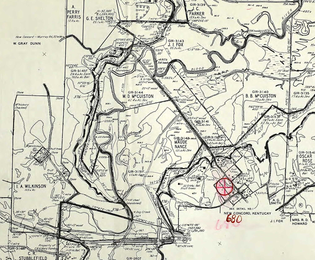
I knew there was a possibility of some old, abandoned roads and bridges in the Blood River bottoms area, located northwest of New Concord, Ky. But after looking at the old TVA Land Acquisition Maps from 1939, my curiosity went through the roof.
A portion of the TVA Land Acquisition Map from 1939 of the Blood River bottoms area.
Before I go much further, I want to disclose that I’m making a few assumptions in this feature. I’ve been able to find very little about the history of the bottoms. All I have are some maps and a couple of photos to make some educated assumptions.
Back to this old TVA map, one of the two old roads shows an abandoned steel bridge crossing Dog Creek, a tributary of Blood River. This meant that in 1939, the bridge was considered abandoned. Wow – if (in the off chance) the old bridge was still there, that would be something.
Finding the First Road
Last winter I ventured out Highway 121 and pulled off into the Blood River Bottoms Day Use Area. Good thing I had the Jeep, because let me tell you – that gravel drive is sketchy. Especially for it to be a public day use area.
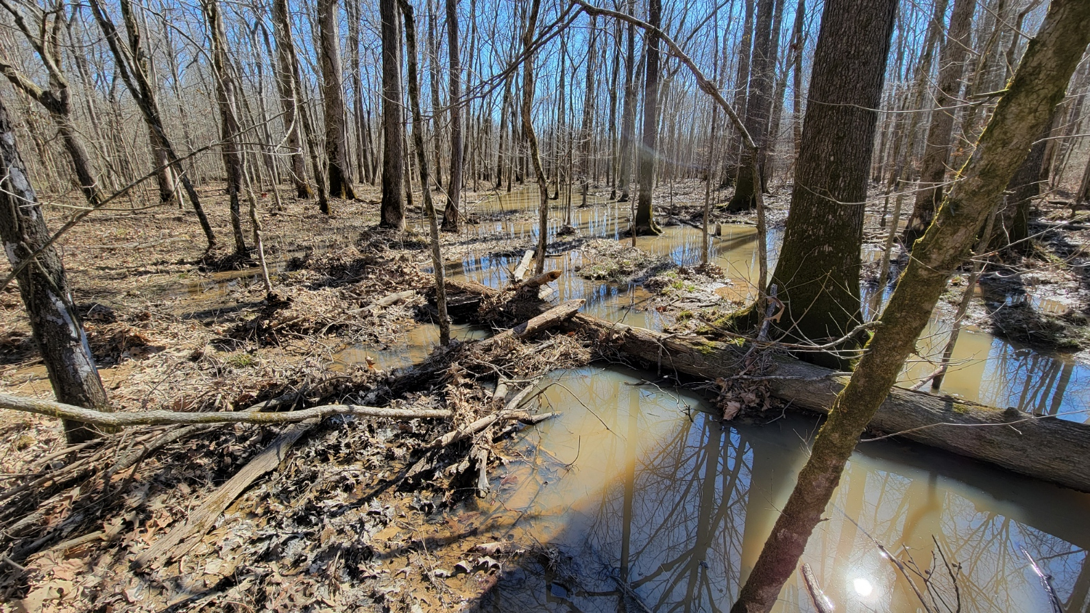
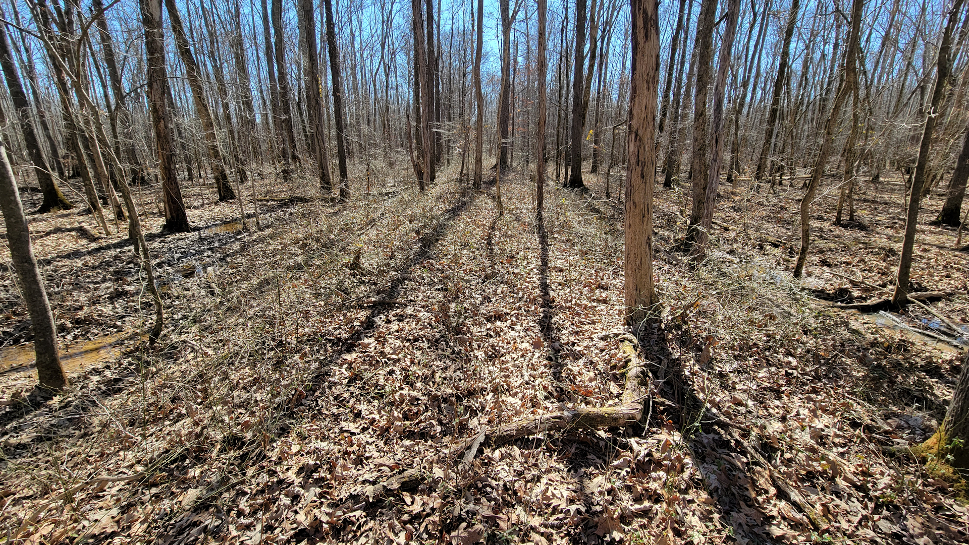
Once parked, I walked along the edge of the river on a makeshift path. Eventually the path disappeared, and thorns began to take over. I trudged through the thickets and crossed a log over a marshy ditch. Then, right in front of me, a long mound of dirt appeared stretching from the river to the west. I had found one of the two old roads.
It was built up several feet to protect it and the old bridges from flooding. However, there was zero evidence of a bridge crossing Blood River here. Interestingly, the TVA map shows the road abandoned in 1939 with no structure crossing the river.
Certainly, at one point there was a bridge, for the raised roadbed could be seen on the east side of Blood River. However, no concrete approaches, pilings or anything of the nature could be found. Whatever was there was likely destroyed by flooding long ago.
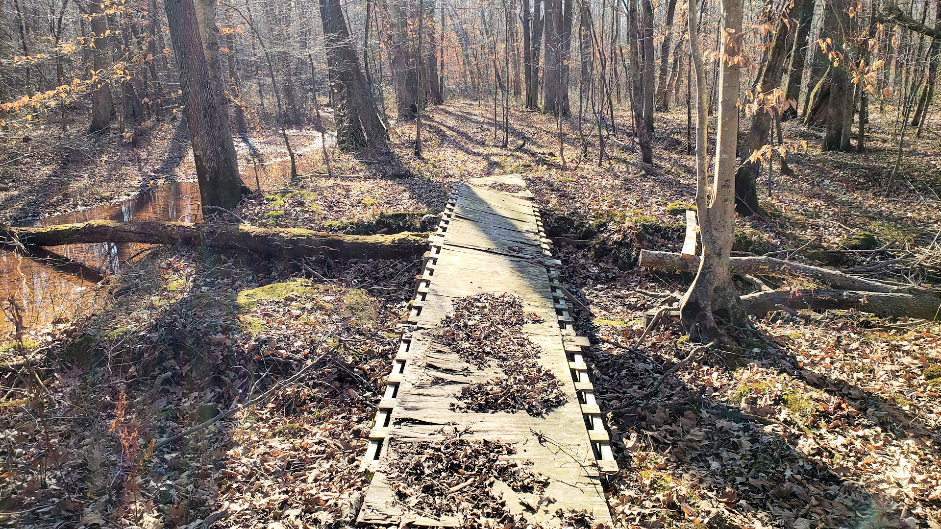
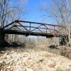
I began walking west down the old roadbed toward the location of the abandoned steel bridge. The path here was pretty good, with someone even constructing a makeshift wooden footbridge across a ditch (it had seen better days – I didn’t use that rickety thing).
Sketchy makeshift foot bridge someone built too long ago.
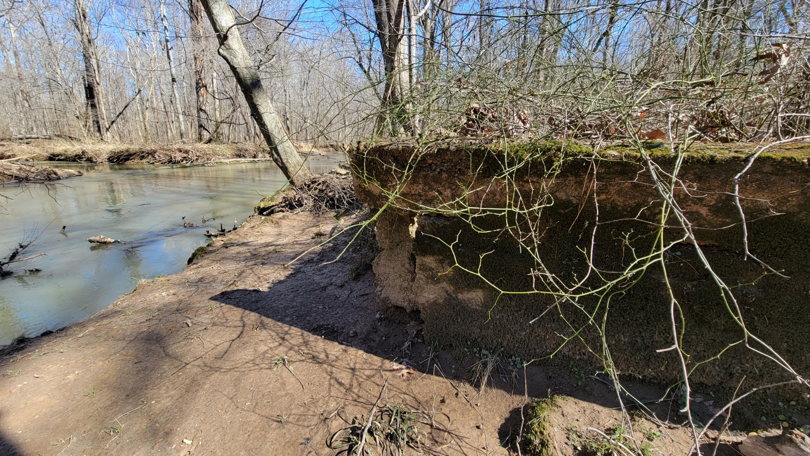
Eventually I got to the spot where the 71’ x 14’ abandoned steel bridge was once located. I don’t know why I was disappointed to find it gone – I really didn’t expect it to still be there 80-plus years later.
What stood out to me is how much silt and mud filled in the spot where the bridge once stood. The concrete approaches were barely visible on one side but looking at the spot made me wonder why there was such a big bridge there to begin with. It’s wild how nature can redirect the course of streams and rivers over time.
I'm standing where the old steel bridge mentioned in the map was located. There's hardly a ditch here, let alone a creek or a river. This is located on the edge of TVA's property, with private property in the background.
This old, abandoned road seems to appear on an 1885 map of western Kentucky. At that time the road headed west toward New Providence. It also appears on the 1930 map of Calloway County. The 1936 USGS map shows it partially abandoned with the steel bridge and whatever crossed Blood River gone.
The entire old road disappears from the 1940 Calloway County map. I’m assuming that this road was toast by the early 1930s, perhaps its fate sealed when the modern Kentucky 121 opened around that time.
Today, Heritage Lane in New Concord is the road now, but dead-ends on private property. On the west side, a portion of today’s Kentucky 280 uses that old roadbed, with the portion going into the bottoms also on private property. If you choose to find this abandoned road, please access it from the day use area and not private lands.
New Concord-Wadesboro Road
The TVA Land Acquisition Map featured a second old road I wanted to explore. Located north of the first road, this one was known as the New Concord–Wadesboro Road. This is significant because it refers to the first county seat of Wadesboro. Wadesboro lost its status as the seat of government in 1842 when Murray was picked after Marshall County split from Calloway.
Wadesboro had dwindled down to nearly nothing by the turn of the century. So, this road being known as the New Concord–Wadesboro Road suggests it was one of the first roads created by pioneers in Calloway County.
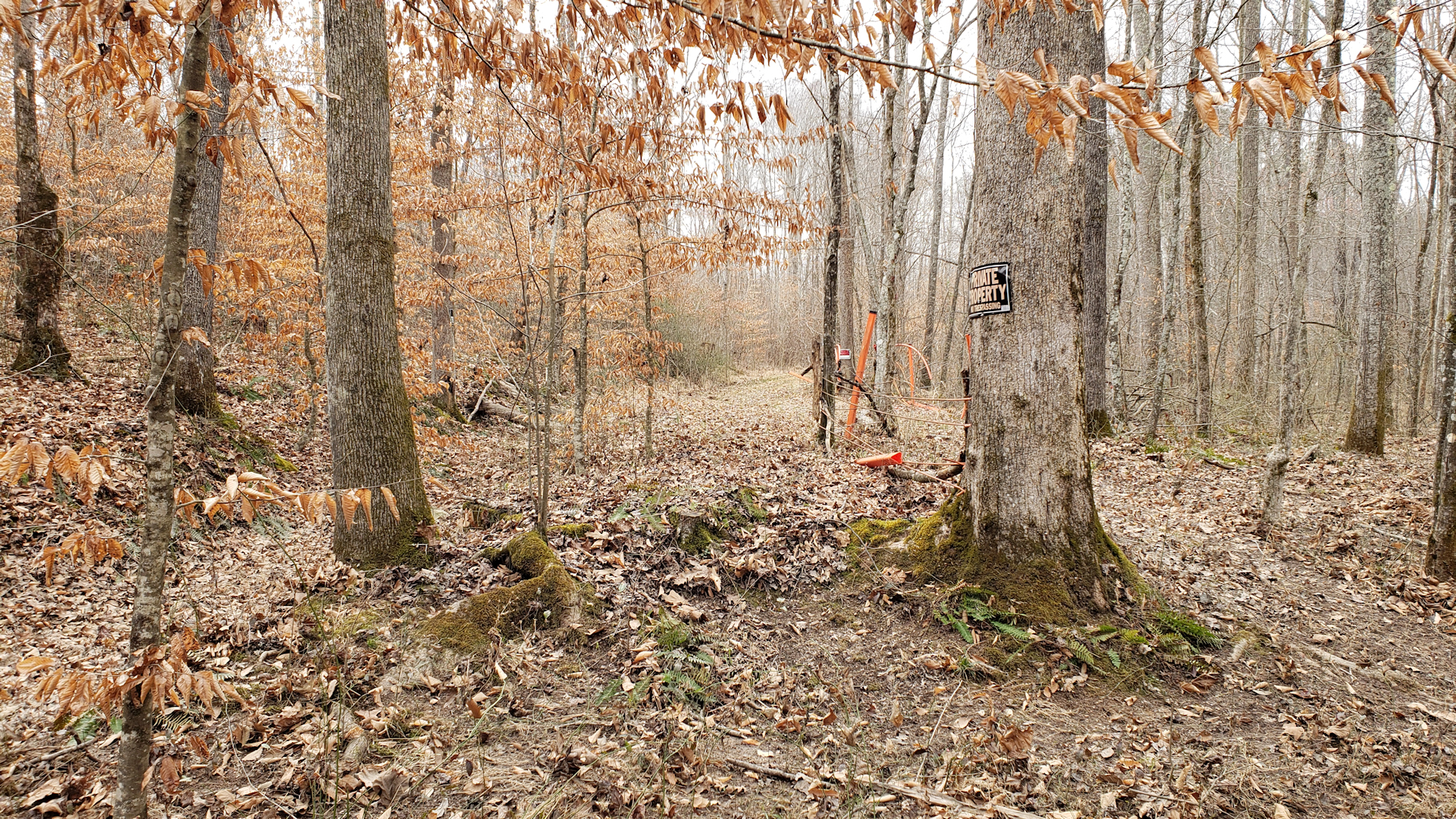
Accessing the road from the north is a no-go due to a portion of it being on private land. The only way to get to it is parking at the end of Artesian Lane in New Concord (which once was the former New Concord-Wadesboro Road). The county road dead-ends and becomes essentially abandoned at the edge of TVA’s property.
Just recently I was able to get to this old road to see if there was anything significant left from before TVA’s acquisition. A portion of this road can be walked down for a bit before nature takes over. Another makeshift pathway traverses along the edge of the road and eventually disappears.
The vast marshy bottoms of Blood River near the abandoned New Concord-Wadesboro Road.
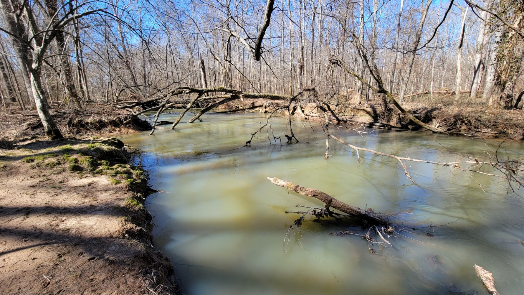
Determined to find where this road crossed Blood River, I continued on, battling mud, thorns and having to use fallen limbs and logs to cross water-filled ditches. Talk about exploring!
Eventually, I was able to make it to the river’s edge and saw where the former New Concord-Wadesboro Road crossed. Of course, nothing was left of the bridge but heavily damaged concrete approaches.
What's left of the concrete approaches of an old bridge crossing Blood River, appropriately covered in thorns.
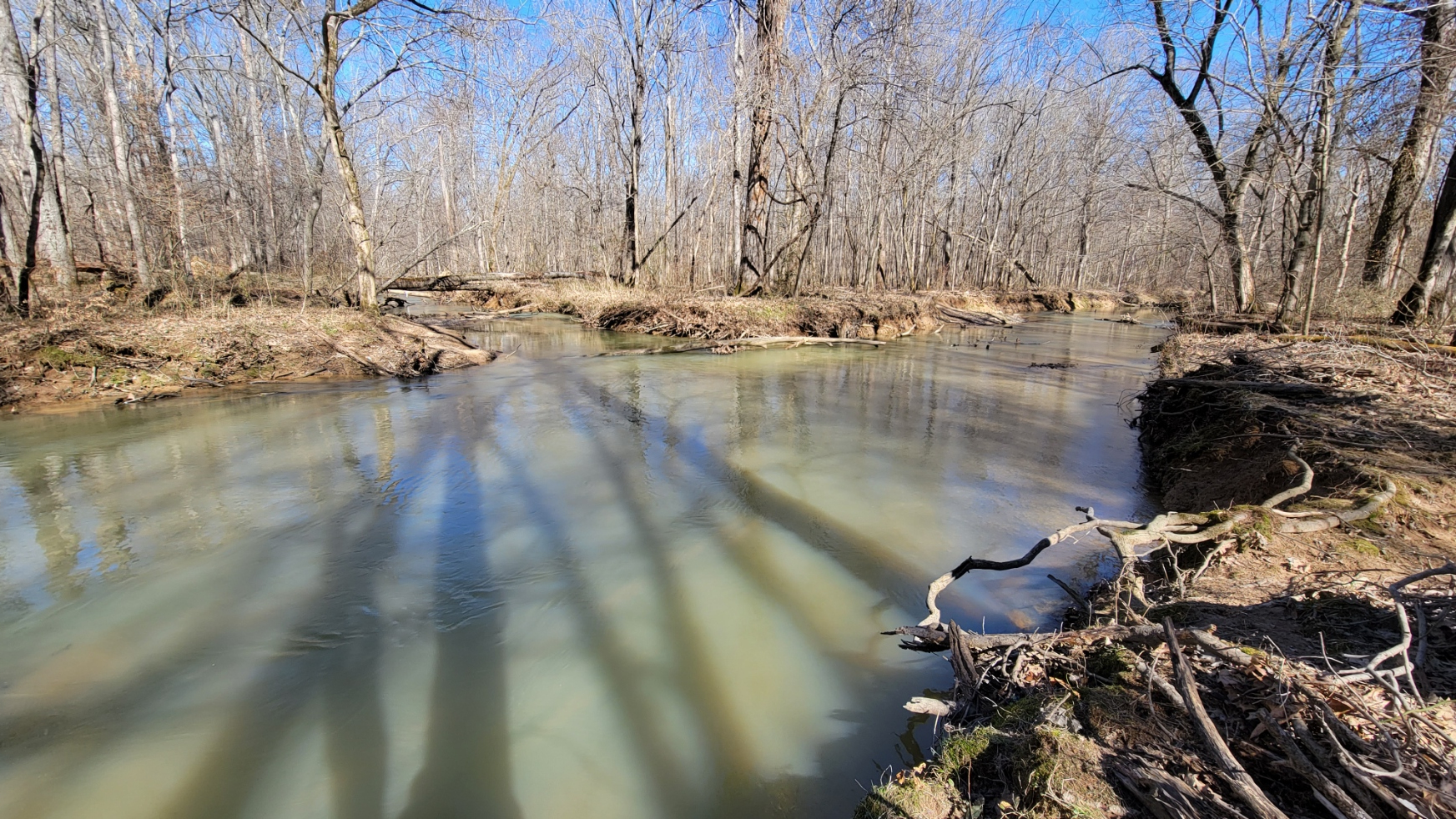
A wide-angle shot of Blood River splitting right where the bridge once crossed.
Another testament of how the river can change course over time, the TVA map shows the main channel of Blood River being further northwest. What I saw looked like the main channel of the river, although splitting at the location of the old crossing. If I understand this map correctly, a 69.5’ x 12’ wood bridge crossed the river here.
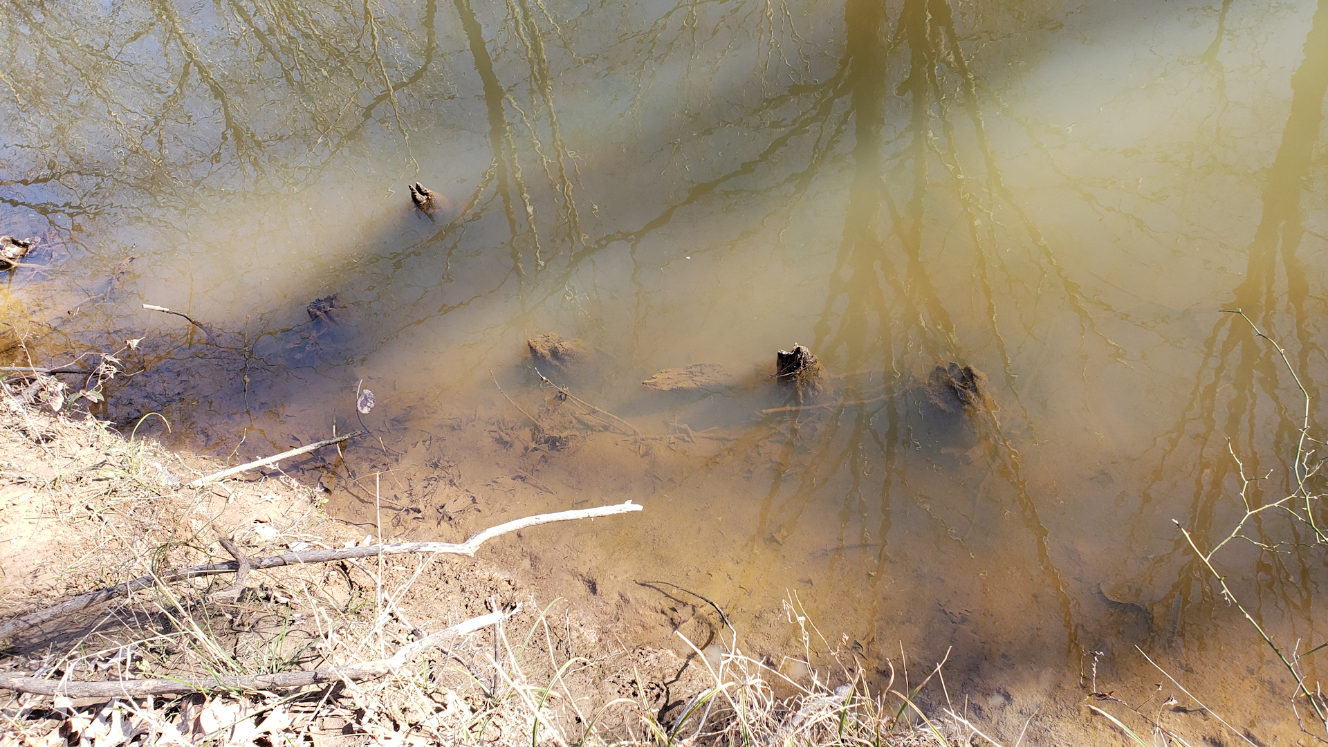
According to the map, four more bridges are on this road, with two of them being over 60’ long. I couldn’t see the other locations except for the one furthest north crossing one of the tributaries. Again, concrete approaches and some old wooden pilings cut down to the water’s surface remained, but nothing else.
What appears to be old wooden bridge pilings crossing one of the tributaries in the Blood River bottoms.
It's hard to see it due to overgrowth, but I'm standing in the middle of the abandoned New Concord-Wadesboro Road.
Blood River is notorious for flooding. These bottoms have been completely inundated, including the old raised roadbeds, when Kentucky Lake rises several feet above summer pool. I do not know if TVA removed these bridges when they purchased the bottoms or if flooding took them.
I do think they took the abandoned steel bridge mentioned on the map, but I can’t confirm that. Wish it was still there!
A portion of today’s Deerberry Lane on the west side of the bottoms served as the road going from New Concord to Murray, and another portion of Deerberry Lane covers the old road going toward Brandon’s Mill and Wadesboro.
A Third Abandoned Road?
Before TVA came into existence, Kentucky built a modern highway in the early 1930s a few hundred yards south of the first abandoned road. Kentucky 121 essentially replaced it, which would make sense as to why TVA maps show the abandoned steel bridge.
When TVA came along and announced plans for the creation of Kentucky Lake, the Blood River bottoms would be vastly affected. Kentucky 121 through the bottoms would potentially be under water at times of high lake levels. Apparently, TVA decided to raise the bridges across Blood River, according to this National Archives photo’s caption.
There is clearly an old road right next to present-day 121. At first I had assumed TVA simply relocated the road a little south with new bridges. Now I’m thinking TVA built a temporary road for travelers while they raised the bridges.
If that’s accurate, that old abandoned “third route” would have been the temporary road. I haven’t been able to find anything to back that up. The sketchy Blood River Bottoms Day Use Area drive uses a part of this alleged temporary road.
While that was an exhausting and boring explanation, I felt like that needed to be pointed out since it’s clearly visible from the road today.
This TVA photo obtained from the National Archives by request shows Kentucky 121 (gravel back then) in the late 1930s. This was the Blood River bridge, which the caption attached to the photo states it to be raised, not replaced or relocated.
I Explored It, So You Don't Have To
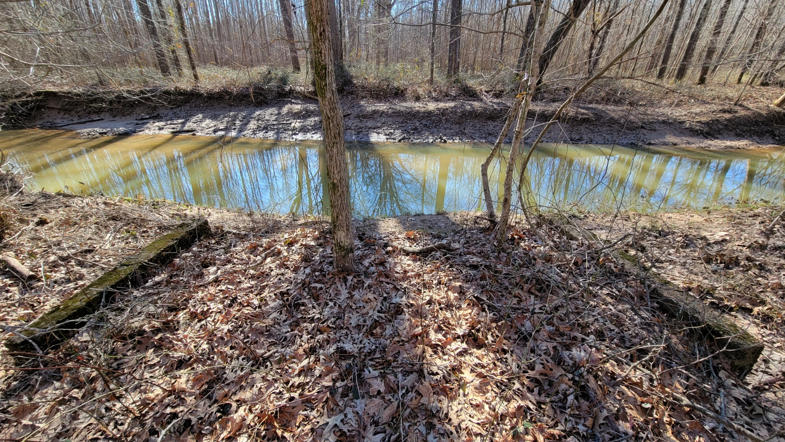
Blood River appears more greenish or bluish than red, although some of the tributaries have a reddish brown color.
The Blood River bottoms area would be a great place for some non-profit or government-backed organization to develop water trails, hiking trails and picnic areas. However, in its current state, it is very hard to explore. You will definitely want to go in the winter months, because this place is a snake haven. And then the overgrowth of wild nature, mud, and thorns are abundant, even in winter.
Blood River has been identified on maps for around a couple of centuries. With its unique name likely taken from minerals giving it a rusty red color (it’s more bluish-green than red), I would propose that the name comes from two hundred years of people being stuck by thorns. Good grief.
Now that I’ve been there and have shared what I’ve found here on Four Rivers Explorer, which really is a whole lot of nothing, you don’t have to go! Perhaps if the terrain was a little more forgiving, it would be a cool place to check out. But I’m likely not going back – those thorns were a little too much.
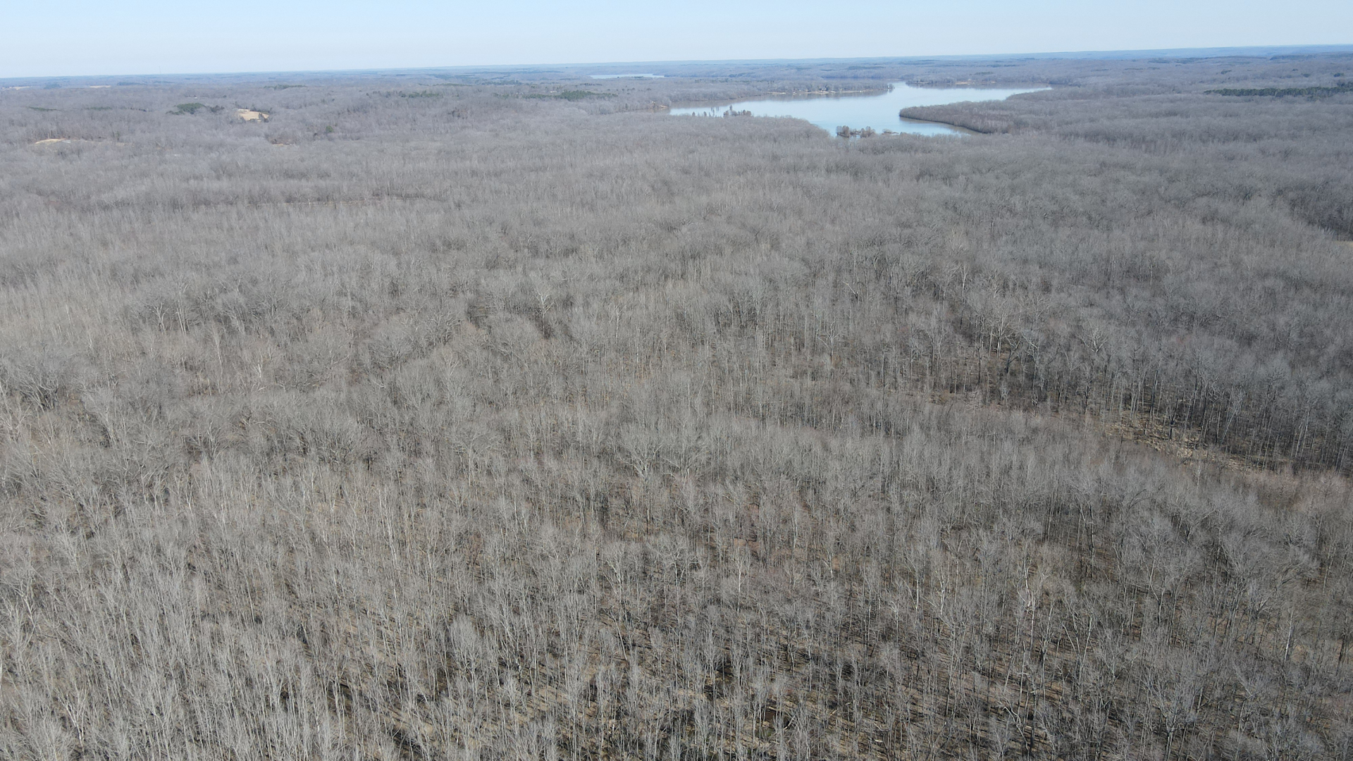
The Blood River bottoms with the lake in the background, courtesy Kentucky Lake Drone.
Got Anything to Share?
If you have any historical information about the Blood River bottoms you’d like to share, please get in touch!