Early settlers in Calloway County founded one of the first towns in the county known as “Callaway”. The Kentucky General Assembly officially incorporated Callaway on February 6, 1837. Trustees named by the act were John Caise, Isaac Wells, B. Wells, J. McClure, and L. Wells.
Interestingly, the act to incorporate the town of Callaway mentioned it was in “Callaway County”. With the county named after Richard Callaway (or sometimes spelled as Richard Calloway), it’s easy to understand how spelling mistakes were made.
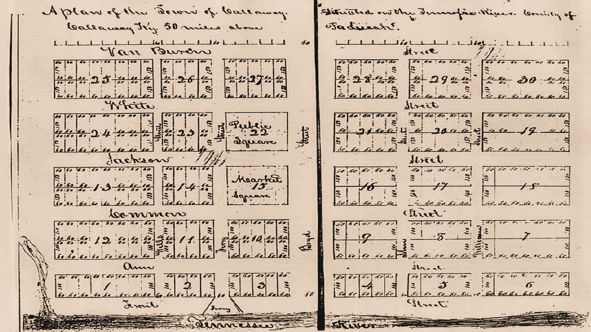
Somehow the official plat for Callaway was preserved after all these years, considering the town never really developed. Across the top is written “A plan of the Town of Callaway situated on the Tennessee River, County of Callaway, Ky., 50 miles above Paducah.”
The plat shows north-south streets named Van Buren, White, Jackson, Front and two others, which I think read “Ann” and “Gammon”. The other streets were to be called Wells, Ferry, Boyd, John (or Johns) and Williams. The plat featured a large public square and market space and dozens of lots ready for purchase.
However, not much is known about the development of Callaway over the next 20 years. The name morphed into “Callaway Town” in 1858 with the establishment of the post office on September 14. It briefly served the area, having closed just 18 months later on March 1, 1860.
The Civil War & Callowaytown
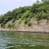
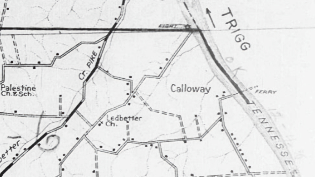
During the Civil War, the name transitioned again, this time into Callowaytown. Maps from this period show a ferry at the location with that name. Some simply mention “Calloway Ferry” with others as “Old Calloway”. Historical documents suggest there were just two buildings at that time, at least which could be seen from the river.
On January 25, 1862, Union troops used the ferry landing to enter Calloway County from the Tennessee River. One account mentions a Confederate scout (or a “picket”) reporting back to Fort Henry “10 to 12 thousand” federal troops were camped on the banks of the river, apparently staging a battle at Fort Henry, located just 16 miles upstream. Another reference says “three federal regiments” were at Callowaytown during this time.
A “large public road” is in yet another Civil War era reference between Callowaytown and Murray. An act to adjust the location of the state road between Callowaytown and Murray is mentioned by the Kentucky General Assembly in September 1861, so this is probably the road Union troops used when getting to Murray.
Today’s Ledbetter and Highland roads were likely the location of that state road in 1861. Callowaytown probably benefited as a quicker way of traveling from Murray to Canton on the Cumberland River instead of going further north and using Eggner’s Ferry.
The Postal Service advertised bids for a contract for mail delivery from Canton to Murray via Callowaytown and Snow Hill (a defunct post office near Elm Grove) among hundreds of others in February 1862. Considering this was the most volatile period during the war in western Kentucky, I would imagine not many proposals were sent.
After the Civil War, very few references to Callowaytown can be found. A publication in 1885 mentions “nothing is there” except for the ferry. Surveyors were planning a railroad through Callowaytown in 1906 known as the Cairo and Tennessee River Railroad, but it never materialized.
In 1911, Callowaytown was one of two possible routes for an automobile highway – The Jefferson Davis Highway. Autos were a novelty, but planners knew cars would rule the road in the decades to come, so they were making plans for an east-west route across the state of Kentucky. Eggner’s Ferry was the other alternative for the new highway, and ultimately that route was favored over Callowaytown. Eventually that road would become Kentucky 94 and US 68, or where today’s Eggner’s Ferry Bridge is located.
If both the railroad and highway materialized in the early 20th Century, Eggner’s Ferry Bridge would not exist today. Perhaps the Calloway Ferry Bridge? And the railroad right beside it? Things would definitely look different across Kentucky Lake today.
A Mystery Murder at the Ferry
A maritime publication in 1918 mentions a gas-powered passenger ferry at Callowaytown called the Ark. Specifically, the boat measured 16’ wide by 52’ long, had three crew members and was pulled by a 20-horsepower motor. That particular boat began service in 1909.
The ferry at Callowaytown also brought mischief and malice. Night riders would cross the river using the ferry during the 1904-1909 Black Patch Tobacco Wars, wreaking havoc across the region. Moonshiners hauled their “white lightning” from Trigg County in the area known as “between the rivers” to Calloway County across the ferry. Western Trigg County, where Land Between The Lakes is located today, was a haven for bootleggers.
In 1923, a young 22-year-old man named Florice May operated the Callowaytown ferry. He moved over to Calloway from Trigg County just a few months prior. Apparently growing tired of the illegal alcohol being shipped across his ferry, he tipped authorities on some of the moonshiners based in Trigg County.
One May morning around 6:00 a.m., Mr. May went out to start up his ferry engine when it exploded. We’re not talking about blowing your engine because you don’t have any oil. We’re talking shockwave-inducing, cannot-be-just-gasoline type explosion. The blast was so great, it could be heard in Murray 15 miles away. May died instantly, with his mangled body being thrown 100 feet. His four-year-old son witnessed the tragic event and received minor injuries.
Reports from this time say the engine was likely sabotaged. The cylinders were filled with either nitroglycerin or “gun cottage” and when he went to start the engine, it exploded with great force. Newspaper accounts speculated the bootleggers of Trigg County came up with the scheme. No other accounts of this story appear after this event, so the masterminds of the evil deed were apparently never caught.
Kentucky Lake Floods Callowaytown
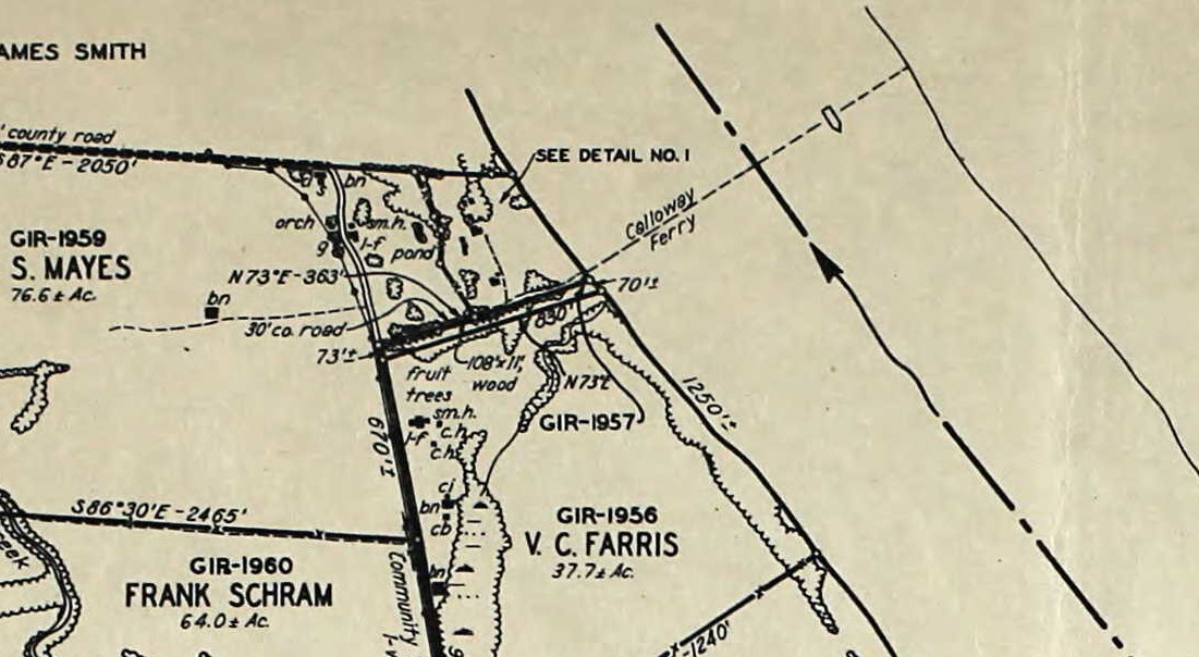
When the Tennessee Valley Authority announcing the construction of Kentucky Dam at Gilbertsville in 1938, what remained of Callowaytown would go underwater. The ferry appears on TVA Land Acquisition Maps but not much of anything else. Peculiarly, there is a reference to a 108’ long by 11’ wide wood bridge going to the landing site. Otherwise, not much else is shown – even the reference to Callowaytown is excluded. Once the dam’s gates were shut in 1944, Callowaytown went underwater for good.
Today the old Murray-Callowaytown Road can be traced from Highland Road to Ledbetter Road. The road today dead ends into a private drive, but once veered east into where Anderson Bay is located now. Otherwise, there are zero traces of the former community.
Location of Callowaytown
Have Information on Callowaytown?
If you have any photos or other items related to Callowaytown you would like to share, please get in touch!
Articles Related to Callowaytown
No posts found.
References
- Courier-Journal – September 10, 1861
- Owensboro Messenger – April 22, 1908
- Owensboro Messenger – May 8, 1923
- Paducah Sun Democrat – May 8, 1923
- Gazette & Advertiser – January 25, 1862
- Memphis Daily Appeal – January 26, 1862
- Fort Henry & Fort Donelson Campaigns – 1923
- Fiftieth Annual List of Merchant Vessels of the United States – 1918, Department of Commerce
- History of Kentucky – Perrin, 1885
- Murray Ledger – November 30, 1911
- Kentucky Place Names – Robert Rennick