Mantle Rock is, without a doubt, one of the best-kept secrets in western Kentucky. This natural wonder is hidden away on publicly accessible land just off Highway 133 near the community of Joy.
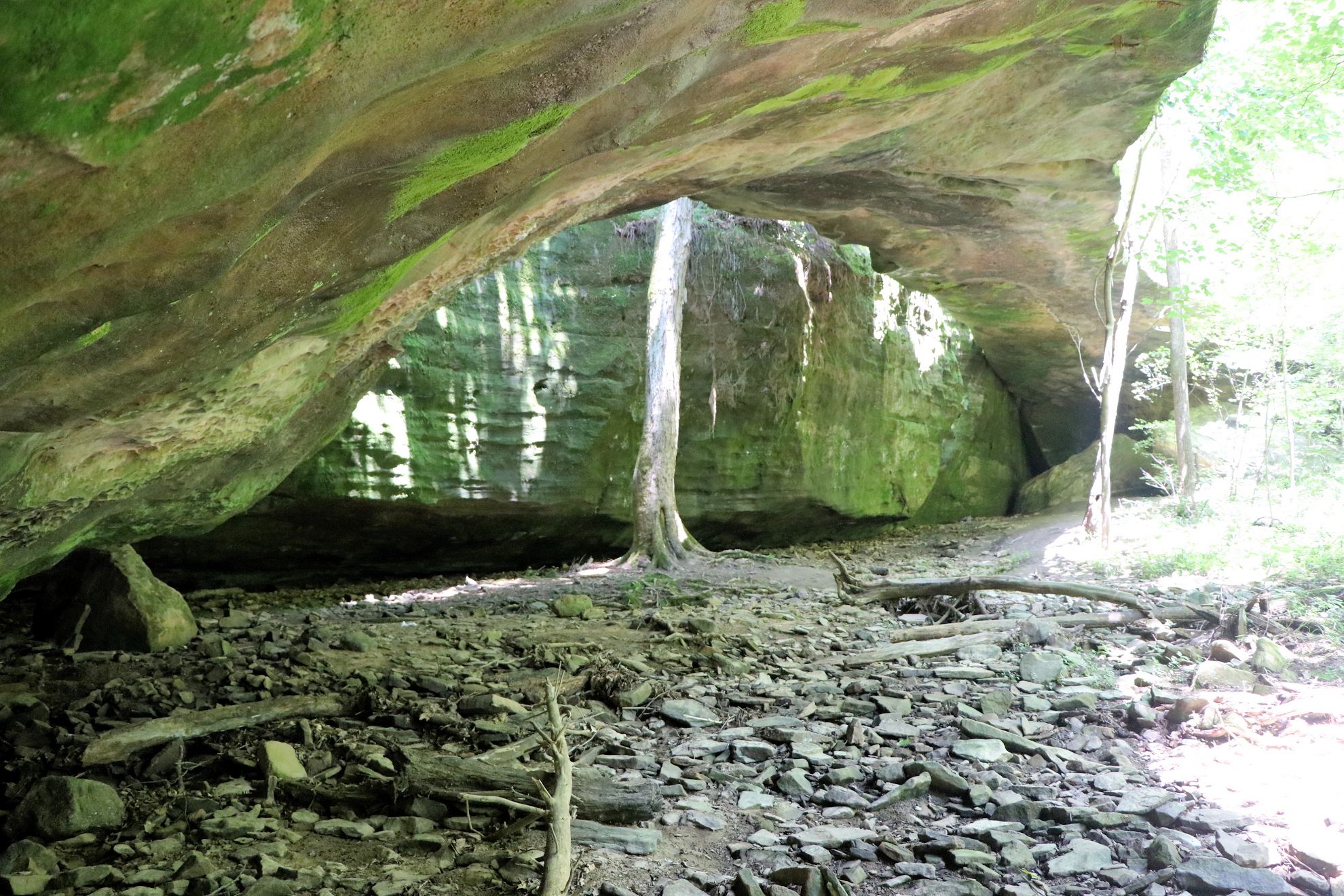
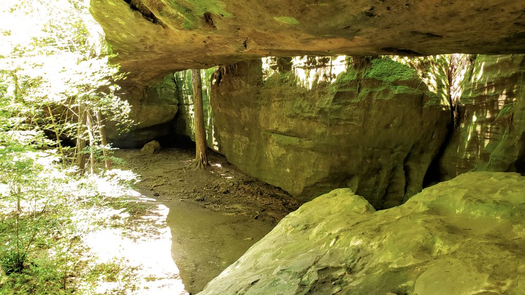
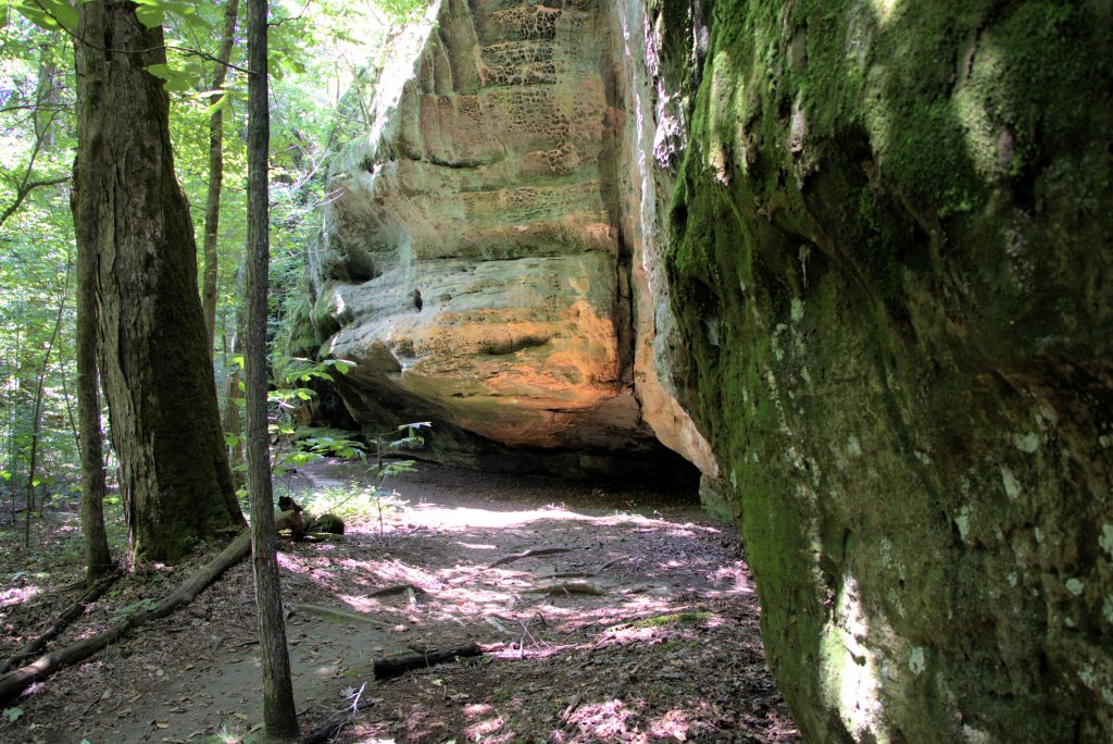
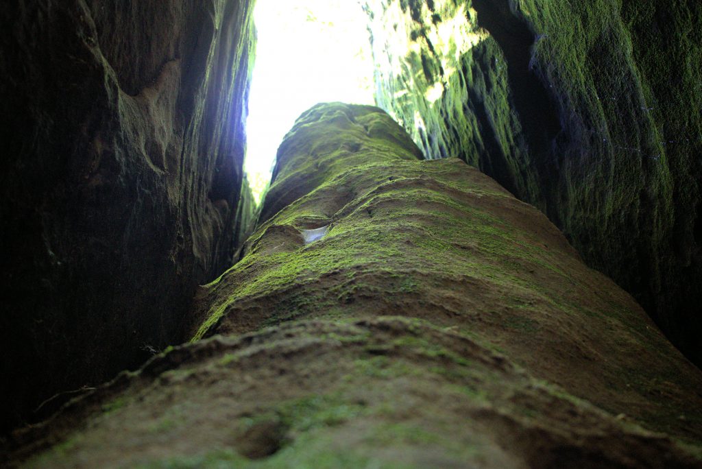
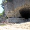
Located in Livingston County, 34 miles north of Grand Rivers, Mantle Rock is an incredible sight, considering most of land in this part of Kentucky is relatively flat. But not here. Mantle Rock is the largest freestanding arch east of the Mississippi River, spanning 188 feet in length and rising 30 feet from the ground.
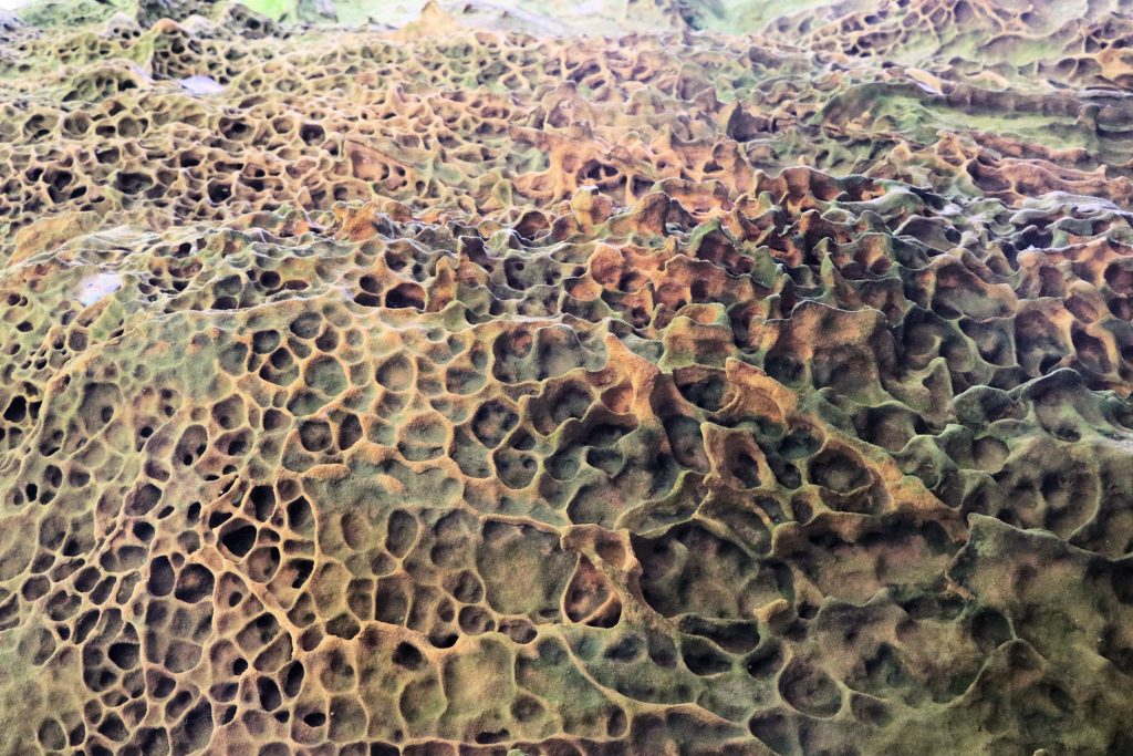
The rock has honeycomb formations, fluorite deposits and boulders bigger than cars. The stream flowing into the Mantle Rock area is certainly a sight to see after a period of rain, with water flowing over the bedrock that creates a setting like the Smoky Mountains.
And just like the Smokies, Mantle Rock features plants that do not grow anywhere else in Kentucky. Some of the plants found here are not known to the rest of the state. The extraordinary biodiversity of this place includes June grass and other glade species such as prickly pear cactus, rush foil, hairy lipfern, little bluestem, pinweed and poverty grass.
With all its natural wonder and beauty, there is another layer to Mantle Rock that makes it all the more special.
Ties to the Trail of Tears
The Indian Removal Act of 1830 forced the relocation of thousands of Native Americans to present-day Oklahoma. Known as the “Trail of Tears”, a branch of the route went through the area near Mantle Rock. During the winter of 1838-1839, 11 detachments containing over 10,000 Cherokee passed through here.
Before Highway 133 became into existence in the early 1930s, the original old dirt road was taken by the Cherokee Indians as they passed through this way toward Golconda, Illinois. This part of the trail is located to the southwest of present-day Highway 133, about a quarter mile from Mantle Rock.
The Peter Hildebrand detachment was forced to spend two bitterly cold weeks in the Mantle Rock area, camping alongside the road for miles. They had to wait for the frozen Ohio River to thaw enough to ferry people form Brown’s Ferry, Kentucky to Golconda, Illinois. Once they crossed, they became trapped again in Illinois, waiting on the Mississippi River to thaw.
It is not known how many Cherokee saw Mantle Rock when they walked the historic road north. Considering the distance from the road, it is unlikely that many Cherokee visited the rock or stayed in the vicinity of it. They would have wanted to be near the road in order to gain access to precious supplies.
As they ventured west toward to Oklahoma, several hundred Cherokee died along the way due to exhaustion and illness.
Getting to Mantle Rock
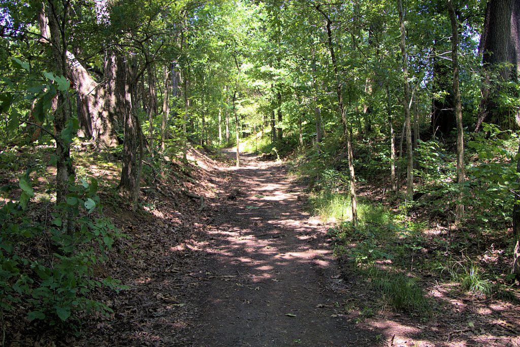
The Mantle Rock Nature Preserve is easy to get to with the rock itself a short hike from the parking area. A gravel lot is available off Highway 133 with educational signs about the history of the Mantle Rock area. This area and the rock is open to the public.
You can choose to walk the entire 2.75 mile trail or head directly to Mantle Rock, which is a little over a quarter mile from the lot. One mile of this 2.75 mile stretch is along the original path of the Trail of Tears. This section of the trial is flat and easy, with the other portion of the trail to the rock rated as moderate in difficulty.
To access the Mantle Rock directly, turn left when you reach the Trail of Tears path, and the rock will be about a quarter mile down, perhaps a bit more.


Pingback: Pennyrile Forest State Park - Four Rivers Explorer