The purpose of Four Rivers Explorer can be traced back to my years as a kid. My family traveled down US 79 between Paris Landing and Dover, Tenn. several times back in the early 1990s.
Each time we went down the road, I always looked for the bridge. No, not the one crossing Kentucky Lake or the one at Dover, but a small abandoned bridge right on the edge of US 79. It’s hard to see it in the summer with all the overgrowth, but you could get a great look at it in the winter time.
I always dreamed of exploring that old bridge and perhaps trying to find out why it was there and why it had been long abandoned. I didn’t get the chance until several years ago when my wife and I checked it out. We took photos but for the life of me I couldn’t find them for this article.
Aww, shucks. I guess I’ll have to go back and get more photos.
Of course I was excited to have an excuse to make the 45-minute drive down to Stewart County. Not to mention I was equally excited about trying out my new four-wheel drive. I remembered several years ago getting to this bridge was a little tricky, but we had made it in our car. Today was a totally different story. Glad I had the truck!
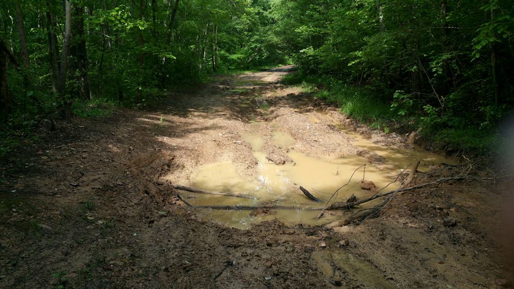
This bridge is located right on US 79 but you cannot access it from there. Well, you could, but parking along the busy highway probably isn’t a good idea. The “best” way (and I use “best” tongue-in-cheek) is to access it from the other side. To do that, you’ve got to take a little detour into Land Between The Lakes. And on this day, most people wouldn’t be able to get there. The road is awful.
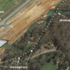
On the official Land Between The Lakes road map this road is numbered 236. It stretches 1.7 miles from Fort Henry Road before dead-ending at the old bridge, near US 79. Google maps show the road going to US 79, but it doesn’t. It stops just short of it.
This gravel road is full of large pot holes and washed-out ditches. There no chance a car would make it, and probably not any other vehicle except a four-wheel drive.
One particular hole almost stopped me; I was hesitant to put my new truck through that. I convinced myself to try, and she made it through alright, but not without getting a little sideways and hitting my head on the roof with the jarring action. I wasn’t looking forward to the return trip after hitting that hole.
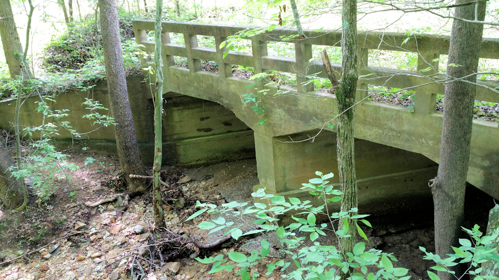
I continued down and reached the end of the road. There it sat, an old, abandoned concrete bridge that crossed the rather lovely Lost Creek. At one time, this bridge was active and was probably used often. It was a narrow two-lane bridge made entirely of concrete, including the bottom of the bridge where the creek spilled through. Almost like a large culvert.
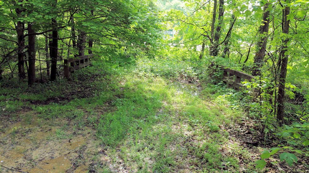
While I don’t know for sure, the bridge and road probably was an extension of TN 232. And I’m also assuming that when LBL was created in the 1960s, they severed access to LBL here by closing the road off at the intersection of US 79.
I took some pics of the bridge with my phone, inspected my once-shiny truck that was now covered in mud, and took off.
Crossing the hole was just as bad as the first time. Except going back, I hit my head on the side of the window post. But it was all worth it!
Along this stretch of road is an overgrown cemetery that I didn’t have time to explore. Also, there was a marker for Lost Creek United Methodist Church. One wouldn’t know a church once stood there; no other evidence suggested anything was ever there. And there were several old box culverts that I crossed, which was more evidence at one time this road was a state-maintained road or at least well-traveled. Not anymore!
To get there take Fort Henry Road into LBL from US 79. Take the first right, this is marked as LBL 236. Go about 1.7 miles to the end and there you’ll find the bridge.
At the time of this writing (May 12, 2016), this road is open and is a legal LBL public-use road. However, it may be impassable to most vehicles. You’ll need a four-wheel drive with plenty of ground clearance to get back there. The GPS coordinates of the bridge is 36.465811, -87.988463.
Have fun exploring!